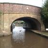
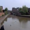
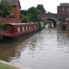
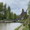
Coleshill Road Bridge No 41 carries a farm track over the Coventry Canal (Main Line - Hawkesbury to Fazeley).
The Coventry Canal (Main Line - Hawkesbury to Fazeley) was built by Nicholas Wright and opened on January 1 1835. In his autobiography Oliver Taylor writes of his experiences as a boatman in the 1960s

Coleshill Road Bridge No 41
is a minor waterways place
on the Coventry Canal (Main Line - Hawkesbury to Fazeley) between
A5 (Watling Street) Road Bridge (3¾ furlongs
and 5 locks
to the northwest) and
C&RT Hartshill Maintenance Yard and Wharf (2 miles
to the southeast).
The nearest place in the direction of A5 (Watling Street) Road Bridge is Atherstone Top Lock Winding Hole (C&RT services also available);
¼ furlongs
away.
The nearest place in the direction of C&RT Hartshill Maintenance Yard and Wharf is Atherstone Visitor Moorings;
½ furlongs
away.
There may be access to the towpath here.
Mooring here is good (a nice place to moor).
There is a bridge here which takes a minor road over the canal.
| Atherstone Lock No 3 | 1¾ furlongs | |
| Atherstone Lock No 2 | 1 furlong | |
| Atherstone Top Lock No 1 | ½ furlongs | |
| Site of Minion's Wharf & Basin | ¼ furlongs | |
| Atherstone Top Lock Winding Hole | ¼ furlongs | |
| Coleshill Road Bridge No 41 | ||
| Atherstone Visitor Moorings | ½ furlongs | |
| Taveners Bridge No 40 | 1¼ furlongs | |
| Clay Pits Bridge No 39 | 2 furlongs | |
| Outwoods Bridge No 38 | 3¼ furlongs | |
| Rawn Hill Bridge No 37 | 3¾ furlongs | |
There are no links to external websites from here.
Why not log in and add some (select "External websites" from the menu (sometimes this is under "Edit"))?
Why not log in and add some (select "External websites" from the menu (sometimes this is under "Edit"))?
Mouseover for more information or show routes to facility
Nearest water point
In the direction of Fazeley Junction
Atherstone Top Lock Winding Hole — ¼ furlongs away
On this waterway in the direction of Fazeley Junction
Atherstone Lock No 5 — 3 furlongs and 4 locks away
On this waterway in the direction of Fazeley Junction
Baddesley Basin — 6¼ furlongs and 6 locks away
On this waterway in the direction of Fazeley Junction
Bradley Green Services — 2 miles, 3¼ furlongs and 11 locks away
On this waterway in the direction of Fazeley Junction
Glascote Top Lock No 12 — 9 miles, 2 furlongs and 11 locks away
On this waterway in the direction of Fazeley Junction
Fazeley Junction — 10 miles, 5½ furlongs and 13 locks away
On this waterway in the direction of Fazeley Junction
Coleshill Road Bridge Water Point — 11 miles, 1 furlong and 13 locks away
Travel to Fazeley Junction, then on the Birmingham Canal Navigations (Birmingham and Fazeley Canal - Main Line) to Coleshill Road Bridge Water Point
Bodymoor Heath Wharf — 14 miles, 4¼ furlongs and 15 locks away
Travel to Fazeley Junction, then on the Birmingham Canal Navigations (Birmingham and Fazeley Canal - Main Line) to Bodymoor Heath Wharf
In the direction of Hawkesbury Junction
C&RT Hartshill Maintenance Yard and Wharf — 2 miles away
On this waterway in the direction of Hawkesbury Junction
Springwood Haven Marina — 3 miles, 2¾ furlongs away
On this waterway in the direction of Hawkesbury Junction
Hawkesbury Water Point (Engine House) — 10 miles, 5¾ furlongs away
On this waterway in the direction of Hawkesbury Junction
Hawkesbury Services — 10 miles, 6¾ furlongs away
Travel to Hawkesbury Junction, then on the Coventry Canal (Main Line - Coventry to Hawkesbury) to Hawkesbury Services
Hawkesbury Water Point (stop lock) — 10 miles, 7¼ furlongs and 1 lock away
Travel to Hawkesbury Junction, then on the Oxford Canal (Northern Section - Main Line) to Hawkesbury Water Point (stop lock)
Limekiln Bridge No 15 — 13 miles, ¾ furlongs away
Travel to Marston Junction, then on the Ashby Canal (Main Line) to Limekiln Bridge No 15
Trinity Marina — 14 miles, ¾ furlongs away
Travel to Marston Junction, then on the Ashby Canal (Main Line) to Trinity Marina
Ansty Water Point — 14 miles, 4¼ furlongs and 1 lock away
Travel to Hawkesbury Junction, then on the Oxford Canal (Northern Section - Main Line) to Ansty Water Point
Coventry Visitor Moorings (outside basin) — 16 miles, 1¾ furlongs away
Travel to Hawkesbury Junction, then on the Coventry Canal (Main Line - Coventry to Hawkesbury) to Coventry Visitor Moorings (outside basin)
Coventry Basin Services — 16 miles, 2¼ furlongs away
Travel to Hawkesbury Junction, then on the Coventry Canal (Main Line - Coventry to Hawkesbury) to Coventry Basin Services
Stretton Stop — 18 miles, ¾ furlongs and 1 lock away
Travel to Hawkesbury Junction, then on the Oxford Canal (Northern Section - Main Line) to Stretton Stop
Sutton Cheney Wharf — 19 miles, 2¾ furlongs away
Travel to Marston Junction, then on the Ashby Canal (Main Line) to Sutton Cheney WharfNearest rubbish disposal
In the direction of Fazeley Junction
Atherstone Top Lock Winding Hole — ¼ furlongs away
On this waterway in the direction of Fazeley Junction
Bradley Green Services — 2 miles, 3¼ furlongs and 11 locks away
On this waterway in the direction of Fazeley Junction
Bodymoor Heath Wharf — 14 miles, 4¼ furlongs and 15 locks away
Travel to Fazeley Junction, then on the Birmingham Canal Navigations (Birmingham and Fazeley Canal - Main Line) to Bodymoor Heath Wharf
Minworth Services — 19 miles, 5 furlongs and 26 locks away
Travel to Fazeley Junction, then on the Birmingham Canal Navigations (Birmingham and Fazeley Canal - Main Line) to Minworth Services
In the direction of Hawkesbury Junction
Mancetter Marina — 1 mile, 2¾ furlongs away
On this waterway in the direction of Hawkesbury Junction
Hawkesbury Services — 10 miles, 6¾ furlongs away
Travel to Hawkesbury Junction, then on the Coventry Canal (Main Line - Coventry to Hawkesbury) to Hawkesbury Services
Trinity Marina — 14 miles, ¾ furlongs away
Travel to Marston Junction, then on the Ashby Canal (Main Line) to Trinity Marina
Stoke Golding Wharf — 16 miles, 6½ furlongs away
Travel to Marston Junction, then on the Ashby Canal (Main Line) to Stoke Golding WharfNearest chemical toilet disposal
In the direction of Fazeley Junction
Atherstone Top Lock Winding Hole — ¼ furlongs away
On this waterway in the direction of Fazeley Junction
Bradley Green Services — 2 miles, 3¼ furlongs and 11 locks away
On this waterway in the direction of Fazeley Junction
Alvecote Marina — 6 miles, 7¼ furlongs and 11 locks away
On this waterway in the direction of Fazeley Junction
Minworth Services — 19 miles, 5 furlongs and 26 locks away
Travel to Fazeley Junction, then on the Birmingham Canal Navigations (Birmingham and Fazeley Canal - Main Line) to Minworth Services
In the direction of Hawkesbury Junction
Springwood Haven Marina — 3 miles, 2¾ furlongs away
On this waterway in the direction of Hawkesbury Junction
Hawkesbury Services — 10 miles, 6¾ furlongs away
Travel to Hawkesbury Junction, then on the Coventry Canal (Main Line - Coventry to Hawkesbury) to Hawkesbury Services
Trinity Marina — 14 miles, ¾ furlongs away
Travel to Marston Junction, then on the Ashby Canal (Main Line) to Trinity Marina
Coventry Basin Services — 16 miles, 2¼ furlongs away
Travel to Hawkesbury Junction, then on the Coventry Canal (Main Line - Coventry to Hawkesbury) to Coventry Basin Services
Sutton Cheney Wharf — 19 miles, 2¾ furlongs away
Travel to Marston Junction, then on the Ashby Canal (Main Line) to Sutton Cheney WharfNearest place to turn
In the direction of Fazeley Junction
Atherstone Top Lock Winding Hole — ¼ furlongs away
On this waterway in the direction of Fazeley Junction
Bradley Green Winding Hole — 2 miles, 3¾ furlongs and 11 locks away
On this waterway in the direction of Fazeley Junction
Samuel Barlow Winding Hole — 6 miles, 6½ furlongs and 11 locks away
On this waterway in the direction of Fazeley Junction
In the direction of Hawkesbury Junction
Worthington Farm Bridge Winding Hole — 1 mile, 2¾ furlongs away
On this waterway in the direction of Hawkesbury Junction
Cherrytree Farm Winding Hole — 1 mile, 5¾ furlongs away
On this waterway in the direction of Hawkesbury Junction
White House Winding Hole — 3 miles, ¼ furlongs away
On this waterway in the direction of Hawkesbury Junction
Wash Lane Winding Hole — 5 miles, 1¼ furlongs away
On this waterway in the direction of Hawkesbury Junction
Junction with Griff Arm (disused) — 6 miles, 7½ furlongs away
On this waterway in the direction of Hawkesbury Junction
Marston Junction — 8 miles, ¼ furlongs away
On this waterway in the direction of Hawkesbury Junction
Bedworth Winding Hole — 9 miles, 7½ furlongs away
On this waterway in the direction of Hawkesbury Junction
Hawkesbury Junction — 10 miles, 6½ furlongs away
On this waterway in the direction of Hawkesbury Junction
Foleshill Winding Hole — 13 miles, ½ furlongs away
Travel to Hawkesbury Junction, then on the Coventry Canal (Main Line - Coventry to Hawkesbury) to Foleshill Winding Hole
Wyken Arm Junction — 12 miles, 2½ furlongs and 1 lock away
Travel to Hawkesbury Junction, then on the Oxford Canal (Northern Section - Main Line) to Wyken Arm Junction
Wyken Arm Terminal Basin — 12 miles, 4½ furlongs and 1 lock away
Travel to Hawkesbury Junction, then on the Oxford Canal (Northern Section - Main Line) to Wyken Arm Junction, then on the Oxford Canal (Northern Section - Wyken Arm) to Wyken Arm Terminal Basin
Hinckley Wharf Arm Junction — 13 miles, 5 furlongs away
Travel to Marston Junction, then on the Ashby Canal (Main Line) to Hinckley Wharf Arm Junction
Trinity Marina — 14 miles, ¾ furlongs away
Travel to Marston Junction, then on the Ashby Canal (Main Line) to Trinity Marina
Stoke Heath Basin — 14 miles, 2½ furlongs away
Travel to Hawkesbury Junction, then on the Coventry Canal (Main Line - Coventry to Hawkesbury) to Stoke Heath Basin
William Henry Bridge Winding Hole — 15 miles, 2¼ furlongs away
Travel to Hawkesbury Junction, then on the Coventry Canal (Main Line - Coventry to Hawkesbury) to William Henry Bridge Winding Hole
Basin Bridge Winding Hole — 16 miles, 1 furlong away
Travel to Marston Junction, then on the Ashby Canal (Main Line) to Basin Bridge Winding Hole
Coventry Basin Winding Point — 16 miles, 2½ furlongs away
Travel to Hawkesbury Junction, then on the Coventry Canal (Main Line - Coventry to Hawkesbury) to Coventry Basin Winding PointNearest self-operated pump-out
In the direction of Hawkesbury Junction
Trinity Marina — 14 miles, ¾ furlongs away
Travel to Marston Junction, then on the Ashby Canal (Main Line) to Trinity Marina
Coventry Basin Services — 16 miles, 2¼ furlongs away
Travel to Hawkesbury Junction, then on the Coventry Canal (Main Line - Coventry to Hawkesbury) to Coventry Basin ServicesNearest boatyard pump-out
In the direction of Fazeley Junction
Narrowcraft Boat Services — 6 miles, 7¼ furlongs and 11 locks away
On this waterway in the direction of Fazeley Junction
Kings Orchard Marina — 18 miles, 2¾ furlongs and 13 locks away
Travel to Fazeley Junction, then on the Birmingham Canal Navigations (Birmingham and Fazeley Canal - along route of Coventry Canal) to Whittington Brook, then on the Coventry Canal (Detached Portion) to Kings Orchard Marina
Streethay Wharf — 18 miles, 5 furlongs and 13 locks away
Travel to Fazeley Junction, then on the Birmingham Canal Navigations (Birmingham and Fazeley Canal - along route of Coventry Canal) to Whittington Brook, then on the Coventry Canal (Detached Portion) to Streethay Wharf
In the direction of Hawkesbury Junction
Mancetter Marina — 1 mile, 2¾ furlongs away
On this waterway in the direction of Hawkesbury Junction
Springwood Haven Marina — 3 miles, 2¾ furlongs away
On this waterway in the direction of Hawkesbury Junction
Boot Wharf — 5 miles, 7 furlongs away
On this waterway in the direction of Hawkesbury Junction
Trinity Marina — 14 miles, ¾ furlongs away
Travel to Marston Junction, then on the Ashby Canal (Main Line) to Trinity Marina
Stretton Stop — 18 miles, ¾ furlongs and 1 lock away
Travel to Hawkesbury Junction, then on the Oxford Canal (Northern Section - Main Line) to Stretton StopDirection of TV transmitter (From Wolfbane Cybernetic)
There is no page on Wikipedia called “Coleshill Road Bridge”
Wikipedia pages that might relate to Coleshill Road Bridge
[Coleshill Parkway railway station]
Coleshill Parkway is a railway station at Hams Hall on the Birmingham to Peterborough railway line, serving Coleshill in Warwickshire, England. Sitting
[Listed buildings in Fazeley]
England, "Fazeley Bridge, Fazeley (1297343)", National Heritage List for England, retrieved 30 July 2019 Historic England, "No. 2 Coleshill Road, Fazeley (1374307)"
[Water Orton]
of Warwickshire in England. It is located between Castle Bromwich and Coleshill, and borders the West Midlands metropolitan county boundary to the north
[M6 Toll]
named the Birmingham Northern Relief Road or BNRR), and stylised as M6toll, connects M6 Junction 3a at the Coleshill Interchange to M6 Junction 11A at Wolverhampton
[River Cole, West Midlands]
largely north-east across the plateau to enter the River Blythe below Coleshill, near Ladywalk, shortly before the Blythe meets the Tame. This then joins
[New Hall Valley Country Park]
park: By foot via Coleshill road at the bottom of Reddicap Hill Road, via the cycle path By foot or via the carpark on Wylde Green Road (next to Bishop
[B roads in Zone 4 of the Great Britain numbering scheme]
B roads are numbered routes in Great Britain of lesser importance than A roads. See the article Great Britain road numbering scheme for the rationale behind
[List of motorways in the United Kingdom]
for Great Britain does not include roads in Northern Ireland, which are allocated numbers on an ad hoc basis. Roads which used to be motorways but have
[Castle Bromwich]
junction of two turnpike roads. Chester Road, an old Roman way which ran from London to Chester, joined the Birmingham to Coleshill road near Castle Bromwich
[River Cole, Wiltshire]
marsh and out under the A419 road. It runs to the east of the town through Stratton St Margaret, South Marston and Coleshill, Oxfordshire. It joins the
Results of Google Search
Feb 20, 2016 ... SP3097 : Coleshill Road Bridge No 41. taken 5 years ago, near to Atherstone, Warwickshire, Great Britain. More sizes. Coleshill Road Bridge ...
Canal side. Dog Friendly. WiFi. Real Ale. Comments. Coleshill Road Bridge No 41. The Red Lion Hotel. Long Street. ATHERSTONE. CV9 1BB. 01827 713156.
May 13, 2016 ... Coleshill Road Bridge. BF-024-013. Bradley ... Bumble Hole Arm (Dudley No 2 Canal). Winding Hole ... Bridge 62, Hayton Smeath Lane Bridge CH-021-005. 04- 19-2016 ... Bridge 41C, Morse Lock Footbridge. CH-042-015.
... North/Middle Fork, as seen from Foresthill Bridge (the SR-49 bridge is not visible). The South Fork of the Yuba River as it intersects with Hwy 49. State Route 49 (SR 49) is a north–south state highway in the U.S. state of California that passes ... SR 49 starts at an intersection with SR 41 near Oakhurst. The road heads west ...
32, Land R/o 41-43, Church Road, 4. 33, Kingsbury ... 39, Land r/o Barge & Bridge PH, Coleshill Road, 11 ... 1, SITE, NUMBER OF COMPLETIONS IN 2010/ 11.
3D Earth view is not available. Terms. Send feedback. Report a problemReport a problemReport a problemEdit the map. When you have eliminated the ...
Mar 18, 2012 ... ... just S of Coleshill Rd Bridge Number 41, Atherstone, N Warks (c.p. + ... New walk in an attractive area that has little or no anytime challenges.


