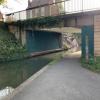
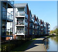
Tavern Hill Bridge No 12
is a minor waterways place
on the Worcester and Birmingham Canal (Diglis Basin to King's Norton Junction) between
Diglis Basin (Tow-path goes around the first basin) (1 mile and 5 furlongs
and 2 locks
to the south) and
Hanbury Junction (Junction with Droitwich Junction Canal (Restored - Opened 1/July/2011). Hanbury Wharf) (7 miles and 3½ furlongs
and 12 locks
to the northeast).
The nearest place in the direction of Diglis Basin is Lansdowne Road Bridge No 11;
2 furlongs
away.
The nearest place in the direction of Hanbury Junction is Lowesmoor Visitor Moorings;
½ furlongs
away.
There may be access to the towpath here.
Mooring here is impossible (it may be physically impossible, forbidden, or allowed only for specific short-term purposes).
There is a bridge here which takes a minor road over the canal.
Lowesmoor Bridge No 8 | 5½ furlongs | |
Rainbow Hill Bridge No 9 | 5 furlongs | |
Lowesmoor Basin | 4¾ furlongs | |
Lowesmoor Railway Bridge No 10 | 4½ furlongs | |
Lansdowne Road Bridge No 11 | 2 furlongs | |
Tavern Hill Bridge No 12 | ||
Lowesmoor Visitor Moorings | ½ furlongs | |
Gregory's Mill Bridge No 13 | 1½ furlongs | |
Gregory's Mill Bottom Lock No 5 | 1½ furlongs | |
Gregory's Mill Top Lock No 6 | 2½ furlongs | |
Astwood Cemetery Bridge No 14 | 3¾ furlongs |
Amenities here
Amenities nearby at Lowesmoor Visitor Moorings
Amenities nearby at Lansdowne Road Bridge No 11
Amenities in Worcester
Amenities at other places in Worcester
at
at
at
at
at
at
at
at
at
at
at
at
at
at
at
at
at
at
at
at
at
at
at
at
at
at
at
at
at
at
at
at
at
at
at
at
at
at
at
at
at
at
at
at
at
at
at
at
at
at
at
at
at
at
at
at
at
at
at
at
at
at
at
at
at
There are no links to external websites from here.
Why not log in and add some (select "External websites" from the menu (sometimes this is under "Edit"))?
Mouseover for more information or show routes to facility
Nearest water point
In the direction of King's Norton Junction
Hanbury Boatyard — 7 miles, 2¾ furlongs and 12 locks away
On this waterway in the direction of King's Norton Junction
Droitwich Spa Marina — 7 miles, 6¾ furlongs and 15 locks away
Travel to Hanbury Junction, then on the Droitwich Canals (Droitwich Junction Canal) to Droitwich Spa Marina
Stoke Works Water Point — 9 miles, 7¾ furlongs and 18 locks away
On this waterway in the direction of King's Norton Junction
Netherwich Basin — 9 miles, 2¼ furlongs and 20 locks away
Travel to Hanbury Junction, then on the Droitwich Canals (Droitwich Junction Canal) to Droitwich Junction, then on the Droitwich Canals (Droitwich Barge Canal) to Netherwich Basin
Tardebigge Wharf — 14 miles, ¼ furlongs and 54 locks away
On this waterway in the direction of King's Norton Junction
Hopwood Visitor Moorings — 19 miles, 4 furlongs and 54 locks away
On this waterway in the direction of King's Norton Junction
In the direction of Diglis Basin
Lowesmoor Basin — 4¾ furlongs away
On this waterway in the direction of Diglis Basin
Diglis Services — 1 mile, 4½ furlongs and 2 locks away
On this waterway in the direction of Diglis Basin
Diglis Locks — 2 miles, ½ furlongs and 4 locks away
Travel to Diglis Basin, then on the Worcester and Birmingham Canal (Diglis Junction to Diglis Basin) to Diglis Junction, then on the River Severn (main river - Worcester to Gloucester) to Diglis Locks
Worcester Trip Boat Moorings — 2 miles, 4¼ furlongs and 4 locks away
Travel to Diglis Basin, then on the Worcester and Birmingham Canal (Diglis Junction to Diglis Basin) to Diglis Junction, then on the River Severn (main river - Stourport to Worcester) to Worcester Trip Boat Moorings
Holt Lock (Holt Fleet) — 9 miles, 1 furlong and 5 locks away
Travel to Diglis Basin, then on the Worcester and Birmingham Canal (Diglis Junction to Diglis Basin) to Diglis Junction, then on the River Severn (main river - Stourport to Worcester) to Holt Lock (Holt Fleet)
Lincomb Lock — 13 miles, 2¾ furlongs and 6 locks away
Travel to Diglis Basin, then on the Worcester and Birmingham Canal (Diglis Junction to Diglis Basin) to Diglis Junction, then on the River Severn (main river - Stourport to Worcester) to Lincomb Lock
Upper Basin Waterpoint — 14 miles, 6 furlongs and 9 locks away
Travel to Diglis Basin, then on the Worcester and Birmingham Canal (Diglis Junction to Diglis Basin) to Diglis Junction, then on the River Severn (main river - Stourport to Worcester) to Severn - Stourport Broad Locks Entrance, then on the Staffordshire and Worcestershire Canal (Stourport Basins: Broad Route) to Stourport Upper Basin, then on the Staffordshire and Worcestershire Canal (Stourport Basins: Narrow Route) to Upper Basin Waterpoint
Upper Lode Lock No 5 — 18 miles, 2¼ furlongs and 5 locks away
Travel to Diglis Basin, then on the Worcester and Birmingham Canal (Diglis Junction to Diglis Basin) to Diglis Junction, then on the River Severn (main river - Worcester to Gloucester) to Upper Lode Lock No 5
Tewkesbury Services — 18 miles and 6 locks away
Travel to Diglis Basin, then on the Worcester and Birmingham Canal (Diglis Junction to Diglis Basin) to Diglis Junction, then on the River Severn (main river - Worcester to Gloucester) to Tewkesbury Junction, then on the River Avon - Warwickshire (Lower Avon Navigation) to Tewkesbury Services
Tewkesbury Lower Lode — 19 miles, ½ furlongs and 6 locks away
Travel to Diglis Basin, then on the Worcester and Birmingham Canal (Diglis Junction to Diglis Basin) to Diglis Junction, then on the River Severn (main river - Worcester to Gloucester) to Tewkesbury Lower Lode
Caldwall Mill Bridge No 14 — 18 miles, 4¼ furlongs and 12 locks away
Travel to Diglis Basin, then on the Worcester and Birmingham Canal (Diglis Junction to Diglis Basin) to Diglis Junction, then on the River Severn (main river - Stourport to Worcester) to Severn - Stourport Broad Locks Entrance, then on the Staffordshire and Worcestershire Canal (Stourport Basins: Broad Route) to Stourport Upper Basin, then on the Staffordshire and Worcestershire Canal (Stourport Basins: Narrow Route) to York Street Bridge, then on the Staffordshire and Worcestershire Canal (Main Line: Stourport to Stourton) to Caldwall Mill Bridge No 14Nearest rubbish disposal
In the direction of King's Norton Junction
Droitwich Spa Marina — 7 miles, 6¾ furlongs and 15 locks away
Travel to Hanbury Junction, then on the Droitwich Canals (Droitwich Junction Canal) to Droitwich Spa Marina
Stoke Bottom Lock No 23 — 10 miles, 5½ furlongs and 18 locks away
On this waterway in the direction of King's Norton Junction
Netherwich Basin — 9 miles, 2¼ furlongs and 20 locks away
Travel to Hanbury Junction, then on the Droitwich Canals (Droitwich Junction Canal) to Droitwich Junction, then on the Droitwich Canals (Droitwich Barge Canal) to Netherwich Basin
Tardebigge Wharf — 14 miles, ¼ furlongs and 54 locks away
On this waterway in the direction of King's Norton Junction
In the direction of Diglis Basin
Lowesmoor Basin — 4¾ furlongs away
On this waterway in the direction of Diglis Basin
Diglis Basin — 1 mile, 5 furlongs and 2 locks away
On this waterway in the direction of Diglis Basin
Sabrina Footbridge — 2 miles, 6 furlongs and 4 locks away
Travel to Diglis Basin, then on the Worcester and Birmingham Canal (Diglis Junction to Diglis Basin) to Diglis Junction, then on the River Severn (main river - Stourport to Worcester) to Sabrina Footbridge
Upper Basin Waterpoint — 14 miles, 6 furlongs and 9 locks away
Travel to Diglis Basin, then on the Worcester and Birmingham Canal (Diglis Junction to Diglis Basin) to Diglis Junction, then on the River Severn (main river - Stourport to Worcester) to Severn - Stourport Broad Locks Entrance, then on the Staffordshire and Worcestershire Canal (Stourport Basins: Broad Route) to Stourport Upper Basin, then on the Staffordshire and Worcestershire Canal (Stourport Basins: Narrow Route) to Upper Basin Waterpoint
Tewkesbury Services — 18 miles and 6 locks away
Travel to Diglis Basin, then on the Worcester and Birmingham Canal (Diglis Junction to Diglis Basin) to Diglis Junction, then on the River Severn (main river - Worcester to Gloucester) to Tewkesbury Junction, then on the River Avon - Warwickshire (Lower Avon Navigation) to Tewkesbury ServicesNearest chemical toilet disposal
In the direction of King's Norton Junction
Droitwich Spa Marina — 7 miles, 6¾ furlongs and 15 locks away
Travel to Hanbury Junction, then on the Droitwich Canals (Droitwich Junction Canal) to Droitwich Spa Marina
Stoke Bottom Lock No 23 — 10 miles, 5½ furlongs and 18 locks away
On this waterway in the direction of King's Norton Junction
Tardebigge Wharf — 14 miles, ¼ furlongs and 54 locks away
On this waterway in the direction of King's Norton Junction
In the direction of Diglis Basin
Lowesmoor Basin — 4¾ furlongs away
On this waterway in the direction of Diglis Basin
Diglis Services — 1 mile, 4½ furlongs and 2 locks away
On this waterway in the direction of Diglis Basin
Stourport Marina — 13 miles, 6 furlongs and 7 locks away
Travel to Diglis Basin, then on the Worcester and Birmingham Canal (Diglis Junction to Diglis Basin) to Diglis Junction, then on the River Severn (main river - Stourport to Worcester) to Stourport Marina
Upper Basin Waterpoint — 14 miles, 6 furlongs and 9 locks away
Travel to Diglis Basin, then on the Worcester and Birmingham Canal (Diglis Junction to Diglis Basin) to Diglis Junction, then on the River Severn (main river - Stourport to Worcester) to Severn - Stourport Broad Locks Entrance, then on the Staffordshire and Worcestershire Canal (Stourport Basins: Broad Route) to Stourport Upper Basin, then on the Staffordshire and Worcestershire Canal (Stourport Basins: Narrow Route) to Upper Basin Waterpoint
Caldwall Mill Bridge No 14 — 18 miles, 4¼ furlongs and 12 locks away
Travel to Diglis Basin, then on the Worcester and Birmingham Canal (Diglis Junction to Diglis Basin) to Diglis Junction, then on the River Severn (main river - Stourport to Worcester) to Severn - Stourport Broad Locks Entrance, then on the Staffordshire and Worcestershire Canal (Stourport Basins: Broad Route) to Stourport Upper Basin, then on the Staffordshire and Worcestershire Canal (Stourport Basins: Narrow Route) to York Street Bridge, then on the Staffordshire and Worcestershire Canal (Main Line: Stourport to Stourton) to Caldwall Mill Bridge No 14Nearest place to turn
In the direction of King's Norton Junction
Bilford Locks Winding Hole — 5¼ furlongs and 3 locks away
On this waterway in the direction of King's Norton Junction
Tibberton Winding Hole — 4 miles, 2½ furlongs and 12 locks away
On this waterway in the direction of King's Norton Junction
Dunhampstead Winding Hole — 5 miles, 2 furlongs and 12 locks away
On this waterway in the direction of King's Norton Junction
Dunhampstead Boatyard — 5 miles, 4¼ furlongs and 12 locks away
On this waterway in the direction of King's Norton Junction
Hanbury Boatyard — 7 miles, 2¾ furlongs and 12 locks away
On this waterway in the direction of King's Norton Junction
Hanbury Junction — 7 miles, 3½ furlongs and 12 locks away
On this waterway in the direction of King's Norton Junction
Hanbury Junction Winding Hole — 7 miles, 4¾ furlongs and 12 locks away
On this waterway in the direction of King's Norton Junction
Droitwich Spa Marina — 7 miles, 6¾ furlongs and 15 locks away
Travel to Hanbury Junction, then on the Droitwich Canals (Droitwich Junction Canal) to Droitwich Spa Marina
In the direction of Diglis Basin
Lowesmoor Basin — 4¾ furlongs away
On this waterway in the direction of Diglis Basin
Diglis Junction — 1 mile, 6 furlongs and 4 locks away
Travel to Diglis Basin, then on the Worcester and Birmingham Canal (Diglis Junction to Diglis Basin) to Diglis Junction
Diglis Locks Weir Exit — 2 miles, 1¼ furlongs and 5 locks away
Travel to Diglis Basin, then on the Worcester and Birmingham Canal (Diglis Junction to Diglis Basin) to Diglis Junction, then on the River Severn (main river - Worcester to Gloucester) to Diglis Locks Weir Exit
Severn - Teme Junction — 2 miles, 7¼ furlongs and 5 locks away
Travel to Diglis Basin, then on the Worcester and Birmingham Canal (Diglis Junction to Diglis Basin) to Diglis Junction, then on the River Severn (main river - Worcester to Gloucester) to Severn - Teme Junction
Bevere Lock Weir Exit — 5 miles, 4½ furlongs and 4 locks away
Travel to Diglis Basin, then on the Worcester and Birmingham Canal (Diglis Junction to Diglis Basin) to Diglis Junction, then on the River Severn (main river - Stourport to Worcester) to Bevere Lock Weir Exit
Bevere Lock Weir Entrance — 5 miles, 7¼ furlongs and 5 locks away
Travel to Diglis Basin, then on the Worcester and Birmingham Canal (Diglis Junction to Diglis Basin) to Diglis Junction, then on the River Severn (main river - Stourport to Worcester) to Bevere Lock Weir Entrance
Holt Lock Weir Exit — 9 miles and 5 locks away
Travel to Diglis Basin, then on the Worcester and Birmingham Canal (Diglis Junction to Diglis Basin) to Diglis Junction, then on the River Severn (main river - Stourport to Worcester) to Holt Lock Weir Exit
Holt Lock Weir Entrance — 9 miles, 3¼ furlongs and 6 locks away
Travel to Diglis Basin, then on the Worcester and Birmingham Canal (Diglis Junction to Diglis Basin) to Diglis Junction, then on the River Severn (main river - Stourport to Worcester) to Holt Lock Weir Entrance
Ladywood Top Lock Winding Hole — 8 miles, 7 furlongs and 13 locks away
Travel to Diglis Basin, then on the Worcester and Birmingham Canal (Diglis Junction to Diglis Basin) to Diglis Junction, then on the River Severn (main river - Stourport to Worcester) to Hawford Junction, then on the Droitwich Canals (Droitwich Barge Canal) to Ladywood Top Lock Winding Hole
Severn - Stourport Narrow Locks Entrance — 14 miles, 5¼ furlongs and 7 locks away
Travel to Diglis Basin, then on the Worcester and Birmingham Canal (Diglis Junction to Diglis Basin) to Diglis Junction, then on the River Severn (main river - Stourport to Worcester) to Severn - Stourport Narrow Locks Entrance
Stourport Lower Basin - between Broad Locks — 14 miles, 5¼ furlongs and 8 locks away
Travel to Diglis Basin, then on the Worcester and Birmingham Canal (Diglis Junction to Diglis Basin) to Diglis Junction, then on the River Severn (main river - Stourport to Worcester) to Severn - Stourport Broad Locks Entrance, then on the Staffordshire and Worcestershire Canal (Stourport Basins: Broad Route) to Stourport Lower Basin - between Broad Locks
Stourport Lower Basin - between Narrow Locks — 14 miles, 5½ furlongs and 8 locks away
Travel to Diglis Basin, then on the Worcester and Birmingham Canal (Diglis Junction to Diglis Basin) to Diglis Junction, then on the River Severn (main river - Stourport to Worcester) to Severn - Stourport Broad Locks Entrance, then on the Staffordshire and Worcestershire Canal (Stourport Basins: Broad Route) to Stourport Lower Basin - between Broad Locks, then on the Staffordshire and Worcestershire Canal (Stourport Basins: Broad Locks to Narrow Locks to Stourport Lower Basin - between Narrow LocksNearest self-operated pump-out
In the direction of King's Norton Junction
Droitwich Spa Marina — 7 miles, 6¾ furlongs and 15 locks away
Travel to Hanbury Junction, then on the Droitwich Canals (Droitwich Junction Canal) to Droitwich Spa Marina
In the direction of Diglis Basin
Diglis Services — 1 mile, 4½ furlongs and 2 locks away
On this waterway in the direction of Diglis BasinNearest boatyard pump-out
In the direction of King's Norton Junction
Dunhampstead Boatyard — 5 miles, 4¼ furlongs and 12 locks away
On this waterway in the direction of King's Norton Junction
Hanbury Boatyard — 7 miles, 2¾ furlongs and 12 locks away
On this waterway in the direction of King's Norton Junction
In the direction of Diglis Basin
Lowesmoor Basin — 4¾ furlongs away
On this waterway in the direction of Diglis Basin
Stourport Marina — 13 miles, 6 furlongs and 7 locks away
Travel to Diglis Basin, then on the Worcester and Birmingham Canal (Diglis Junction to Diglis Basin) to Diglis Junction, then on the River Severn (main river - Stourport to Worcester) to Stourport Marina
Stourport Upper Basin — 14 miles, 6 furlongs and 9 locks away
Travel to Diglis Basin, then on the Worcester and Birmingham Canal (Diglis Junction to Diglis Basin) to Diglis Junction, then on the River Severn (main river - Stourport to Worcester) to Severn - Stourport Broad Locks Entrance, then on the Staffordshire and Worcestershire Canal (Stourport Basins: Broad Route) to Stourport Upper Basin
Upper Staircase Lock Landing Pontoon — 14 miles, 6½ furlongs and 9 locks away
Travel to Diglis Basin, then on the Worcester and Birmingham Canal (Diglis Junction to Diglis Basin) to Diglis Junction, then on the River Severn (main river - Stourport to Worcester) to Severn - Stourport Broad Locks Entrance, then on the Staffordshire and Worcestershire Canal (Stourport Basins: Broad Route) to Stourport Upper Basin, then on the Staffordshire and Worcestershire Canal (Stourport Basins: Narrow Route) to Upper Staircase Lock Landing PontoonDirection of TV transmitter (From Wolfbane Cybernetic)
There is no page on Wikipedia called “Tavern Hill Bridge”
Wikipedia pages that might relate to Tavern Hill Bridge
[Marble Hill, Manhattan]
from both bridges. In 1772 the Dyckmans sold the tavern to Caleb Hyatt and was known by the new owner's name as Hyatt's Tavern at the Free Bridge. When hostilities
[Tukey's Bridge]
Several bridges by the same name have existed connecting the areas. The current bridge was completed in 1960 and named for Lemuel Tukey, a tavern owner
[Black Horse Tavern (Gettysburg, Pennsylvania)]
arch roadway bridge was subsequently built at the tavern and in 1927, the highway near the structure was rerouted from over Bream's Hill to an excavation
[Charlestown, Boston]
Tavern first opened in 1780. It is located at 2 Pleasant Street. The building was one of the first built after the Battle of Bunker Hill. The Tavern took
[Silvermine, Connecticut]
Arts Center. The Silvermine Tavern, an inn occupying several historic buildings, also remains in the neighborhood. Silver Hill Hospital is just beyond the
[Putnam Cottage]
militia tearing up the bridge at Byram. A company of the 5th Connecticut, and more militia, was stationed on Put's Hill near Knapp's Tavern, under the command
[Battle of Cooch's Bridge]
The Battle of Cooch's Bridge, also known as the Battle of Iron Hill, was a battle fought on September 3, 1777, between the Continental Army and American
[Murder of Martha Moxley]
Greenwich station Phebe Seaman House Putnam Cottage (Knapp Tavern) Riverside Avenue Bridge Rosemary Hall Sylvanus Selleck Gristmill United States Post
[Butters' Tavern]
the junction of South Main, Water, and West streets. Butters' Tavern sat atop "Butters' Hill" and was said to have been a desirable business location where
[Birmingham Six]
Birmingham pubs: the Mulberry Bush at the foot of the Rotunda, and the Tavern in the Town – a basement pub in New Street. The resulting explosions, at
Results of Google Search
TAVERN ON THE HILL, Duluth - Menu, Prices, Restaurant Reviews ...Reserve a table at Tavern on the Hill, Duluth on Tripadvisor: See 1419 unbiased ... #12 of 202 Restaurants in Duluth ... Disappointing and not at all kid friendly.
The Battle of Meadow Bridge was an engagement on May 12, 1864, in Henrico County, Virginia, during Lt. Gen. Ulysses S. Grant's Overland Campaign of the American Civil War. Following their victory at the Battle of Yellow Tavern on May 11, Union cavalry ... Federal horse artillery made sure that the Confederate infantry no longer was ...
View full beer menu with prices for Bridge View Tavern restaurant, including Other Half Stacks On Stacks, West Kill Brewing Kaaterskill IPA, and Fiddlehead ...
Nov 16, 2014 ... Brooklyn's Sleepy Enclave, Vinegar Hill, Awakens. Slide 1 of 12. 1/12 ... On Bridge Street, considered by many the border between boomtown ... The portion of Vinegar Hill not occupied by Con Edison is only about nine or 10 ... almost a quarter of the heads of household in Vinegar Hill as tavern proprietors.
The Silvermine Tavern, an inn occupying several historic buildings, also remains in the neighborhood. Silver Hill Hospital is just beyond the northern end of the ...
Feb 2, 2017 ... Cold Spring Tavern is one of those historic and beautiful places that has an ... time just to sit and listen to the stories that no doubt these walls could tell. ... road in the hills above Santa Barbara, Cold Springs Tavern feels about as ... the amazing Cold Springs Bridge, you will see this little cabin nestled in the ...
You call a telephone at the back of Tavern law to get in, and ascend a narrow dark ... Seattle's not so secret speakeasy and yet it's always a pleasant surprise to  ...
There are no menus at Blue Hill at Stone Barns. ... The restaurant will be closed on 6/27, 7/11, 7/12, 7/25, 8/2, 8/15, 8/16, 8/22, 8/29, 9/5, 9/6, 9/12, 9/20, 9/25, ...
Alchymy, 12 Avenue A (between Houston & 2nd St.) Kelly's. Alibi, 116 ... Bar Between the Bridges, 63 York St. (Adams St.), DUMBO, Brooklyn. Bar Cichette, 220Â ...
A modern tavern nestled in a bucolic Central Park setting, Tavern on the Green is an iconic, landmark restaurant unlike any other.