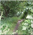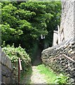
Mark Bottom Bridge No 30
is a minor waterways place
on the Huddersfield Narrow Canal between
Golcar (1 mile and 1¾ furlongs
and 7 locks
to the west) and
Aspley Basin (Huddersfield) (Moorings for Huddersfield and Junction of Huddersfield Broad and Narrow Canals) (1 mile and 4¼ furlongs
and 5 locks
to the east).
The nearest place in the direction of Golcar is Stoney Battery Pipe Bridge;
1 furlong
away.
The nearest place in the direction of Aspley Basin (Huddersfield) is Birkhouse Lane Bridge No 29;
2 furlongs
away.
There may be access to the towpath here.
Mooring here is unrated.
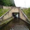
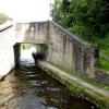
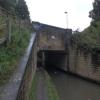
There is a bridge here which takes a minor road over the canal.
| Fountain Lock No 7E | 3¼ furlongs | |
| Stafford Mills Narrows | 2¼ furlongs | |
| Mark Lock Pipe Bridge | 1½ furlongs | |
| Mark Bottom Lock No 6E | 1¼ furlongs | |
| Stoney Battery Pipe Bridge | 1 furlong | |
| Mark Bottom Bridge No 30 | ||
| Birkhouse Lane Bridge No 29 | 2 furlongs | |
| Paddock Foot Aqueduct | 2¾ furlongs | |
| Paddock Foot Lock No 5E | 2¾ furlongs | |
| Springwood Railway Viaduct No 26 | 3 furlongs | |
| Longroyd Lock No 4E | 3¾ furlongs | |
Amenities here
Amenities nearby at Stoney Battery Pipe Bridge
Amenities nearby at Birkhouse Lane Bridge No 29
There are no links to external websites from here.
Why not log in and add some (select "External websites" from the menu (sometimes this is under "Edit"))?
Why not log in and add some (select "External websites" from the menu (sometimes this is under "Edit"))?
Mouseover for more information or show routes to facility
Nearest water point
In the direction of Ashton-under-Lyne Junction
Waterside Lock No 21E — 3 miles, 1¼ furlongs and 15 locks away
On this waterway in the direction of Ashton-under-Lyne Junction
Slaithwaite Winding Hole — 3 miles, 2 furlongs and 16 locks away
On this waterway in the direction of Ashton-under-Lyne Junction
Standedge Tunnel (eastern entrance) — 6 miles, 5 furlongs and 37 locks away
On this waterway in the direction of Ashton-under-Lyne Junction
Standedge Tunnel (western entrance) — 9 miles, 6¾ furlongs and 37 locks away
On this waterway in the direction of Ashton-under-Lyne Junction
Wool Road Bridge No 70 — 11 miles, 6¾ furlongs and 46 locks away
On this waterway in the direction of Ashton-under-Lyne Junction
Grove Road Bridge No 96 — 17 miles, 6¾ furlongs and 61 locks away
On this waterway in the direction of Ashton-under-Lyne Junction
In the direction of Aspley Basin (Huddersfield)
Aspley Basin (Huddersfield) — 1 mile, 4¼ furlongs and 5 locks away
On this waterway in the direction of Aspley Basin (Huddersfield)
Shepley Bridge Sanitary Station — 8 miles, ¾ furlongs and 16 locks away
Travel to Aspley Basin (Huddersfield), then on the Huddersfield Broad Canal to Cooper Bridge Junction, then on the Calder and Hebble Navigation (Main Line) to Shepley Bridge Sanitary Station
Brighouse Basin — 7 miles, 2¾ furlongs and 18 locks away
Travel to Aspley Basin (Huddersfield), then on the Huddersfield Broad Canal to Cooper Bridge Junction, then on the Calder and Hebble Navigation (Main Line) to Brighouse Basin
Salterhebble Sanitary Station — 11 miles, 4¾ furlongs and 27 locks away
Travel to Aspley Basin (Huddersfield), then on the Huddersfield Broad Canal to Cooper Bridge Junction, then on the Calder and Hebble Navigation (Main Line) to Salterhebble Sanitary Station
Broad Cut Low Lock No 3 — 14 miles, 5¾ furlongs and 24 locks away
Travel to Aspley Basin (Huddersfield), then on the Huddersfield Broad Canal to Cooper Bridge Junction, then on the Calder and Hebble Navigation (Main Line) to Broad Cut Low Lock No 3
Salterhebble Junction — 11 miles, 5 furlongs and 28 locks away
Travel to Aspley Basin (Huddersfield), then on the Huddersfield Broad Canal to Cooper Bridge Junction, then on the Calder and Hebble Navigation (Main Line) to Salterhebble Junction
Sowerby Bridge Basin — 13 miles, 6¾ furlongs and 28 locks away
Travel to Aspley Basin (Huddersfield), then on the Huddersfield Broad Canal to Cooper Bridge Junction, then on the Calder and Hebble Navigation (Main Line) to Salterhebble Junction, then on the Calder and Hebble Navigation (Main Line) to Sowerby Bridge Basin
Hebden Bridge Services — 19 miles, 2¼ furlongs and 35 locks away
Travel to Aspley Basin (Huddersfield), then on the Huddersfield Broad Canal to Cooper Bridge Junction, then on the Calder and Hebble Navigation (Main Line) to Salterhebble Junction, then on the Calder and Hebble Navigation (Main Line) to Sowerby Bridge Junction, then on the Rochdale Canal to Hebden Bridge ServicesNearest rubbish disposal
In the direction of Ashton-under-Lyne Junction
Pickle Lock No 22E — 3 miles, 2½ furlongs and 16 locks away
On this waterway in the direction of Ashton-under-Lyne Junction
Wool Road Visitor Mooring — 11 miles, 7 furlongs and 46 locks away
On this waterway in the direction of Ashton-under-Lyne Junction
In the direction of Aspley Basin (Huddersfield)
Aspley Basin (Huddersfield) — 1 mile, 4¼ furlongs and 5 locks away
On this waterway in the direction of Aspley Basin (Huddersfield)
Shepley Bridge Sanitary Station — 8 miles, ¾ furlongs and 16 locks away
Travel to Aspley Basin (Huddersfield), then on the Huddersfield Broad Canal to Cooper Bridge Junction, then on the Calder and Hebble Navigation (Main Line) to Shepley Bridge Sanitary Station
Brighouse Lower Basin Visitor Moorings — 7 miles, 2¼ furlongs and 17 locks away
Travel to Aspley Basin (Huddersfield), then on the Huddersfield Broad Canal to Cooper Bridge Junction, then on the Calder and Hebble Navigation (Main Line) to Brighouse Lower Basin Visitor Moorings
Horbury Basin Residential Moorings & Sanitary Station — 12 miles, 5¼ furlongs and 23 locks away
Travel to Aspley Basin (Huddersfield), then on the Huddersfield Broad Canal to Cooper Bridge Junction, then on the Calder and Hebble Navigation (Main Line) to Horbury Basin Residential Moorings & Sanitary Station
Salterhebble Sanitary Station — 11 miles, 4¾ furlongs and 27 locks away
Travel to Aspley Basin (Huddersfield), then on the Huddersfield Broad Canal to Cooper Bridge Junction, then on the Calder and Hebble Navigation (Main Line) to Salterhebble Sanitary Station
Sowerby Bridge Basin — 13 miles, 6¾ furlongs and 28 locks away
Travel to Aspley Basin (Huddersfield), then on the Huddersfield Broad Canal to Cooper Bridge Junction, then on the Calder and Hebble Navigation (Main Line) to Salterhebble Junction, then on the Calder and Hebble Navigation (Main Line) to Sowerby Bridge Basin
Hebden Bridge Services — 19 miles, 2¼ furlongs and 35 locks away
Travel to Aspley Basin (Huddersfield), then on the Huddersfield Broad Canal to Cooper Bridge Junction, then on the Calder and Hebble Navigation (Main Line) to Salterhebble Junction, then on the Calder and Hebble Navigation (Main Line) to Sowerby Bridge Junction, then on the Rochdale Canal to Hebden Bridge ServicesNearest chemical toilet disposal
In the direction of Ashton-under-Lyne Junction
Waterside Lock No 21E — 3 miles, 1¼ furlongs and 15 locks away
On this waterway in the direction of Ashton-under-Lyne Junction
Pickle Lock No 22E — 3 miles, 2½ furlongs and 16 locks away
On this waterway in the direction of Ashton-under-Lyne Junction
Wool Road Bridge No 70 — 11 miles, 6¾ furlongs and 46 locks away
On this waterway in the direction of Ashton-under-Lyne Junction
Grove Road Bridge No 96 — 17 miles, 6¾ furlongs and 61 locks away
On this waterway in the direction of Ashton-under-Lyne Junction
In the direction of Aspley Basin (Huddersfield)
Aspley Basin (Huddersfield) — 1 mile, 4¼ furlongs and 5 locks away
On this waterway in the direction of Aspley Basin (Huddersfield)
Shepley Bridge Sanitary Station — 8 miles, ¾ furlongs and 16 locks away
Travel to Aspley Basin (Huddersfield), then on the Huddersfield Broad Canal to Cooper Bridge Junction, then on the Calder and Hebble Navigation (Main Line) to Shepley Bridge Sanitary Station
Brighouse Basin — 7 miles, 2¾ furlongs and 18 locks away
Travel to Aspley Basin (Huddersfield), then on the Huddersfield Broad Canal to Cooper Bridge Junction, then on the Calder and Hebble Navigation (Main Line) to Brighouse Basin
Savile Town Wharf and Basin (Dewsbury) — 11 miles, 4¼ furlongs and 20 locks away
Travel to Aspley Basin (Huddersfield), then on the Huddersfield Broad Canal to Cooper Bridge Junction, then on the Calder and Hebble Navigation (Main Line) to Dewsbury Arm Junction, then on the Calder and Hebble Navigation (Dewsbury Old Cut) to Savile Town Wharf and Basin (Dewsbury)
Horbury Basin Residential Moorings & Sanitary Station — 12 miles, 5¼ furlongs and 23 locks away
Travel to Aspley Basin (Huddersfield), then on the Huddersfield Broad Canal to Cooper Bridge Junction, then on the Calder and Hebble Navigation (Main Line) to Horbury Basin Residential Moorings & Sanitary Station
Salterhebble Sanitary Station — 11 miles, 4¾ furlongs and 27 locks away
Travel to Aspley Basin (Huddersfield), then on the Huddersfield Broad Canal to Cooper Bridge Junction, then on the Calder and Hebble Navigation (Main Line) to Salterhebble Sanitary Station
Sowerby Bridge Basin — 13 miles, 6¾ furlongs and 28 locks away
Travel to Aspley Basin (Huddersfield), then on the Huddersfield Broad Canal to Cooper Bridge Junction, then on the Calder and Hebble Navigation (Main Line) to Salterhebble Junction, then on the Calder and Hebble Navigation (Main Line) to Sowerby Bridge Basin
Hebden Bridge Services — 19 miles, 2¼ furlongs and 35 locks away
Travel to Aspley Basin (Huddersfield), then on the Huddersfield Broad Canal to Cooper Bridge Junction, then on the Calder and Hebble Navigation (Main Line) to Salterhebble Junction, then on the Calder and Hebble Navigation (Main Line) to Sowerby Bridge Junction, then on the Rochdale Canal to Hebden Bridge ServicesNearest place to turn
In the direction of Ashton-under-Lyne Junction
Isis Lock Winding Hole — 5 furlongs and 3 locks away
On this waterway in the direction of Ashton-under-Lyne Junction
Linthwaite Winding Hole — 2 miles, 1½ furlongs and 11 locks away
On this waterway in the direction of Ashton-under-Lyne Junction
Slaithwaite Winding Hole — 3 miles, 2 furlongs and 16 locks away
On this waterway in the direction of Ashton-under-Lyne Junction
Booth Lock Winding Hole — 4 miles, 7 furlongs and 26 locks away
On this waterway in the direction of Ashton-under-Lyne Junction
In the direction of Aspley Basin (Huddersfield)
University Arm — 1 mile, 3½ furlongs and 5 locks away
On this waterway in the direction of Aspley Basin (Huddersfield)
Aspley Basin (Huddersfield) — 1 mile, 4¼ furlongs and 5 locks away
On this waterway in the direction of Aspley Basin (Huddersfield)
Anchor Street Winding Hole — 2 miles, 1¼ furlongs and 5 locks away
Travel to Aspley Basin (Huddersfield), then on the Huddersfield Broad Canal to Anchor Street Winding Hole
New Road Winding Hole — 2 miles, 4¾ furlongs and 5 locks away
Travel to Aspley Basin (Huddersfield), then on the Huddersfield Broad Canal to New Road Winding Hole
Deighton Road Bridge Winding Hole — 3 miles, 6¼ furlongs and 10 locks away
Travel to Aspley Basin (Huddersfield), then on the Huddersfield Broad Canal to Deighton Road Bridge Winding Hole
Cooper Bridge Junction — 5 miles, ¼ furlongs and 14 locks away
Travel to Aspley Basin (Huddersfield), then on the Huddersfield Broad Canal to Cooper Bridge Junction
Battye Weir Entrance — 5 miles, 5¼ furlongs and 15 locks away
Travel to Aspley Basin (Huddersfield), then on the Huddersfield Broad Canal to Cooper Bridge Junction, then on the Calder and Hebble Navigation (Main Line) to Battye Weir Entrance
Shepley Bridge Marina — 8 miles, 1¼ furlongs and 16 locks away
Travel to Aspley Basin (Huddersfield), then on the Huddersfield Broad Canal to Cooper Bridge Junction, then on the Calder and Hebble Navigation (Main Line) to Shepley Bridge Marina
Brighouse Basin — 7 miles, 2¾ furlongs and 18 locks away
Travel to Aspley Basin (Huddersfield), then on the Huddersfield Broad Canal to Cooper Bridge Junction, then on the Calder and Hebble Navigation (Main Line) to Brighouse Basin
Ganny Winding Hole — 8 miles and 19 locks away
Travel to Aspley Basin (Huddersfield), then on the Huddersfield Broad Canal to Cooper Bridge Junction, then on the Calder and Hebble Navigation (Main Line) to Ganny Winding Hole
Dewsbury Arm Junction — 10 miles, 4¼ furlongs and 20 locks away
Travel to Aspley Basin (Huddersfield), then on the Huddersfield Broad Canal to Cooper Bridge Junction, then on the Calder and Hebble Navigation (Main Line) to Dewsbury Arm Junction
Savile Town Wharf and Basin (Dewsbury) — 11 miles, 4¼ furlongs and 20 locks away
Travel to Aspley Basin (Huddersfield), then on the Huddersfield Broad Canal to Cooper Bridge Junction, then on the Calder and Hebble Navigation (Main Line) to Dewsbury Arm Junction, then on the Calder and Hebble Navigation (Dewsbury Old Cut) to Savile Town Wharf and Basin (Dewsbury)
Horbury Basin Residential Moorings & Sanitary Station — 12 miles, 5¼ furlongs and 23 locks away
Travel to Aspley Basin (Huddersfield), then on the Huddersfield Broad Canal to Cooper Bridge Junction, then on the Calder and Hebble Navigation (Main Line) to Horbury Basin Residential Moorings & Sanitary Station
Salterhebble Wharf — 11 miles, 4 furlongs and 26 locks away
Travel to Aspley Basin (Huddersfield), then on the Huddersfield Broad Canal to Cooper Bridge Junction, then on the Calder and Hebble Navigation (Main Line) to Salterhebble Wharf
Salterhebble Bottom Basin Visitor Moorings — 11 miles, 4¼ furlongs and 26 locks away
Travel to Aspley Basin (Huddersfield), then on the Huddersfield Broad Canal to Cooper Bridge Junction, then on the Calder and Hebble Navigation (Main Line) to Salterhebble Bottom Basin Visitor Moorings
Salterhebble Sanitary Station — 11 miles, 4¾ furlongs and 27 locks away
Travel to Aspley Basin (Huddersfield), then on the Huddersfield Broad Canal to Cooper Bridge Junction, then on the Calder and Hebble Navigation (Main Line) to Salterhebble Sanitary StationNearest self-operated pump-out
In the direction of Ashton-under-Lyne Junction
Slaithwaite Winding Hole — 3 miles, 2 furlongs and 16 locks away
On this waterway in the direction of Ashton-under-Lyne Junction
Wool Road Bridge No 70 — 11 miles, 6¾ furlongs and 46 locks away
On this waterway in the direction of Ashton-under-Lyne Junction
In the direction of Aspley Basin (Huddersfield)
Hebden Bridge Services — 19 miles, 2¼ furlongs and 35 locks away
Travel to Aspley Basin (Huddersfield), then on the Huddersfield Broad Canal to Cooper Bridge Junction, then on the Calder and Hebble Navigation (Main Line) to Salterhebble Junction, then on the Calder and Hebble Navigation (Main Line) to Sowerby Bridge Junction, then on the Rochdale Canal to Hebden Bridge ServicesNearest boatyard pump-out
In the direction of Aspley Basin (Huddersfield)
Aspley Basin (Huddersfield) — 1 mile, 4¼ furlongs and 5 locks away
On this waterway in the direction of Aspley Basin (Huddersfield)
Shepley Bridge Marina — 8 miles, 1¼ furlongs and 16 locks away
Travel to Aspley Basin (Huddersfield), then on the Huddersfield Broad Canal to Cooper Bridge Junction, then on the Calder and Hebble Navigation (Main Line) to Shepley Bridge Marina
Sowerby Bridge Basin — 13 miles, 6¾ furlongs and 28 locks away
Travel to Aspley Basin (Huddersfield), then on the Huddersfield Broad Canal to Cooper Bridge Junction, then on the Calder and Hebble Navigation (Main Line) to Salterhebble Junction, then on the Calder and Hebble Navigation (Main Line) to Sowerby Bridge BasinDirection of TV transmitter (From Wolfbane Cybernetic)
There is no page on Wikipedia called “Mark Bottom Bridge”
Wikipedia pages that might relate to Mark Bottom Bridge
[Crybaby Bridge]
this road previously led from the bottom of the hollow (Hametown Rd.) to the top (Rogue Hollow Rd.). The bridge is only approachable from Hametown Rd
[Bailey bridge]
and bottom chord of each panel had interlocking male and female lugs into which engineers could inset panel connecting pins. The floor of the bridge consists
[Diode bridge]
A diode bridge is an arrangement of four (or more) diodes in a bridge circuit configuration that provides the same polarity of output for either polarity
[Tappan Zee Bridge (2017–present)]
The Tappan Zee Bridge, officially named the Governor Mario M. Cuomo Bridge, is a twin cable-stayed bridge spanning the Hudson River between Tarrytown and
[List of Dragon Ball episodes]
robot emerges bent on terminating intruders. 51 "The Security Guard at the Bottom of the Ocean" / "Beware of Robot" Transcription: "Kaitei no Gādoman" (Japanese:
[Hebden Bridge]
Hebden Bridge is a market town in the Upper Calder Valley in West Yorkshire, England. It is 8 miles (13 km) west of Halifax and 14 miles (21 km) north-east
[Brooklyn Bridge]
The Brooklyn Bridge is a hybrid cable-stayed/suspension bridge in New York City, spanning the East River between Manhattan Island and Brooklyn on Long
[Bridge]
A bridge is a structure built to span a physical obstacle, such as a body of water, valley, or road, without closing the way underneath. It is constructed
[Sydney Harbour Bridge]
The Sydney Harbour Bridge is an Australian heritage-listed steel through arch bridge across Sydney Harbour that carries rail, vehicular, bicycle, and
[Colorado Street Bridge (Pasadena, California)]
Colorado Street Bridge replaced the small Scoville Bridge located near the bottom of the Arroyo Seco. It opened on December 13, 1913. The bridge follows a curved
Results of Google Search
Nov 9, 2019 ... Berlin marks 30 years since fall of the wall in reflective mood ... This year, however, there was no single unifying event that brought Berliners together ... By the Oberbaumbrücke Oberbaum bridge in Friedrichshain, a chain of neon ... consent at any time by going to 'Privacy settings' at the bottom of any page.
Aug 15, 2008 ... Multi-lane Undivided Roadway Pavement Marking Details . ... Minimum Length of a No Passing Zone in Advance of a Stop Condition . . . . . . . . . . . . . . .7-63. 7-3 ... bituminous and concrete pavements (including bridge decks). ... shall a stop line be placed more than 30 feet or less than 4 feet from the nearest ...
Oct 29, 2010 ... As the first volume of Mark Twain's unexpurgated autobiography is finally ... Despite being dead for a century, Twain is not only as celebrated as ... Almost uniquely, Twain bridges the perpetual ideological divide that ... 30 Oct 2010 0:05 ... at any time by going to 'Privacy settings' at the bottom of any page.
No overnight camping in day use portion at any time of year. North Fork Recreational Area Campground is open seasonally 5/15-11/30 (Water will be ... Rental; River of Life; Sunburst Ranch Canoe Rental; Twin Bridges Canoe Rental ... Use caution as the current, river bottom and debris will create hazards at anytime.
A traffic control device is a sign, signal, marking or other device placed on or ... The bottom of signs mounted on barricades or temporary supports shall be no less than ... 30"x30". Multiple Left Turn Lane - R3-8 30"x30". R3-8 30"x30". Do Not Pass ... gross weight or axle weight that can be permitted on the roadway or bridge.
Jul 27, 2016 ... The channel bottom appeared stable with no significant scour and with no ... Item 113: Scour Critical Bridge: Code: No. (Mark your selection with an X). Yes. X ... BRIDGE 84508 CSAH 30 OVER RED RIVER OF THE NORTH.
1 inch = 200 feet. FSP 1. 2013-1481. March 30, 2015. As Noted. DATE. REVISIONS. DATE. DESCRIPTION. MARK. SCALE. JOB NO. SHEET. INDEX MAP.
The M1903 Springfield, formally the United States Rifle, Caliber .30-06, Model 1903, is an ... The M1903 not only replaced the various versions of the U.S. Army's Krag, but also the Lee ... Toward the end of the war, Springfield turned out the Model 1903 Mark I. The Mark I has a ... Left to right, top to bottom, they are as follows.
PART 2. DATE: 30Apr2019. SHEET 1 of 2. FILE NO. 26.TOC-1 ... Sample 3: Bridge Replacement – Cofferdam / Wetland ................... 30Apr2019 ... The elevation of the bottom of the footing is below the ordinary high water elevation or ... of the water (the contour line of ordinary high water mark or mean high water mark).



![Mill and canal, Paddock. Mark Bottom Lock [6E] on the Huddersfield Narrow Canal, alongside the enormous Britannia Mill. by Christine Johnstone – 21 May 2010](https://s2.geograph.org.uk/geophotos/01/88/61/1886162_bda9790c_120x120.jpg)


