CanalPlanAC

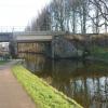
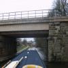
Aldcliffe Road Railway Bridge No 97

 
78 Aldcliffe Road, Lancaster LA1 1SJ, United Kingdom
 
Information about the place
Aldcliffe Road Railway Bridge No 97 is a minor waterways place on the Lancaster Canal (Main Line) between Lodge Hill Junction (Junction with Lancaster Canal - Glasson Dock Branch) (5 miles and 1½ furlongs to the south) and Lune Aqueduct (northern end) (Over the River Lune, built by Rennie) (2 miles and 4¾ furlongs to the northeast).
 
 
The nearest place in the direction of Lodge Hill Junction is Aldcliffe Road Footbridge No 96; 1¼ furlongs away.
 
The nearest place in the direction of Lune Aqueduct (northern end) is Ashton Road South Bridge No 98; 1 furlong away.

Mooring here is unrated.

There is a bridge here which takes a railway over the canal.


Amenities

Amenities here

 Fish & Chips

Amenities nearby at Aldcliffe Road Footbridge No 96

 Cashpoint
 TB Turbos

Amenities nearby at Ashton Road South Bridge No 98

 SPAR
 
Maps
If you are a user and are logged on, or if you are actively planning a route, a map will be displayed here.
Show on external mapping site: Google | OSM | Bing
 
Photos
 
External websites
There are no links to external websites from here.
Why not log in and add some (select "External websites" from the menu (sometimes this is under "Edit"))?
 
Nearest facilities

Mouseover for more information or show routes to facility

Nearest water point

In the direction of Preston Terminus

Lodge Hill Junction5 miles, 1½ furlongs away
On this waterway in the direction of Preston Terminus
Ratcliffe Bridge No 758 miles, 2¼ furlongs away
On this waterway in the direction of Preston Terminus
Moss Lane Bridge No 6312 miles, 3¼ furlongs away
On this waterway in the direction of Preston Terminus
Brows Bridge No 87 miles, 5½ furlongs and 6 locks away
Travel to Lodge Hill Junction, then on the Lancaster Canal (Glasson Branch) to Brows Bridge No 8
Glasson Visitor Moorings7 miles, 6¼ furlongs and 6 locks away
Travel to Lodge Hill Junction, then on the Lancaster Canal (Glasson Branch) to Glasson Visitor Moorings
Glasson Basin7 miles, 7½ furlongs and 6 locks away
Travel to Lodge Hill Junction, then on the Lancaster Canal (Glasson Branch) to Glasson Basin
Bilsborrow Winding Hole17 miles, 4 furlongs away
On this waterway in the direction of Preston Terminus

In the direction of Tewitfield

Hest Bank Bridge No 1185 miles, 1¾ furlongs away
On this waterway in the direction of Tewitfield
Tewitfield12 miles, 7¼ furlongs away
On this waterway in the direction of Tewitfield

Nearest rubbish disposal

In the direction of Preston Terminus

Bilsborrow Winding Hole17 miles, 4 furlongs away
On this waterway in the direction of Preston Terminus

In the direction of Tewitfield

Hest Bank Bridge No 1185 miles, 1¾ furlongs away
On this waterway in the direction of Tewitfield
Tewitfield12 miles, 7¼ furlongs away
On this waterway in the direction of Tewitfield

Nearest chemical toilet disposal

In the direction of Preston Terminus

Bilsborrow Winding Hole17 miles, 4 furlongs away
On this waterway in the direction of Preston Terminus

In the direction of Tewitfield

Hest Bank Bridge No 1185 miles, 1¾ furlongs away
On this waterway in the direction of Tewitfield
Lundsfield Wharf8 miles, 4¾ furlongs away
On this waterway in the direction of Tewitfield
Tewitfield12 miles, 7¼ furlongs away
On this waterway in the direction of Tewitfield

Nearest place to turn

In the direction of Preston Terminus

Ashton Park Bridge Winding Hole3 miles, 1 furlong away
On this waterway in the direction of Preston Terminus
Galgate Basin Wharf4 miles, 6¾ furlongs away
On this waterway in the direction of Preston Terminus
Lodge Hill Junction5 miles, 1½ furlongs away
On this waterway in the direction of Preston Terminus
Carter's Wood Winding Hole5 miles, 3¾ furlongs and 1 lock away
Travel to Lodge Hill Junction, then on the Lancaster Canal (Glasson Branch) to Carter's Wood Winding Hole
Richmond Bridge Winding Hole6 miles, 6¼ furlongs away
On this waterway in the direction of Preston Terminus
Ratcliffe Bridge Winding Hole8 miles, 3 furlongs away
On this waterway in the direction of Preston Terminus
Bells Bridge Winding Hole10 miles, 6¾ furlongs away
On this waterway in the direction of Preston Terminus
Cathouse Bridge Winding Hole12 miles, 1¼ furlongs away
On this waterway in the direction of Preston Terminus
Moss Lane Bridge Winding Hole (north)12 miles, 3¼ furlongs away
On this waterway in the direction of Preston Terminus
Moss Lane Bridge Winding Hole (south)12 miles, 3¼ furlongs away
On this waterway in the direction of Preston Terminus
Kepple Lane Bridge Winding Hole12 miles, 4¾ furlongs away
On this waterway in the direction of Preston Terminus
Thurnham Bridge Winding Hole7 miles, ½ furlongs and 6 locks away
Travel to Lodge Hill Junction, then on the Lancaster Canal (Glasson Branch) to Thurnham Bridge Winding Hole
The Moorings Basin12 miles, 5¼ furlongs away
On this waterway in the direction of Preston Terminus

In the direction of Tewitfield

Halton Road Winding Hole2 miles, 5 furlongs away
On this waterway in the direction of Tewitfield
Folly Bridge Winding Hole3 miles, 6 furlongs away
On this waterway in the direction of Tewitfield
Belmont Bridge Winding Hole4 miles, 1¼ furlongs away
On this waterway in the direction of Tewitfield
Hest Bank Winding Hole5 miles, 3 furlongs away
On this waterway in the direction of Tewitfield
Lundsfield Wharf8 miles, 4¾ furlongs away
On this waterway in the direction of Tewitfield
Capernwray Winding Hole11 miles, ½ furlongs away
On this waterway in the direction of Tewitfield
Lovers Creek11 miles, 4½ furlongs away
On this waterway in the direction of Tewitfield

No information

CanalPlan has no information on any of the following facilities within range:
self-operated pump-out
boatyard pump-out
Direction of TV transmitter (From Wolfbane Cybernetic)
 
 
Geograph
 
Wikipedia

There is no page on Wikipedia called “Aldcliffe Road Railway Bridge”

Wikipedia pages that might relate to Aldcliffe Road Railway Bridge
[Abbeystead House] building. York Lodge stands 0.5 miles (1 km) to the east on the road to Dunsop Bridge and is also listed Grade II. In 1891–92 the same architects designed [Skerton Bridge] Skerton Bridge is a road bridge carrying the southbound lanes of the A6 road over the River Lune in Lancaster, Lancashire, England. The bridge is recorded [Lancaster Castle] influenced by the Roman fort and the associated civilian settlement; the main road through the town was the route that led east from the fort. After the Norman [Greyhound Bridge] same railway line. After the closure of the railway in 1966, the Greyhound Bridge was converted for use by road traffic, and re-opened in 1972. It now carries [Loyn Bridge] Loyn Bridge (or Loyne Bridge) crosses the River Lune, carrying a minor road between the villages of Hornby and Gressingham in Lancashire, England. The [Morecambe Winter Gardens] Demolished Aldcliffe Hall Cockerham Priory Hornby Priory Lancaster Friary Lancaster Roman Fort North Western Hotel Over Burrow Roman Fort Old Loyne Bridge Wyresdale [Royal Albert Hospital] benefactors of the hospital. Also in this hall are galleries. On Ashton Road at the entrance to the drive to the former hospital is a lodge, built in [Lancaster Roman Fort] follow the classic Roman plan. Next to the Wery Wall (near the junction of Bridge Lane and Church Street), the remains of a bath-house incorporating a reused [Listed buildings in Carnforth] associated with the railway and, in addition, a signal box moved from another site. The Lancaster Canal passes through the parish, and two bridges crossing it [Judges' Lodgings, Lancaster] the display cabinets are doll's houses, Lego, Meccano and some Hornby railway trains. Lancashire portal Grade I listed buildings in Lancashire Listed
 
Google