CanalPlanAC

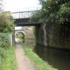
Rother Way Railway Bridge No 2

 
Sainsbury's, Rother Way, Chesterfield S41 0UG, United Kingdom
 
Information about the place
Rother Way Railway Bridge No 2 is a minor waterways place on the Chesterfield Canal (Derbyshire restored section) between Chesterfield Waterside (New development under construction and limit of navigation) (1 mile and ¾ furlongs and 1 lock to the south) and Staveley Town Lock No 5A (4 miles and 3½ furlongs and 4 locks to the east).
 
It is part of Staveley Works Locks.
 
The nearest place in the direction of Chesterfield Waterside is Tapton Slipway; 1¼ furlongs away.
 
The nearest place in the direction of Staveley Town Lock No 5A is Rother Way Railway Bridge No 1; ¼ furlongs away.

Mooring here is unrated.

There is a bridge here which takes a railway over the canal.


Amenities

Amenities here

 Lidl
 Sainsbury's
 Sainsburys - Rother Way - Chesterfield S41 0UB
 Burger King
 Fish & Chips
 Cashpoint
 Gas & Hire Ltd
 Je James Cycles - Chesterfield
 Plumbing Trade Supplies

Amenities nearby at Rother Way Railway Bridge No 1

 Sainsburys
 Chesterfield Caravans Ltd
 Sainsburys Fuel
 
Maps
If you are a user and are logged on, or if you are actively planning a route, a map will be displayed here.
Show on external mapping site: Google | OSM | Bing
 
Photos
 
External websites
 Chesterfield Canal Trust — associated with Chesterfield Canal (Derbyshire restored section)
Restoration website
 
Nearest facilities

Mouseover for more information or show routes to facility

Nearest place to turn

In the direction of Staveley Town Basin

Bilby Lane Bridge Winding Hole1 mile, 6½ furlongs and 2 locks away
On this waterway in the direction of Staveley Town Basin
Works Road Winding Hole2 miles, 7¾ furlongs and 4 locks away
On this waterway in the direction of Staveley Town Basin
Staveley Town Basin4 miles, 3¼ furlongs and 4 locks away
On this waterway in the direction of Staveley Town Basin
Hartington Harbour4 miles, 4½ furlongs and 5 locks away
Travel to Staveley Town Basin, then on the Chesterfield Canal (Unnavigable section) to Hartington Harbour
Norwood Winding Hole10 miles, 4 furlongs and 20 locks away
Travel to Staveley Town Basin, then on the Chesterfield Canal (Unnavigable section) to New Leah’s Bridge No 26B, then on the Chesterfield Canal (Central Line West) to Nethermoor Lake Marina, then on the Chesterfield Canal (Unnavigable section) to Norwood Winding Hole
Kiveton Waters Marina12 miles and 43 locks away
Travel to Staveley Town Basin, then on the Chesterfield Canal (Unnavigable section) to New Leah’s Bridge No 26B, then on the Chesterfield Canal (Central Line West) to Nethermoor Lake Marina, then on the Chesterfield Canal (Unnavigable section) to Kiveton Waters Marina
Manor Road Winding Hole12 miles, 6¾ furlongs and 46 locks away
Travel to Staveley Town Basin, then on the Chesterfield Canal (Unnavigable section) to New Leah’s Bridge No 26B, then on the Chesterfield Canal (Central Line West) to Nethermoor Lake Marina, then on the Chesterfield Canal (Unnavigable section) to Norwood Tunnel (eastern entrance), then on the Chesterfield Canal (Norwood to Retford) to Manor Road Winding Hole
Little Lane Bridge Winding Hole15 miles, 3½ furlongs and 61 locks away
Travel to Staveley Town Basin, then on the Chesterfield Canal (Unnavigable section) to New Leah’s Bridge No 26B, then on the Chesterfield Canal (Central Line West) to Nethermoor Lake Marina, then on the Chesterfield Canal (Unnavigable section) to Norwood Tunnel (eastern entrance), then on the Chesterfield Canal (Norwood to Retford) to Little Lane Bridge Winding Hole
Shireoaks Marina16 miles, 3¼ furlongs and 69 locks away
Travel to Staveley Town Basin, then on the Chesterfield Canal (Unnavigable section) to New Leah’s Bridge No 26B, then on the Chesterfield Canal (Central Line West) to Nethermoor Lake Marina, then on the Chesterfield Canal (Unnavigable section) to Norwood Tunnel (eastern entrance), then on the Chesterfield Canal (Norwood to Retford) to Shireoaks Marina
Junction with former Lady Lee Arm17 miles, 6 furlongs and 76 locks away
Travel to Staveley Town Basin, then on the Chesterfield Canal (Unnavigable section) to New Leah’s Bridge No 26B, then on the Chesterfield Canal (Central Line West) to Nethermoor Lake Marina, then on the Chesterfield Canal (Unnavigable section) to Norwood Tunnel (eastern entrance), then on the Chesterfield Canal (Norwood to Retford) to Junction with former Lady Lee Arm
Morse Lock Winding Hole18 miles, 2¼ furlongs and 77 locks away
Travel to Staveley Town Basin, then on the Chesterfield Canal (Unnavigable section) to New Leah’s Bridge No 26B, then on the Chesterfield Canal (Central Line West) to Nethermoor Lake Marina, then on the Chesterfield Canal (Unnavigable section) to Norwood Tunnel (eastern entrance), then on the Chesterfield Canal (Norwood to Retford) to Morse Lock Winding Hole
High Hoe Road Bridge Winding Hole19 miles, 2¼ furlongs and 79 locks away
Travel to Staveley Town Basin, then on the Chesterfield Canal (Unnavigable section) to New Leah’s Bridge No 26B, then on the Chesterfield Canal (Central Line West) to Nethermoor Lake Marina, then on the Chesterfield Canal (Unnavigable section) to Norwood Tunnel (eastern entrance), then on the Chesterfield Canal (Norwood to Retford) to High Hoe Road Bridge Winding Hole

No information

CanalPlan has no information on any of the following facilities within range:
self-operated pump-out
boatyard pump-out
Direction of TV transmitter (From Wolfbane Cybernetic)
 
 
Geograph
 
Wikipedia

There is no page on Wikipedia called “Rother Way Railway Bridge”

Wikipedia pages that might relate to Rother Way Railway Bridge
[River Don, Yorkshire] The Don's major tributaries are the Loxley, the Rivelin, the Sheaf, the Rother and the Dearne. Along the Sheffield–Rotherham stretch of the river are five [River Rother, East Sussex] The River Rother flows for 35 miles (56 km) through the English counties of East Sussex and Kent. Its source is near Rotherfield in East Sussex, and its [River Rother, South Yorkshire] joins the Rother from the east, the river is crossed by a grade II listed two-arched bridge built around 1840 by the North Midland Railway, which carries [Rother Link] river bank from Rotherham to the A631 bridge, and then follows the valley to Rother Valley Country Park, on its way to Chesterfield. The Trans Pennine Trail [Kent and East Sussex Railway] Chatham Railway, seeking to relieve themselves from building the Tenterden Railway, entered into an agreement with the Rother Valley Railway for the latter [River Rother, West Sussex] The River Rother flows from Empshott in Hampshire, England, to Stopham in West Sussex, where it joins the River Arun. At 52 kilometres (32 mi) long, most [New Lipchis Way] descends to cross the River Rother for the first time at Iping Bridge, then follows a bridleway east to another ancient stone bridge at Stedham where it re-crosses [Pudding Lane] lower end called Rothersgate (from the "rothers" or cattle that were landed there), and it was also known as Rother Lane. Another name for it was Red Rose [River Arun] Turning to the south, it is joined by its main tributary, the western River Rother, and continues through a gap in the South Downs to Arundel to join the English [Romney Marsh] Dungeness; the Rother Levels, which, with various ditches, lie around the Isle of Oxney; and the Rye, Winchelsea and Pett Levels. The River Rother today flows
 
Google

Results of Google Search

River Rother, South Yorkshire - Wikipedia
The villages which grew up around the mines often had little or no sewage treatment facilities, and hence sewage found its way into the river. The River Doe Lea, the River Drone and the Pools Brook became lifeless sewers, as did the Rother. Derbyshire County Council obtained a ruling from the Chesterfield County Court ...
Killamarsh and the Surrounding Area 2 Bridges Greenway
Rotherham. Sheffield. Doncaster. New routes for 2013 are part of the National Cycle Network. Good reasons to get around by foot, bike, bus or train. For health. Walking and cycling to work, the shops, or to visit friends and family are great ways to fit regular physical activity into your daily routine. As well as getting you from A ...
Template:River Rother South Yorkshire map - Wikipedia
This is a route-map template for a UK waterway. For a key to symbols, see the Waterways legend. For information on using this template, refer to Wikipedia: Route diagram template. For pictograms used, see Wikipedia:Route diagram template/Catalog of pictograms. Suitable instructions belong here – please add to ...
Rother District Council
2. Rother District Council. CONSERVATION + DESIGN ADVICE. Conservation Area Appraisal : Rye. Adopted by Council. 26th November 2006. Article 4(2) ..... Railway Bridge. Once over the bridge, the focal point of the medieval fortification of Landgate acts as a visual draw to the town beyond, whilst a pleasant green open ...
Rother Link - Wikipedia
The route of the river is quite easy to follow, as the Trans Pennine Trail runs along the river bank from Rotherham to the A631 bridge, and then follows the valley to Rother Valley Country Park, on its way to Chesterfield. The Trans Pennine Trail is a long distance footpath, connecting Liverpool, Leeds, Hull and Chesterfield, ...
Appledore to Rye – Saxon Shore Way – MiFotoLife
Jan 20, 2017 ... START OF WALK: We drove to Rye and parked at the railway station, parking for whole day costs £2.70. Caught the train to Appledore ... (view walk here). Walked from Appledore Station along road, then via a signposted footpath across muddy, ploughed fields into Appledore village (about two (2) miles).
Kent and East Sussex Railway - Wikipedia
Although the Rother Valley Railway and the Kent & East Sussex Light Railway originally ran separate passenger and freight trains, by the 1920s mixed trains were the norm. The first railbus was introduced in 1923. Although these were light and economical to run, they did not provide much in the way of passenger comfort.
Heritage railway and Network Rail open new links at Robertsbridge ...
Dec 9, 2016 ... Our chairman, Sir Peter Hendy, opened new sidings in Robertsbridge, East Sussex, this week, linking the rail network to the Rother Valley Railway (RVR) for the first time. The reinstated sidings will not only help Network Rail in its ongoing work to improve the train service for passengers but also the RVR.
Flood and scour related failure incidents at railway assets between ...
The JBA Trust is an independent charity, registration No. 1150278. ... ii. Authors. Zora van Leeuwen and Rob Lamb. Acknowledgements. The JBA Trust is very grateful to the Rail Safety and Standards Board for permission to include ... We have found evidence of 138 incidents of failure of rail bridges or culverts related to.
Trains Rotherham Central to London Kings Cross - Train Timetables ...
How long does it take to travel from Rotherham Central to London Kings Cross by train? The average journey time between Rotherham Central and London Kings Cross is 2 hours 21 minutes. The fastest journey time is 2 hours 21 minutes. On an average weekday, there are 48 trains per day travelling from Rotherham ...