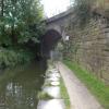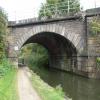
Rother Way Railway Bridge No 1
is a minor waterways place
on the Chesterfield Canal (Derbyshire restored section) between
Chesterfield Waterside (New development under construction and limit of navigation) (1 mile and 1 furlong
and 1 lock
to the south) and
Staveley Town Lock No 5A (4 miles and 3¼ furlongs
and 4 locks
to the east).
The nearest place in the direction of Chesterfield Waterside is Rother Way Railway Bridge No 2;
¼ furlongs
away.
The nearest place in the direction of Staveley Town Lock No 5A is Brimington Wharf;
3¾ furlongs
away.
Mooring here is unrated.
There is a bridge here which takes a railway over the canal.
| Rother Way Tunnel (northern entrance) | 2¼ furlongs | |
| Tapton Lock No 1 | 2 furlongs | |
| Lockoford Lane Bridge | 2 furlongs | |
| Tapton Slipway | 1¾ furlongs | |
| Rother Way Railway Bridge No 2 | ¼ furlongs | |
| Rother Way Railway Bridge No 1 | ||
| Brimington Wharf | 3¾ furlongs | |
| Station Road Bridge (Brimington) | 4 furlongs | |
| Wheeldon Mill Lock No 2 | 5½ furlongs | |
| Newbridge Lane Bridge | 5½ furlongs | |
| Bluebank Lock No 3 | 1 mile, 3½ furlongs | |
- Chesterfield Canal Trust — associated with Chesterfield Canal (Derbyshire restored section)
- Restoration website
Mouseover for more information or show routes to facility
Nearest water point
In the direction of Staveley Town Basin
Shireoaks Marina — 16 miles, 2¾ furlongs and 69 locks away
Travel to Staveley Town Basin, then on the Chesterfield Canal (Unnavigable section) to New Leah’s Bridge No 26B, then on the Chesterfield Canal (Central Line West) to Nethermoor Lake Marina, then on the Chesterfield Canal (Unnavigable section) to Norwood Tunnel (eastern entrance), then on the Chesterfield Canal (Norwood to Retford) to Shireoaks MarinaNearest rubbish disposal
In the direction of Staveley Town Basin
Shireoaks Marina — 16 miles, 2¾ furlongs and 69 locks away
Travel to Staveley Town Basin, then on the Chesterfield Canal (Unnavigable section) to New Leah’s Bridge No 26B, then on the Chesterfield Canal (Central Line West) to Nethermoor Lake Marina, then on the Chesterfield Canal (Unnavigable section) to Norwood Tunnel (eastern entrance), then on the Chesterfield Canal (Norwood to Retford) to Shireoaks MarinaNearest chemical toilet disposal
In the direction of Staveley Town Basin
Shireoaks Marina — 16 miles, 2¾ furlongs and 69 locks away
Travel to Staveley Town Basin, then on the Chesterfield Canal (Unnavigable section) to New Leah’s Bridge No 26B, then on the Chesterfield Canal (Central Line West) to Nethermoor Lake Marina, then on the Chesterfield Canal (Unnavigable section) to Norwood Tunnel (eastern entrance), then on the Chesterfield Canal (Norwood to Retford) to Shireoaks Marina
Cuckoo Wharf Elsan — 18 miles, 4¾ furlongs and 78 locks away
Travel to Staveley Town Basin, then on the Chesterfield Canal (Unnavigable section) to New Leah’s Bridge No 26B, then on the Chesterfield Canal (Central Line West) to Nethermoor Lake Marina, then on the Chesterfield Canal (Unnavigable section) to Norwood Tunnel (eastern entrance), then on the Chesterfield Canal (Norwood to Retford) to Cuckoo Wharf ElsanNearest place to turn
In the direction of Staveley Town Basin
Bilby Lane Bridge Winding Hole — 1 mile, 6¼ furlongs and 2 locks away
On this waterway in the direction of Staveley Town Basin
Works Road Winding Hole — 2 miles, 7½ furlongs and 4 locks away
On this waterway in the direction of Staveley Town Basin
Staveley Town Basin — 4 miles, 3 furlongs and 4 locks away
On this waterway in the direction of Staveley Town Basin
Hartington Harbour — 4 miles, 4¼ furlongs and 5 locks away
Travel to Staveley Town Basin, then on the Chesterfield Canal (Unnavigable section) to Hartington Harbour
Norwood Winding Hole — 10 miles, 3¾ furlongs and 20 locks away
Travel to Staveley Town Basin, then on the Chesterfield Canal (Unnavigable section) to New Leah’s Bridge No 26B, then on the Chesterfield Canal (Central Line West) to Nethermoor Lake Marina, then on the Chesterfield Canal (Unnavigable section) to Norwood Winding Hole
Kiveton Waters Marina — 11 miles, 7¾ furlongs and 43 locks away
Travel to Staveley Town Basin, then on the Chesterfield Canal (Unnavigable section) to New Leah’s Bridge No 26B, then on the Chesterfield Canal (Central Line West) to Nethermoor Lake Marina, then on the Chesterfield Canal (Unnavigable section) to Kiveton Waters Marina
Manor Road Winding Hole — 12 miles, 6½ furlongs and 46 locks away
Travel to Staveley Town Basin, then on the Chesterfield Canal (Unnavigable section) to New Leah’s Bridge No 26B, then on the Chesterfield Canal (Central Line West) to Nethermoor Lake Marina, then on the Chesterfield Canal (Unnavigable section) to Norwood Tunnel (eastern entrance), then on the Chesterfield Canal (Norwood to Retford) to Manor Road Winding Hole
Little Lane Bridge Winding Hole — 15 miles, 3¼ furlongs and 61 locks away
Travel to Staveley Town Basin, then on the Chesterfield Canal (Unnavigable section) to New Leah’s Bridge No 26B, then on the Chesterfield Canal (Central Line West) to Nethermoor Lake Marina, then on the Chesterfield Canal (Unnavigable section) to Norwood Tunnel (eastern entrance), then on the Chesterfield Canal (Norwood to Retford) to Little Lane Bridge Winding Hole
Shireoaks Marina — 16 miles, 2¾ furlongs and 69 locks away
Travel to Staveley Town Basin, then on the Chesterfield Canal (Unnavigable section) to New Leah’s Bridge No 26B, then on the Chesterfield Canal (Central Line West) to Nethermoor Lake Marina, then on the Chesterfield Canal (Unnavigable section) to Norwood Tunnel (eastern entrance), then on the Chesterfield Canal (Norwood to Retford) to Shireoaks Marina
Junction with former Lady Lee Arm — 17 miles, 5½ furlongs and 76 locks away
Travel to Staveley Town Basin, then on the Chesterfield Canal (Unnavigable section) to New Leah’s Bridge No 26B, then on the Chesterfield Canal (Central Line West) to Nethermoor Lake Marina, then on the Chesterfield Canal (Unnavigable section) to Norwood Tunnel (eastern entrance), then on the Chesterfield Canal (Norwood to Retford) to Junction with former Lady Lee Arm
Morse Lock Winding Hole — 18 miles, 2 furlongs and 77 locks away
Travel to Staveley Town Basin, then on the Chesterfield Canal (Unnavigable section) to New Leah’s Bridge No 26B, then on the Chesterfield Canal (Central Line West) to Nethermoor Lake Marina, then on the Chesterfield Canal (Unnavigable section) to Norwood Tunnel (eastern entrance), then on the Chesterfield Canal (Norwood to Retford) to Morse Lock Winding Hole
High Hoe Road Bridge Winding Hole — 19 miles, 2 furlongs and 79 locks away
Travel to Staveley Town Basin, then on the Chesterfield Canal (Unnavigable section) to New Leah’s Bridge No 26B, then on the Chesterfield Canal (Central Line West) to Nethermoor Lake Marina, then on the Chesterfield Canal (Unnavigable section) to Norwood Tunnel (eastern entrance), then on the Chesterfield Canal (Norwood to Retford) to High Hoe Road Bridge Winding HoleNo information
CanalPlan has no information on any of the following facilities within range:self-operated pump-out
boatyard pump-out
Direction of TV transmitter (From Wolfbane Cybernetic)
There is no page on Wikipedia called “Rother Way Railway Bridge”
Wikipedia pages that might relate to Rother Way Railway Bridge
[River Don, Yorkshire]
The Don's major tributaries are the Loxley, the Rivelin, the Sheaf, the Rother and the Dearne. Along the Sheffield–Rotherham stretch of the river are five
[River Rother, East Sussex]
The River Rother flows for 35 miles (56 km) through the English counties of East Sussex and Kent. Its source is near Rotherfield in East Sussex, and its
[River Rother, South Yorkshire]
joins the Rother from the east, the river is crossed by a grade II listed two-arched bridge built around 1840 by the North Midland Railway, which carries
[Rother Link]
river bank from Rotherham to the A631 bridge, and then follows the valley to Rother Valley Country Park, on its way to Chesterfield. The Trans Pennine Trail
[Kent and East Sussex Railway]
Chatham Railway, seeking to relieve themselves from building the Tenterden Railway, entered into an agreement with the Rother Valley Railway for the latter
[River Rother, West Sussex]
The River Rother flows from Empshott in Hampshire, England, to Stopham in West Sussex, where it joins the River Arun. At 52 kilometres (32 mi) long, most
[New Lipchis Way]
descends to cross the River Rother for the first time at Iping Bridge, then follows a bridleway east to another ancient stone bridge at Stedham where it re-crosses
[Pudding Lane]
lower end called Rothersgate (from the "rothers" or cattle that were landed there), and it was also known as Rother Lane. Another name for it was Red Rose
[River Arun]
Turning to the south, it is joined by its main tributary, the western River Rother, and continues through a gap in the South Downs to Arundel to join the English
[Romney Marsh]
Dungeness; the Rother Levels, which, with various ditches, lie around the Isle of Oxney; and the Rye, Winchelsea and Pett Levels. The River Rother today flows
Results of Google Search
River Rother, South Yorkshire - WikipediaThe River Rother, a waterway in the northern midlands of England, gives its name to the town ... The valley is shared with the Derby to Rotherham Railway, which makes the first two of a total of 20 crossings ... of the railway severed the link, and a new basin was constructed to the north of the Brimington Road bridge in 1890.
Jul 18, 2019 ... In Britain, scour has caused the failure of railway bridges crossing rivers in more than 50 flood events. ... The fragility curves generated are to some extent sensitive to the way in ... Any bridge not in a failed state is assumed to be operational (s = 1), ... 51, 1, 11, September, 2003, River Rother, Beighton, 2.
Killamarsh is situated on the eastern side of the Rother Valley. The centre of Killamarsh can be defined as the junction where Bridge Street meets Sheffield Road ...
You can buy train tickets for most days online by clicking on the date of your visit below. ... B = No catering or access for wheelchair users ... your journey - so you can get off the train at any station and explore the area or visit one of the attractions nearby, ... Tenterden Town Station, Station Road, Tenterden, Kent, TN30 6HE.
attribution – You must attribute the work in the manner specified by the author or licensor (but not in any way that suggests that they endorse you or your use of ...
Mar 5, 2020 ... Original gauge, 4 ft 8 1â„2 in (1,435 mm) standard gauge ... 2012, Line extends to Junction Road Halt (no station built or planned, special events only) ... Although the Rother Valley Railway and the Kent & East Sussex Light ...
Jun 16, 2014 ... Track Reinstatement between Northbridge Street and Junction Road ... 1. Rother Valley Railway Limited. Track Reinstatement between Northbridge Street and Junction Road ... the Robertsbridge station would not be viable.
SOll. DIRT, SNOW. 9 rOTHER/UNKNOWN o SCHOOl. ZONE ... 11 - &w1EO,U.. PATH OR TRAtk. 10 MOTORIZED BICYCLE. 10. 1. 12 NON. ... 29 - BRIDGE RAIL .
Apr 19, 2017 ... Lt. Colonel John Patterson in 1898, with one of the Tsavo man-eaters that he shot . ... maneless, man-eating lions hunted railway workers in the Tsavo region ... " There would be no way to resolve these questions if it weren't for ...


![Three ways of travelling north of Chesterfield. The Chesterfield Canal was built to carry freight by boat. It is crossed here by two railway lines [near to Sheffield, far to Rotherham] which carry passengers and freight. The canal towpath is now used by two long distance walking and cycling routes [Trans Pennine Trail and Cuckoo Way]. by Christine Johnstone – 27 August 2012](https://s1.geograph.org.uk/geophotos/03/10/38/3103805_7fe20abb_120x120.jpg)


