Tarnwater Aqueduct
Burrow Beck Bridge, Tarnwater Lane, Lancaster LA2 0AH, United Kingdom

Tarnwater Aqueduct
is a minor waterways place
on the Lancaster Canal (Main Line) between
Lodge Hill Junction (Junction with Lancaster Canal - Glasson Dock Branch) (2 miles and 5½ furlongs
to the southeast) and
Lune Aqueduct (northern end) (Over the River Lune, built by Rennie) (5 miles and ¾ furlongs
to the north).
The nearest place in the direction of Lodge Hill Junction is Brankbeck Bridge No 91;
2 furlongs
away.
The nearest place in the direction of Lune Aqueduct (northern end) is Scotforth Bridge No 92 (Start of Burrow Heights Cutting);
1 furlong
away.
Mooring here is unrated.
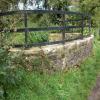
There is a small aqueduct or underbridge here which takes a stream under the canal.
Galgate Winding Hole | 1 mile, 5¼ furlongs | |
New Park Bridge No 89 | 1 mile | |
Ashton Park Bridge Winding Hole | 5 furlongs | |
Ashton Park Bridge No 90 | 5 furlongs | |
Brankbeck Bridge No 91 | 2 furlongs | |
Tarnwater Aqueduct | ||
Scotforth Bridge No 92 | 1 furlong | |
Carr Lane Bridge No 93 | 4½ furlongs | |
Pipe Bridge No XX3 (Lancaster Canal) | 6¼ furlongs | |
Deep Cutting Bridge No 94 | 1 mile, 1½ furlongs | |
Haverbreaks Bridge No 95 | 2 miles, 2 furlongs |
There are no links to external websites from here.
Why not log in and add some (select "External websites" from the menu (sometimes this is under "Edit"))?
Mouseover for more information or show routes to facility
Nearest water point
In the direction of Preston Terminus
Lodge Hill Junction — 2 miles, 5½ furlongs away
On this waterway in the direction of Preston Terminus
Ratcliffe Bridge No 75 — 5 miles, 6¼ furlongs away
On this waterway in the direction of Preston Terminus
Moss Lane Bridge No 63 — 9 miles, 7¼ furlongs away
On this waterway in the direction of Preston Terminus
Brows Bridge No 8 — 5 miles, 1½ furlongs and 6 locks away
Travel to Lodge Hill Junction, then on the Lancaster Canal (Glasson Branch) to Brows Bridge No 8
Glasson Visitor Moorings — 5 miles, 2 furlongs and 6 locks away
Travel to Lodge Hill Junction, then on the Lancaster Canal (Glasson Branch) to Glasson Visitor Moorings
Glasson Basin — 5 miles, 3½ furlongs and 6 locks away
Travel to Lodge Hill Junction, then on the Lancaster Canal (Glasson Branch) to Glasson Basin
Bilsborrow Winding Hole — 15 miles away
On this waterway in the direction of Preston Terminus
Swill Brook Basin — 19 miles, 4¼ furlongs away
On this waterway in the direction of Preston Terminus
Blackleach Lane Marina — 19 miles, 7¾ furlongs away
On this waterway in the direction of Preston Terminus
In the direction of Tewitfield
Hest Bank Bridge No 118 — 7 miles, 5¾ furlongs away
On this waterway in the direction of Tewitfield
Tewitfield — 15 miles, 3¼ furlongs away
On this waterway in the direction of TewitfieldNearest rubbish disposal
In the direction of Preston Terminus
Bilsborrow Winding Hole — 15 miles away
On this waterway in the direction of Preston Terminus
In the direction of Tewitfield
Hest Bank Bridge No 118 — 7 miles, 5¾ furlongs away
On this waterway in the direction of Tewitfield
Tewitfield — 15 miles, 3¼ furlongs away
On this waterway in the direction of TewitfieldNearest chemical toilet disposal
In the direction of Preston Terminus
Bilsborrow Winding Hole — 15 miles away
On this waterway in the direction of Preston Terminus
In the direction of Tewitfield
Hest Bank Bridge No 118 — 7 miles, 5¾ furlongs away
On this waterway in the direction of Tewitfield
Lundsfield Wharf — 11 miles, ¾ furlongs away
On this waterway in the direction of Tewitfield
Tewitfield — 15 miles, 3¼ furlongs away
On this waterway in the direction of TewitfieldNearest place to turn
In the direction of Preston Terminus
Ashton Park Bridge Winding Hole — 5 furlongs away
On this waterway in the direction of Preston Terminus
Galgate Basin Wharf — 2 miles, 2¾ furlongs away
On this waterway in the direction of Preston Terminus
Lodge Hill Junction — 2 miles, 5½ furlongs away
On this waterway in the direction of Preston Terminus
Carter's Wood Winding Hole — 2 miles, 7¾ furlongs and 1 lock away
Travel to Lodge Hill Junction, then on the Lancaster Canal (Glasson Branch) to Carter's Wood Winding Hole
Richmond Bridge Winding Hole — 4 miles, 2¼ furlongs away
On this waterway in the direction of Preston Terminus
Ratcliffe Bridge Winding Hole — 5 miles, 7 furlongs away
On this waterway in the direction of Preston Terminus
Bells Bridge Winding Hole — 8 miles, 2¾ furlongs away
On this waterway in the direction of Preston Terminus
Cathouse Bridge Winding Hole — 9 miles, 5¼ furlongs away
On this waterway in the direction of Preston Terminus
Moss Lane Bridge Winding Hole (north) — 9 miles, 7¼ furlongs away
On this waterway in the direction of Preston Terminus
Moss Lane Bridge Winding Hole (south) — 9 miles, 7¼ furlongs away
On this waterway in the direction of Preston Terminus
Kepple Lane Bridge Winding Hole — 10 miles, ¾ furlongs away
On this waterway in the direction of Preston Terminus
Thurnham Bridge Winding Hole — 4 miles, 4¼ furlongs and 6 locks away
Travel to Lodge Hill Junction, then on the Lancaster Canal (Glasson Branch) to Thurnham Bridge Winding Hole
The Moorings Basin — 10 miles, 1¼ furlongs away
On this waterway in the direction of Preston Terminus
Dimples Bridge Winding Hole — 10 miles, 7 furlongs away
On this waterway in the direction of Preston Terminus
Glasson Basin — 5 miles, 3½ furlongs and 6 locks away
Travel to Lodge Hill Junction, then on the Lancaster Canal (Glasson Branch) to Glasson Basin
In the direction of Tewitfield
Halton Road Winding Hole — 5 miles, 1¼ furlongs away
On this waterway in the direction of Tewitfield
Folly Bridge Winding Hole — 6 miles, 2 furlongs away
On this waterway in the direction of Tewitfield
Belmont Bridge Winding Hole — 6 miles, 5¼ furlongs away
On this waterway in the direction of Tewitfield
Hest Bank Winding Hole — 7 miles, 7 furlongs away
On this waterway in the direction of Tewitfield
Lundsfield Wharf — 11 miles, ¾ furlongs away
On this waterway in the direction of TewitfieldNo information
CanalPlan has no information on any of the following facilities within range:self-operated pump-out
boatyard pump-out
Direction of TV transmitter (From Wolfbane Cybernetic)
There is no page on Wikipedia called “Tarnwater Aqueduct”
Wikipedia pages that might relate to Tarnwater Aqueduct
[Listed buildings in Tunstall, Lancashire]
Heritage List for England, retrieved 19 June 2015 Historic England, "Tarnwater, Tunstall (1071644)", National Heritage List for England, retrieved 19
[Listed buildings in Thurnham, Lancashire]
00981; -2.80605 (Brantbeck Bridge) Late 18th century The bridge carries Tarnwater Lane over the Lancaster Canal. It is in sandstone and is a tall bridge
Results of Google Search
Elevation of Kingfsher Barn, Tarnwater Ln, Lancaster LA2 0PQ, UK ...This tool allows you to look up elevation data by searching address or clicking on a live google map. This page shows the elevation/altitude information of ...
Tunstall is a civil parish in Lancaster, Lancashire, England. It contains eight listed buildings that ... Historic England, "Tarnwater, Tunstall (1071644)", National Heritage List for England, retrieved 19 June 2015 ... Castle · Judges' Lodgings · Lancaster Castle · Lancaster Priory · Lune Aqueduct · Old Rectory · Thurnham Hall.
Tarn Water Race 2020 : en SUP ou en Kayak une expérience unique dans des gorges inscrites au patrimoine mondial de l'UNESCO. Certaines courses ...
Visit Andorra, France, and Spain in a single day on a tour from Barcelona that takes in historic architecture, gorgeous mountain landscapes, and three distinctive ...
Sodium fluorescein dye from the Tarn Water Sinks arrived at the Aire Head risings 153.5 hours after injection and peaked 21.25 hours after breakthrough.
Tarn water is stored in the Troussy Reservoir, ... 108 miles long, 26 to 31 million gallons per day; the aqueduct of the Avre,. 63 miles long, from Rueil la Gadeliere ...
bridge, arch bridge, viaduct, river, devil's bridge, sky, aqueduct, ... reflection, nature, wilderness, tarn, water, mountain, sky, mountainous landforms ...
... Aqueduct (by), Caton Road) (Lansil) · Ascot Close (by), Kempton Road) (The ... Tarnwater Road (by), Ashton Road) (Stodday) · Tatham Hall (by), Wennington ...
Your Best Black and White. reflection, nature, wilderness, tarn, water, highland, nature reserve, lake. 5055. 2855. Magnificent Scenery. black and white, bridge, ...