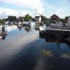
West Stockwith Basin
is a minor waterways place
on the Chesterfield Canal (Retford to the Trent) between
Chesterfield Canal - River Trent Junction (West Stockwith) (¾ furlongs
and 1 lock
to the southeast) and
Cooper's Bridge No 80 (Misterton) (1 mile and 5¼ furlongs
and 2 locks
to the west).
The nearest place in the direction of Chesterfield Canal - River Trent Junction is West Stockwith Lock (Lock between Chesterfield Canal and Tidal River Trent);
¼ furlongs
away.
The nearest place in the direction of Cooper's Bridge No 80 is Stockwith Bridge No 85;
¼ furlongs
away.
Mooring here is excellent (this is a really good mooring), mooring rings or bollards are available. Mooring is limited to 48 hours.
Facilities: chemical toilet disposal, chemical toilet disposal suitable for DIY pump-out, rubbish disposal, showers, toilets, water point, glass recycling, paper recycling, tin can recycling and aluminium can recycling.
You can wind here.
Chesterfield Canal - River Trent Junction | ¾ furlongs | |
West Stockwith Lock | ¼ furlongs | |
West Stockwith Basin | ||
Stockwith Bridge No 85 | ¼ furlongs | |
Railway Bridge No 84 | 4½ furlongs | |
Misterton Low Lock Bridge No 83 | 5 furlongs | |
Misterton Low Lock No 64 | 5¼ furlongs | |
Station Street Bridge No 82A (Misterton) | 5¼ furlongs |
Amenities here
There are no links to external websites from here.
Why not log in and add some (select "External websites" from the menu (sometimes this is under "Edit"))?
Mouseover for more information or show routes to facility
Nearest water point
The nearest water point is here. Others are at:
In the direction of West Retford Lock No 58
Clayworth CRT Boaters Facilities — 9 miles, 4¾ furlongs and 4 locks away
On this waterway in the direction of West Retford Lock No 58
Hop Pole Bridge No 59 — 13 miles, 7½ furlongs and 5 locks away
On this waterway in the direction of West Retford Lock No 58
Forest Middle Top Lock No 55 — 18 miles, 1½ furlongs and 9 locks away
Travel to West Retford Lock No 58, then on the Chesterfield Canal (Norwood to Retford) to Forest Middle Top Lock No 55
Forest Middle Top Water Point — 18 miles, 1½ furlongs and 10 locks away
Travel to West Retford Lock No 58, then on the Chesterfield Canal (Norwood to Retford) to Forest Middle Top Water Point
In the direction of Chesterfield Canal - River Trent Junction
Keadby Visitor Moorings — 12 miles, 7½ furlongs and 2 locks away
Travel to Chesterfield Canal - River Trent Junction, then on the River Trent (tidal section - Cromwell to Keadby) to Keadby Junction, then on the Sheffield and South Yorkshire Navigation (Stainforth and Keadby Canal) to Keadby Visitor Moorings
Torksey Lock — 15 miles, 1 furlong and 1 lock away
Travel to Chesterfield Canal - River Trent Junction, then on the River Trent (tidal section - Cromwell to Keadby) to Torksey Junction, then on the Fossdyke Canal to Torksey LockNearest rubbish disposal
The nearest rubbish disposal is here. Others are at:
In the direction of West Retford Lock No 58
Clayworth CRT Boaters Facilities — 9 miles, 4¾ furlongs and 4 locks away
On this waterway in the direction of West Retford Lock No 58
Forest Middle Top Lock No 55 — 18 miles, 1½ furlongs and 9 locks away
Travel to West Retford Lock No 58, then on the Chesterfield Canal (Norwood to Retford) to Forest Middle Top Lock No 55
In the direction of Chesterfield Canal - River Trent Junction
Keadby Visitor Moorings — 12 miles, 7½ furlongs and 2 locks away
Travel to Chesterfield Canal - River Trent Junction, then on the River Trent (tidal section - Cromwell to Keadby) to Keadby Junction, then on the Sheffield and South Yorkshire Navigation (Stainforth and Keadby Canal) to Keadby Visitor Moorings
Torksey Lock — 15 miles, 1 furlong and 1 lock away
Travel to Chesterfield Canal - River Trent Junction, then on the River Trent (tidal section - Cromwell to Keadby) to Torksey Junction, then on the Fossdyke Canal to Torksey LockNearest chemical toilet disposal
The nearest chemical toilet disposal is here. Others are at:
In the direction of West Retford Lock No 58
Clayworth CRT Boaters Facilities — 9 miles, 4¾ furlongs and 4 locks away
On this waterway in the direction of West Retford Lock No 58
Forest Middle Top Lock No 55 — 18 miles, 1½ furlongs and 9 locks away
Travel to West Retford Lock No 58, then on the Chesterfield Canal (Norwood to Retford) to Forest Middle Top Lock No 55
In the direction of Chesterfield Canal - River Trent Junction
Keadby Visitor Moorings — 12 miles, 7½ furlongs and 2 locks away
Travel to Chesterfield Canal - River Trent Junction, then on the River Trent (tidal section - Cromwell to Keadby) to Keadby Junction, then on the Sheffield and South Yorkshire Navigation (Stainforth and Keadby Canal) to Keadby Visitor Moorings
Torksey Lock — 15 miles, 1 furlong and 1 lock away
Travel to Chesterfield Canal - River Trent Junction, then on the River Trent (tidal section - Cromwell to Keadby) to Torksey Junction, then on the Fossdyke Canal to Torksey LockNearest place to turn
In the direction of West Retford Lock No 58
Manor Farm Winding Hole — 2 miles, 4¼ furlongs and 2 locks away
On this waterway in the direction of West Retford Lock No 58
Drakeholes Tunnel (southern entrance) — 6 miles, 3¾ furlongs and 4 locks away
On this waterway in the direction of West Retford Lock No 58
Drakeholes Visitor Moorings — 6 miles, 4¼ furlongs and 4 locks away
On this waterway in the direction of West Retford Lock No 58
Otter's Bridge Winding Hole — 8 miles, 7¼ furlongs and 4 locks away
On this waterway in the direction of West Retford Lock No 58
Clayworth Top Bridge Winding Hole — 9 miles, 4¼ furlongs and 4 locks away
On this waterway in the direction of West Retford Lock No 58
Main Street Winding Hole — 11 miles, 2 furlongs and 4 locks away
On this waterway in the direction of West Retford Lock No 58
Grove Mill Bridge Winding Hole — 14 miles, 6 furlongs and 5 locks away
On this waterway in the direction of West Retford Lock No 58
Retford Winding Hole — 14 miles, 7¾ furlongs and 5 locks away
On this waterway in the direction of West Retford Lock No 58
Babworth Winding Hole — 16 miles, 3¾ furlongs and 7 locks away
Travel to West Retford Lock No 58, then on the Chesterfield Canal (Norwood to Retford) to Babworth Winding Hole
Forest Top Lock Winding Hole — 18 miles, 4¼ furlongs and 10 locks away
Travel to West Retford Lock No 58, then on the Chesterfield Canal (Norwood to Retford) to Forest Top Lock Winding HoleNearest self-operated pump-out
In the direction of Chesterfield Canal - River Trent Junction
Torksey Lock — 15 miles, 1 furlong and 1 lock away
Travel to Chesterfield Canal - River Trent Junction, then on the River Trent (tidal section - Cromwell to Keadby) to Torksey Junction, then on the Fossdyke Canal to Torksey LockNo information
CanalPlan has no information on any of the following facilities within range:boatyard pump-out
Direction of TV transmitter (From Wolfbane Cybernetic)
There is no page on Wikipedia called “West Stockwith Basin”
Wikipedia pages that might relate to West Stockwith Basin
[West Stockwith]
West Stockwith is a village within the Bassetlaw district of Nottinghamshire, England. The population at the 2011 census was 327. it lies on the west
[Chesterfield Canal]
opened in 1777 and ran for 46 miles (74 km) from the River Trent at West Stockwith, Nottinghamshire to Chesterfield, Derbyshire, passing through the Norwood
[Tidal bore]
River Hebert and Maccan River on the Cumberland Basin, the St. Croix and Kennetcook rivers in the Minas Basin, and the Salmon River in Truro. Historically
[River Trent]
villages include West Stockwith and East Stockwith, Owston Ferry and East Ferry, and West Butterwick and East Butterwick. At West Stockwith the Trent is joined
[Shireoaks Colliery]
ship coal to the River Trent at West Stockwith. Shireoaks Basin opened soon afterwards, and coal was shipped to Stockwith until 1949. The Shireoaks Colliery
[Retford]
narrow lock on the canal from its junction with the River Trent at West Stockwith. However, narrow sections now prevent such craft reaching Retford. The
[Walks Around Britain (TV series)]
White walks alongside a canal and two rivers between Misterton and West Stockwith in Nottinghamshire. 5 7 "Rufford Abbey Country Park and" Andrew White
[River Idle]
flows north through Retford and Bawtry before entering the River Trent at Stockwith near Misterton. The county boundary with South Yorkshire follows the river
[River Ryton]
Data from the Blyth station is transmitted to the pumping station at West Stockwith, where it is used to control discharges from the River Idle into the
[Stainforth and Keadby Canal]
up to 200 tons. In 1828, there was a proposal to build a canal from West Stockwith on the River Trent to the River Don at Doncaster, which would have bypassed
Results of Google Search
West Stockwith L1 :: Waterside MooringsPretty West Stockwith Basin lies at the junction of the Chesterfield Canal and the River Trent in Nottinghamshire. The site offers a good base for those wishing to ...
West Stockwith is where the canal meets the River Trent. It is a beautiful place which - as the photos further down show - has changed little in over half a century .
West Stockwith Basin. , 2001; Medium: oil on board; Size: 31.5 x 41.5 cm. (12.4 x 16.3 in.) Description: *; Sale: *; Estimate: *; Price: *. Price Database. * Subscribe ...
Watercolour Paintings by Artist - David Curtis ROI RSMA. March 2020. David Curtis :: West Stockwith Basin. Watercolor ArtistsWatercolor Landscape Landscape ...
May 28, 2016 ... May 28th 2016. Featuring The Waterfront Inn, The Yacht Club, West Stockwith Country Park, The River Trent and the Chesterfield Canal.
Jan 24, 2019 ... The media could not be loaded, either because the server or network failed or because the format is not supported. Beginning of dialog window ...
English: West Stockwith is a village within the Bassetlaw district of Nottinghamshire, ... West Stockwith basin - geograph.org.uk - 1300525.jpg 640 × 426; 69 KB.
May 23, 2016 ... This is where the Chesterfield canal meets the River Trent. Also featuring the Waterfront Inn, a Linroyale Truck and lots of barges.
Contact. Stockwith Lock Canal Lane, West Stockwith DN10 4ET England ... A lovely atmospheric view of the river and basin especially at sunset and sunrise.
West Stockwith is a village within the Bassetlaw district of Nottinghamshire, England. ... Only two pubs remain although the Yacht Club in the basin caters to boat owners and holds various events over the year. The Hospital Day which was  ...