Todmorden Aqueduct
is a minor waterways place
on the Rochdale Canal between
Hollings Lock No 27 (Walsden) (1 mile and 3 furlongs
and 7 locks
to the south) and
Walkley's Clog Mill (5 miles and 1¼ furlongs
and 12 locks
to the east).
The nearest place in the direction of Hollings Lock No 27 is Dobroyd Road Bridge;
2 furlongs
away.
The nearest place in the direction of Walkley's Clog Mill is Todmorden Guillotine Lock No 19;
a few yards
away.
Mooring here is unrated.
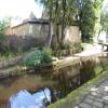
There is a small aqueduct or underbridge here.
Gauxholme Railway Viaduct | 4¾ furlongs | |
Shade Lock No 21 | 4¼ furlongs | |
Site of Wadsworth Mill | 3½ furlongs | |
Wadsworth Mill Lock No 20 | 3¼ furlongs | |
Dobroyd Road Bridge | 2 furlongs | |
Todmorden Aqueduct | ||
Todmorden Guillotine Lock No 19 | a few yards | |
Todmorden Changeline Bridge No 30 | ¼ furlongs | |
Todmorden Bridge Winding Hole | ¼ furlongs | |
Fielden Wharf & Services | ½ furlongs | |
Shop Lock No 18 | 1¼ furlongs |
There are no links to external websites from here.
Why not log in and add some (select "External websites" from the menu (sometimes this is under "Edit"))?
Mouseover for more information or show routes to facility
Nearest water point
In the direction of Castlefield Junction
Travis Mill Lock No 28 — 1 mile, 5 furlongs and 8 locks away
On this waterway in the direction of Castlefield Junction
Littleborough Sanitary Station — 5 miles, 2 furlongs and 27 locks away
On this waterway in the direction of Castlefield Junction
In the direction of Sowerby Bridge Junction
Fielden Wharf & Services — ½ furlongs and 1 lock away
On this waterway in the direction of Sowerby Bridge Junction
Baltimore Marina — 3½ furlongs and 2 locks away
On this waterway in the direction of Sowerby Bridge Junction
Hebden Bridge Services — 4 miles, 3 furlongs and 11 locks away
On this waterway in the direction of Sowerby Bridge Junction
Sowerby Bridge Basin — 10 miles, ¼ furlongs and 18 locks away
Travel to Sowerby Bridge Junction, then on the Calder and Hebble Navigation (Main Line) to Sowerby Bridge Basin
Salterhebble Junction — 12 miles and 18 locks away
Travel to Sowerby Bridge Junction, then on the Calder and Hebble Navigation (Main Line) to Salterhebble Junction
Salterhebble Sanitary Station — 12 miles, ½ furlongs and 19 locks away
Travel to Sowerby Bridge Junction, then on the Calder and Hebble Navigation (Main Line) to Salterhebble Junction, then on the Calder and Hebble Navigation (Main Line) to Salterhebble Sanitary Station
Brighouse Basin — 16 miles, 2½ furlongs and 28 locks away
Travel to Sowerby Bridge Junction, then on the Calder and Hebble Navigation (Main Line) to Salterhebble Junction, then on the Calder and Hebble Navigation (Main Line) to Brighouse BasinNearest rubbish disposal
In the direction of Castlefield Junction
Littleborough Sanitary Station — 5 miles, 2 furlongs and 27 locks away
On this waterway in the direction of Castlefield Junction
In the direction of Sowerby Bridge Junction
Fielden Wharf & Services — ½ furlongs and 1 lock away
On this waterway in the direction of Sowerby Bridge Junction
Hebden Bridge Services — 4 miles, 3 furlongs and 11 locks away
On this waterway in the direction of Sowerby Bridge Junction
Sowerby Bridge Basin — 10 miles, ¼ furlongs and 18 locks away
Travel to Sowerby Bridge Junction, then on the Calder and Hebble Navigation (Main Line) to Sowerby Bridge Basin
Salterhebble Sanitary Station — 12 miles, ½ furlongs and 19 locks away
Travel to Sowerby Bridge Junction, then on the Calder and Hebble Navigation (Main Line) to Salterhebble Junction, then on the Calder and Hebble Navigation (Main Line) to Salterhebble Sanitary Station
Brighouse Lower Basin Visitor Moorings — 16 miles, 3 furlongs and 29 locks away
Travel to Sowerby Bridge Junction, then on the Calder and Hebble Navigation (Main Line) to Salterhebble Junction, then on the Calder and Hebble Navigation (Main Line) to Brighouse Lower Basin Visitor MooringsNearest chemical toilet disposal
In the direction of Castlefield Junction
Littleborough Sanitary Station — 5 miles, 2 furlongs and 27 locks away
On this waterway in the direction of Castlefield Junction
In the direction of Sowerby Bridge Junction
Baltimore Marina — 3½ furlongs and 2 locks away
On this waterway in the direction of Sowerby Bridge Junction
Hebden Bridge Services — 4 miles, 3 furlongs and 11 locks away
On this waterway in the direction of Sowerby Bridge Junction
Sowerby Bridge Basin — 10 miles, ¼ furlongs and 18 locks away
Travel to Sowerby Bridge Junction, then on the Calder and Hebble Navigation (Main Line) to Sowerby Bridge Basin
Salterhebble Sanitary Station — 12 miles, ½ furlongs and 19 locks away
Travel to Sowerby Bridge Junction, then on the Calder and Hebble Navigation (Main Line) to Salterhebble Junction, then on the Calder and Hebble Navigation (Main Line) to Salterhebble Sanitary Station
Brighouse Basin — 16 miles, 2½ furlongs and 28 locks away
Travel to Sowerby Bridge Junction, then on the Calder and Hebble Navigation (Main Line) to Salterhebble Junction, then on the Calder and Hebble Navigation (Main Line) to Brighouse BasinNearest place to turn
In the direction of Castlefield Junction
Winding Hole between Nip Square and Winterbutlee Locks — 1 mile, 6½ furlongs and 10 locks away
On this waterway in the direction of Castlefield Junction
Lightbank Lock Winding Hole — 2 miles, 1½ furlongs and 12 locks away
On this waterway in the direction of Castlefield Junction
Bottomley Road Winding Hole — 2 miles, 3¼ furlongs and 13 locks away
On this waterway in the direction of Castlefield Junction
Summit Pound Winding Hole — 3 miles, 1½ furlongs and 17 locks away
On this waterway in the direction of Castlefield Junction
Bent House Bridge Winding Hole — 4 miles, 7¼ furlongs and 26 locks away
On this waterway in the direction of Castlefield Junction
Bent House Winding Hole — 5 miles, ¼ furlongs and 26 locks away
On this waterway in the direction of Castlefield Junction
In the direction of Sowerby Bridge Junction
Todmorden Bridge Winding Hole — ¼ furlongs and 1 lock away
On this waterway in the direction of Sowerby Bridge Junction
Baltimore Winding Hole — 3¾ furlongs and 2 locks away
On this waterway in the direction of Sowerby Bridge Junction
Lobb Mill Lock Winding Hole — 1 mile, 2¾ furlongs and 4 locks away
On this waterway in the direction of Sowerby Bridge Junction
Stoodley Bridge Winding Hole — 1 mile, 7½ furlongs and 5 locks away
On this waterway in the direction of Sowerby Bridge Junction
Winding Hole below Holmcoat Lock — 2 miles, 1¾ furlongs and 6 locks away
On this waterway in the direction of Sowerby Bridge Junction
Rawden Mill Lock Winding Hole — 3 miles, 1¼ furlongs and 8 locks away
On this waterway in the direction of Sowerby Bridge Junction
Hebden Bridge Wharf — 4 miles, 3¼ furlongs and 11 locks away
On this waterway in the direction of Sowerby Bridge Junction
Walkley's Clog Mill — 5 miles, 1¼ furlongs and 12 locks away
On this waterway in the direction of Sowerby Bridge Junction
Winding Hole below Lock No 5 — 7 miles, ½ furlongs and 15 locks away
On this waterway in the direction of Sowerby Bridge Junction
Tower Hill Winding Hole — 9 miles, 3½ furlongs and 15 locks away
On this waterway in the direction of Sowerby Bridge Junction
Sowerby Bridge Winding Hole — 9 miles, 5¼ furlongs and 17 locks away
On this waterway in the direction of Sowerby Bridge Junction
Sowerby Bridge Junction — 9 miles, 7¼ furlongs and 18 locks away
On this waterway in the direction of Sowerby Bridge Junction
Sterne Mill Winding Hole — 10 miles, 5½ furlongs and 18 locks away
Travel to Sowerby Bridge Junction, then on the Calder and Hebble Navigation (Main Line) to Sterne Mill Winding Hole
Salterhebble Basin — 12 miles, 4 furlongs and 18 locks away
Travel to Sowerby Bridge Junction, then on the Calder and Hebble Navigation (Main Line) to Salterhebble Junction, then on the Calder and Hebble Navigation (Halifax Branch) to Salterhebble BasinNearest self-operated pump-out
In the direction of Sowerby Bridge Junction
Hebden Bridge Services — 4 miles, 3 furlongs and 11 locks away
On this waterway in the direction of Sowerby Bridge JunctionNearest boatyard pump-out
In the direction of Sowerby Bridge Junction
Pickwell and Arnold Boatyard — 1 mile, 5 furlongs and 5 locks away
On this waterway in the direction of Sowerby Bridge Junction
Sowerby Bridge Basin — 10 miles, ¼ furlongs and 18 locks away
Travel to Sowerby Bridge Junction, then on the Calder and Hebble Navigation (Main Line) to Sowerby Bridge BasinDirection of TV transmitter (From Wolfbane Cybernetic)
There is no page on Wikipedia called “Todmorden Aqueduct”
Wikipedia pages that might relate to Todmorden Aqueduct
[Huddersfield Narrow Canal]
structure, similar to the Holmes Aqueduct on the Derby Canal. Outram set out to overcome the problems with the Holmes Aqueduct by making the walls thicker
[Rochdale Canal]
make surveys for branches to Rochdale, Oldham and to a limeworks near Todmorden. Rennie at the time had no experience of building canals. The promoters
[River Roch]
Irwell, that gives Rochdale its name. Rising on Chelburn Moor (south of Todmorden in the Pennines), the river flows south through Littleborough towards
[Leeds and Liverpool Canal]
The same year John Rennie surveyed a branch of the Rochdale between Todmorden and Burnley. In 1794 an agreement was reached with the Manchester, Bolton
[List of collieries in Lancashire since 1854]
Thornlee - shown disused 1908 Thorny Bank, Burnley - Closed 1968 Todmorden Moor, Todmorden Tonacliffe, Rossendale - shown as abandoned 1908 Tonacliffe Level
[John Rennie the Elder]
difficult country between Rochdale and Todmorden (1799). The Kennet and Avon Canal – including the Dundas Aqueduct, Caen Hill Locks and Crofton Pumping
[Burnley]
railway station and Manchester's Victoria station, via the newly restored Todmorden Curve, which opened in May 2015. The name Burnley is believed to have
[History of architecture]
into a continuous wall became a hallmark of later classicism, as in the Todmorden Town Hall (Yorkshire, the UK) from 1875, where the half columns wrapped
[Urban agriculture]
"Incredible Edible Todmorden: Eating the Street", Farming Matters, 27(3):28-29. "Incredible Edible Todmorden - The Future Of Local Food In Todmorden".
[Manchester Victoria station]
by TransPennine Express. Reinstatement of the south and west curve at Todmorden on the Caldervale Line facilitated a direct service between Victoria and
Results of Google Search
Virtual Journey along the Rochdale Canal - Hebden Bridge to Todmorden (1) ... Bridge is Lock 9, Blackpit Lock, with the aqueduct over Hebden Water beyond.
The Rochdale Canal is in Northern England, between Manchester and Sowerby Bridge, part of ... The section from Todmorden to Hebden Bridge was completed in 1983, and opened on 20 May. ... echoing the great Middleton canal tragedy of 1927, when a breach occurred at the aqueduct, and three people were drowned.
Todmorden. Map Ref. SD 918235. Known occupiers. 1610-1626. LORD Charles, fulling. c1805-1863. MADEN Henry & Son. c1823-1826. ORMEROD John.
township of Todmorden . and Walsden; Ports- mouth in ... reservoirs, "aqueducts, cuts, conduit pipes, pipe- ... And also an aqueduct, conduit, drain, or cut com-.
Beyond the lock the Rochdale Canal is carried over the River Calder on an aqueduct. The building on right, a former dyeworks, has been extended and ...
... of the Black Pit aqueduct to stop cyclists falling into the river deserves ... particularly approaching Todmorden and in the centre of Todmorden.
Gauxholme Lower Lock 22 and Gauxholme Railway Viaduct Rochdale Canal Todmorden Steel Girder, Rochdale, ... See also Stanley Ferry Aqueduct…