CanalPlanAC

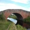
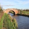
Hillsyde Avenue Field Bridge No 82

 
Hillsyde Avenue, Misterton DN10 4BZ, United Kingdom
 
Information about the place
Hillsyde Avenue Field Bridge No 82 is a minor waterways place on the Chesterfield Canal (Retford to the Trent) between Chesterfield Canal - River Trent Junction (West Stockwith) (7½ furlongs and 3 locks to the east) and Cooper's Bridge No 80 (Misterton) (6¼ furlongs to the west).
 
 
The nearest place in the direction of Chesterfield Canal - River Trent Junction is Misterton Top Lock No 63; 1 furlong away.
 
The nearest place in the direction of Cooper's Bridge No 80 is Misterton Shopping Moorings; 1½ furlongs away.

There may be access to the towpath here.

Mooring here is unrated.

There is a bridge here which takes a track over the canal.


Amenities

Amenities nearby at Misterton Shopping Moorings

 Misterton Coop
 Fish & Chips

Amenities nearby at Misterton Top Lock No 63

 K&H Feeds
 
Maps
If you are a user and are logged on, or if you are actively planning a route, a map will be displayed here.
Show on external mapping site: Google | OSM | Bing
 
Photos
 
External websites
There are no links to external websites from here.
Why not log in and add some (select "External websites" from the menu (sometimes this is under "Edit"))?
 
Nearest facilities

Mouseover for more information or show routes to facility

Nearest water point

In the direction of West Retford Lock No 58

Clayworth CRT Boaters Facilities8 miles, 5¾ furlongs and 2 locks away
On this waterway in the direction of West Retford Lock No 58
Hop Pole Bridge No 5913 miles, ¾ furlongs and 3 locks away
On this waterway in the direction of West Retford Lock No 58
Forest Middle Top Lock No 5517 miles, 2½ furlongs and 7 locks away
Travel to West Retford Lock No 58, then on the Chesterfield Canal (Norwood to Retford) to Forest Middle Top Lock No 55
Forest Middle Top Water Point17 miles, 2¾ furlongs and 8 locks away
Travel to West Retford Lock No 58, then on the Chesterfield Canal (Norwood to Retford) to Forest Middle Top Water Point

In the direction of Chesterfield Canal - River Trent Junction

West Stockwith Basin7 furlongs and 2 locks away
On this waterway in the direction of Chesterfield Canal - River Trent Junction
Keadby Visitor Moorings13 miles, 6½ furlongs and 4 locks away
Travel to Chesterfield Canal - River Trent Junction, then on the River Trent (tidal section - Cromwell to Keadby) to Keadby Junction, then on the Sheffield and South Yorkshire Navigation (Stainforth and Keadby Canal) to Keadby Visitor Moorings
Torksey Lock16 miles and 3 locks away
Travel to Chesterfield Canal - River Trent Junction, then on the River Trent (tidal section - Cromwell to Keadby) to Torksey Junction, then on the Fossdyke Canal to Torksey Lock

Nearest rubbish disposal

Nearest chemical toilet disposal

Nearest place to turn

In the direction of West Retford Lock No 58

Manor Farm Winding Hole1 mile, 5¼ furlongs away
On this waterway in the direction of West Retford Lock No 58
Drakeholes Tunnel (southern entrance)5 miles, 4¾ furlongs and 2 locks away
On this waterway in the direction of West Retford Lock No 58
Drakeholes Visitor Moorings5 miles, 5¼ furlongs and 2 locks away
On this waterway in the direction of West Retford Lock No 58
Otter's Bridge Winding Hole8 miles, ½ furlongs and 2 locks away
On this waterway in the direction of West Retford Lock No 58
Clayworth Top Bridge Winding Hole8 miles, 5¼ furlongs and 2 locks away
On this waterway in the direction of West Retford Lock No 58
Main Street Winding Hole10 miles, 3¼ furlongs and 2 locks away
On this waterway in the direction of West Retford Lock No 58
Grove Mill Bridge Winding Hole13 miles, 7 furlongs and 3 locks away
On this waterway in the direction of West Retford Lock No 58
Retford Winding Hole14 miles, ¾ furlongs and 3 locks away
On this waterway in the direction of West Retford Lock No 58
Babworth Winding Hole15 miles, 4¾ furlongs and 5 locks away
Travel to West Retford Lock No 58, then on the Chesterfield Canal (Norwood to Retford) to Babworth Winding Hole
Forest Top Lock Winding Hole17 miles, 5¼ furlongs and 8 locks away
Travel to West Retford Lock No 58, then on the Chesterfield Canal (Norwood to Retford) to Forest Top Lock Winding Hole
Ranby Bridge Winding Hole19 miles, 7¼ furlongs and 9 locks away
Travel to West Retford Lock No 58, then on the Chesterfield Canal (Norwood to Retford) to Ranby Bridge Winding Hole

In the direction of Chesterfield Canal - River Trent Junction

West Stockwith Basin7 furlongs and 2 locks away
On this waterway in the direction of Chesterfield Canal - River Trent Junction

Nearest self-operated pump-out

No information

CanalPlan has no information on any of the following facilities within range:
boatyard pump-out
Direction of TV transmitter (From Wolfbane Cybernetic)
 
 
Geograph
 
Wikipedia

There is no page on Wikipedia called “Hillsyde Avenue Field Bridge”

 
Google

Results of Google Search

Routes
B39 Williamsburg Bridge Plaza - Lower East Side. via Williamsburg ... Select Bus Service via Utica Av - Malcolm X Blvd. B47 Kings ... B82-SBS Coney Island - spring Creek Towers. select Bus ... via Springfield Blvd / Braddock Av / Hillside Av .
Southwest Region Highway Projects and Studies
Construction Projects | Design Projects | Studies (no construction activity) ... I-94 bridges over Johnson Creek and Hillside Drive, Johnson Creek - Jefferson County. Juneau County. WIS 80 (Liberty Street to WIS 82), Elroy - Juneau County  ...
NYC DOT - Current Projects
NYC DOT is proposing bus priority treatments on 167th Street and 168th Street to increase ... Tremont Avenue, University Avenue, 181st Street/Washington Bridge, ... These conditions impede bicycles, are difficult for pedestrians and do not meet ... extensions at the intersection of Broadway with Nagle and Hillside Avenues.
2010 Act 82 - PA General Assembly
2010 Act 82 ... (A) Consolidate three field maintenance shops in the region into one unit with ... (i) Reconstruction of Clymer Avenue Bridge, County Bridge No. ... retrofit of existing structures and new construction at the Lands at Hillside Farms.
Sellwood Bridge
Sellwood Bridge Field Work Update for October 11. Building rebar cage for ... The new cemetery road is expected to reopen to traffic next month. Hwy. 43 Lane ...
Queens Bus Map November 2018
St. 103 St 1. 3. 96 St. 1. 2. 1. 86 St. FLUSHING. Euclid. Av. Grant Av. Queensboro Plaza. N. 21 St. Queens- bridge. E. A. Woodhaven. Blvd. Mets -. Willets Pt. M. M.