CanalPlanAC

Ramsdens Footbridge (Closed)

 
with attached pipebridge
21 Ward Lane, Wakefield WF3 4LU, United Kingdom
 
Information about the place
Ramsdens Footbridge (Closed) is a place on the waterways on the Aire and Calder Navigation (Wakefield Section) between Fall Ing Junction (Junction of the Calder and Hebble Navigation and the Aire and Calder Navigation (Wakefield Section)) (2 miles and 3 furlongs and 1 lock to the southwest) and Stanley Ferry Aqueduct (This is a pair of Aqueducts over the River Calder) (1¾ furlongs to the northeast).
 
 
The nearest place in the direction of Fall Ing Junction is Ramsdens Swing Bridge; a few yards away.
 
The nearest place in the direction of Stanley Ferry Aqueduct is Ramsdens Bridge Visitor Moorings (48 hour moorings); ¼ furlongs away.

There may be access to the towpath here.

Mooring here is unrated.

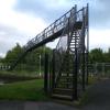
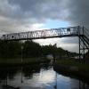
There is a bridge here which takes pedestrian traffic over the canal.


Amenities
 
Maps
If you are a user and are logged on, or if you are actively planning a route, a map will be displayed here.
Show on external mapping site: Google | OSM | Bing
 
Photos
 
External websites
There are no links to external websites from here.
Why not log in and add some (select "External websites" from the menu (sometimes this is under "Edit"))?
 
Nearest facilities

Mouseover for more information or show routes to facility

Nearest water point

In the direction of Castleford Junction

Stanley Ferry Water Point½ furlongs away
On this waterway in the direction of Castleford Junction
King's Road Lock No 31 mile, 5¾ furlongs and 1 lock away
On this waterway in the direction of Castleford Junction
Woodnook Lock No 62 miles, 7¼ furlongs and 2 locks away
On this waterway in the direction of Castleford Junction
Fairies Hill Moorings3 miles, 2¾ furlongs and 4 locks away
Travel to Fairies Hill Lock Junction, then on the Aire and Calder Navigation (Wakefield Section - Fairies Hill Mooring Arm) to Fairies Hill Moorings
Castleford Sanitary Station5 miles, 1¾ furlongs and 4 locks away
Travel to Castleford Junction, then on the Aire and Calder Navigation (Main Line - Goole to Castleford) to Castleford Sanitary Station
Bulholme Lock No 105 miles, 6½ furlongs and 4 locks away
Travel to Castleford Junction, then on the Aire and Calder Navigation (Main Line - Goole to Castleford) to Bulholme Lock No 10
Lemonroyd Lock No 78 miles, 4½ furlongs and 3 locks away
Travel to Castleford Junction, then on the Aire and Calder Navigation (Main Line - Castleford to Leeds) to Lemonroyd Lock No 7
Lemonroyd Marina8 miles, 5½ furlongs and 4 locks away
Travel to Castleford Junction, then on the Aire and Calder Navigation (Main Line - Castleford to Leeds) to Lemonroyd Marina
Woodlesford Lock No 59 miles, 7¼ furlongs and 4 locks away
Travel to Castleford Junction, then on the Aire and Calder Navigation (Main Line - Castleford to Leeds) to Woodlesford Lock No 5
Ferrybridge Flood Lock Footbridge10 miles, 4¼ furlongs and 5 locks away
Travel to Castleford Junction, then on the Aire and Calder Navigation (Main Line - Goole to Castleford) to Ferrybridge Flood Lock Footbridge
Ferrybridge Flood Lock No 1110 miles, 4½ furlongs and 5 locks away
Travel to Castleford Junction, then on the Aire and Calder Navigation (Main Line - Goole to Castleford) to Ferrybridge Flood Lock No 11
Fishpond Lock No 410 miles, 6¼ furlongs and 5 locks away
Travel to Castleford Junction, then on the Aire and Calder Navigation (Main Line - Castleford to Leeds) to Fishpond Lock No 4
Bank Dole Lock No 112 miles, 2¾ furlongs and 6 locks away
Travel to Castleford Junction, then on the Aire and Calder Navigation (Main Line - Goole to Castleford) to Bank Dole Junction, then on the Aire and Calder Navigation (Selby Section) to Bank Dole Lock No 1
Leeds Sanitary Station14 miles, 4 furlongs and 7 locks away
Travel to Castleford Junction, then on the Aire and Calder Navigation (Main Line - Castleford to Leeds) to Leeds Sanitary Station
Beal Bridge14 miles, 5¼ furlongs and 7 locks away
Travel to Castleford Junction, then on the Aire and Calder Navigation (Main Line - Goole to Castleford) to Bank Dole Junction, then on the Aire and Calder Navigation (Selby Section) to Beal Bridge
Beal Lock No 214 miles, 6½ furlongs and 7 locks away
Travel to Castleford Junction, then on the Aire and Calder Navigation (Main Line - Goole to Castleford) to Bank Dole Junction, then on the Aire and Calder Navigation (Selby Section) to Beal Lock No 2
Whitley Lock No 1216 miles, ½ furlongs and 6 locks away
Travel to Castleford Junction, then on the Aire and Calder Navigation (Main Line - Goole to Castleford) to Whitley Lock No 12
Leeds Dock Visitor Moorings14 miles, 6¼ furlongs and 8 locks away
Travel to Castleford Junction, then on the Aire and Calder Navigation (Main Line - Castleford to Leeds) to Leeds Dock Entrance, then on the Aire and Calder Navigation (Leeds Dock) to Leeds Dock Visitor Moorings

In the direction of Fall Ing Junction

On this waterway in the direction of Fall Ing Junction
Broad Cut Low Lock No 35 miles, 4 furlongs and 3 locks away
Travel to Fall Ing Junction, then on the Calder and Hebble Navigation (Main Line) to Broad Cut Low Lock No 3

Nearest rubbish disposal

In the direction of Castleford Junction

On this waterway in the direction of Castleford Junction
Castleford Sanitary Station5 miles, 1¾ furlongs and 4 locks away
Travel to Castleford Junction, then on the Aire and Calder Navigation (Main Line - Goole to Castleford) to Castleford Sanitary Station
Lemonroyd Marina8 miles, 5½ furlongs and 4 locks away
Travel to Castleford Junction, then on the Aire and Calder Navigation (Main Line - Castleford to Leeds) to Lemonroyd Marina
Woodlesford Lock No 59 miles, 7¼ furlongs and 4 locks away
Travel to Castleford Junction, then on the Aire and Calder Navigation (Main Line - Castleford to Leeds) to Woodlesford Lock No 5
Leeds Sanitary Station14 miles, 4 furlongs and 7 locks away
Travel to Castleford Junction, then on the Aire and Calder Navigation (Main Line - Castleford to Leeds) to Leeds Sanitary Station
Whitley Lock No 1216 miles, ½ furlongs and 6 locks away
Travel to Castleford Junction, then on the Aire and Calder Navigation (Main Line - Goole to Castleford) to Whitley Lock No 12
Leeds Basin15 miles, 3 furlongs and 9 locks away
Travel to Castleford Junction, then on the Aire and Calder Navigation (Main Line - Castleford to Leeds) to Leeds Bridge, then on the Leeds and Liverpool Canal (Main Line - Wigan to Leeds) to Leeds Basin

In the direction of Fall Ing Junction

Horbury Basin Residential Moorings & Sanitary Station7 miles, 4½ furlongs and 5 locks away
Travel to Fall Ing Junction, then on the Calder and Hebble Navigation (Main Line) to Horbury Basin Residential Moorings & Sanitary Station
Shepley Bridge Sanitary Station12 miles, 1 furlong and 12 locks away
Travel to Fall Ing Junction, then on the Calder and Hebble Navigation (Main Line) to Shepley Bridge Sanitary Station
Brighouse Lower Basin Visitor Moorings17 miles, 3½ furlongs and 17 locks away
Travel to Fall Ing Junction, then on the Calder and Hebble Navigation (Main Line) to Brighouse Lower Basin Visitor Moorings
Aspley Basin (Huddersfield)18 miles, 5½ furlongs and 23 locks away
Travel to Fall Ing Junction, then on the Calder and Hebble Navigation (Main Line) to Cooper Bridge Junction, then on the Huddersfield Broad Canal to Aspley Basin (Huddersfield)

Nearest chemical toilet disposal

In the direction of Castleford Junction

Fairies Hill Moorings3 miles, 2¾ furlongs and 4 locks away
Travel to Fairies Hill Lock Junction, then on the Aire and Calder Navigation (Wakefield Section - Fairies Hill Mooring Arm) to Fairies Hill Moorings
Castleford Sanitary Station5 miles, 1¾ furlongs and 4 locks away
Travel to Castleford Junction, then on the Aire and Calder Navigation (Main Line - Goole to Castleford) to Castleford Sanitary Station
Lemonroyd Marina8 miles, 5½ furlongs and 4 locks away
Travel to Castleford Junction, then on the Aire and Calder Navigation (Main Line - Castleford to Leeds) to Lemonroyd Marina
Leeds Sanitary Station14 miles, 4 furlongs and 7 locks away
Travel to Castleford Junction, then on the Aire and Calder Navigation (Main Line - Castleford to Leeds) to Leeds Sanitary Station
Whitley Lock No 1216 miles, ½ furlongs and 6 locks away
Travel to Castleford Junction, then on the Aire and Calder Navigation (Main Line - Goole to Castleford) to Whitley Lock No 12

In the direction of Fall Ing Junction

On this waterway in the direction of Fall Ing Junction
Horbury Basin Residential Moorings & Sanitary Station7 miles, 4½ furlongs and 5 locks away
Travel to Fall Ing Junction, then on the Calder and Hebble Navigation (Main Line) to Horbury Basin Residential Moorings & Sanitary Station
Savile Town Wharf and Basin (Dewsbury)10 miles, 5½ furlongs and 8 locks away
Travel to Fall Ing Junction, then on the Calder and Hebble Navigation (Main Line) to Dewsbury Arm Junction, then on the Calder and Hebble Navigation (Dewsbury Old Cut) to Savile Town Wharf and Basin (Dewsbury)
Shepley Bridge Sanitary Station12 miles, 1 furlong and 12 locks away
Travel to Fall Ing Junction, then on the Calder and Hebble Navigation (Main Line) to Shepley Bridge Sanitary Station
Brighouse Basin17 miles, 4 furlongs and 18 locks away
Travel to Fall Ing Junction, then on the Calder and Hebble Navigation (Main Line) to Brighouse Basin
Aspley Basin (Huddersfield)18 miles, 5½ furlongs and 23 locks away
Travel to Fall Ing Junction, then on the Calder and Hebble Navigation (Main Line) to Cooper Bridge Junction, then on the Huddersfield Broad Canal to Aspley Basin (Huddersfield)

Nearest place to turn

In the direction of Castleford Junction

Stanley Ferry Marina1¼ furlongs away
On this waterway in the direction of Castleford Junction
Fairies Hill Lock Arm2 miles, 5¾ furlongs and 2 locks away
On this waterway in the direction of Castleford Junction
Bulholme Lock Weir Exit5 miles, 7 furlongs and 5 locks away
Travel to Castleford Junction, then on the Aire and Calder Navigation (Main Line - Goole to Castleford) to Bulholme Lock Weir Exit
Lemonroyd Lock Weir Exit8 miles, 3½ furlongs and 3 locks away
Travel to Castleford Junction, then on the Aire and Calder Navigation (Main Line - Castleford to Leeds) to Lemonroyd Lock Weir Exit
Fleet Lane Arm8 miles, 7½ furlongs and 4 locks away
Travel to Castleford Junction, then on the Aire and Calder Navigation (Main Line - Castleford to Leeds) to Fleet Lane Arm
Junction with River Aire (Old Channel) South13 miles, 1¾ furlongs and 6 locks away
Travel to Castleford Junction, then on the Aire and Calder Navigation (Main Line - Castleford to Leeds) to Junction with River Aire (Old Channel) South
Bank Dole Lock Junction12 miles, 3 furlongs and 7 locks away
Travel to Castleford Junction, then on the Aire and Calder Navigation (Main Line - Goole to Castleford) to Bank Dole Junction, then on the Aire and Calder Navigation (Selby Section) to Bank Dole Lock Junction
Junction with River Aire (Old Channel) North13 miles, 7 furlongs and 7 locks away
Travel to Castleford Junction, then on the Aire and Calder Navigation (Main Line - Castleford to Leeds) to Junction with River Aire (Old Channel) North
Knostrop Flood Lock Weir Entrance13 miles, 7¼ furlongs and 7 locks away
Travel to Castleford Junction, then on the Aire and Calder Navigation (Main Line - Castleford to Leeds) to Knostrop Flood Lock Weir Entrance
Beal Lock No 2 Weir Entrance14 miles, 5½ furlongs and 7 locks away
Travel to Castleford Junction, then on the Aire and Calder Navigation (Main Line - Goole to Castleford) to Bank Dole Junction, then on the Aire and Calder Navigation (Selby Section) to Beal Lock No 2 Weir Entrance
Leeds Dock Side Arm14 miles, 6¼ furlongs and 8 locks away
Travel to Castleford Junction, then on the Aire and Calder Navigation (Main Line - Castleford to Leeds) to Leeds Dock Entrance, then on the Aire and Calder Navigation (Leeds Dock) to Leeds Dock Side Arm
River Aire Junction15 miles, 2½ furlongs and 8 locks away
Travel to Castleford Junction, then on the Aire and Calder Navigation (Main Line - Castleford to Leeds) to Leeds Bridge, then on the Leeds and Liverpool Canal (Main Line - Wigan to Leeds) to River Aire Junction
Leeds Basin15 miles, 3 furlongs and 9 locks away
Travel to Castleford Junction, then on the Aire and Calder Navigation (Main Line - Castleford to Leeds) to Leeds Bridge, then on the Leeds and Liverpool Canal (Main Line - Wigan to Leeds) to Leeds Basin

In the direction of Fall Ing Junction

Wakefield Weir Entrance2 miles, 7 furlongs and 2 locks away
Travel to Fall Ing Junction, then on the Calder and Hebble Navigation (Main Line) to Wakefield Weir Entrance
Broad Cut Weir Entrance5 miles, 3½ furlongs and 3 locks away
Travel to Fall Ing Junction, then on the Calder and Hebble Navigation (Main Line) to Broad Cut Weir Entrance
Waller Bridge Winding Hole5 miles, 5¾ furlongs and 4 locks away
Travel to Fall Ing Junction, then on the Calder and Hebble Navigation (Main Line) to Waller Bridge Winding Hole
Horbury Basin Residential Moorings & Sanitary Station7 miles, 4½ furlongs and 5 locks away
Travel to Fall Ing Junction, then on the Calder and Hebble Navigation (Main Line) to Horbury Basin Residential Moorings & Sanitary Station
Dewsbury Arm Junction9 miles, 5½ furlongs and 8 locks away
Travel to Fall Ing Junction, then on the Calder and Hebble Navigation (Main Line) to Dewsbury Arm Junction
Savile Town Wharf and Basin (Dewsbury)10 miles, 5½ furlongs and 8 locks away
Travel to Fall Ing Junction, then on the Calder and Hebble Navigation (Main Line) to Dewsbury Arm Junction, then on the Calder and Hebble Navigation (Dewsbury Old Cut) to Savile Town Wharf and Basin (Dewsbury)
Shepley Bridge Marina12 miles, ½ furlongs and 12 locks away
Travel to Fall Ing Junction, then on the Calder and Hebble Navigation (Main Line) to Shepley Bridge Marina

Nearest self-operated pump-out

In the direction of Castleford Junction

Castleford Sanitary Station5 miles, 1¾ furlongs and 4 locks away
Travel to Castleford Junction, then on the Aire and Calder Navigation (Main Line - Goole to Castleford) to Castleford Sanitary Station
Leeds Sanitary Station14 miles, 4 furlongs and 7 locks away
Travel to Castleford Junction, then on the Aire and Calder Navigation (Main Line - Castleford to Leeds) to Leeds Sanitary Station

In the direction of Fall Ing Junction

On this waterway in the direction of Fall Ing Junction

Nearest boatyard pump-out

In the direction of Castleford Junction

Lemonroyd Marina8 miles, 5½ furlongs and 4 locks away
Travel to Castleford Junction, then on the Aire and Calder Navigation (Main Line - Castleford to Leeds) to Lemonroyd Marina

In the direction of Fall Ing Junction

Shepley Bridge Marina12 miles, ½ furlongs and 12 locks away
Travel to Fall Ing Junction, then on the Calder and Hebble Navigation (Main Line) to Shepley Bridge Marina
Aspley Basin (Huddersfield)18 miles, 5½ furlongs and 23 locks away
Travel to Fall Ing Junction, then on the Calder and Hebble Navigation (Main Line) to Cooper Bridge Junction, then on the Huddersfield Broad Canal to Aspley Basin (Huddersfield)
Direction of TV transmitter (From Wolfbane Cybernetic)
 
 
Geograph
 
Wikipedia

There is no page on Wikipedia called “Ramsdens Footbridge”

Wikipedia pages that might relate to Ramsdens Footbridge
[Fleet services] September 2018 and included Burger King, KFC, Pizza Express, Tossed, Harry Ramsdens, WHSmith and Little Waitrose. Additionally a number of Tesla and Ecotricity [The Waterfront Barrow-in-Furness] pedestrian footbridge will serve as the most iconic piece within the waterfront development and will connect south Marina Village to the Ramsden Dock marina [Bank of England] Golden Jubilee Bridges Kew Bridge Lambeth Bridge London Bridge Millennium Footbridge Putney Bridge Southwark Bridge Tower Bridge Vauxhall Bridge Wandsworth [Huddersfield Narrow Canal] Wakefield Road Huddersfield Broad Canal Lock 1E – Start of HNC University footbridge Commercial Street Former Lock 2E Bates Tunnel West Portal Lock 2E  A616  [Records of members of parliament of the United Kingdom] 1865, 1880 Arthur Otway: 1865, 1878 b Edward Watkin: 1864, 1874 Sir John Ramsden: 1859 b, 1868, 1880 Sir James Fergusson: 1859, 1885 Abel Smith: 1859, 1866 [Westquay] Station, was cut in half by the centre. Harbour Parade is crossed by a footbridge to the adjacent multi-storey car park. It absorbs a 4½ metre change in [Yorkshire Water Way] After this is passes over Denton Moor and into West Yorkshire via a footbridge over the River Wharfe into Ilkley, where the first book ends. South of [Riverdale Park (Toronto)] outdoor hockey rink to the northeast, and a running track in the centre. A footbridge crosses the Don Valley Parkway, Bayview Avenue, the Canadian National [Peak District Boundary Walk] following the Manifold Trail along the river upstream through Ilam, over the footbridge and up past Musden Low hilltop and back down into Calton village, following [Coniston Railway] was lifted and the other railway structures were removed. The Coniston footbridge was dismantled and re-built at Ravenglass for the Ravenglass and Eskdale
 
Google