CanalPlanAC

Savick Aqueduct No 13

 
Windsor Avenue, Preston PR2 1JD, United Kingdom
 
Information about the place
Savick Aqueduct No 13 is a minor waterways place on the Lancaster Canal (Main Line) between Preston Terminus (Southern end of canal) (6½ furlongs to the southeast) and Ribble Link - Lancaster Canal Junction (5¾ furlongs to the west).
 
 
The nearest place in the direction of Preston Terminus is Cadley Services (Cadley Visitor Moorings and Services); 1¼ furlongs away.
 
The nearest place in the direction of Ribble Link - Lancaster Canal Junction is Hollinshed Fold Bridge No 14; 1 furlong away.

Mooring here is unrated.

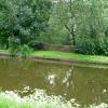
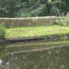
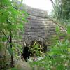
There is a small aqueduct or underbridge here which takes a river under the canal.


Amenities

Amenities nearby at Hollinshed Fold Bridge No 14

 Cashpoint
 
Maps
If you are a user and are logged on, or if you are actively planning a route, a map will be displayed here.
Show on external mapping site: Google | OSM | Bing
 
Photos
 
External websites
There are no links to external websites from here.
Why not log in and add some (select "External websites" from the menu (sometimes this is under "Edit"))?
 
Nearest facilities

Mouseover for more information or show routes to facility

Nearest water point

In the direction of Preston Terminus

Woodplumpton Road Bridge No 121½ furlongs away
On this waterway in the direction of Preston Terminus

In the direction of Tewitfield

Blackleach Lane Marina6 miles, ½ furlongs away
On this waterway in the direction of Tewitfield
Swill Brook Basin6 miles, 3¾ furlongs away
On this waterway in the direction of Tewitfield
Bilsborrow Winding Hole11 miles away
On this waterway in the direction of Tewitfield
Moss Lane Bridge No 6316 miles, ¾ furlongs away
On this waterway in the direction of Tewitfield
Spark Bridge Sanitary Station14 miles, 3 furlongs and 10 locks away
Travel to Ribble Link - Lancaster Canal Junction, then on the River Ribble (Ribble Link) to Ribble - Savick Brook Junction, then on the River Ribble (Main River) to Astland Lamp, then on the River Douglas to Tarleton Junction, then on the Leeds and Liverpool Canal (Rufford Branch) to Spark Bridge Sanitary Station
St Mary's Marina15 miles, 2¾ furlongs and 10 locks away
Travel to Ribble Link - Lancaster Canal Junction, then on the River Ribble (Ribble Link) to Ribble - Savick Brook Junction, then on the River Ribble (Main River) to Astland Lamp, then on the River Douglas to Tarleton Junction, then on the Leeds and Liverpool Canal (Rufford Branch) to St Mary's Marina
Burscough Bridge Wharf19 miles, ½ furlongs and 17 locks away
Travel to Ribble Link - Lancaster Canal Junction, then on the River Ribble (Ribble Link) to Ribble - Savick Brook Junction, then on the River Ribble (Main River) to Astland Lamp, then on the River Douglas to Tarleton Junction, then on the Leeds and Liverpool Canal (Rufford Branch) to Lathom Junction, then on the Leeds and Liverpool Canal (Main Line - Liverpool to Wigan) to Burscough Bridge Wharf

Nearest rubbish disposal

Nearest chemical toilet disposal

Nearest place to turn

In the direction of Preston Terminus

Ashton Basin5½ furlongs away
On this waterway in the direction of Preston Terminus

In the direction of Tewitfield

Bexhill Road Winding Hole2¼ furlongs away
On this waterway in the direction of Tewitfield On this waterway in the direction of Tewitfield On this waterway in the direction of Tewitfield
Ward's House Winding Hole No 12 miles, 7¾ furlongs away
On this waterway in the direction of Tewitfield
Ward's House Winding Hole No 23 miles, 1¾ furlongs away
On this waterway in the direction of Tewitfield
Salwick Hall Winding Hole3 miles, 4 furlongs away
On this waterway in the direction of Tewitfield
Ribble Link Staircase Winding Hole6½ furlongs and 3 locks away
Travel to Ribble Link - Lancaster Canal Junction, then on the River Ribble (Ribble Link) to Ribble Link Staircase Winding Hole
Ribble Link Lock No 5 Winding Hole1 mile, 2¾ furlongs and 4 locks away
Travel to Ribble Link - Lancaster Canal Junction, then on the River Ribble (Ribble Link) to Ribble Link Lock No 5 Winding Hole
Swill Brook Basin6 miles, 3¾ furlongs away
On this waterway in the direction of Tewitfield
Moons Bridge Marina7 miles, 7¾ furlongs away
On this waterway in the direction of Tewitfield
Hollowforth Winding Hole8 miles, ¾ furlongs away
On this waterway in the direction of Tewitfield
Park Head Winding Hole8 miles, 6¾ furlongs away
On this waterway in the direction of Tewitfield
Winding Hole above Lock No 82 miles, 4¼ furlongs and 7 locks away
Travel to Ribble Link - Lancaster Canal Junction, then on the River Ribble (Ribble Link) to Winding Hole above Lock No 8
White Horse Winding Hole9 miles, 7¼ furlongs away
On this waterway in the direction of Tewitfield
Bilsborrow Winding Hole11 miles away
On this waterway in the direction of Tewitfield
Catterall Bridge Winding Hole13 miles, 6¼ furlongs away
On this waterway in the direction of Tewitfield
Greenhalgh Castle Bridge Winding Hole14 miles, 7 furlongs away
On this waterway in the direction of Tewitfield
Dimples Bridge Winding Hole15 miles, 1 furlong away
On this waterway in the direction of Tewitfield
The Moorings Basin15 miles, 6¾ furlongs away
On this waterway in the direction of Tewitfield
Direction of TV transmitter (From Wolfbane Cybernetic)
 
 
Geograph
 
Wikipedia

There is no page on Wikipedia called “Savick Aqueduct”

Wikipedia pages that might relate to Savick Aqueduct
[Ribble Link] It was opened in July 2002. The marshland of the River Ribble and the Savick Brook were natural obstacles preventing easy access north-west of Preston [River Darwen] Ewood Park. The river passes below the Leeds and Liverpool Canal at Ewood Aqueduct and is culverted again at Waterfall and near Griffin Park. It is joined [Listed buildings in Preston, Lancashire] List for England, retrieved 25 April 2014 Historic England, "Small canal aqueduct approx.200m north of Canal Bridge No.14 (1207293)", National Heritage List
 
Google

Results of Google Search

KILN TREE BRIDGE NO 72 19 MILES AND 5½... - Preston Local ...
Woodplumpton Road Bridge No 12 4¾ furlongs 0 locks. Savick Aqueduct No 13 6½ furlongs 0 locks. Hollinshed Fold Bridge No 14 7½ furlongs 0 locks
CANAL AQUEDUCT, NUMBERED 13, APPROXIMATELY 300 ...
Heritage List Entry Summary for Canal Aqueduct, Numbered 13, Approximately 300 Metres South Of Canal Bridge No 14. ... south of Canal Bridge No.14. II Aqueduct carrying Lancaster Canal over Savick Brook. 1797, engineer John Rennie.
Lancaster Canal, Ribble Link
Aqueduct 33, Woodplumpton Aqueduct. Aqueduct 13, Savick Aqueduct. Millennium ... Lock No. 2. Lock 3. Aqueduct 82, Cocker Aqueduct. Max 67ft. Max 67ft.
Canal Aqueduct, Numbered 13, Approximately 300 Metres South of ...
Dec 20, 1991 ... Canal Aqueduct, Numbered 13, Approximately 300 Metres South of Canal ... No. 14. II. Aqueduct carrying Lancaster Canal over Savick Brook.
Ribble Link - Wikipedia
The Millennium Ribble Link is a linear water park and new navigation which links the ... The marshland of the River Ribble and the Savick Brook were natural ... to be precise) and finally overspent by an additional £1.1 million (British Waterways ... The Lune aqueduct was built, but the Ribble one was not, as the construction ...
LANCASTER CANAL 1. Preston to Woodplumpton. | bowlandclimber
Jan 12, 2018 ... Some inauspicious steps lead to a grubby basin with no room to swing ... Bridge 13 is the first aqueduct, here above a diminutive Savick Brook ...
Lancaster Canal, Preston to Woodplumpton photos
May 22, 2010 ... Thomas on Savick Aqueduct (Bridge 13), A few more houses but ... Not much to photograph, all countryside and trees. New bridge (Bridge 28)