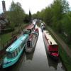
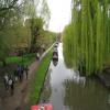
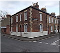
Combe Road Wharf 
College Cruisers hire base
Oxford Canal, Combe Street, Oxford OX2 6BL, United Kingdom

Combe Road Wharf
is a minor waterways place
on the Oxford Canal (Southern Section - Main Line) between
Isis Lock Junction (1¼ furlongs
to the southeast) and
Wolvercote Junction (Junction of Duke's Cut with Oxford Canal) (2 miles and 6¾ furlongs
and 1 lock
to the northwest).
The nearest place in the direction of Isis Lock Junction is Jericho Canal Wharf;
½ furlongs
away.
The nearest place in the direction of Wolvercote Junction is Jericho Footbridge;
½ furlongs
away.
Mooring here is good (a nice place to moor). Mooring is limited to 48 hours. Some rings set back a yard from the edge.
Oxford Visitor Moorings | 2 furlongs | |
Isis Sanitary Station | 1¾ furlongs | |
Isis Lock Junction | 1¼ furlongs | |
Hythe Bridge Arm Winding Hole | 1¼ furlongs | |
Jericho Canal Wharf | ½ furlongs | |
Combe Road Wharf | ||
Jericho Footbridge | ½ furlongs | |
Walton Well Road Bridge No 242 | 2¼ furlongs | |
Aristotle Lane 48 hour Visitor Moorings | 5¼ furlongs | |
Aristotle Bridge No 240 | 5½ furlongs | |
Heyfield Hut Wharf | 5¾ furlongs |
Amenities here
Amenities nearby at Jericho Footbridge
Amenities in City of Oxford
Amenities at other places in City of Oxford
at
at
at
at
at
at
at
at
at
at
at
at
at
at
at
at
at
at
at
at
at
at
at
at
at
at
at
at
at
at
at
at
at
at
at
at
at
at
at
at
at
at
at
at
at
at
at
at
at
at
at
at
at
at
at
at
at
at
at
at
at
at
at
at
at
at
at
at
at
at
at
at
at
at
at
at
at
at
at
- Oxford Canal Walk - Part One - Oxford to Thrupp - YouTube — associated with Oxford Canal
- A walk along the Oxford Canal (Southern Section) from Oxford to Thrupp Wide
Mouseover for more information or show routes to facility
Nearest water point
In the direction of Napton Junction
St Edwards Lift Bridge No 238 — 1 mile, 2½ furlongs away
On this waterway in the direction of Napton Junction
Wolvercote Sanitary Station — 2 miles, 3 furlongs and 1 lock away
On this waterway in the direction of Napton Junction
Wolvercote Junction Water Point — 2 miles, 7½ furlongs and 2 locks away
On this waterway in the direction of Napton Junction
Eynsham Lock — 6 miles, 1½ furlongs and 2 locks away
Travel to Wolvercote Junction, then on the Oxford Canal (Duke's Cut) to Duke's Cut Junction, then on the River Thames (above Oxford) to Eynsham Lock
Langford Lane Bridge No 224 — 5 miles, 7¼ furlongs and 4 locks away
On this waterway in the direction of Napton Junction
Aubreys Lift Bridge No 221 — 6 miles, 4¾ furlongs and 4 locks away
On this waterway in the direction of Napton Junction
Thrupp Cruising Club — 6 miles, 5 furlongs and 4 locks away
On this waterway in the direction of Napton Junction
Shifford Lock — 16 miles, 2¼ furlongs and 5 locks away
Travel to Wolvercote Junction, then on the Oxford Canal (Duke's Cut) to Duke's Cut Junction, then on the River Thames (above Oxford) to Shifford Lock
Heyford Wharf Bridge No 206 — 14 miles, 1 furlong and 9 locks away
On this waterway in the direction of Napton Junction
Heyford Wharf — 14 miles, 1¼ furlongs and 9 locks away
On this waterway in the direction of Napton Junction
In the direction of End of Hythe Bridge Arm
Oxford Visitor Moorings — 2 furlongs away
On this waterway in the direction of End of Hythe Bridge Arm
Abingdon Lock — 9 miles, 1 furlong and 4 locks away
Travel to Isis Lock Junction, then on the River Thames (Sheepwash Channel) to Sheepwash Channel Junction, then on the River Thames (above Oxford) to Osney Bridge, then on the River Thames (below Oxford) to Abingdon Lock
Abingdon Bridge Marine — 9 miles, 4¾ furlongs and 5 locks away
Travel to Isis Lock Junction, then on the River Thames (Sheepwash Channel) to Sheepwash Channel Junction, then on the River Thames (above Oxford) to Osney Bridge, then on the River Thames (below Oxford) to Abingdon Bridge MarineNearest rubbish disposal
In the direction of Napton Junction
Wolvercote Sanitary Station — 2 miles, 3 furlongs and 1 lock away
On this waterway in the direction of Napton Junction
Eynsham Lock — 6 miles, 1½ furlongs and 2 locks away
Travel to Wolvercote Junction, then on the Oxford Canal (Duke's Cut) to Duke's Cut Junction, then on the River Thames (above Oxford) to Eynsham Lock
Aubreys Lift Bridge No 221 — 6 miles, 4¾ furlongs and 4 locks away
On this waterway in the direction of Napton Junction
Thrupp Cruising Club — 6 miles, 5 furlongs and 4 locks away
On this waterway in the direction of Napton Junction
Heyford Wharf Bridge No 206 — 14 miles, 1 furlong and 9 locks away
On this waterway in the direction of Napton Junction
Heyford Wharf — 14 miles, 1¼ furlongs and 9 locks away
On this waterway in the direction of Napton Junction
In the direction of End of Hythe Bridge Arm
Abingdon Lock — 9 miles, 1 furlong and 4 locks away
Travel to Isis Lock Junction, then on the River Thames (Sheepwash Channel) to Sheepwash Channel Junction, then on the River Thames (above Oxford) to Osney Bridge, then on the River Thames (below Oxford) to Abingdon Lock
Day's Lock — 17 miles, 3¼ furlongs and 7 locks away
Travel to Isis Lock Junction, then on the River Thames (Sheepwash Channel) to Sheepwash Channel Junction, then on the River Thames (above Oxford) to Osney Bridge, then on the River Thames (below Oxford) to Day's LockNearest chemical toilet disposal
In the direction of Napton Junction
Wolvercote Sanitary Station — 2 miles, 3 furlongs and 1 lock away
On this waterway in the direction of Napton Junction
Eynsham Lock — 6 miles, 1½ furlongs and 2 locks away
Travel to Wolvercote Junction, then on the Oxford Canal (Duke's Cut) to Duke's Cut Junction, then on the River Thames (above Oxford) to Eynsham Lock
Thrupp Cruising Club — 6 miles, 5 furlongs and 4 locks away
On this waterway in the direction of Napton Junction
In the direction of End of Hythe Bridge Arm
Abingdon Lock — 9 miles, 1 furlong and 4 locks away
Travel to Isis Lock Junction, then on the River Thames (Sheepwash Channel) to Sheepwash Channel Junction, then on the River Thames (above Oxford) to Osney Bridge, then on the River Thames (below Oxford) to Abingdon Lock
Day's Lock — 17 miles, 3¼ furlongs and 7 locks away
Travel to Isis Lock Junction, then on the River Thames (Sheepwash Channel) to Sheepwash Channel Junction, then on the River Thames (above Oxford) to Osney Bridge, then on the River Thames (below Oxford) to Day's LockNearest place to turn
In the direction of Napton Junction
Wolvercote Junction — 2 miles, 6¾ furlongs and 1 lock away
On this waterway in the direction of Napton Junction
Bypass Reservoir Junction — 3 miles, ½ furlongs and 2 locks away
Travel to Wolvercote Junction, then on the Oxford Canal (Duke's Cut) to Bypass Reservoir Junction
Duke's Cut Junction — 3 miles, 5 furlongs and 2 locks away
Travel to Wolvercote Junction, then on the Oxford Canal (Duke's Cut) to Duke's Cut Junction
Thames - Wharf Stream Junction — 5 miles, 7¾ furlongs and 2 locks away
Travel to Wolvercote Junction, then on the Oxford Canal (Duke's Cut) to Duke's Cut Junction, then on the River Thames (above Oxford) to Thames - Wharf Stream Junction
Pinkhill Lock Weir Exit — 7 miles, 3¾ furlongs and 3 locks away
Travel to Wolvercote Junction, then on the Oxford Canal (Duke's Cut) to Duke's Cut Junction, then on the River Thames (above Oxford) to Pinkhill Lock Weir Exit
Thrupp Wide — 6 miles, 4¾ furlongs and 4 locks away
On this waterway in the direction of Napton Junction
Shipton Weir Junction — 7 miles, 5¼ furlongs and 5 locks away
On this waterway in the direction of Napton Junction
In the direction of End of Hythe Bridge Arm
Hythe Bridge Arm Winding Hole — 1¼ furlongs away
On this waterway in the direction of End of Hythe Bridge Arm
End of Hythe Bridge Arm — 2¼ furlongs away
On this waterway in the direction of End of Hythe Bridge Arm
Castle Mill Stream Junction — 1½ furlongs and 1 lock away
Travel to Isis Lock Junction, then on the River Thames (Sheepwash Channel) to Castle Mill Stream Junction
Sheepwash Channel Junction — 2¼ furlongs and 1 lock away
Travel to Isis Lock Junction, then on the River Thames (Sheepwash Channel) to Sheepwash Channel Junction
Bossoms Boat Yard — 1 mile, ¼ furlongs and 1 lock away
Travel to Isis Lock Junction, then on the River Thames (Sheepwash Channel) to Sheepwash Channel Junction, then on the River Thames (above Oxford) to Bossoms Boat Yard
Osney Lock Weir Exit — 5¼ furlongs and 2 locks away
Travel to Isis Lock Junction, then on the River Thames (Sheepwash Channel) to Sheepwash Channel Junction, then on the River Thames (above Oxford) to Osney Bridge, then on the River Thames (below Oxford) to Osney Lock Weir Exit
Thames - Cherwell Junction — 1 mile, 7¼ furlongs and 2 locks away
Travel to Isis Lock Junction, then on the River Thames (Sheepwash Channel) to Sheepwash Channel Junction, then on the River Thames (above Oxford) to Osney Bridge, then on the River Thames (below Oxford) to Thames - Cherwell Junction
Iffley Lock Weir Entrance No 1 — 2 miles, 6¾ furlongs and 2 locks away
Travel to Isis Lock Junction, then on the River Thames (Sheepwash Channel) to Sheepwash Channel Junction, then on the River Thames (above Oxford) to Osney Bridge, then on the River Thames (below Oxford) to Iffley Lock Weir Entrance No 1
Iffley Lock Weir Exit No 1 — 2 miles, 7¾ furlongs and 3 locks away
Travel to Isis Lock Junction, then on the River Thames (Sheepwash Channel) to Sheepwash Channel Junction, then on the River Thames (above Oxford) to Osney Bridge, then on the River Thames (below Oxford) to Iffley Lock Weir Exit No 1
Sandford Lock Weir Exit (Thames) — 4 miles, 5½ furlongs and 4 locks away
Travel to Isis Lock Junction, then on the River Thames (Sheepwash Channel) to Sheepwash Channel Junction, then on the River Thames (above Oxford) to Osney Bridge, then on the River Thames (below Oxford) to Sandford Lock Weir Exit (Thames)
Abingdon Lock Weir Exit No 1 — 9 miles, 1¾ furlongs and 5 locks away
Travel to Isis Lock Junction, then on the River Thames (Sheepwash Channel) to Sheepwash Channel Junction, then on the River Thames (above Oxford) to Osney Bridge, then on the River Thames (below Oxford) to Abingdon Lock Weir Exit No 1
Abingdon Bridge Winding Hole — 9 miles, 4¾ furlongs and 5 locks away
Travel to Isis Lock Junction, then on the River Thames (Sheepwash Channel) to Sheepwash Channel Junction, then on the River Thames (above Oxford) to Osney Bridge, then on the River Thames (below Oxford) to Abingdon Bridge Winding Hole
Culham Lock Weir Entrance — 9 miles, 6¾ furlongs and 5 locks away
Travel to Isis Lock Junction, then on the River Thames (Sheepwash Channel) to Sheepwash Channel Junction, then on the River Thames (above Oxford) to Osney Bridge, then on the River Thames (below Oxford) to Culham Lock Weir EntranceNearest self-operated pump-out
In the direction of Napton Junction
Eynsham Lock — 6 miles, 1½ furlongs and 2 locks away
Travel to Wolvercote Junction, then on the Oxford Canal (Duke's Cut) to Duke's Cut Junction, then on the River Thames (above Oxford) to Eynsham Lock
Aubreys Lift Bridge No 221 — 6 miles, 4¾ furlongs and 4 locks away
On this waterway in the direction of Napton Junction
Thrupp Cruising Club — 6 miles, 5 furlongs and 4 locks away
On this waterway in the direction of Napton Junction
In the direction of End of Hythe Bridge Arm
Abingdon Lock — 9 miles, 1 furlong and 4 locks away
Travel to Isis Lock Junction, then on the River Thames (Sheepwash Channel) to Sheepwash Channel Junction, then on the River Thames (above Oxford) to Osney Bridge, then on the River Thames (below Oxford) to Abingdon LockNearest boatyard pump-out
In the direction of Napton Junction
Oxford Cruisers Marina — 7 miles, 1¼ furlongs and 3 locks away
Travel to Wolvercote Junction, then on the Oxford Canal (Duke's Cut) to Duke's Cut Junction, then on the River Thames (above Oxford) to Oxford Cruisers Marina
Enslow Wharf — 9 miles, ¼ furlongs and 6 locks away
On this waterway in the direction of Napton Junction
Heyford Wharf — 14 miles, 1¼ furlongs and 9 locks away
On this waterway in the direction of Napton Junction
In the direction of End of Hythe Bridge Arm
Abingdon Bridge Marine — 9 miles, 4¾ furlongs and 5 locks away
Travel to Isis Lock Junction, then on the River Thames (Sheepwash Channel) to Sheepwash Channel Junction, then on the River Thames (above Oxford) to Osney Bridge, then on the River Thames (below Oxford) to Abingdon Bridge MarineDirection of TV transmitter (From Wolfbane Cybernetic)
There is no page on Wikipedia called “Combe Road Wharf”
Wikipedia pages that might relate to Combe Road Wharf
[Bath stone]
of calcium carbonate. Originally obtained from the Combe Down and Bathampton Down Mines under Combe Down, Somerset, England, its warm, honey colouring
[Jericho, Oxford]
of Jericho", was partially filmed in the streets of Jericho, notably Combe Road (which is 'Canal Reach' in the drama). It also featured the exterior of
[Prior Park]
from his mine on Combe Down which carried the stone down the hill, now known as Ralph Allen Drive, which runs beside Prior Park, to a wharf he constructed
[Canal Street, Oxford]
prices due to its convenient central location. "Canal Reach", in actuality Combe Road, off Canal Street was used as the location of a murder in The Dead of
[Somerset Coal Canal]
over two aqueducts at Dunkerton, through a tunnel at Combe Hay, then via Midford and Monkton Combe to Limpley Stoke where it joined the Kennet and Avon
[Bridges of York]
north of Rowntree Wharf linking Navigation Road with the Hungate area and Peasholme Green Pedestrian bridge from Foss Islands Road to what is now the
[Chippenham]
re-erected it as a gazebo in the kitchen garden of the manor house at Castle Combe, where it fell into disrepair. The Buttercross was re-erected in 1995 by
[Lewisham]
Lewisham Library. The Manor of Lewisham, with its appendages of Greenwich and Combe, was given by Elthruda, King Alfred's niece, to the abbey of St. Peter at
[Kennet and Avon Canal]
Retrieved 16 August 2006. "Origin of Brassknocker Basin name". Monkton Combe Village. Archived from the original on 2 July 2007. Retrieved 21 November
[List of generic forms in place names in Ireland and the United Kingdom]
personal name. clere Possibly W Possibly clear or bright Burghclere, Highclere combe, coombe Bry valley Barcombe ("Valley of the Britons"), Farncombe, Ilfracombe
Results of Google Search
Directions and contact details for College Cruisers. You can find us at Combe Road Wharf, Oxford, OX2 6BL. Phone: 01865 554343.
Combe Road. Wharf Oxford OX2 6BL United Kingdom. Directions. +44 1865 554343. Call Now · Visit Website. http://www.collegecruisers.com. More Info. Hours.
Hotels Near College CruisersCombe Road Wharf Phone 1865-554-343. Recreation- Boating & Sailing. Hotels Near College FjordSightseeing- Nature.
5,325.3 mi · Combe Road Wharf, Oxford, Oxfordshire. Get directions · Send Message · Call +44 1865 554343 · 5.0. 5 of 5 stars. View 5 reviews. Caz Davies — 5 ...
Wantage Road, Newbury RG14 3BE England. 7.9 miles from Hungerford Wharf. Combe Gibbet. #1 of 1 things to do in Inkpen. 60 reviews. Inkpen, Hungerford ...
Combe Hill wharf. Apperley Ct to Wainlode Hill Road bridge. Entrance lock (dis). River Severn. Coombe Hill Canal lies in the Vale of Gloucester, south west England, north of Leigh and runs ...
Combe Road, Jericho, Oxford. The gate at the far end leads to the College Cruisers boat yard. The street (renamed "Canal Street") featured in the Inspector ...
The cheapest way to get from Newbury to Castle Combe costs only £10, and the quickest way takes just 54 mins. ... Take the bus from Newbury Wharf to Reading Town Centre, Blagrave Street 1 - jet black ... The road distance is 50.3 miles.
London SE3 · Combe Avenue, The Modern House. Sold ... Regent's Park Road, London N3. £650,000 ... Gattis Wharf, New Wharf Road, London N1. Sold. sold ...