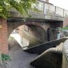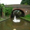
Hanbury Road Bridge No 44
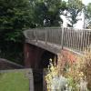
Separate footbridge alongside road bridge
Hanbury Road, Stoke Prior B60 4LA, United Kingdom
(B4091)

Hanbury Road Bridge No 44
is a minor waterways place
on the Worcester and Birmingham Canal (Diglis Basin to King's Norton Junction) between
Hanbury Junction (Junction with Droitwich Junction Canal (Restored - Opened 1/July/2011). Hanbury Wharf) (3 miles and 2 furlongs
and 6 locks
to the southwest) and
King's Norton Junction (Junction of Stratford and Worcester and Birmingham Canals) (12 miles and ½ furlongs
and 36 locks
to the northeast).
The nearest place in the direction of Hanbury Junction is Bridge No 44 Pipe Bridge;
a few yards
away.
The nearest place in the direction of King's Norton Junction is Stoke Bottom Lock No 23;
a few yards
away.
There may be access to the towpath here.
Mooring here is unrated.
There is a bridge here which takes a road over the canal.
Stoke Works Visitor Moorings | 4¾ furlongs | |
Former Salt Works Factory Entrance | 4¾ furlongs | |
Stoke Works Footbridge No 43 | 3 furlongs | |
Navigation Inn (Stoke Prior) | a few yards | |
Bridge No 44 Pipe Bridge | a few yards | |
Hanbury Road Bridge No 44 | ||
Stoke Bottom Lock No 23 | a few yards | |
Stoke Wharf | ½ furlongs | |
Bassington Bridge No 45 | 2¼ furlongs | |
Stoke Prior Lock No 24 | 2¼ furlongs | |
Stoke Prior Lock No 25 | 2¾ furlongs |
Amenities nearby at Stoke Bottom Lock No 23
There are no links to external websites from here.
Why not log in and add some (select "External websites" from the menu (sometimes this is under "Edit"))?
Mouseover for more information or show routes to facility
Nearest water point
In the direction of King's Norton Junction
Tardebigge Wharf — 3 miles, 2¾ furlongs and 36 locks away
On this waterway in the direction of King's Norton Junction
Hopwood Visitor Moorings — 8 miles, 6½ furlongs and 36 locks away
On this waterway in the direction of King's Norton Junction
King's Norton Water Point — 11 miles, 7¾ furlongs and 36 locks away
On this waterway in the direction of King's Norton Junction
Yardley Wood Water Point — 14 miles, 5 furlongs and 36 locks away
Travel to King's Norton Junction, then on the Stratford-on-Avon Canal (Northern Section) to Yardley Wood Water Point
Holliday Wharf — 17 miles, 2½ furlongs and 36 locks away
Travel to King's Norton Junction, then on the Worcester and Birmingham Canal (Birmingham to King's Norton) to Holliday Wharf
Worcester Bar — 17 miles, 4½ furlongs and 36 locks away
Travel to King's Norton Junction, then on the Worcester and Birmingham Canal (Birmingham to King's Norton) to Worcester Bar
Hawne Basin — 17 miles, 5¼ furlongs and 36 locks away
Travel to King's Norton Junction, then on the Worcester and Birmingham Canal (Birmingham to King's Norton) to New Selly Oak Junction, then on the Birmingham Canal Navigations (Dudley Canal No 2 - Lapal Canal - Original Line East End ) to Somery Road Bridge, then on the Birmingham Canal Navigations (Dudley Canal No 2 - Lapal Canal - Abandoned Line ) to Lapal Canal - New line Diverges From Original Route, then on the Birmingham Canal Navigations (Dudley Canal No 2 - Lapal Canal - Original Line West End ) to Coombeswood, then on the Birmingham Canal Navigations (Dudley Canal No 2 - Coombeswood ) to Hawne Basin
Cambrian Wharf Services — 18 miles, ½ furlongs and 36 locks away
Travel to King's Norton Junction, then on the Worcester and Birmingham Canal (Birmingham to King's Norton) to Worcester Bar, then on the Birmingham Canal Navigations (Main Line) to Deep Cuttings Junction, then on the Birmingham Canal Navigations (Newhall Branch) to Cambrian Wharf Services
Earlswood Reservoir Feeder — 18 miles, 6¼ furlongs and 36 locks away
Travel to King's Norton Junction, then on the Stratford-on-Avon Canal (Northern Section) to Earlswood Reservoir Feeder
In the direction of Diglis Basin
Stoke Works Water Point — 5¾ furlongs away
On this waterway in the direction of Diglis Basin
Hanbury Boatyard — 3 miles, 2¾ furlongs and 6 locks away
On this waterway in the direction of Diglis Basin
Droitwich Spa Marina — 3 miles, 5 furlongs and 9 locks away
Travel to Hanbury Junction, then on the Droitwich Canals (Droitwich Junction Canal) to Droitwich Spa Marina
Netherwich Basin — 5 miles, ½ furlongs and 14 locks away
Travel to Hanbury Junction, then on the Droitwich Canals (Droitwich Junction Canal) to Droitwich Junction, then on the Droitwich Canals (Droitwich Barge Canal) to Netherwich Basin
Lowesmoor Basin — 11 miles, 2¼ furlongs and 18 locks away
On this waterway in the direction of Diglis Basin
Diglis Services — 12 miles, 1¾ furlongs and 20 locks away
On this waterway in the direction of Diglis Basin
Diglis Locks — 12 miles, 6 furlongs and 22 locks away
Travel to Diglis Basin, then on the Worcester and Birmingham Canal (Diglis Junction to Diglis Basin) to Diglis Junction, then on the River Severn (main river - Worcester to Gloucester) to Diglis Locks
Worcester Trip Boat Moorings — 13 miles, 1¾ furlongs and 22 locks away
Travel to Diglis Basin, then on the Worcester and Birmingham Canal (Diglis Junction to Diglis Basin) to Diglis Junction, then on the River Severn (main river - Stourport to Worcester) to Worcester Trip Boat Moorings
Holt Lock (Holt Fleet) — 13 miles, 4 furlongs and 22 locks away
Travel to Hanbury Junction, then on the Droitwich Canals (Droitwich Junction Canal) to Droitwich Junction, then on the Droitwich Canals (Droitwich Barge Canal) to Hawford Junction, then on the River Severn (main river - Stourport to Worcester) to Holt Lock (Holt Fleet)
Lincomb Lock — 17 miles, 5¾ furlongs and 23 locks away
Travel to Hanbury Junction, then on the Droitwich Canals (Droitwich Junction Canal) to Droitwich Junction, then on the Droitwich Canals (Droitwich Barge Canal) to Hawford Junction, then on the River Severn (main river - Stourport to Worcester) to Lincomb Lock
Upper Basin Waterpoint — 19 miles, 1 furlong and 26 locks away
Travel to Hanbury Junction, then on the Droitwich Canals (Droitwich Junction Canal) to Droitwich Junction, then on the Droitwich Canals (Droitwich Barge Canal) to Hawford Junction, then on the River Severn (main river - Stourport to Worcester) to Severn - Stourport Broad Locks Entrance, then on the Staffordshire and Worcestershire Canal (Stourport Basins: Broad Route) to Stourport Upper Basin, then on the Staffordshire and Worcestershire Canal (Stourport Basins: Narrow Route) to Upper Basin WaterpointNearest rubbish disposal
In the direction of King's Norton Junction
Stoke Bottom Lock No 23 — a few yards away
On this waterway in the direction of King's Norton Junction
Tardebigge Wharf — 3 miles, 2¾ furlongs and 36 locks away
On this waterway in the direction of King's Norton Junction
Worcester Bar — 17 miles, 4½ furlongs and 36 locks away
Travel to King's Norton Junction, then on the Worcester and Birmingham Canal (Birmingham to King's Norton) to Worcester Bar
Hawne Basin — 17 miles, 5¼ furlongs and 36 locks away
Travel to King's Norton Junction, then on the Worcester and Birmingham Canal (Birmingham to King's Norton) to New Selly Oak Junction, then on the Birmingham Canal Navigations (Dudley Canal No 2 - Lapal Canal - Original Line East End ) to Somery Road Bridge, then on the Birmingham Canal Navigations (Dudley Canal No 2 - Lapal Canal - Abandoned Line ) to Lapal Canal - New line Diverges From Original Route, then on the Birmingham Canal Navigations (Dudley Canal No 2 - Lapal Canal - Original Line West End ) to Coombeswood, then on the Birmingham Canal Navigations (Dudley Canal No 2 - Coombeswood ) to Hawne Basin
Cambrian Wharf Services — 18 miles, ½ furlongs and 36 locks away
Travel to King's Norton Junction, then on the Worcester and Birmingham Canal (Birmingham to King's Norton) to Worcester Bar, then on the Birmingham Canal Navigations (Main Line) to Deep Cuttings Junction, then on the Birmingham Canal Navigations (Newhall Branch) to Cambrian Wharf Services
Waring's Green Wharf — 19 miles, 6 furlongs and 36 locks away
Travel to King's Norton Junction, then on the Stratford-on-Avon Canal (Northern Section) to Waring's Green Wharf
Farmers Bridge Lock No 8 — 18 miles, 3¾ furlongs and 43 locks away
Travel to King's Norton Junction, then on the Worcester and Birmingham Canal (Birmingham to King's Norton) to Worcester Bar, then on the Birmingham Canal Navigations (Main Line) to Deep Cuttings Junction, then on the Birmingham Canal Navigations (Newhall Branch) to Farmers Bridge Junction, then on the Birmingham Canal Navigations (Birmingham and Fazeley Canal - Main Line) to Farmers Bridge Lock No 8
In the direction of Diglis Basin
Droitwich Spa Marina — 3 miles, 5 furlongs and 9 locks away
Travel to Hanbury Junction, then on the Droitwich Canals (Droitwich Junction Canal) to Droitwich Spa Marina
Netherwich Basin — 5 miles, ½ furlongs and 14 locks away
Travel to Hanbury Junction, then on the Droitwich Canals (Droitwich Junction Canal) to Droitwich Junction, then on the Droitwich Canals (Droitwich Barge Canal) to Netherwich Basin
Lowesmoor Basin — 11 miles, 2¼ furlongs and 18 locks away
On this waterway in the direction of Diglis Basin
Diglis Basin — 12 miles, 2½ furlongs and 20 locks away
On this waterway in the direction of Diglis Basin
Sabrina Footbridge — 13 miles, 3½ furlongs and 22 locks away
Travel to Diglis Basin, then on the Worcester and Birmingham Canal (Diglis Junction to Diglis Basin) to Diglis Junction, then on the River Severn (main river - Stourport to Worcester) to Sabrina Footbridge
Upper Basin Waterpoint — 19 miles, 1 furlong and 26 locks away
Travel to Hanbury Junction, then on the Droitwich Canals (Droitwich Junction Canal) to Droitwich Junction, then on the Droitwich Canals (Droitwich Barge Canal) to Hawford Junction, then on the River Severn (main river - Stourport to Worcester) to Severn - Stourport Broad Locks Entrance, then on the Staffordshire and Worcestershire Canal (Stourport Basins: Broad Route) to Stourport Upper Basin, then on the Staffordshire and Worcestershire Canal (Stourport Basins: Narrow Route) to Upper Basin WaterpointNearest chemical toilet disposal
In the direction of King's Norton Junction
Stoke Bottom Lock No 23 — a few yards away
On this waterway in the direction of King's Norton Junction
Tardebigge Wharf — 3 miles, 2¾ furlongs and 36 locks away
On this waterway in the direction of King's Norton Junction
Holliday Wharf — 17 miles, 2½ furlongs and 36 locks away
Travel to King's Norton Junction, then on the Worcester and Birmingham Canal (Birmingham to King's Norton) to Holliday Wharf
Worcester Bar — 17 miles, 4½ furlongs and 36 locks away
Travel to King's Norton Junction, then on the Worcester and Birmingham Canal (Birmingham to King's Norton) to Worcester Bar
Hawne Basin — 17 miles, 5¼ furlongs and 36 locks away
Travel to King's Norton Junction, then on the Worcester and Birmingham Canal (Birmingham to King's Norton) to New Selly Oak Junction, then on the Birmingham Canal Navigations (Dudley Canal No 2 - Lapal Canal - Original Line East End ) to Somery Road Bridge, then on the Birmingham Canal Navigations (Dudley Canal No 2 - Lapal Canal - Abandoned Line ) to Lapal Canal - New line Diverges From Original Route, then on the Birmingham Canal Navigations (Dudley Canal No 2 - Lapal Canal - Original Line West End ) to Coombeswood, then on the Birmingham Canal Navigations (Dudley Canal No 2 - Coombeswood ) to Hawne Basin
Cambrian Wharf Services — 18 miles, ½ furlongs and 36 locks away
Travel to King's Norton Junction, then on the Worcester and Birmingham Canal (Birmingham to King's Norton) to Worcester Bar, then on the Birmingham Canal Navigations (Main Line) to Deep Cuttings Junction, then on the Birmingham Canal Navigations (Newhall Branch) to Cambrian Wharf Services
Earlswood Reservoir Feeder — 18 miles, 6¼ furlongs and 36 locks away
Travel to King's Norton Junction, then on the Stratford-on-Avon Canal (Northern Section) to Earlswood Reservoir Feeder
Waring's Green Wharf — 19 miles, 6 furlongs and 36 locks away
Travel to King's Norton Junction, then on the Stratford-on-Avon Canal (Northern Section) to Waring's Green Wharf
In the direction of Diglis Basin
Droitwich Spa Marina — 3 miles, 5 furlongs and 9 locks away
Travel to Hanbury Junction, then on the Droitwich Canals (Droitwich Junction Canal) to Droitwich Spa Marina
Lowesmoor Basin — 11 miles, 2¼ furlongs and 18 locks away
On this waterway in the direction of Diglis Basin
Diglis Services — 12 miles, 1¾ furlongs and 20 locks away
On this waterway in the direction of Diglis Basin
Stourport Marina — 18 miles, 1 furlong and 24 locks away
Travel to Hanbury Junction, then on the Droitwich Canals (Droitwich Junction Canal) to Droitwich Junction, then on the Droitwich Canals (Droitwich Barge Canal) to Hawford Junction, then on the River Severn (main river - Stourport to Worcester) to Stourport Marina
Upper Basin Waterpoint — 19 miles, 1 furlong and 26 locks away
Travel to Hanbury Junction, then on the Droitwich Canals (Droitwich Junction Canal) to Droitwich Junction, then on the Droitwich Canals (Droitwich Barge Canal) to Hawford Junction, then on the River Severn (main river - Stourport to Worcester) to Severn - Stourport Broad Locks Entrance, then on the Staffordshire and Worcestershire Canal (Stourport Basins: Broad Route) to Stourport Upper Basin, then on the Staffordshire and Worcestershire Canal (Stourport Basins: Narrow Route) to Upper Basin WaterpointNearest place to turn
In the direction of King's Norton Junction
Stoke Wharf — ½ furlongs and 1 lock away
On this waterway in the direction of King's Norton Junction
In the direction of Diglis Basin
Astwood Winding Hole — 1 mile, 4¼ furlongs and 4 locks away
On this waterway in the direction of Diglis Basin
Hanbury Junction Winding Hole — 3 miles, ½ furlongs and 6 locks away
On this waterway in the direction of Diglis Basin
Hanbury Junction — 3 miles, 2 furlongs and 6 locks away
On this waterway in the direction of Diglis Basin
Hanbury Boatyard — 3 miles, 2¾ furlongs and 6 locks away
On this waterway in the direction of Diglis Basin
Dunhampstead Boatyard — 5 miles, 1¼ furlongs and 6 locks away
On this waterway in the direction of Diglis Basin
Dunhampstead Winding Hole — 5 miles, 3½ furlongs and 6 locks away
On this waterway in the direction of Diglis Basin
Tibberton Winding Hole — 6 miles, 3 furlongs and 6 locks away
On this waterway in the direction of Diglis Basin
Droitwich Spa Marina — 3 miles, 5 furlongs and 9 locks away
Travel to Hanbury Junction, then on the Droitwich Canals (Droitwich Junction Canal) to Droitwich Spa Marina
Lock No 6 Winding Hole — 4 miles, ¼ furlongs and 11 locks away
Travel to Hanbury Junction, then on the Droitwich Canals (Droitwich Junction Canal) to Lock No 6 Winding Hole
Droitwich Town Wharf — 4 miles, 6½ furlongs and 14 locks away
Travel to Hanbury Junction, then on the Droitwich Canals (Droitwich Junction Canal) to Droitwich Junction, then on the Droitwich Canals (Droitwich Barge Canal) to Droitwich Town Wharf
Netherwich Basin — 5 miles, ½ furlongs and 14 locks away
Travel to Hanbury Junction, then on the Droitwich Canals (Droitwich Junction Canal) to Droitwich Junction, then on the Droitwich Canals (Droitwich Barge Canal) to Netherwich Basin
Winding Hole (east of Salwarpe Road Bridge) — 5 miles, 2 furlongs and 14 locks away
Travel to Hanbury Junction, then on the Droitwich Canals (Droitwich Junction Canal) to Droitwich Junction, then on the Droitwich Canals (Droitwich Barge Canal) to Winding Hole (east of Salwarpe Road Bridge)
Ladywood Top Lock Winding Hole — 7 miles, 6¾ furlongs and 14 locks away
Travel to Hanbury Junction, then on the Droitwich Canals (Droitwich Junction Canal) to Droitwich Junction, then on the Droitwich Canals (Droitwich Barge Canal) to Ladywood Top Lock Winding Hole
Bilford Locks Winding Hole — 10 miles, ¼ furlongs and 15 locks away
On this waterway in the direction of Diglis Basin
Lowesmoor Basin — 11 miles, 2¼ furlongs and 18 locks away
On this waterway in the direction of Diglis Basin
Bevere Lock Weir Entrance — 10 miles, 6½ furlongs and 22 locks away
Travel to Hanbury Junction, then on the Droitwich Canals (Droitwich Junction Canal) to Droitwich Junction, then on the Droitwich Canals (Droitwich Barge Canal) to Hawford Junction, then on the River Severn (main river - Stourport to Worcester) to Bevere Lock Weir Entrance
Bevere Lock Weir Exit — 11 miles, 1 furlong and 23 locks away
Travel to Hanbury Junction, then on the Droitwich Canals (Droitwich Junction Canal) to Droitwich Junction, then on the Droitwich Canals (Droitwich Barge Canal) to Hawford Junction, then on the River Severn (main river - Stourport to Worcester) to Bevere Lock Weir Exit
Diglis Junction — 12 miles, 3½ furlongs and 22 locks away
Travel to Diglis Basin, then on the Worcester and Birmingham Canal (Diglis Junction to Diglis Basin) to Diglis Junction
Holt Lock Weir Exit — 13 miles, 3 furlongs and 22 locks away
Travel to Hanbury Junction, then on the Droitwich Canals (Droitwich Junction Canal) to Droitwich Junction, then on the Droitwich Canals (Droitwich Barge Canal) to Hawford Junction, then on the River Severn (main river - Stourport to Worcester) to Holt Lock Weir ExitNearest self-operated pump-out
In the direction of Diglis Basin
Droitwich Spa Marina — 3 miles, 5 furlongs and 9 locks away
Travel to Hanbury Junction, then on the Droitwich Canals (Droitwich Junction Canal) to Droitwich Spa Marina
Diglis Services — 12 miles, 1¾ furlongs and 20 locks away
On this waterway in the direction of Diglis BasinNearest boatyard pump-out
In the direction of King's Norton Junction
Hawne Basin — 17 miles, 5¼ furlongs and 36 locks away
Travel to King's Norton Junction, then on the Worcester and Birmingham Canal (Birmingham to King's Norton) to New Selly Oak Junction, then on the Birmingham Canal Navigations (Dudley Canal No 2 - Lapal Canal - Original Line East End ) to Somery Road Bridge, then on the Birmingham Canal Navigations (Dudley Canal No 2 - Lapal Canal - Abandoned Line ) to Lapal Canal - New line Diverges From Original Route, then on the Birmingham Canal Navigations (Dudley Canal No 2 - Lapal Canal - Original Line West End ) to Coombeswood, then on the Birmingham Canal Navigations (Dudley Canal No 2 - Coombeswood ) to Hawne Basin
Sherborne Wharf Services — 18 miles, ¾ furlongs and 36 locks away
Travel to King's Norton Junction, then on the Worcester and Birmingham Canal (Birmingham to King's Norton) to Worcester Bar, then on the Birmingham Canal Navigations (Main Line) to Sherborne Wharf Services
Earlswood Reservoir Feeder — 18 miles, 6¼ furlongs and 36 locks away
Travel to King's Norton Junction, then on the Stratford-on-Avon Canal (Northern Section) to Earlswood Reservoir Feeder
Waring's Green Wharf — 19 miles, 6 furlongs and 36 locks away
Travel to King's Norton Junction, then on the Stratford-on-Avon Canal (Northern Section) to Waring's Green Wharf
In the direction of Diglis Basin
Hanbury Boatyard — 3 miles, 2¾ furlongs and 6 locks away
On this waterway in the direction of Diglis Basin
Dunhampstead Boatyard — 5 miles, 1¼ furlongs and 6 locks away
On this waterway in the direction of Diglis Basin
Lowesmoor Basin — 11 miles, 2¼ furlongs and 18 locks away
On this waterway in the direction of Diglis Basin
Stourport Marina — 18 miles, 1 furlong and 24 locks away
Travel to Hanbury Junction, then on the Droitwich Canals (Droitwich Junction Canal) to Droitwich Junction, then on the Droitwich Canals (Droitwich Barge Canal) to Hawford Junction, then on the River Severn (main river - Stourport to Worcester) to Stourport Marina
Stourport Upper Basin — 19 miles, 1 furlong and 26 locks away
Travel to Hanbury Junction, then on the Droitwich Canals (Droitwich Junction Canal) to Droitwich Junction, then on the Droitwich Canals (Droitwich Barge Canal) to Hawford Junction, then on the River Severn (main river - Stourport to Worcester) to Severn - Stourport Broad Locks Entrance, then on the Staffordshire and Worcestershire Canal (Stourport Basins: Broad Route) to Stourport Upper Basin
Upper Staircase Lock Landing Pontoon — 19 miles, 1½ furlongs and 26 locks away
Travel to Hanbury Junction, then on the Droitwich Canals (Droitwich Junction Canal) to Droitwich Junction, then on the Droitwich Canals (Droitwich Barge Canal) to Hawford Junction, then on the River Severn (main river - Stourport to Worcester) to Severn - Stourport Broad Locks Entrance, then on the Staffordshire and Worcestershire Canal (Stourport Basins: Broad Route) to Stourport Upper Basin, then on the Staffordshire and Worcestershire Canal (Stourport Basins: Narrow Route) to Upper Staircase Lock Landing PontoonDirection of TV transmitter (From Wolfbane Cybernetic)
There is no page on Wikipedia called “Hanbury Road Bridge”
Wikipedia pages that might relate to Hanbury Road Bridge
[Great Bridge High School]
of Chesapeake City Public Schools and is located at 301 West Hanbury Road. Great Bridge opened in 1907, holding students from 1st through 12th grade.
[Pontypool]
The Hanburys were also active at Cwmlickey, Lower Race and Blaendare during the seventeenth century as the demand for coal was met. Major John Hanbury (1664-1734)
[Mark Hanbury Beaufoy]
hands, it was at number 87, South Lambeth Road, South Lambeth, having moved there in 1810. The name Hanbury came into the Beaufoy family in 1743, when
[Caerleon]
collapsed in 1739 - their most obvious remnant is the Round Tower at the Hanbury Arms public house. The Tower is a Grade II* listed building. Across the
[Newport, Wales]
Newport Bridge to George Street Bridge, Newport City Bridge and, via Stephenson Road, Newport Transporter Bridge. Newport has twelve public bridges spanning
[Caerleon Bridge]
Caerleon Bridge is a bridge crossing of the River Usk at Caerleon in the city of Newport, Wales, carrying the B4236 road from Caerleon-ultra-Pontem into
[Virginia State Route 168]
View, is Tidewater Drive, an arterial road with some interchanges, built to carry traffic to the Hampton Roads Bridge-Tunnel before Interstate 64 opened
[Baylis Road]
is at 23 Baylis Road. Historically, this served beer from the now defunct Truman, Hanbury, Buxton & Co Ltd brewery in London. The road is named after Lilian
[Vladimir Putin]
Extravagant $700,000 Watch Collection". ABC News. Retrieved 1 February 2019. Hanbury, Mary (23 June 2017). "How Vladimir Putin spends his mysterious fortune
[Ventimiglia]
in Venice). The Giardini Botanici Hanbury (Hanbury Botanical Gardens), surrounding the villa of Sir Thomas Hanbury, La Mortola, are the biggest in Italy
Results of Google Search
Great Bridge Intermediate Transportation Plan for Families Providing Transportation. As we prepare ... Please do not drop your student off prior to this time as the school building will not be open. Due to our ... Dismissal is at 2:44pm. New this ...
Mar 11, 2010 ... Hanbury Road Bridge No 44. 4.4 - 36. Stoke Works Footbridge No 43. 4.4 - 36. Stoke Works. 4.8 - 36. DAY 1 M:4.8 - L:36 - B:0 - HRS:9.1.
This property is not currently for sale or for rent on Trulia. ... 419 Hanbury Rd W is in the Great Bridge neighborhood in Chesapeake, VA ... 44 Homes For You.
541 Hanbury Road W - Photo 0 of 46; 541 Hanbury Road W - Photo 1 of 46; 541 ... 42 of 46; 541 Hanbury Road W - Photo 43 of 46; 541 Hanbury Road W - Photo 44 of 46 ... Foundation Type: Slab; Number of Stories: 2; Square Feet Approx: 2,600 Sqft ... Elementary School: Great Bridge Primary; Middle School: Great Bridge ...
Sep 10, 2010 ... ... this being number 23. The B4091 Hanbury Road crosses the canal at Bridge No 44. Creative Commons Licence [Some Rights Reserved] ...
... No TowPath; Wast Hill Tunnel South Portal; Lea End Lane Bridge (Bridge 69) ... Hanbury Road Bridge (44); Stoke Works Footbridge (43); Shaw Lane Bridge ...
View maps and transportation information for the Hanbury Manor Marriott Hotel ... Phone:+44 1920 487722 ... Sales fax:+44 1920 487682 ... Pets not allowed ...