CanalPlanAC

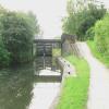
Stanton Lock Footbridge

 
Erewash Valley Trail - Stanton Lock, M1, Stanton by Dale NG9 8GT, United Kingdom
 
Information about the place
Stanton Lock Footbridge is a minor waterways place on the Grand Union Canal (Erewash Canal) between Potter's Lock Bridge (2 miles and ¾ furlongs and 4 locks to the north) and Sandiacre (1 mile and 4¼ furlongs and 1 lock to the south).
 
 
The nearest place in the direction of Potter's Lock Bridge is Stanton Lock No 65; ¼ furlongs away.
 
The nearest place in the direction of Sandiacre is Railway Bridge near Stapleford (disused); 1¾ furlongs away.

There may be access to the towpath here.

Mooring here is unrated.

There is a bridge here which takes pedestrian traffic over the canal.


Amenities
 
Maps
If you are a user and are logged on, or if you are actively planning a route, a map will be displayed here.
Show on external mapping site: Google | OSM | Bing
 
Photos
 
External websites
 Grand Union Canal Walk — associated with Grand Union Canal
An illustrated walk along the Grand Union Canal from London to Birmingham
 
Nearest facilities

Mouseover for more information or show routes to facility

Nearest water point

In the direction of Trent Junction

Former BW Trent Lock Waterway Office5 miles, 2 furlongs and 4 locks away
On this waterway in the direction of Trent Junction
Sawley Locks No 26 miles, 2 furlongs and 5 locks away
Travel to Trent Junction, then on the River Trent (Western End) to Sawley Locks No 2
Cranfleet Lock No 36 miles, ½ furlongs and 6 locks away
Travel to Trent Junction, then on the River Trent (Western End) to Cranfleet Lock No 3
Shardlow8 miles, 3¾ furlongs and 8 locks away
Travel to Trent Junction, then on the River Trent (Western End) to Derwent Mouth, then on the Trent and Mersey Canal (Main Line - Derwent Mouth to Burton) to Shardlow
Beeston Lock No 510 miles, 3 furlongs and 7 locks away
Travel to Trent Junction, then on the River Trent (Western End) to Beeston Lock No 5
Weston Lock No 411 miles, 3½ furlongs and 10 locks away
Travel to Trent Junction, then on the River Trent (Western End) to Derwent Mouth, then on the Trent and Mersey Canal (Main Line - Derwent Mouth to Burton) to Weston Lock No 4
Bishop Meadow Lock No 5413 miles, 4 furlongs and 10 locks away
Travel to Trent Junction, then on the Grand Union Canal (Leicester Section - River Soar Navigation) to Bishop Meadow Lock No 54
Swarkestone Lock No 514 miles, 4¾ furlongs and 9 locks away
Travel to Sandiacre Junction, then on the Derby and Sandiacre Canal to Swarkestone Junction, then on the Trent and Mersey Canal (Main Line - Derwent Mouth to Burton) to Swarkestone Lock No 5
Loughborough Basin14 miles, 4¾ furlongs and 12 locks away
Travel to Trent Junction, then on the Grand Union Canal (Leicester Section - River Soar Navigation) to Loughborough Branch Junction, then on the Grand Union Canal (Leicester Section - Loughborough Branch) to Loughborough Basin
Holme Lock No 518 miles, 5½ furlongs and 10 locks away
Travel to Trent Junction, then on the River Trent (Western End) to Beeston Lock No 5, then on the River Trent (Beeston Canal) to Lenton Chain, then on the River Trent (Nottingham Canal) to Meadow Lane Junction, then on the River Trent (non-tidal section) to Holme Lock No 5
Willington Services19 miles, 6¾ furlongs and 10 locks away
Travel to Sandiacre Junction, then on the Derby and Sandiacre Canal to Swarkestone Junction, then on the Trent and Mersey Canal (Main Line - Derwent Mouth to Burton) to Willington Services
Barrow Boating18 miles, 4¼ furlongs and 14 locks away
Travel to Trent Junction, then on the Grand Union Canal (Leicester Section - River Soar Navigation) to Barrow Boating

In the direction of Derby Road Bridge

Langley Junction6 miles, 2 furlongs and 10 locks away
Travel to Derby Road Bridge, then on the Cromford Canal (broad gauge, navigable) to Langley Junction

Nearest rubbish disposal

In the direction of Trent Junction

Former BW Trent Lock Waterway Office5 miles, 2 furlongs and 4 locks away
On this waterway in the direction of Trent Junction
Sawley Locks No 26 miles, 2 furlongs and 5 locks away
Travel to Trent Junction, then on the River Trent (Western End) to Sawley Locks No 2
Cranfleet Lock No 36 miles, ½ furlongs and 6 locks away
Travel to Trent Junction, then on the River Trent (Western End) to Cranfleet Lock No 3
Beeston Lock No 510 miles, 3 furlongs and 7 locks away
Travel to Trent Junction, then on the River Trent (Western End) to Beeston Lock No 5
Swarkestone Lock No 514 miles, 4¾ furlongs and 9 locks away
Travel to Sandiacre Junction, then on the Derby and Sandiacre Canal to Swarkestone Junction, then on the Trent and Mersey Canal (Main Line - Derwent Mouth to Burton) to Swarkestone Lock No 5
Loughborough Basin14 miles, 4¾ furlongs and 12 locks away
Travel to Trent Junction, then on the Grand Union Canal (Leicester Section - River Soar Navigation) to Loughborough Branch Junction, then on the Grand Union Canal (Leicester Section - Loughborough Branch) to Loughborough Basin
Holme Lock No 518 miles, 5½ furlongs and 10 locks away
Travel to Trent Junction, then on the River Trent (Western End) to Beeston Lock No 5, then on the River Trent (Beeston Canal) to Lenton Chain, then on the River Trent (Nottingham Canal) to Meadow Lane Junction, then on the River Trent (non-tidal section) to Holme Lock No 5
Willington Services19 miles, 6¾ furlongs and 10 locks away
Travel to Sandiacre Junction, then on the Derby and Sandiacre Canal to Swarkestone Junction, then on the Trent and Mersey Canal (Main Line - Derwent Mouth to Burton) to Willington Services
Barrow Boating18 miles, 4¼ furlongs and 14 locks away
Travel to Trent Junction, then on the Grand Union Canal (Leicester Section - River Soar Navigation) to Barrow Boating
Broome Island19 miles, 2½ furlongs and 14 locks away
Travel to Trent Junction, then on the Grand Union Canal (Leicester Section - River Soar Navigation) to Broome Island

Nearest chemical toilet disposal

In the direction of Trent Junction

Former BW Trent Lock Waterway Office5 miles, 2 furlongs and 4 locks away
On this waterway in the direction of Trent Junction
Sawley Locks No 26 miles, 2 furlongs and 5 locks away
Travel to Trent Junction, then on the River Trent (Western End) to Sawley Locks No 2
Sawley Cut Wharf6 miles, 3½ furlongs and 6 locks away
Travel to Trent Junction, then on the River Trent (Western End) to Sawley Cut Wharf
Beeston Lock No 510 miles, 3 furlongs and 7 locks away
Travel to Trent Junction, then on the River Trent (Western End) to Beeston Lock No 5
Meadow Lane Lock No 716 miles, 2 furlongs and 9 locks away
Travel to Trent Junction, then on the River Trent (Western End) to Beeston Lock No 5, then on the River Trent (Beeston Canal) to Lenton Chain, then on the River Trent (Nottingham Canal) to Meadow Lane Lock No 7
Holme Lock No 518 miles, 5½ furlongs and 10 locks away
Travel to Trent Junction, then on the River Trent (Western End) to Beeston Lock No 5, then on the River Trent (Beeston Canal) to Lenton Chain, then on the River Trent (Nottingham Canal) to Meadow Lane Junction, then on the River Trent (non-tidal section) to Holme Lock No 5
Willington Services19 miles, 6¾ furlongs and 10 locks away
Travel to Sandiacre Junction, then on the Derby and Sandiacre Canal to Swarkestone Junction, then on the Trent and Mersey Canal (Main Line - Derwent Mouth to Burton) to Willington Services
Barrow Boating18 miles, 4¼ furlongs and 14 locks away
Travel to Trent Junction, then on the Grand Union Canal (Leicester Section - River Soar Navigation) to Barrow Boating

In the direction of Derby Road Bridge

Langley Junction6 miles, 2 furlongs and 10 locks away
Travel to Derby Road Bridge, then on the Cromford Canal (broad gauge, navigable) to Langley Junction

Nearest place to turn

In the direction of Derby Road Bridge

Winding Hole above Stanton Lock1 furlong and 1 lock away
On this waterway in the direction of Derby Road Bridge
Hallam Fields Lock Winding Hole4¾ furlongs and 2 locks away
On this waterway in the direction of Derby Road Bridge
Winding Hole below Stenson's Lock3 miles, 3½ furlongs and 6 locks away
On this waterway in the direction of Derby Road Bridge
Bridge Street Winding Hole3 miles, 7 furlongs and 7 locks away
On this waterway in the direction of Derby Road Bridge
Shipley Mill Winding Hole4 miles, 5 furlongs and 7 locks away
On this waterway in the direction of Derby Road Bridge
Anchor Road Winding Hole5 miles, 7¼ furlongs and 9 locks away
On this waterway in the direction of Derby Road Bridge
Langley Junction6 miles, 2 furlongs and 10 locks away
Travel to Derby Road Bridge, then on the Cromford Canal (broad gauge, navigable) to Langley Junction

In the direction of Trent Junction

Sandiacre Junction2 miles, ½ furlongs and 1 lock away
On this waterway in the direction of Trent Junction
Long Eaton Winding Hole3 miles, 3¼ furlongs and 3 locks away
On this waterway in the direction of Trent Junction
Sheet Stores Basin4 miles, 5 furlongs and 4 locks away
On this waterway in the direction of Trent Junction
Former BW Trent Lock Waterway Office5 miles, 2 furlongs and 4 locks away
On this waterway in the direction of Trent Junction
Soar Mouth5 miles, 4½ furlongs and 5 locks away
Travel to Trent Junction, then on the Grand Union Canal (Leicester Section - River Soar Navigation) to Soar Mouth
Redhill Lock Junction5 miles, 7¼ furlongs and 5 locks away
Travel to Trent Junction, then on the Grand Union Canal (Leicester Section - River Soar Navigation) to Redhill Lock Junction
Sawley Lock No 2 Weir Exit6 miles, 1¼ furlongs and 5 locks away
Travel to Trent Junction, then on the River Trent (Western End) to Sawley Lock No 2 Weir Exit
Redhill Marine Ltd6 miles, 3½ furlongs and 6 locks away
Travel to Trent Junction, then on the Grand Union Canal (Leicester Section - River Soar Navigation) to Redhill Marine Ltd
Ratcliffe Lock Junction6 miles, 6 furlongs and 6 locks away
Travel to Trent Junction, then on the Grand Union Canal (Leicester Section - River Soar Navigation) to Ratcliffe Lock Junction
Cranfleet Lock Weir Exit6 miles, 1¼ furlongs and 7 locks away
Travel to Trent Junction, then on the River Trent (Western End) to Cranfleet Lock Weir Exit
Sawley Flood Lock Weir Entrance6 miles, 7¼ furlongs and 7 locks away
Travel to Trent Junction, then on the River Trent (Western End) to Sawley Flood Lock Weir Entrance
Ratcliffe Weir7 miles, ¾ furlongs and 7 locks away
Travel to Trent Junction, then on the Grand Union Canal (Leicester Section - River Soar Navigation) to Ratcliffe Weir
Derwent Mouth7 miles, 3 furlongs and 7 locks away
Travel to Trent Junction, then on the River Trent (Western End) to Derwent Mouth

Nearest self-operated pump-out

In the direction of Trent Junction

Mercia Marina19 miles, 1¾ furlongs and 10 locks away
Travel to Sandiacre Junction, then on the Derby and Sandiacre Canal to Swarkestone Junction, then on the Trent and Mersey Canal (Main Line - Derwent Mouth to Burton) to Mercia Marina

Nearest boatyard pump-out

In the direction of Derby Road Bridge

Langley Junction6 miles, 2 furlongs and 10 locks away
Travel to Derby Road Bridge, then on the Cromford Canal (broad gauge, navigable) to Langley Junction

In the direction of Trent Junction

Mercia Marina19 miles, 1¾ furlongs and 10 locks away
Travel to Sandiacre Junction, then on the Derby and Sandiacre Canal to Swarkestone Junction, then on the Trent and Mersey Canal (Main Line - Derwent Mouth to Burton) to Mercia Marina
Direction of TV transmitter (From Wolfbane Cybernetic)
 
 
Geograph
 
Wikipedia

There is no page on Wikipedia called “Stanton Lock Footbridge”

Wikipedia pages that might relate to Stanton Lock Footbridge
[Pinkhill Lock] the island and carries a public footbridge. The name Luck's or Lot's Hole is given to part of the weir stream. The lock is named after a farm in the area [Thames Path] (S) Eysey Footbridge (N) Water Eaton House Bridge (S) Bloomers Hole Footbridge (N) Radcot Bridge (S) Rushey Lock (N) Shifford Lockcut footbridge (S) Newbridge [River Thames] at Benson Lock. Others were replaced by a footbridge when the weir was removed as at Hart's Weir Footbridge. Around 2000, several footbridges were added [Tippecanoe Lake] a long channel which is clearly marked by a large sign, underneath a footbridge, and into a lagoon. Gas is available at TBC, and there is a full boat [Coventry Canal] Polesworth, to Tamworth. At Atherstone a set of 11 locks (Top Lock No. 1 to Atherstone Bottom Lock No. 11) lower the level of the canal 80 feet (24 m) towards [Kennet and Avon Canal] Archived from the original on 12 October 2012. Historic England. "Footbridge Adjoining Top Lock (442749)". Images of England. Archived from the original on [List of crossings of the River Soar] Birstall Lock. 56 Birstall Lock footbridge Birstall 52°40′26″N 1°06′57″W / 52.67381°N 1.11596°W / 52.67381; -1.11596 (Birstall Lock footbridge) Footpath [Northmoor, Oxfordshire] be a flash lock on the Thames on the southern edge of the parish at Hart's Weir, also known as Ridge's Weir. In 1879 Hart's Weir Footbridge was built at [101st Airborne Division] artillery battery, capturing the Douve River lock at La Barquette (opposite Carentan), capturing two footbridges spanning the Douve at La Porte opposite Brévands [Wey and Arun Canal] with lower, brick-faced parapets, to match the adjacent lock and footbridge. The lock and footbridge achieved second place in the Royal Institution of Chartered
 
Google

Results of Google Search

Pinkhill Lock - Wikipedia
Pinkhill Lock is a lock on the River Thames in England. It is close to Farmoor, Oxfordshire. The first lock was built of stone by Daniel Harris for the Thames Navigation Commission in 1791. The weir is on the other side of the island and carries a public footbridge. ... river over the lock head gates to the northern bank towards Stanton Harcourt, ...
Stanton Concepts RKS(Robo Key System) Cutaway Cam Lock ...
The Robo Key System Cutaway Cam Lock is a great way to see and understand how the revolutionary RKS cylinder works. It allows for full viewing of the ...
Coventry Canal - Wikipedia
Priestley's Bridge/Stoney Stanton Road. William Henry Bridge/Foleshill Road. Cash's Lane Bridge. Cash's Hundred Houses. Canal Basin, Coventry. The Coventry Canal is a navigable narrow canal in the Midlands of England. It starts in ... The only other locks on the Coventry canal are the two Glascote locks which lower the ...
Trowell Circular - Part 03
Aug 11, 2013 ... At Stanton Lock the Hallam Fields Industrial Trail joins the Nutbrook Trail to cross the footbridge and continue through the former Stanton Works ...
20030 | Lock Lane Footbridge on the Erewash Canal, in Long E ...
May 24, 2013 ... Lock Lane Footbridge on the Erewash Canal, in Long Eaton, Derbyshire ... the Lawrence Street access and Stanton Lock where the cycle route ...
Waterway Wanderers - September 2015 Aire & Calder Navigation ...
Bridge 98 Glover Street to Bridge 101 Footbridge, Garrison Lane. Bow Back Rivers ... Lock 65 Stanton to Lock 63 Sandiacre. Lock 70 Barkers to Bridge 21a ...
21 :: Kennet Avon Canal Newbury to Devizes :: Geograph Britain ...
... Bridge No.51: Hungerford Marsh Lock 72: Cobbler's Lock Footbridge No.52: .... Stanton Bridge carries a minor metalled road, so why the 'tank trap' visible on ...
Erewash Canal, Sandiacre Bridge to Station Road, Ilkeston ...
From Pasture Lock the canal then heads towards Stanton Gate before going under the Motorway and Railway and on to Stanton Lock. Access is available ...
Waterway Wanderers - January 2018 Aire & Calder Navigation ...
Spon Lane Junction to Bar Lock Footbridge including Gas Street Basin. BCN - Main Line Old ... Lock 65 Stanton to Lock 63 Sandiacre. Lock 70 Barkers to Bridge ...