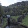
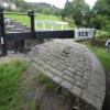
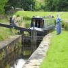
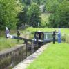
Pig Tail Lock No 32E
is a minor waterways place
on the Huddersfield Narrow Canal between
Railway Lock No 42E (Marsden. Eastern summit lock) (6¼ furlongs
and 9 locks
to the southwest) and
Titanic Mill (Linthwaite) (2 miles and 7¼ furlongs
and 15 locks
to the east).
The nearest place in the direction of Railway Lock No 42E is Pig Tail Bridge No 54;
½ furlongs
away.
The nearest place in the direction of Titanic Mill is Sparth Reservoir Feeder;
¼ furlongs
away.
There may be access to the towpath here.
Mooring here is unrated.
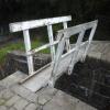
There is a bridge here which takes pedestrian traffic over the canal.
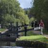
This is a lock, the rise of which is not known.
White Syke Bridge No 55 | 2¾ furlongs | |
Moorvale Lock No 35E | 2¼ furlongs | |
Cellars Lock No 34E | 1¾ furlongs | |
Sparth Lock No 33E | ¾ furlongs | |
Pig Tail Bridge No 54 | ½ furlongs | |
Pig Tail Lock No 32E | ||
Sparth Reservoir Feeder | ¼ furlongs | |
Fishers Footbridge No 53 | ¾ furlongs | |
Booth Lock Winding Hole | 2½ furlongs | |
Booth Lock No 31E | 2¾ furlongs | |
Booths Bridge No 52 | 2¾ furlongs |
There are no links to external websites from here.
Why not log in and add some (select "External websites" from the menu (sometimes this is under "Edit"))?
Mouseover for more information or show routes to facility
Nearest water point
In the direction of Ashton-under-Lyne Junction
Standedge Tunnel (eastern entrance) — 1 mile, 3½ furlongs and 11 locks away
On this waterway in the direction of Ashton-under-Lyne Junction
Standedge Tunnel (western entrance) — 4 miles, 5½ furlongs and 11 locks away
On this waterway in the direction of Ashton-under-Lyne Junction
Wool Road Bridge No 70 — 6 miles, 5¼ furlongs and 20 locks away
On this waterway in the direction of Ashton-under-Lyne Junction
Grove Road Bridge No 96 — 12 miles, 5½ furlongs and 35 locks away
On this waterway in the direction of Ashton-under-Lyne Junction
In the direction of Aspley Basin (Huddersfield)
Slaithwaite Winding Hole — 1 mile, 7½ furlongs and 11 locks away
On this waterway in the direction of Aspley Basin (Huddersfield)
Waterside Lock No 21E — 2 miles and 11 locks away
On this waterway in the direction of Aspley Basin (Huddersfield)
Aspley Basin (Huddersfield) — 6 miles, 5¾ furlongs and 32 locks away
On this waterway in the direction of Aspley Basin (Huddersfield)
Shepley Bridge Sanitary Station — 13 miles, 2¼ furlongs and 43 locks away
Travel to Aspley Basin (Huddersfield), then on the Huddersfield Broad Canal to Cooper Bridge Junction, then on the Calder and Hebble Navigation (Main Line) to Shepley Bridge Sanitary Station
Brighouse Basin — 12 miles, 4 furlongs and 45 locks away
Travel to Aspley Basin (Huddersfield), then on the Huddersfield Broad Canal to Cooper Bridge Junction, then on the Calder and Hebble Navigation (Main Line) to Brighouse Basin
Salterhebble Sanitary Station — 16 miles, 6 furlongs and 54 locks away
Travel to Aspley Basin (Huddersfield), then on the Huddersfield Broad Canal to Cooper Bridge Junction, then on the Calder and Hebble Navigation (Main Line) to Salterhebble Sanitary Station
Broad Cut Low Lock No 3 — 19 miles, 7¼ furlongs and 51 locks away
Travel to Aspley Basin (Huddersfield), then on the Huddersfield Broad Canal to Cooper Bridge Junction, then on the Calder and Hebble Navigation (Main Line) to Broad Cut Low Lock No 3
Salterhebble Junction — 16 miles, 6½ furlongs and 55 locks away
Travel to Aspley Basin (Huddersfield), then on the Huddersfield Broad Canal to Cooper Bridge Junction, then on the Calder and Hebble Navigation (Main Line) to Salterhebble Junction
Sowerby Bridge Basin — 19 miles, ¼ furlongs and 55 locks away
Travel to Aspley Basin (Huddersfield), then on the Huddersfield Broad Canal to Cooper Bridge Junction, then on the Calder and Hebble Navigation (Main Line) to Salterhebble Junction, then on the Calder and Hebble Navigation (Main Line) to Sowerby Bridge BasinNearest rubbish disposal
In the direction of Ashton-under-Lyne Junction
Wool Road Visitor Mooring — 6 miles, 5½ furlongs and 20 locks away
On this waterway in the direction of Ashton-under-Lyne Junction
In the direction of Aspley Basin (Huddersfield)
Pickle Lock No 22E — 1 mile, 7 furlongs and 10 locks away
On this waterway in the direction of Aspley Basin (Huddersfield)
Aspley Basin (Huddersfield) — 6 miles, 5¾ furlongs and 32 locks away
On this waterway in the direction of Aspley Basin (Huddersfield)
Shepley Bridge Sanitary Station — 13 miles, 2¼ furlongs and 43 locks away
Travel to Aspley Basin (Huddersfield), then on the Huddersfield Broad Canal to Cooper Bridge Junction, then on the Calder and Hebble Navigation (Main Line) to Shepley Bridge Sanitary Station
Brighouse Lower Basin Visitor Moorings — 12 miles, 3¾ furlongs and 44 locks away
Travel to Aspley Basin (Huddersfield), then on the Huddersfield Broad Canal to Cooper Bridge Junction, then on the Calder and Hebble Navigation (Main Line) to Brighouse Lower Basin Visitor Moorings
Horbury Basin Residential Moorings & Sanitary Station — 17 miles, 6¾ furlongs and 50 locks away
Travel to Aspley Basin (Huddersfield), then on the Huddersfield Broad Canal to Cooper Bridge Junction, then on the Calder and Hebble Navigation (Main Line) to Horbury Basin Residential Moorings & Sanitary Station
Salterhebble Sanitary Station — 16 miles, 6 furlongs and 54 locks away
Travel to Aspley Basin (Huddersfield), then on the Huddersfield Broad Canal to Cooper Bridge Junction, then on the Calder and Hebble Navigation (Main Line) to Salterhebble Sanitary Station
Sowerby Bridge Basin — 19 miles, ¼ furlongs and 55 locks away
Travel to Aspley Basin (Huddersfield), then on the Huddersfield Broad Canal to Cooper Bridge Junction, then on the Calder and Hebble Navigation (Main Line) to Salterhebble Junction, then on the Calder and Hebble Navigation (Main Line) to Sowerby Bridge BasinNearest chemical toilet disposal
In the direction of Ashton-under-Lyne Junction
Wool Road Bridge No 70 — 6 miles, 5¼ furlongs and 20 locks away
On this waterway in the direction of Ashton-under-Lyne Junction
Grove Road Bridge No 96 — 12 miles, 5½ furlongs and 35 locks away
On this waterway in the direction of Ashton-under-Lyne Junction
In the direction of Aspley Basin (Huddersfield)
Pickle Lock No 22E — 1 mile, 7 furlongs and 10 locks away
On this waterway in the direction of Aspley Basin (Huddersfield)
Waterside Lock No 21E — 2 miles and 11 locks away
On this waterway in the direction of Aspley Basin (Huddersfield)
Aspley Basin (Huddersfield) — 6 miles, 5¾ furlongs and 32 locks away
On this waterway in the direction of Aspley Basin (Huddersfield)
Shepley Bridge Sanitary Station — 13 miles, 2¼ furlongs and 43 locks away
Travel to Aspley Basin (Huddersfield), then on the Huddersfield Broad Canal to Cooper Bridge Junction, then on the Calder and Hebble Navigation (Main Line) to Shepley Bridge Sanitary Station
Brighouse Basin — 12 miles, 4 furlongs and 45 locks away
Travel to Aspley Basin (Huddersfield), then on the Huddersfield Broad Canal to Cooper Bridge Junction, then on the Calder and Hebble Navigation (Main Line) to Brighouse Basin
Savile Town Wharf and Basin (Dewsbury) — 16 miles, 5¾ furlongs and 47 locks away
Travel to Aspley Basin (Huddersfield), then on the Huddersfield Broad Canal to Cooper Bridge Junction, then on the Calder and Hebble Navigation (Main Line) to Dewsbury Arm Junction, then on the Calder and Hebble Navigation (Dewsbury Old Cut) to Savile Town Wharf and Basin (Dewsbury)
Horbury Basin Residential Moorings & Sanitary Station — 17 miles, 6¾ furlongs and 50 locks away
Travel to Aspley Basin (Huddersfield), then on the Huddersfield Broad Canal to Cooper Bridge Junction, then on the Calder and Hebble Navigation (Main Line) to Horbury Basin Residential Moorings & Sanitary Station
Salterhebble Sanitary Station — 16 miles, 6 furlongs and 54 locks away
Travel to Aspley Basin (Huddersfield), then on the Huddersfield Broad Canal to Cooper Bridge Junction, then on the Calder and Hebble Navigation (Main Line) to Salterhebble Sanitary Station
Sowerby Bridge Basin — 19 miles, ¼ furlongs and 55 locks away
Travel to Aspley Basin (Huddersfield), then on the Huddersfield Broad Canal to Cooper Bridge Junction, then on the Calder and Hebble Navigation (Main Line) to Salterhebble Junction, then on the Calder and Hebble Navigation (Main Line) to Sowerby Bridge BasinNearest place to turn
In the direction of Ashton-under-Lyne Junction
Standedge Tunnel End Winding Hole — 1 mile, 2¾ furlongs and 11 locks away
On this waterway in the direction of Ashton-under-Lyne Junction
Diggle Winding Hole — 5 miles and 11 locks away
On this waterway in the direction of Ashton-under-Lyne Junction
Wool Road Winding Hole — 6 miles, 6 furlongs and 20 locks away
On this waterway in the direction of Ashton-under-Lyne Junction
Saddleworth Visitor Centre Winding Hole — 7 miles, 4 furlongs and 22 locks away
On this waterway in the direction of Ashton-under-Lyne Junction
Manns Wharf Bridge Winding Hole — 8 miles, 6¾ furlongs and 24 locks away
On this waterway in the direction of Ashton-under-Lyne Junction
Roughtown Court Winding Hole — 10 miles, ¼ furlongs and 29 locks away
On this waterway in the direction of Ashton-under-Lyne Junction
Mossley Bottoms Winding Hole — 10 miles, 7¾ furlongs and 31 locks away
On this waterway in the direction of Ashton-under-Lyne Junction
Knowle Street Winding Hole — 15 miles and 36 locks away
On this waterway in the direction of Ashton-under-Lyne Junction
In the direction of Aspley Basin (Huddersfield)
Booth Lock Winding Hole — 2½ furlongs and 1 lock away
On this waterway in the direction of Aspley Basin (Huddersfield)
Slaithwaite Winding Hole — 1 mile, 7½ furlongs and 11 locks away
On this waterway in the direction of Aspley Basin (Huddersfield)
Linthwaite Winding Hole — 3 miles and 16 locks away
On this waterway in the direction of Aspley Basin (Huddersfield)
Isis Lock Winding Hole — 4 miles, 4¼ furlongs and 24 locks away
On this waterway in the direction of Aspley Basin (Huddersfield)
University Arm — 6 miles, 5 furlongs and 32 locks away
On this waterway in the direction of Aspley Basin (Huddersfield)
Aspley Basin (Huddersfield) — 6 miles, 5¾ furlongs and 32 locks away
On this waterway in the direction of Aspley Basin (Huddersfield)
Anchor Street Winding Hole — 7 miles, 2¾ furlongs and 32 locks away
Travel to Aspley Basin (Huddersfield), then on the Huddersfield Broad Canal to Anchor Street Winding Hole
New Road Winding Hole — 7 miles, 6 furlongs and 32 locks away
Travel to Aspley Basin (Huddersfield), then on the Huddersfield Broad Canal to New Road Winding Hole
Deighton Road Bridge Winding Hole — 8 miles, 7¾ furlongs and 37 locks away
Travel to Aspley Basin (Huddersfield), then on the Huddersfield Broad Canal to Deighton Road Bridge Winding Hole
Cooper Bridge Junction — 10 miles, 1¾ furlongs and 41 locks away
Travel to Aspley Basin (Huddersfield), then on the Huddersfield Broad Canal to Cooper Bridge Junction
Battye Weir Entrance — 10 miles, 6¾ furlongs and 42 locks away
Travel to Aspley Basin (Huddersfield), then on the Huddersfield Broad Canal to Cooper Bridge Junction, then on the Calder and Hebble Navigation (Main Line) to Battye Weir Entrance
Shepley Bridge Marina — 13 miles, 2½ furlongs and 43 locks away
Travel to Aspley Basin (Huddersfield), then on the Huddersfield Broad Canal to Cooper Bridge Junction, then on the Calder and Hebble Navigation (Main Line) to Shepley Bridge MarinaNearest self-operated pump-out
In the direction of Ashton-under-Lyne Junction
Wool Road Bridge No 70 — 6 miles, 5¼ furlongs and 20 locks away
On this waterway in the direction of Ashton-under-Lyne Junction
In the direction of Aspley Basin (Huddersfield)
Slaithwaite Winding Hole — 1 mile, 7½ furlongs and 11 locks away
On this waterway in the direction of Aspley Basin (Huddersfield)Nearest boatyard pump-out
In the direction of Ashton-under-Lyne Junction
Portland Basin Arm — 17 miles, 6 furlongs and 43 locks away
Travel to Ashton-under-Lyne Junction, then on the Ashton Canal (Main Line) to Dukinfield Junction, then on the Peak Forest Canal (Lower) to Portland Basin Arm
In the direction of Aspley Basin (Huddersfield)
Aspley Basin (Huddersfield) — 6 miles, 5¾ furlongs and 32 locks away
On this waterway in the direction of Aspley Basin (Huddersfield)
Shepley Bridge Marina — 13 miles, 2½ furlongs and 43 locks away
Travel to Aspley Basin (Huddersfield), then on the Huddersfield Broad Canal to Cooper Bridge Junction, then on the Calder and Hebble Navigation (Main Line) to Shepley Bridge Marina
Sowerby Bridge Basin — 19 miles, ¼ furlongs and 55 locks away
Travel to Aspley Basin (Huddersfield), then on the Huddersfield Broad Canal to Cooper Bridge Junction, then on the Calder and Hebble Navigation (Main Line) to Salterhebble Junction, then on the Calder and Hebble Navigation (Main Line) to Sowerby Bridge BasinDirection of TV transmitter (From Wolfbane Cybernetic)
There is no page on Wikipedia called “Pig Tail Lock No 32E”
Wikipedia pages that might relate to Pig Tail Lock No 32E
[Hair of the dog]
(Central America), the same expression is used but it refers to a pig, as in: hair of the same pig ("pelos de la misma chancha" in Central America) referring
[Tail gunner]
British slang term for tail gunners was "Tail-end Charlies", while in the Luftwaffe they were called Heckschwein ("tail-end pigs"). Both the specific armament
[Edith Rosenbaum]
music box in the shape of a pig. The papier-mâché toy, covered in pigskin and playing a tune known as "The Maxixe" when its tail was twisted, was used by
[List of Dirty Jobs episodes]
No. in series No. in season Title Original air date 132 1 "Exotic Nanny" October 19, 2010 (2010-10-19) Sharkarosa Wildlife Ranch: ring-tailed lemurs,
[Peter Rabbit (TV series)]
Dr. Warren Bobtail Spike Spencer as The Shrew and Felix Joshua Colley as Pig Robinson David McCamley (23 episodes, 2014–2015) Dino Athanassiou (23 episodes
[List of The Return of Superman episodes]
힘들게 해"(종합)". pop.heraldcorp.com (in Korean). Retrieved 29 June 2020. Cha, E (15 November 2020). "Lee Sang Yeob Hilariously Pretends To Be Bentley From
[Toyota Land Cruiser]
colloquially known as the "Moose". It has also been referred to as a "pig" or an "iron pig". The FJ55 had a longer wheelbase (at 2,700 mm (106 in)) and was
[Moose]
are the antlers. The tail is short (6 cm to 8 cm in length) and vestigial in appearance; unlike other ungulates the moose tail is too short to swish
[Pronghorn]
males are 1.3–1.5 m (4 ft 3 in–4 ft 11 in) long from nose to tail, stand 81–104 cm (32–41 in) high at the shoulder, and weigh 40–65 kg (88–143 lb). The
[Deer]
White-tailed Deer Diets." Intermountain Journal of Sciences 24, no. 3-4 (2018): 118–122. Case, D.J.; McCullough, D.R. (February 1987). "White-tailed deer
Results of Google Search
Dec 27, 2011 ... The shareholders had no return on their investment for 30 years. The canal did enjoy a short period of relative prosperity until 1845, when it ...
SKATER™ catheter; Removable pigtail straightener; Metal stiffening cannula; Flexible stiffening cannula (Not available on 6F and 7F); Locking system with ...
The ReSolve locking drainage catheter is a radiopaque catheter that has a locking pigtail and hydrophilic coating and has multiple side holes for drainage.
ReSolve non-locking drainage catheters feature a hydrophilic coating and are radiopaque and feature several side holes used for percutaneous drainage.
GP™ General-Purpose Drainage Catheter with locking pigtail ... Provides for easy, accurate, non-traumatic over-the-guidewire catheter placement. Features a  ...
Apr 1, 2016 ... Subscribe and watch new videos uploaded every week. ☆ YouTube Channel: http://www.youtube.com/Pinkfong PINKFONG! no. 1 kids' app ...
Apr 28, 2011 ... Boaters should not attempt to force a boat over a cill but should ensure that the water ... Pigtail Lower Lock (32e) Huddersfield Narrow Canal ...