Defford Railway Bridge
is a minor waterways place
on the River Avon - Warwickshire (Lower Avon Navigation) between
Eckington Bridge (2½ furlongs
to the east) and
Bredon (3 miles and 5½ furlongs
and 1 lock
to the south).
The nearest place in the direction of Bredon is Strensham Sewage Works;
1 mile and ½ furlongs
away.
Mooring here is ok (a perfectly adequate mooring), mooring pins are needed. Immediatly downsteam of the bridge is a boat club with a visitor mooring and a restaurant .
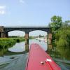
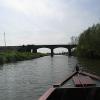
There is a bridge here which takes a railway over the canal.
Nafford Lock Weir Exit No 1 | 1 mile, 5¾ furlongs | |
Nafford Lock Weir Exit No 2 | 1 mile, 5½ furlongs | |
Swan's Neck | 7¼ furlongs | |
Eckington Wharf | 3 furlongs | |
Eckington Bridge | 2½ furlongs | |
Defford Railway Bridge | ||
Strensham Sewage Works | 1 mile, ½ furlongs | |
Strensham Lock Weir Entrance | 1 mile, 4¾ furlongs | |
Strensham Lock | 1 mile, 5 furlongs | |
Strensham Lock Swing Bridge | 1 mile, 5¼ furlongs | |
Strensham Lock Weir Exit No 2 | 1 mile, 6½ furlongs |
- Avon Navigation Trust — associated with River Avon - Warwickshire
- Navigation Authority
Mouseover for more information or show routes to facility
Nearest water point
In the direction of Tewkesbury Junction
Strensham Lock — 1 mile, 5 furlongs away
On this waterway in the direction of Tewkesbury Junction
Bredon — 3 miles, 5½ furlongs and 1 lock away
On this waterway in the direction of Tewkesbury Junction
Tewkesbury Services — 7 miles, 1¼ furlongs and 1 lock away
On this waterway in the direction of Tewkesbury Junction
Upper Lode Lock No 5 — 7 miles, 7¼ furlongs and 2 locks away
Travel to Tewkesbury Junction, then on the River Severn (main river - Worcester to Gloucester) to Upper Lode Lock No 5
Tewkesbury Lower Lode — 8 miles, 5½ furlongs and 3 locks away
Travel to Tewkesbury Junction, then on the River Severn (main river - Worcester to Gloucester) to Tewkesbury Lower Lode
In the direction of Evesham Lock
Pershore Recreation Ground — 6 miles, 6¾ furlongs and 2 locks away
On this waterway in the direction of Evesham Lock
Workman Gardens — 16 miles, 7 furlongs and 5 locks away
On this waterway in the direction of Evesham Lock
Evesham Lock — 17 miles, 1¾ furlongs and 5 locks away
On this waterway in the direction of Evesham LockNearest rubbish disposal
In the direction of Tewkesbury Junction
Tewkesbury Services — 7 miles, 1¼ furlongs and 1 lock away
On this waterway in the direction of Tewkesbury Junction
In the direction of Evesham Lock
Pershore Bridge Moorings — 6 miles, 1½ furlongs and 1 lock away
On this waterway in the direction of Evesham Lock
Pershore New Bridge — 6 miles, 2 furlongs and 1 lock away
On this waterway in the direction of Evesham Lock
Pershore Recreation Ground — 6 miles, 6¾ furlongs and 2 locks away
On this waterway in the direction of Evesham Lock
Workman Gardens — 16 miles, 7 furlongs and 5 locks away
On this waterway in the direction of Evesham LockNearest chemical toilet disposal
In the direction of Evesham Lock
Pershore Recreation Ground — 6 miles, 6¾ furlongs and 2 locks away
On this waterway in the direction of Evesham Lock
Evesham Lock — 17 miles, 1¾ furlongs and 5 locks away
On this waterway in the direction of Evesham LockNearest place to turn
In the direction of Tewkesbury Junction
Tewkesbury Marina Entrance No 2 — 6 miles, 5½ furlongs and 1 lock away
On this waterway in the direction of Tewkesbury Junction
Avon Lock Junction — 7 miles, 1½ furlongs and 1 lock away
On this waterway in the direction of Tewkesbury Junction
Abbey Mill Tewkesbury — 7 miles, 2½ furlongs and 1 lock away
Travel to Avon Lock Junction, then on the River Avon - Warwickshire (Mill Avon) to Abbey Mill Tewkesbury
Upper Lode Lock Weir Entrance — 7 miles, 6¼ furlongs and 2 locks away
Travel to Tewkesbury Junction, then on the River Severn (main river - Worcester to Gloucester) to Upper Lode Lock Weir Entrance
Upper Lode Lock Weir Exit — 8 miles, 1¼ furlongs and 3 locks away
Travel to Tewkesbury Junction, then on the River Severn (main river - Worcester to Gloucester) to Upper Lode Lock Weir Exit
Upper Parting Junction — 17 miles, 6¼ furlongs and 3 locks away
Travel to Tewkesbury Junction, then on the River Severn (main river - Worcester to Gloucester) to Upper Parting Junction
Over Winding Hole — 19 miles, 4¼ furlongs and 5 locks away
Travel to Tewkesbury Junction, then on the River Severn (main river - Worcester to Gloucester) to Upper Parting Junction, then on the River Severn (Maisemore Channel - Northern Section) to Over Junction, then on the Hereford and Gloucester Canal to Over Winding Hole
In the direction of Evesham Lock
Nafford Lock Weir Exit No 2 — 1 mile, 5½ furlongs away
On this waterway in the direction of Evesham Lock
Nafford Lock Weir Entrance No 1 — 1 mile, 6½ furlongs and 1 lock away
On this waterway in the direction of Evesham Lock
Pershore Lock Weir Exit No 1 — 6 miles, 3¾ furlongs and 1 lock away
On this waterway in the direction of Evesham Lock
Pershore Lock Weir Entrance No 2 — 6 miles, 4¾ furlongs and 2 locks away
On this waterway in the direction of Evesham Lock
Wyre Lock Weir Entrance — 7 miles, 5¼ furlongs and 3 locks away
On this waterway in the direction of Evesham Lock
Fladbury Lock Weir Exit — 11 miles, 5½ furlongs and 3 locks away
On this waterway in the direction of Evesham Lock
Fladbury Lock Weir Entrance — 11 miles, 6¾ furlongs and 4 locks away
On this waterway in the direction of Evesham Lock
Chadbury Lock Weir Entrance — 14 miles, 3½ furlongs and 5 locks away
On this waterway in the direction of Evesham Lock
Evesham Lock Weir Exit — 17 miles, 1¼ furlongs and 5 locks away
On this waterway in the direction of Evesham LockNearest self-operated pump-out
In the direction of Evesham Lock
Evesham Lock — 17 miles, 1¾ furlongs and 5 locks away
On this waterway in the direction of Evesham LockNearest boatyard pump-out
In the direction of Evesham Lock
Pershore Recreation Ground — 6 miles, 6¾ furlongs and 2 locks away
On this waterway in the direction of Evesham LockDirection of TV transmitter (From Wolfbane Cybernetic)
There is no page on Wikipedia called “Defford Railway Bridge”
Wikipedia pages that might relate to Defford Railway Bridge
[Defford railway station]
Defford railway station was a station in Defford, Worcestershire, England. The station was opened in 1841 and closed in 1965. "Defford Station". Historic
[Lickey Incline]
Lickey Incline, south of Birmingham, is the steepest sustained main-line railway incline in Great Britain. The climb is a gradient of 1 in 37.7 (2.65% or
[River Avon, Warwickshire]
Bidford-on-Avon, Harvington, Offenham, Evesham, Craycombe, Wyre, Pershore, Defford, Comberton, Birlingham, Eckington, Strensham and Tewkesbury. There are
[List of closed railway stations in Britain: D-F]
list of closed railway stations in Britain includes the following: Year of closure is given if known. Stations reopened as heritage railways continue to
[Worcestershire Parkway railway station]
Worcestershire Parkway is a split-level railway station where the Cotswold and Cross Country lines cross near Norton, Worcester, England. It opened on
[Cross Country Route]
Birmingham and Derby Junction Railway to Derby, thence the North Midland Railway to Leeds, thence the York and North Midland Railway. From the Labour Government's
[Pershore]
play in the Birmingham and District League, is situated at The Bottoms on Defford Road. Pershore Rugby Club has a clubhouse and pitches by the river in nearby
[Alan Blumlein]
Research Establishment (TRE) on 7 June 1942. During the flight from RAF Defford, whilst at an altitude of 500 ft the Halifax developed an engine fire which
[Birmingham and Gloucester Railway]
4 January 1965; Eckington; opened 24 June 1840; closed 4 January 1965; Defford; opened 24 June 1840; closed 4 January 1965; Besford; opened November 1841;
[Worcester Shrub Hill railway station]
Worcester Shrub Hill railway station is one of two railway stations serving the city of Worcester in Worcestershire, England. It is managed by West Midlands
Results of Google Search
Jul 29, 2011 ... Defford. ... later taken over by a business but reverted to railway use in 2015. ... The road bridge had been rebuilt since the 1972 photograph.
Lithograph in black, stone and white by E T Dolby showing a railway bridge over the River Avon. Published by Clerk & Co, Holborn, London.
Defford railway station was a station in Defford, Worcestershire, England. The station was opened in 1841 and closed in 1965.
Jan 10, 2019 ... Defford - Croft Farm Airstrip Arrival Information - Strip Identification ... Find a white building to the right of the road bridge over the railway. A lane ...
Defford is a small village in the county of Worcestershire, England, located between the towns ... Defford air field · Defford church · Former rail station · Photos of Defford and surrounding area from Geograph.co. ... Badsey · Beckford · Bengeworth · Besford Bridge · Besford · Bickmarsh · Birlingham · Bishampton · Blackminster ...
Jan 29, 2018 ... Part of the Midland Railway. ... Defford Bridge. From Graces Guide. Jump to: navigation, search. 1877. Part of the Midland Railway ...
Road Bridge, Defford (Hansard, 14 July 1969) ... traffic road bridge carrying the A440 over the Birmingham-Bristol main railway line at Defford, Worcestershire;Â ...
1 A bridge in this position is recorded in 1397. In Dugdale's time the bridge was called Defford's Bridge. 2 This bridge was formerly 'Defford' (or 'deep ford')Â ...
Apr 27, 2018 ... Defford Bridge, Worcestershire - geograph.org.uk - 1000557.jpg .... Defford - The Railway Inn - geograph.org.uk - 4353.jpg 640 × 480; 46 KB.