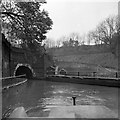
Harecastle Tunnel (northern entrance) 


Harecastle Tunnel (northern entrance) is on the Trent and Mersey Canal (Main Line - Etruria to Hardings Wood) just past the junction with The River Brue.
The Trent and Mersey Canal (Main Line - Etruria to Hardings Wood) was built by Cecil Clarke and opened on 17 September 1876. Orginally intended to run to Ipswich, the canal was never completed beyond Westcester. The Trent and Mersey Canal (Main Line - Etruria to Hardings Wood) was closed in 1955 when Charnwood Cutting collapsed. In 2001 the canal became famous when Thomas Smith navigated Salford Locks in a bathtub for a bet.

An extra 45 minutes is added to route calculations when passing through Harecastle Tunnel.
Mooring here is tolerable (it's just about possible if really necessary), mooring rings or bollards are available. Mooring is limited to 24 hours. Rated as 'tolerable' only because it is POSSIBLE to moor here, but it is gloomy and feels unsafe, with lots of noise from the nearby railway.
Facilities: chemical toilet disposal, rubbish disposal, showers, toilets and water point.
| Ravensdale Bridge No 129 | 2 miles, 2¼ furlongs | |
| Tunstall Pipe Bridge | 2 miles, 1 furlong | |
| Chatterley Arm Bridge No 129A | 2 miles | |
| Turnover Bridge No 130 | 1 mile, 6 furlongs | |
| Harecastle Tunnel (southern entrance) | 1 mile, 5¼ furlongs | |
| Harecastle Tunnel (northern entrance) | ||
| Harecastle Bridge No 131 | ½ furlongs | |
| Kidsgrove Railway Bridge | ½ furlongs | |
| Turnover Bridge No 132 | 1¼ furlongs | |
| Kinnersley Wharf (Kidsgrove) | 1¾ furlongs | |
| Hardings Wood Railway Bridge | 2¼ furlongs | |
- Trent & Mersey Canal Society – founded in 1974 — associated with Trent and Mersey Canal
- NarrowBoat Through Harecastle Tunnel — associated with Harecastle Tunnel
- A narrowboat goes through the Harecastle Tunnel on the Trent & Mersey canal at Kidsgrove in Staffordshire. This is the Telford side, running for 2,926 yards (1.66 miles). The video is 1min 35sec long, though the actual journey shown was just under 40minutes.
Mouseover for more information or show routes to facility
Nearest water point
In the direction of Hardings Wood Junction
In the direction of Etruria Junction
Nearest rubbish disposal
In the direction of Hardings Wood Junction
In the direction of Etruria Junction
Nearest chemical toilet disposal
In the direction of Hardings Wood Junction
In the direction of Etruria Junction
Nearest place to turn
In the direction of Hardings Wood Junction
In the direction of Etruria Junction
Nearest self-operated pump-out
In the direction of Hardings Wood Junction
In the direction of Etruria Junction
Nearest boatyard pump-out
In the direction of Hardings Wood Junction
In the direction of Etruria Junction
Wikipedia has a page about Harecastle Tunnel
Harecastle Tunnel is a canal tunnel on the Trent and Mersey Canal in Staffordshire between Kidsgrove and Tunstall. The tunnel, which is 1.6 mi (2.6 km) long, was once one of the longest in the country. Its industrial purpose was for the transport of coal to the kilns in the Staffordshire Potteries. The canal runs under the 195 m (640 ft) Harecastle Hill near Goldenhill, the highest district in Stoke-on-Trent.
Although described singularly as a tunnel, Harecastle is actually two separate but parallel tunnels built almost 50 years apart. The first was constructed by James Brindley in the late 18th century and the second larger tunnel was designed by Thomas Telford, and opened in the late 1820s.
Only the Telford tunnel remains navigable after a partial collapse closed the Brindley tunnel shortly before the First World War. As the Telford tunnel is only wide enough for a single boat, canal traffic is managed by sending alternating northbound and southbound groups of boats through the tunnel. Ventilation is provided by large electric fans at the south portal.




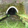

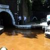




![North portal of Harecastle new tunnel. The tunnel was constructed in 1827, and since 1914 has entirely replaced the old one [[7220897]]. It has suffered some subsidence, evidenced by the hanging gauge showing the most restrictive profile, but is still in use subject to strict controls [[7220900]]. by Stephen Craven – 02 July 2022](https://s2.geograph.org.uk/geophotos/07/22/08/7220898_be43a588_120x120.jpg)
![Narrowboat emerging from the Harecastle Tunnel, Kidsgrove. Trent and Mersey Canal.This shows the north portal of Telford's 1827 tunnel, with a narrowboat having completed the 40+ minutes journey through it.Although it appears to have a towpath in it on the left, that suffered from subsidence and was replaced by an electric tug boat in 1914, then demolished in the 1970s.The tunnel is 2926 yards (2676 metres) in length, leading to Tunstall, Stoke-on-Trent.[[[7170669]]][[[7170651]]] by Roger D Kidd – 02 September 2011](https://s1.geograph.org.uk/geophotos/07/17/06/7170677_f7b9da90_120x120.jpg)
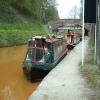
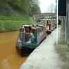
![Harecastle Tunnel near Kidsgrove in Staffordshire. Trent and Mersey Canal.This shows the north portal of Telford's 1827 tunnel, with a narrowboat approaching.Although it appears to have a towpath in it, that suffered from subsidence and was replaced by an electric tug boat in 1914, then demolished in the 1970s. Water entering the canal from the Brindley tunnel carries the iron ore leaching into the canal and is responsible for the prominent rusty colour of the water.The tunnel is 2926 yards (2676 metres) in length, and emerges in Tunstall, Stoke-on-Trent.[[[7170677]]][[[7170651]]] by Roger D Kidd – 02 September 2011](https://s1.geograph.org.uk/geophotos/07/17/06/7170669_037c3d5d_120x120.jpg)


![Information board for Harecastle new tunnel. The board gives the rules for using the tunnel [[7220897]]. by Stephen Craven – 02 July 2022](https://s0.geograph.org.uk/geophotos/07/22/09/7220900_7a7fa389_120x120.jpg)
![Plaque for Harecastle old tunnel. The plaque is on a facilities building [[7220888]] and notes the construction of the 'old' tunnel in 1777 and its closure in 1914. by Stephen Craven – 02 July 2022](https://s0.geograph.org.uk/geophotos/07/22/08/7220892_2ad49036_120x120.jpg)


![Plaque for Harecastle new tunnel. The plaque is on a facilities building [[7220888]] and notes the construction of the 'new' (presently open) tunnel in 1827. by Stephen Craven – 02 July 2022](https://s3.geograph.org.uk/geophotos/07/22/08/7220891_ddf066ac_120x120.jpg)


![Northern portals, 1st and 2nd Harecastle Tunnels. On the Trent & Mersey Canal. The first tunnel is low down on the right /west. Designed by James Brindley, without a towpath, it opened in 1777. It soon became a serious bottleneck and in 1827 the second tunnel opened, designed by Thomas Telford. All through the 1800s boats used both tunnels, as a one-way system - one northbound only, one southbound only. In 1914 the Brindley tunnel was abandoned as mining subsidence had made the bore sink and the ceiling too low. The Telford tunnel [on the left / east] is the one that boats still use. by Christine Johnstone – 12 May 2024](https://s1.geograph.org.uk/geophotos/07/82/70/7827061_ffe72d57_120x120.jpg)


![Trent & Mersey Canal Milepost at Kidsgrove. The milepost is along the towpath near the northern end of Harecastle Tunnel.[[4578716]], for the previous milepost at the southern portal of the tunnel.[[4579347]], for the next milepost along the canal. by Mat Fascione – 11 July 2015](https://s1.geograph.org.uk/geophotos/04/57/89/4578933_da36d565_120x120.jpg)


