CanalPlanAC

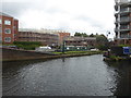
Ladywood Junction

 
Western end of Oozells Street Loop
101 St Vincent Street, Birmingham B16, United Kingdom
 

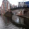
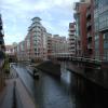
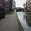
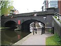
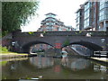
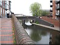
Ladywood Junction is a historical waterways junction.

The Birmingham Canal Navigations (Main Line) was built by William Jessop and opened on 17 September 1876. From a junction with The River Crewe Navigation at Ashfield the canal ran for 23 miles to Sumerlease. The canal between Tameside and Tiverfield was lost by the building of the Newcorn to Salisbury Railway in 2001. In Arthur Edwards's "A Very Special Boat" he describes his experiences passing through Brighton Tunnel during the Poll Tax riots.

The Birmingham Canal Navigations (Oozells Street Loop) was built by Thomas Dadford and opened on 17 September 1835. The Birmingham Canal Navigations (Oozells Street Loop) was closed in 1905 when Wrexham Tunnel collapsed. In Peter Thomas's "It Gets a Lot Worse Further Up" he describes his experiences passing through Solihull Locks during the Poll Tax riots.

Information about the place
Ladywood Junction is a major waterways place at the junction of the Birmingham Canal Navigations (Main Line) with the Birmingham Canal Navigations (Oozells Street Loop).
 
Old Turn Junction is on the Birmingham Canal Navigations (Main Line), 2¼ furlongs to the east. Sandy Turn (Eastern end of Icknield Port Road Wharf Loop) is on the Birmingham Canal Navigations (Main Line), 4¾ furlongs to the northwest. Old Turn Junction is on the Birmingham Canal Navigations (Main Line), 3 furlongs to the east.
 
 
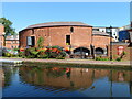
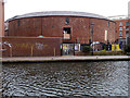
The nearest place in the direction of Old Turn Junction is The Roundhouse; ½ furlongs away.
 
The nearest place in the direction of Sandy Turn is St. Vincent Street Bridge; ¼ furlongs away.
 
The nearest place in the direction of Old Turn Junction is Ladywood Junction Bridge; a few yards away.

Mooring here is impossible (it may be physically impossible, forbidden, or allowed only for specific short-term purposes).


Amenities
 
Maps
If you are a user and are logged on, or if you are actively planning a route, a map will be displayed here.
Show on external mapping site: Google | OSM | Bing
 
Navigational Notes

It is possible to turn a 58 ft boat to starboard on exiting Oozell's Street Loop at Ladywood Junction but it is not for the feint hearted. The wind can be gathered by the high nature of the appartment blocks adjacent to the canal here and can have a serious effect on the positioning of the boat for such a turn. There is an alternative place to wind at the entrance to Monument Road Basin which is 3 furlongs (5 minutes) in the direction of Monument Road Bridge (away from the city centre).

 
Photos
 
External websites
 Birmingham Canal Walks — associated with Birmingham Canal Navigations
Sixteen walks along the Birmingham Canal Navigations with a detailed description, history and photographs.
 
Nearest facilities

Mouseover for more information or show routes to facility

Nearest water point

In the direction of Worcester Bar

Cambrian Wharf Services — 4¼ furlongs away
Travel to Deep Cuttings Junction, then on the Birmingham Canal Navigations (Newhall Branch) to Cambrian Wharf Services
Worcester Bar — 5 furlongs away
On the Birmingham Canal Navigations (Main Line) in the direction of Worcester Bar
Holliday Wharf — 7 furlongs away
Travel to Worcester Bar, then on the Worcester and Birmingham Canal (Birmingham to King's Norton) to Holliday Wharf
King's Norton Water Point — 6 miles, 1½ furlongs away
Travel to Worcester Bar, then on the Worcester and Birmingham Canal (Birmingham to King's Norton) to King's Norton Junction, then on the Worcester and Birmingham Canal (Diglis Basin to King's Norton Junction) to King's Norton Water Point
Hawne Basin — 6 miles, 6½ furlongs away
Travel to Worcester Bar, then on the Worcester and Birmingham Canal (Birmingham to King's Norton) to New Selly Oak Junction, then on the Birmingham Canal Navigations (Dudley Canal No 2 - Lapal Canal - Original Line East End ) to Somery Road Bridge, then on the Birmingham Canal Navigations (Dudley Canal No 2 - Lapal Canal - Abandoned Line ) to Lapal Canal - New line Diverges From Original Route, then on the Birmingham Canal Navigations (Dudley Canal No 2 - Lapal Canal - Original Line West End ) to Coombeswood, then on the Birmingham Canal Navigations (Dudley Canal No 2 - Coombeswood ) to Hawne Basin
Yardley Wood Water Point — 8 miles, 5½ furlongs away
Travel to Worcester Bar, then on the Worcester and Birmingham Canal (Birmingham to King's Norton) to King's Norton Junction, then on the Stratford-on-Avon Canal (Northern Section) to Yardley Wood Water Point
Hopwood Visitor Moorings — 9 miles, 3 furlongs away
Travel to Worcester Bar, then on the Worcester and Birmingham Canal (Birmingham to King's Norton) to King's Norton Junction, then on the Worcester and Birmingham Canal (Diglis Basin to King's Norton Junction) to Hopwood Visitor Moorings
Bumble Hole Visitor Centre — 9 miles, 4½ furlongs away
Travel to Worcester Bar, then on the Worcester and Birmingham Canal (Birmingham to King's Norton) to New Selly Oak Junction, then on the Birmingham Canal Navigations (Dudley Canal No 2 - Lapal Canal - Original Line East End ) to Somery Road Bridge, then on the Birmingham Canal Navigations (Dudley Canal No 2 - Lapal Canal - Abandoned Line ) to Lapal Canal - New line Diverges From Original Route, then on the Birmingham Canal Navigations (Dudley Canal No 2 - Lapal Canal - Original Line West End ) to Coombeswood, then on the Birmingham Canal Navigations (Dudley Canal No 2 - Coombeswood ) to Bumble Hole Visitor Centre
Blowers Green Pumphouse — 12 miles, ½ furlongs away
Travel to Worcester Bar, then on the Worcester and Birmingham Canal (Birmingham to King's Norton) to New Selly Oak Junction, then on the Birmingham Canal Navigations (Dudley Canal No 2 - Lapal Canal - Original Line East End ) to Somery Road Bridge, then on the Birmingham Canal Navigations (Dudley Canal No 2 - Lapal Canal - Abandoned Line ) to Lapal Canal - New line Diverges From Original Route, then on the Birmingham Canal Navigations (Dudley Canal No 2 - Lapal Canal - Original Line West End ) to Coombeswood, then on the Birmingham Canal Navigations (Dudley Canal No 2 - Coombeswood ) to Blowers Green Pumphouse
Earlswood Reservoir Feeder — 12 miles, 6½ furlongs away
Travel to Worcester Bar, then on the Worcester and Birmingham Canal (Birmingham to King's Norton) to King's Norton Junction, then on the Stratford-on-Avon Canal (Northern Section) to Earlswood Reservoir Feeder
Waring's Green Wharf — 13 miles, 6½ furlongs away
Travel to Worcester Bar, then on the Worcester and Birmingham Canal (Birmingham to King's Norton) to King's Norton Junction, then on the Stratford-on-Avon Canal (Northern Section) to Waring's Green Wharf
Tardebigge Wharf — 14 miles, 6¾ furlongs away
Travel to Worcester Bar, then on the Worcester and Birmingham Canal (Birmingham to King's Norton) to King's Norton Junction, then on the Worcester and Birmingham Canal (Diglis Basin to King's Norton Junction) to Tardebigge Wharf

In the direction of Aldersley Junction

Handsworth Wharf Winding Hole — 3 miles, 5 furlongs and 3 locks away
Travel to Smethwick Junction, then on the Birmingham Canal Navigations (Old Main Line) to Engine Arm Junction, then on the Birmingham Canal Navigations (Engine Arm) to Handsworth Wharf Winding Hole
Todds End Customer Service Facility — 8 miles, 2 furlongs and 3 locks away
Travel to Smethwick Junction, then on the Birmingham Canal Navigations (Old Main Line) to Tipton Junction, then on the Birmingham Canal Navigations (Dudley Canal No 1 - Birmingham End) to Todds End Customer Service Facility
Black Country Museum — 8 miles, 2¼ furlongs and 3 locks away
Travel to Smethwick Junction, then on the Birmingham Canal Navigations (Old Main Line) to Tipton Junction, then on the Birmingham Canal Navigations (Dudley Canal No 1 - Birmingham End) to Black Country Museum
Dudley Canal & Tunnel Trust Footbridge — 8 miles, 2½ furlongs and 3 locks away
Travel to Smethwick Junction, then on the Birmingham Canal Navigations (Old Main Line) to Tipton Junction, then on the Birmingham Canal Navigations (Dudley Canal No 1 - Birmingham End) to Dudley Canal & Tunnel Trust Footbridge
Dudley Tunnel (northern entrance) — 8 miles, 3¼ furlongs and 3 locks away
Travel to Smethwick Junction, then on the Birmingham Canal Navigations (Old Main Line) to Tipton Junction, then on the Birmingham Canal Navigations (Dudley Canal No 1 - Birmingham End) to Dudley Tunnel (northern entrance)
C&RT Bradley Workshops — 11 miles, 5½ furlongs and 3 locks away
Travel to Deepfields Junction, then on the Birmingham Canal Navigations (Wednesbury Oak Loop) to C&RT Bradley Workshops
Lower Ocker Hill Branch Junction — 7 miles, 3¾ furlongs and 8 locks away
Travel to Pudding Green Junction, then on the Birmingham Canal Navigations (Wednesbury Old Canal - Main Line) to Ryders Green Junction, then on the Birmingham Canal Navigations (Walsall Canal) to Lower Ocker Hill Branch Junction
Broad Street Basin — 13 miles, 2¾ furlongs and 3 locks away
On the Birmingham Canal Navigations (Main Line) in the direction of Aldersley Junction

Nearest rubbish disposal

In the direction of Worcester Bar

Cambrian Wharf Services — 4¼ furlongs away
Travel to Deep Cuttings Junction, then on the Birmingham Canal Navigations (Newhall Branch) to Cambrian Wharf Services
Worcester Bar — 5 furlongs away
On the Birmingham Canal Navigations (Main Line) in the direction of Worcester Bar
Hawne Basin — 6 miles, 6½ furlongs away
Travel to Worcester Bar, then on the Worcester and Birmingham Canal (Birmingham to King's Norton) to New Selly Oak Junction, then on the Birmingham Canal Navigations (Dudley Canal No 2 - Lapal Canal - Original Line East End ) to Somery Road Bridge, then on the Birmingham Canal Navigations (Dudley Canal No 2 - Lapal Canal - Abandoned Line ) to Lapal Canal - New line Diverges From Original Route, then on the Birmingham Canal Navigations (Dudley Canal No 2 - Lapal Canal - Original Line West End ) to Coombeswood, then on the Birmingham Canal Navigations (Dudley Canal No 2 - Coombeswood ) to Hawne Basin
Farmers Bridge Lock No 8 — 7½ furlongs and 7 locks away
Travel to Deep Cuttings Junction, then on the Birmingham Canal Navigations (Newhall Branch) to Farmers Bridge Junction, then on the Birmingham Canal Navigations (Birmingham and Fazeley Canal - Main Line) to Farmers Bridge Lock No 8
Blowers Green Bridge — 12 miles, ¼ furlongs away
Travel to Worcester Bar, then on the Worcester and Birmingham Canal (Birmingham to King's Norton) to New Selly Oak Junction, then on the Birmingham Canal Navigations (Dudley Canal No 2 - Lapal Canal - Original Line East End ) to Somery Road Bridge, then on the Birmingham Canal Navigations (Dudley Canal No 2 - Lapal Canal - Abandoned Line ) to Lapal Canal - New line Diverges From Original Route, then on the Birmingham Canal Navigations (Dudley Canal No 2 - Lapal Canal - Original Line West End ) to Coombeswood, then on the Birmingham Canal Navigations (Dudley Canal No 2 - Coombeswood ) to Blowers Green Bridge
Waring's Green Wharf — 13 miles, 6½ furlongs away
Travel to Worcester Bar, then on the Worcester and Birmingham Canal (Birmingham to King's Norton) to King's Norton Junction, then on the Stratford-on-Avon Canal (Northern Section) to Waring's Green Wharf
Waterfront Services (Dudley) — 13 miles, 1½ furlongs and 1 lock away
Travel to Worcester Bar, then on the Worcester and Birmingham Canal (Birmingham to King's Norton) to New Selly Oak Junction, then on the Birmingham Canal Navigations (Dudley Canal No 2 - Lapal Canal - Original Line East End ) to Somery Road Bridge, then on the Birmingham Canal Navigations (Dudley Canal No 2 - Lapal Canal - Abandoned Line ) to Lapal Canal - New line Diverges From Original Route, then on the Birmingham Canal Navigations (Dudley Canal No 2 - Lapal Canal - Original Line West End ) to Coombeswood, then on the Birmingham Canal Navigations (Dudley Canal No 2 - Coombeswood ) to Parkhead Junction, then on the Birmingham Canal Navigations (Dudley Canal No 1 - Through Route) to Waterfront Services (Dudley)
Tardebigge Wharf — 14 miles, 6¾ furlongs away
Travel to Worcester Bar, then on the Worcester and Birmingham Canal (Birmingham to King's Norton) to King's Norton Junction, then on the Worcester and Birmingham Canal (Diglis Basin to King's Norton Junction) to Tardebigge Wharf
Delph Bottom Lock No 8 — 14 miles, 1¼ furlongs and 8 locks away
Travel to Worcester Bar, then on the Worcester and Birmingham Canal (Birmingham to King's Norton) to New Selly Oak Junction, then on the Birmingham Canal Navigations (Dudley Canal No 2 - Lapal Canal - Original Line East End ) to Somery Road Bridge, then on the Birmingham Canal Navigations (Dudley Canal No 2 - Lapal Canal - Abandoned Line ) to Lapal Canal - New line Diverges From Original Route, then on the Birmingham Canal Navigations (Dudley Canal No 2 - Lapal Canal - Original Line West End ) to Coombeswood, then on the Birmingham Canal Navigations (Dudley Canal No 2 - Coombeswood ) to Parkhead Junction, then on the Birmingham Canal Navigations (Dudley Canal No 1 - Through Route) to Delph Bottom Lock No 8
Minworth Services — 6 miles, 5 furlongs and 25 locks away
Travel to Deep Cuttings Junction, then on the Birmingham Canal Navigations (Newhall Branch) to Farmers Bridge Junction, then on the Birmingham Canal Navigations (Birmingham and Fazeley Canal - Main Line) to Minworth Services
Henwood Mill Winding Hole — 11 miles, 4¼ furlongs and 25 locks away
Travel to Deep Cuttings Junction, then on the Birmingham Canal Navigations (Newhall Branch) to Farmers Bridge Junction, then on the Birmingham Canal Navigations (Birmingham and Fazeley Canal - Main Line) to Aston Junction, then on the Birmingham Canal Navigations (Birmingham and Fazeley Canal - Digbeth Branch) to Proof House Junction, then on the Grand Union Canal (Warwick and Birmingham Canal) to Camp Hill Top Lock Winding Hole, then on the Grand Union Canal (Warwick and Birmingham Canal: widened section - Main Line) to Henwood Mill Winding Hole

In the direction of Aldersley Junction

Handsworth Wharf Winding Hole — 3 miles, 5 furlongs and 3 locks away
Travel to Smethwick Junction, then on the Birmingham Canal Navigations (Old Main Line) to Engine Arm Junction, then on the Birmingham Canal Navigations (Engine Arm) to Handsworth Wharf Winding Hole
Black Country Museum — 8 miles, 2¼ furlongs and 3 locks away
Travel to Smethwick Junction, then on the Birmingham Canal Navigations (Old Main Line) to Tipton Junction, then on the Birmingham Canal Navigations (Dudley Canal No 1 - Birmingham End) to Black Country Museum
C&RT Bradley Workshops — 11 miles, 5½ furlongs and 3 locks away
Travel to Deepfields Junction, then on the Birmingham Canal Navigations (Wednesbury Oak Loop) to C&RT Bradley Workshops
Lower Ocker Hill Branch Junction — 7 miles, 3¾ furlongs and 8 locks away
Travel to Pudding Green Junction, then on the Birmingham Canal Navigations (Wednesbury Old Canal - Main Line) to Ryders Green Junction, then on the Birmingham Canal Navigations (Walsall Canal) to Lower Ocker Hill Branch Junction
Broad Street Basin — 13 miles, 2¾ furlongs and 3 locks away
On the Birmingham Canal Navigations (Main Line) in the direction of Aldersley Junction
Perry Barr Top Lock Services — 13 miles, 1 furlong and 8 locks away
Travel to Pudding Green Junction, then on the Birmingham Canal Navigations (Wednesbury Old Canal - Main Line) to Ryders Green Junction, then on the Birmingham Canal Navigations (Walsall Canal) to Tame Valley Junction, then on the Birmingham Canal Navigations (Tame Valley Canal) to Perry Barr Top Lock Services
Wolverhampton Lock No 9 — 14 miles, ¼ furlongs and 11 locks away
On the Birmingham Canal Navigations (Main Line) in the direction of Aldersley Junction
Longwood Junction — 13 miles, 6½ furlongs and 17 locks away
Travel to Pudding Green Junction, then on the Birmingham Canal Navigations (Wednesbury Old Canal - Main Line) to Ryders Green Junction, then on the Birmingham Canal Navigations (Walsall Canal) to Tame Valley Junction, then on the Birmingham Canal Navigations (Tame Valley Canal) to Tame Valley - Rushall Junction, then on the Birmingham Canal Navigations (Rushall Canal) to Longwood Junction
Aldridge Marina — 17 miles, 2¼ furlongs and 17 locks away
Travel to Pudding Green Junction, then on the Birmingham Canal Navigations (Wednesbury Old Canal - Main Line) to Ryders Green Junction, then on the Birmingham Canal Navigations (Walsall Canal) to Tame Valley Junction, then on the Birmingham Canal Navigations (Tame Valley Canal) to Tame Valley - Rushall Junction, then on the Birmingham Canal Navigations (Rushall Canal) to Longwood Junction, then on the Birmingham Canal Navigations (Daw End Branch) to Aldridge Marina

Nearest chemical toilet disposal

In the direction of Worcester Bar

Cambrian Wharf Services — 4¼ furlongs away
Travel to Deep Cuttings Junction, then on the Birmingham Canal Navigations (Newhall Branch) to Cambrian Wharf Services
Worcester Bar — 5 furlongs away
On the Birmingham Canal Navigations (Main Line) in the direction of Worcester Bar
Holliday Wharf — 7 furlongs away
Travel to Worcester Bar, then on the Worcester and Birmingham Canal (Birmingham to King's Norton) to Holliday Wharf
Hawne Basin — 6 miles, 6½ furlongs away
Travel to Worcester Bar, then on the Worcester and Birmingham Canal (Birmingham to King's Norton) to New Selly Oak Junction, then on the Birmingham Canal Navigations (Dudley Canal No 2 - Lapal Canal - Original Line East End ) to Somery Road Bridge, then on the Birmingham Canal Navigations (Dudley Canal No 2 - Lapal Canal - Abandoned Line ) to Lapal Canal - New line Diverges From Original Route, then on the Birmingham Canal Navigations (Dudley Canal No 2 - Lapal Canal - Original Line West End ) to Coombeswood, then on the Birmingham Canal Navigations (Dudley Canal No 2 - Coombeswood ) to Hawne Basin
Blowers Green Pumphouse — 12 miles, ½ furlongs away
Travel to Worcester Bar, then on the Worcester and Birmingham Canal (Birmingham to King's Norton) to New Selly Oak Junction, then on the Birmingham Canal Navigations (Dudley Canal No 2 - Lapal Canal - Original Line East End ) to Somery Road Bridge, then on the Birmingham Canal Navigations (Dudley Canal No 2 - Lapal Canal - Abandoned Line ) to Lapal Canal - New line Diverges From Original Route, then on the Birmingham Canal Navigations (Dudley Canal No 2 - Lapal Canal - Original Line West End ) to Coombeswood, then on the Birmingham Canal Navigations (Dudley Canal No 2 - Coombeswood ) to Blowers Green Pumphouse
Earlswood Reservoir Feeder — 12 miles, 6½ furlongs away
Travel to Worcester Bar, then on the Worcester and Birmingham Canal (Birmingham to King's Norton) to King's Norton Junction, then on the Stratford-on-Avon Canal (Northern Section) to Earlswood Reservoir Feeder
Waring's Green Wharf — 13 miles, 6½ furlongs away
Travel to Worcester Bar, then on the Worcester and Birmingham Canal (Birmingham to King's Norton) to King's Norton Junction, then on the Stratford-on-Avon Canal (Northern Section) to Waring's Green Wharf
Waterfront Services (Dudley) — 13 miles, 1½ furlongs and 1 lock away
Travel to Worcester Bar, then on the Worcester and Birmingham Canal (Birmingham to King's Norton) to New Selly Oak Junction, then on the Birmingham Canal Navigations (Dudley Canal No 2 - Lapal Canal - Original Line East End ) to Somery Road Bridge, then on the Birmingham Canal Navigations (Dudley Canal No 2 - Lapal Canal - Abandoned Line ) to Lapal Canal - New line Diverges From Original Route, then on the Birmingham Canal Navigations (Dudley Canal No 2 - Lapal Canal - Original Line West End ) to Coombeswood, then on the Birmingham Canal Navigations (Dudley Canal No 2 - Coombeswood ) to Parkhead Junction, then on the Birmingham Canal Navigations (Dudley Canal No 1 - Through Route) to Waterfront Services (Dudley)
Tardebigge Wharf — 14 miles, 6¾ furlongs away
Travel to Worcester Bar, then on the Worcester and Birmingham Canal (Birmingham to King's Norton) to King's Norton Junction, then on the Worcester and Birmingham Canal (Diglis Basin to King's Norton Junction) to Tardebigge Wharf
Swallow Wharf — 16 miles, 4 furlongs away
Travel to Worcester Bar, then on the Worcester and Birmingham Canal (Birmingham to King's Norton) to King's Norton Junction, then on the Stratford-on-Avon Canal (Northern Section) to Swallow Wharf
Cuckoo Wharf — 3 miles, 4¼ furlongs and 24 locks away
Travel to Deep Cuttings Junction, then on the Birmingham Canal Navigations (Newhall Branch) to Farmers Bridge Junction, then on the Birmingham Canal Navigations (Birmingham and Fazeley Canal - Main Line) to Cuckoo Wharf

In the direction of Aldersley Junction

Handsworth Wharf Winding Hole — 3 miles, 5 furlongs and 3 locks away
Travel to Smethwick Junction, then on the Birmingham Canal Navigations (Old Main Line) to Engine Arm Junction, then on the Birmingham Canal Navigations (Engine Arm) to Handsworth Wharf Winding Hole
Todds End Customer Service Facility — 8 miles, 2 furlongs and 3 locks away
Travel to Smethwick Junction, then on the Birmingham Canal Navigations (Old Main Line) to Tipton Junction, then on the Birmingham Canal Navigations (Dudley Canal No 1 - Birmingham End) to Todds End Customer Service Facility
Black Country Museum — 8 miles, 2¼ furlongs and 3 locks away
Travel to Smethwick Junction, then on the Birmingham Canal Navigations (Old Main Line) to Tipton Junction, then on the Birmingham Canal Navigations (Dudley Canal No 1 - Birmingham End) to Black Country Museum
Dudley Tunnel (northern entrance) — 8 miles, 3¼ furlongs and 3 locks away
Travel to Smethwick Junction, then on the Birmingham Canal Navigations (Old Main Line) to Tipton Junction, then on the Birmingham Canal Navigations (Dudley Canal No 1 - Birmingham End) to Dudley Tunnel (northern entrance)
Lower Ocker Hill Branch Junction — 7 miles, 3¾ furlongs and 8 locks away
Travel to Pudding Green Junction, then on the Birmingham Canal Navigations (Wednesbury Old Canal - Main Line) to Ryders Green Junction, then on the Birmingham Canal Navigations (Walsall Canal) to Lower Ocker Hill Branch Junction
Broad Street Basin — 13 miles, 2¾ furlongs and 3 locks away
On the Birmingham Canal Navigations (Main Line) in the direction of Aldersley Junction
Perry Barr Top Lock Services — 13 miles, 1 furlong and 8 locks away
Travel to Pudding Green Junction, then on the Birmingham Canal Navigations (Wednesbury Old Canal - Main Line) to Ryders Green Junction, then on the Birmingham Canal Navigations (Walsall Canal) to Tame Valley Junction, then on the Birmingham Canal Navigations (Tame Valley Canal) to Perry Barr Top Lock Services
Sneyd Wharf — 14 miles, 5 furlongs and 16 locks away
Travel to Pudding Green Junction, then on the Birmingham Canal Navigations (Wednesbury Old Canal - Main Line) to Ryders Green Junction, then on the Birmingham Canal Navigations (Walsall Canal) to Walsall Junction, then on the Birmingham Canal Navigations (Walsall Junction Canal) to Birchills Junction, then on the Birmingham Canal Navigations (Wyrley and Essington Canal) to Sneyd Wharf
Longwood Junction — 13 miles, 6½ furlongs and 17 locks away
Travel to Pudding Green Junction, then on the Birmingham Canal Navigations (Wednesbury Old Canal - Main Line) to Ryders Green Junction, then on the Birmingham Canal Navigations (Walsall Canal) to Tame Valley Junction, then on the Birmingham Canal Navigations (Tame Valley Canal) to Tame Valley - Rushall Junction, then on the Birmingham Canal Navigations (Rushall Canal) to Longwood Junction

Nearest place to turn

In the direction of Worcester Bar

Old Turn Junction — 2¼ furlongs away
On the Birmingham Canal Navigations (Main Line) in the direction of Worcester Bar
Deep Cuttings Junction — 2½ furlongs away
On the Birmingham Canal Navigations (Main Line) in the direction of Worcester Bar
Gas Street Basin (Old Wharf) — 4¾ furlongs away
On the Birmingham Canal Navigations (Main Line) in the direction of Worcester Bar
Gas Street Basin — 5¼ furlongs away
Travel to Worcester Bar, then on the Worcester and Birmingham Canal (Birmingham to King's Norton) to Gas Street Basin
The Vale Winding Hole — 2 miles, ¼ furlongs away
Travel to Worcester Bar, then on the Worcester and Birmingham Canal (Birmingham to King's Norton) to The Vale Winding Hole
Selly Oak Winding Hole — 3 miles, 6¾ furlongs away
Travel to Worcester Bar, then on the Worcester and Birmingham Canal (Birmingham to King's Norton) to Selly Oak Winding Hole
King's Norton Junction — 6 miles, 1 furlong away
Travel to Worcester Bar, then on the Worcester and Birmingham Canal (Birmingham to King's Norton) to King's Norton Junction

In the direction of Aldersley Junction

Monument Lane Basin — 3 furlongs away
On the Birmingham Canal Navigations (Main Line) in the direction of Aldersley Junction
Sandy Turn — 4¾ furlongs away
On the Birmingham Canal Navigations (Main Line) in the direction of Aldersley Junction
Rotton Park Junction — 5½ furlongs away
On the Birmingham Canal Navigations (Main Line) in the direction of Aldersley Junction
Hockley Port Junction — 1 mile, 2½ furlongs away
Travel to Rotton Park Junction, then on the Birmingham Canal Navigations (Soho Loop) to Hockley Port Junction
Winson Green Junction — 1 mile, 4 furlongs away
On the Birmingham Canal Navigations (Main Line) in the direction of Aldersley Junction
Hockley Port Interchange Basins — 1 mile, 5½ furlongs away
Travel to Rotton Park Junction, then on the Birmingham Canal Navigations (Soho Loop) to Hockley Port Junction, then on the Birmingham Canal Navigations (Birmingham Heath, or Soho, Branch) to Hockley Port Interchange Basins
Smethwick Junction — 2 miles, 4 furlongs away
On the Birmingham Canal Navigations (Main Line) in the direction of Aldersley Junction
Bromford Junction — 4 miles, 5½ furlongs away
On the Birmingham Canal Navigations (Main Line) in the direction of Aldersley Junction
Pudding Green Junction — 5 miles, 4 furlongs away
On the Birmingham Canal Navigations (Main Line) in the direction of Aldersley Junction
Albion Junction — 6 miles away
On the Birmingham Canal Navigations (Main Line) in the direction of Aldersley Junction
Handsworth Wharf Winding Hole — 3 miles, 5 furlongs and 3 locks away
Travel to Smethwick Junction, then on the Birmingham Canal Navigations (Old Main Line) to Engine Arm Junction, then on the Birmingham Canal Navigations (Engine Arm) to Handsworth Wharf Winding Hole
Dudley Port Junction — 6 miles, 5½ furlongs away
On the Birmingham Canal Navigations (Main Line) in the direction of Aldersley Junction
Swan Bridge Winding Hole — 6 miles, 6 furlongs away
Travel to Pudding Green Junction, then on the Birmingham Canal Navigations (Wednesbury Old Canal - Main Line) to Ryders Green Junction, then on the Birmingham Canal Navigations (Wednesbury Old Canal - Un-navigable) to Swan Bridge Winding Hole

Nearest self-operated pump-out

In the direction of Aldersley Junction

Handsworth Wharf Winding Hole — 3 miles, 5 furlongs and 3 locks away
Travel to Smethwick Junction, then on the Birmingham Canal Navigations (Old Main Line) to Engine Arm Junction, then on the Birmingham Canal Navigations (Engine Arm) to Handsworth Wharf Winding Hole
Todds End Customer Service Facility — 8 miles, 2 furlongs and 3 locks away
Travel to Smethwick Junction, then on the Birmingham Canal Navigations (Old Main Line) to Tipton Junction, then on the Birmingham Canal Navigations (Dudley Canal No 1 - Birmingham End) to Todds End Customer Service Facility
Black Country Museum — 8 miles, 2¼ furlongs and 3 locks away
Travel to Smethwick Junction, then on the Birmingham Canal Navigations (Old Main Line) to Tipton Junction, then on the Birmingham Canal Navigations (Dudley Canal No 1 - Birmingham End) to Black Country Museum
Dudley Tunnel (northern entrance) — 8 miles, 3¼ furlongs and 3 locks away
Travel to Smethwick Junction, then on the Birmingham Canal Navigations (Old Main Line) to Tipton Junction, then on the Birmingham Canal Navigations (Dudley Canal No 1 - Birmingham End) to Dudley Tunnel (northern entrance)
Lower Ocker Hill Branch Junction — 7 miles, 3¾ furlongs and 8 locks away
Travel to Pudding Green Junction, then on the Birmingham Canal Navigations (Wednesbury Old Canal - Main Line) to Ryders Green Junction, then on the Birmingham Canal Navigations (Walsall Canal) to Lower Ocker Hill Branch Junction
Aldridge Marina — 17 miles, 2¼ furlongs and 17 locks away
Travel to Pudding Green Junction, then on the Birmingham Canal Navigations (Wednesbury Old Canal - Main Line) to Ryders Green Junction, then on the Birmingham Canal Navigations (Walsall Canal) to Tame Valley Junction, then on the Birmingham Canal Navigations (Tame Valley Canal) to Tame Valley - Rushall Junction, then on the Birmingham Canal Navigations (Rushall Canal) to Longwood Junction, then on the Birmingham Canal Navigations (Daw End Branch) to Aldridge Marina

In the direction of Worcester Bar

Lapworth Services — 18 miles, 6 furlongs and 19 locks away
Travel to Worcester Bar, then on the Worcester and Birmingham Canal (Birmingham to King's Norton) to King's Norton Junction, then on the Stratford-on-Avon Canal (Northern Section) to Kingswood Junction (south), then on the Stratford-on-Avon Canal (Southern Section) to Lapworth Services

Nearest boatyard pump-out

In the direction of Worcester Bar

Sherborne Wharf Services — ½ furlongs away
On the Birmingham Canal Navigations (Main Line) in the direction of Worcester Bar
Hawne Basin — 6 miles, 6½ furlongs away
Travel to Worcester Bar, then on the Worcester and Birmingham Canal (Birmingham to King's Norton) to New Selly Oak Junction, then on the Birmingham Canal Navigations (Dudley Canal No 2 - Lapal Canal - Original Line East End ) to Somery Road Bridge, then on the Birmingham Canal Navigations (Dudley Canal No 2 - Lapal Canal - Abandoned Line ) to Lapal Canal - New line Diverges From Original Route, then on the Birmingham Canal Navigations (Dudley Canal No 2 - Lapal Canal - Original Line West End ) to Coombeswood, then on the Birmingham Canal Navigations (Dudley Canal No 2 - Coombeswood ) to Hawne Basin
Withymoor Island Service Wharf — 9 miles, 7½ furlongs away
Travel to Worcester Bar, then on the Worcester and Birmingham Canal (Birmingham to King's Norton) to New Selly Oak Junction, then on the Birmingham Canal Navigations (Dudley Canal No 2 - Lapal Canal - Original Line East End ) to Somery Road Bridge, then on the Birmingham Canal Navigations (Dudley Canal No 2 - Lapal Canal - Abandoned Line ) to Lapal Canal - New line Diverges From Original Route, then on the Birmingham Canal Navigations (Dudley Canal No 2 - Lapal Canal - Original Line West End ) to Coombeswood, then on the Birmingham Canal Navigations (Dudley Canal No 2 - Coombeswood ) to Withymoor Island Service Wharf
Earlswood Reservoir Feeder — 12 miles, 6½ furlongs away
Travel to Worcester Bar, then on the Worcester and Birmingham Canal (Birmingham to King's Norton) to King's Norton Junction, then on the Stratford-on-Avon Canal (Northern Section) to Earlswood Reservoir Feeder
Waring's Green Wharf — 13 miles, 6½ furlongs away
Travel to Worcester Bar, then on the Worcester and Birmingham Canal (Birmingham to King's Norton) to King's Norton Junction, then on the Stratford-on-Avon Canal (Northern Section) to Waring's Green Wharf
Swallow Wharf — 16 miles, 4 furlongs away
Travel to Worcester Bar, then on the Worcester and Birmingham Canal (Birmingham to King's Norton) to King's Norton Junction, then on the Stratford-on-Avon Canal (Northern Section) to Swallow Wharf
Barston Lane Bridge No 76 — 11 miles, 7½ furlongs and 25 locks away
Travel to Deep Cuttings Junction, then on the Birmingham Canal Navigations (Newhall Branch) to Farmers Bridge Junction, then on the Birmingham Canal Navigations (Birmingham and Fazeley Canal - Main Line) to Aston Junction, then on the Birmingham Canal Navigations (Birmingham and Fazeley Canal - Digbeth Branch) to Proof House Junction, then on the Grand Union Canal (Warwick and Birmingham Canal) to Camp Hill Top Lock Winding Hole, then on the Grand Union Canal (Warwick and Birmingham Canal: widened section - Main Line) to Barston Lane Bridge No 76
Narrowcraft Boat Services — 19 miles, 2½ furlongs and 40 locks away
Travel to Deep Cuttings Junction, then on the Birmingham Canal Navigations (Newhall Branch) to Farmers Bridge Junction, then on the Birmingham Canal Navigations (Birmingham and Fazeley Canal - Main Line) to Fazeley Junction, then on the Coventry Canal (Main Line - Hawkesbury to Fazeley) to Narrowcraft Boat Services

In the direction of Aldersley Junction

Autherley Wharf — 15 miles, 6¼ furlongs and 25 locks away
Travel to Aldersley Junction, then on the Staffordshire and Worcestershire Canal (Main Line: Aldersley to Autherley) to Autherley Junction, then on the Shropshire Union Canal (Birmingham and Liverpool Junction Canal - Main Line) to Autherley Wharf
Direction of TV transmitter (From Wolfbane Cybernetic)
 
 
Geograph
 
Wikipedia

There is no page on Wikipedia called “Ladywood Junction”

Wikipedia pages that might relate to Ladywood Junction
[Lee Bank] Edgbaston and Ladywood wards, inside the Ring Road, which surrounds Central Birmingham. Lee Bank's neighbouring areas are Edgbaston, Ladywood, Highgate and [A4540 road] the island instead (Pedestrian subway through island) Ladywood Middleway Ladywood Circus Junction with A457 Icknield Street (Heaton Street, a road which [BCN Main Line] Charles Street. The 1773 Paradise Street Branch split off at Old Turn Junction and headed through Broad Street Tunnel, turned left at what is now Gas [Aston] from standing in the following election. Aston is part of the Birmingham Ladywood constituency, held by Labour since 1940 and represented by Labour MP Shabana [Star City, Birmingham] City Birmingham". www.adventureminigolf.co.uk. Council, Birmingham City. "Ladywood constituency". www.birmingham.gov.uk. "BBC - Birmingham - Features - Cirque [Nechells] population in 2011 was 33,957. It is also a ward within the formal district of Ladywood. Nechells local government ward includes areas, for example parts of Birmingham [Droitwich Canal] in Worcestershire, England; the Droitwich Barge Canal and the Droitwich Junction Canal. The Barge Canal is a broad canal which opened in 1771 linking Droitwich [Birmingham] migrants outnumbered newer migrants in all wards except for, Edgbaston, Ladywood, Nechells and Selly Oak. In Birmingham, 60.4% of the population was aged [A38(M) motorway] road passes through its first junction after 1 mile (1.6 km). It enters a cutting before reaching the second junction, where the tidal flow ends as does [Birmingham city centre] Core Westside Eastside Southside Jewellery Quarter Gun Quarter Highgate Ladywood Digbeth Following the removal of the Inner Ring Road, which acted as a
 
Google

Results of Google Search

St Vincent Street Bridge - Ladywood Junction - BCN - cycle… | Flickr
New shots of the St Vincent Street Bridge, at Ladywood Junction on the BCN New Main Line Canal. NCN5 signs. A French tourist asked me for the way to ...
Panoramas 1 – Ladywood Junction to Old Turn Junction | www ...
Jun 8, 2020 ... This is the First Panoramic Tour of: Birmingham Canal Photos - In Paranormal Panoramic Perspective Is it that your photos are wonderful but ...
Ladywood Junction Footbridge - King Edward's Wharf - Oozel… | Flickr
Ladywood Junction Footbridge - King Edward's Wharf - Oozells Street Loop. A nice view of some flats around Birmingham's canals. Going beyond Brindleyplace ...
BCN Main Line - Wikipedia
On 21 September 1772 the canal was joined with the Staffordshire and Worcestershire Canal at Aldersley Junction via another 20 locks (increased to 21 in 1784 to ...
ladywood-junction-birmingham-interactive-panorama-screenshot ...
Feb 6, 2015 ... ladywood-junction-birmingham-interactive-panorama-screenshot. ‹ › Ladywood Junction Click to open the panorama ...
Ladywood Junction – Waterway Routes
Under the bridge is Ladywood Junction where the Oozells Street Loop meets the Birmingham Canal Navigations (BCN) Main Line. Wolverhampton is almost ...
Birmingham Canal Mainline
LADYWOOD JUNCTION (Oozells Street Loop returns); St Vincents Street Bridge; Monument Road Bridge (Carries A4540 Ladywood Middleway); ICKNIELD ...
Ladywood Junction – Waterway Routes
Ladywood Junction is on the Birmingham Canal Navigations (BCN). We are looking along the BCN Main Line towards Old Turn Junction, with Wolverhampton ...
Livonia Ladywood High School to close at end of school year ...
Dec 11, 2017 ... Ladywood High School in Livonia will be closing after the 2017-2018 ... JCHS BLUE JAY LIVESTREAM, JUNCTION CITY HIGH SCHOOL ...
Old Turn Junction - Ladywood Junction
CORONAVIRUS UPDATE: Waterway Routes services are continuing as normal including downloading maps and posting out DVDs and maps on disc.