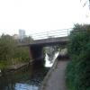
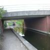
Sandy Lane Bridge No 41A carries a farm track over the Chesterfield Canal (Norwood to Retford) near to Wealden Aqueduct.
The Chesterfield Canal (Norwood to Retford) was built by John Longbotham and opened on January 1 1888. Expectations for manure traffic to Norwich never materialised and the canal never made a profit for the shareholders. "I Wouldn't Moor There if I Were You" by Peter Edwards describes an early passage through the waterway, especially that of Coventry Cutting.

Sandy Lane Bridge No 41A
is a minor waterways place
on the Chesterfield Canal (Norwood to Retford) between
Chequer House Bridge No 51 (Ranby village) (6 miles and 1½ furlongs
and 5 locks
to the east) and
Manor Road Winding Hole (Feeder from Harthill Reservoir enters at winding hole) (4 miles and 7¼ furlongs
and 30 locks
to the west).
The nearest place in the direction of Chequer House Bridge No 51 is Junction with former Lady Lee Arm;
a few yards
away.
The nearest place in the direction of Manor Road Winding Hole is Stret Lock No 48;
¼ furlongs
away.
There may be access to the towpath here.
Mooring here is unrated.
There is a bridge here which takes a major road over the canal.
| Worksop Town Lock No 50 | 7 furlongs | |
| Worksop Town - Visitor Moorings | 6½ furlongs | |
| Morse Lock Winding Hole | 4¼ furlongs | |
| Morse Lock No 49 | 3 furlongs | |
| Junction with former Lady Lee Arm | a few yards | |
| Sandy Lane Bridge No 41A | ||
| Stret Lock No 48 | ¼ furlongs | |
| The Lock Keeper Inn Bridge No 41 | ¾ furlongs | |
| Deep Lock No 47 | 1 furlong | |
| Tylden Road Bridge No 40A | 4 furlongs | |
| Woodhouse Inn Footbridge No 40 | 4¼ furlongs | |
There are no links to external websites from here.
Why not log in and add some (select "External websites" from the menu (sometimes this is under "Edit"))?
Why not log in and add some (select "External websites" from the menu (sometimes this is under "Edit"))?
Mouseover for more information or show routes to facility
Nearest water point
In the direction of West Retford Lock No 58
Forest Middle Top Water Point — 8 miles, 1 furlong and 6 locks away
On this waterway in the direction of West Retford Lock No 58
Forest Middle Top Lock No 55 — 8 miles, 1¼ furlongs and 6 locks away
On this waterway in the direction of West Retford Lock No 58
Hop Pole Bridge No 59 — 12 miles, 3 furlongs and 11 locks away
Travel to West Retford Lock No 58, then on the Chesterfield Canal (Retford to the Trent) to Hop Pole Bridge No 59
Clayworth CRT Boaters Facilities — 16 miles, 5¾ furlongs and 12 locks away
Travel to West Retford Lock No 58, then on the Chesterfield Canal (Retford to the Trent) to Clayworth CRT Boaters Facilities
In the direction of Norwood Tunnel (eastern entrance)
Shireoaks Marina — 1 mile, 2¾ furlongs and 7 locks away
On this waterway in the direction of Norwood Tunnel (eastern entrance)Nearest rubbish disposal
In the direction of West Retford Lock No 58
Forest Middle Top Lock No 55 — 8 miles, 1¼ furlongs and 6 locks away
On this waterway in the direction of West Retford Lock No 58
Clayworth CRT Boaters Facilities — 16 miles, 5¾ furlongs and 12 locks away
Travel to West Retford Lock No 58, then on the Chesterfield Canal (Retford to the Trent) to Clayworth CRT Boaters Facilities
In the direction of Norwood Tunnel (eastern entrance)
Shireoaks Marina — 1 mile, 2¾ furlongs and 7 locks away
On this waterway in the direction of Norwood Tunnel (eastern entrance)Nearest chemical toilet disposal
In the direction of West Retford Lock No 58
Cuckoo Wharf Elsan — 7¼ furlongs and 2 locks away
On this waterway in the direction of West Retford Lock No 58
Forest Middle Top Lock No 55 — 8 miles, 1¼ furlongs and 6 locks away
On this waterway in the direction of West Retford Lock No 58
Clayworth CRT Boaters Facilities — 16 miles, 5¾ furlongs and 12 locks away
Travel to West Retford Lock No 58, then on the Chesterfield Canal (Retford to the Trent) to Clayworth CRT Boaters Facilities
In the direction of Norwood Tunnel (eastern entrance)
Shireoaks Marina — 1 mile, 2¾ furlongs and 7 locks away
On this waterway in the direction of Norwood Tunnel (eastern entrance)Nearest place to turn
In the direction of West Retford Lock No 58
Junction with former Lady Lee Arm — a few yards away
On this waterway in the direction of West Retford Lock No 58
Morse Lock Winding Hole — 4¼ furlongs and 1 lock away
On this waterway in the direction of West Retford Lock No 58
High Hoe Road Bridge Winding Hole — 1 mile, 4½ furlongs and 3 locks away
On this waterway in the direction of West Retford Lock No 58
Ranby Bridge Winding Hole — 5 miles, 4½ furlongs and 5 locks away
On this waterway in the direction of West Retford Lock No 58
Forest Top Lock Winding Hole — 7 miles, 6¼ furlongs and 6 locks away
On this waterway in the direction of West Retford Lock No 58
Babworth Winding Hole — 9 miles, 6¾ furlongs and 9 locks away
On this waterway in the direction of West Retford Lock No 58
Retford Winding Hole — 11 miles, 2¾ furlongs and 11 locks away
Travel to West Retford Lock No 58, then on the Chesterfield Canal (Retford to the Trent) to Retford Winding Hole
Grove Mill Bridge Winding Hole — 11 miles, 4¾ furlongs and 11 locks away
Travel to West Retford Lock No 58, then on the Chesterfield Canal (Retford to the Trent) to Grove Mill Bridge Winding Hole
Main Street Winding Hole — 15 miles, ½ furlongs and 12 locks away
Travel to West Retford Lock No 58, then on the Chesterfield Canal (Retford to the Trent) to Main Street Winding Hole
Clayworth Top Bridge Winding Hole — 16 miles, 6¼ furlongs and 12 locks away
Travel to West Retford Lock No 58, then on the Chesterfield Canal (Retford to the Trent) to Clayworth Top Bridge Winding Hole
Otter's Bridge Winding Hole — 17 miles, 3¼ furlongs and 12 locks away
Travel to West Retford Lock No 58, then on the Chesterfield Canal (Retford to the Trent) to Otter's Bridge Winding Hole
Drakeholes Visitor Moorings — 19 miles, 6½ furlongs and 12 locks away
Travel to West Retford Lock No 58, then on the Chesterfield Canal (Retford to the Trent) to Drakeholes Visitor Moorings
Drakeholes Tunnel (southern entrance) — 19 miles, 6¾ furlongs and 12 locks away
Travel to West Retford Lock No 58, then on the Chesterfield Canal (Retford to the Trent) to Drakeholes Tunnel (southern entrance)
In the direction of Norwood Tunnel (eastern entrance)
Shireoaks Marina — 1 mile, 2¾ furlongs and 7 locks away
On this waterway in the direction of Norwood Tunnel (eastern entrance)
Little Lane Bridge Winding Hole — 2 miles, 2¼ furlongs and 15 locks away
On this waterway in the direction of Norwood Tunnel (eastern entrance)
Manor Road Winding Hole — 4 miles, 7¼ furlongs and 30 locks away
On this waterway in the direction of Norwood Tunnel (eastern entrance)
Kiveton Waters Marina — 5 miles, 5¾ furlongs and 33 locks away
Travel to Norwood Tunnel (eastern entrance), then on the Chesterfield Canal (Unnavigable section) to Kiveton Waters Marina
Norwood Winding Hole — 7 miles, 1¾ furlongs and 56 locks away
Travel to Norwood Tunnel (eastern entrance), then on the Chesterfield Canal (Unnavigable section) to Norwood Winding Hole
Hartington Harbour — 13 miles, 1¼ furlongs and 71 locks away
Travel to Norwood Tunnel (eastern entrance), then on the Chesterfield Canal (Unnavigable section) to Nethermoor Lake Marina, then on the Chesterfield Canal (Central Line West) to New Leah’s Bridge No 26B, then on the Chesterfield Canal (Unnavigable section) to Hartington Harbour
Staveley Town Basin — 13 miles, 2½ furlongs and 72 locks away
Travel to Norwood Tunnel (eastern entrance), then on the Chesterfield Canal (Unnavigable section) to Nethermoor Lake Marina, then on the Chesterfield Canal (Central Line West) to New Leah’s Bridge No 26B, then on the Chesterfield Canal (Unnavigable section) to Staveley Town BasinNo information
CanalPlan has no information on any of the following facilities within range:self-operated pump-out
boatyard pump-out
Direction of TV transmitter (From Wolfbane Cybernetic)
There is no page on Wikipedia called “Sandy Lane Bridge No 41A”
Wikipedia pages that might relate to Sandy Lane Bridge No 41A
[Bourne Bridge]
operates both the bridges and the canal. Each bridge carries four lanes of traffic over a 616-foot (188 m) main span, with a 135-foot (41 m) ship clearance
[Sagamore Bridge]
operates both the bridges and the canal. Both bridges carry four lanes of traffic over a 616 feet (188 m) main span, with a 135 feet (41 m) ship clearance
[Worksop Town F.C.]
currently playing their home games at The Windsor Foodservice Stadium, Sandy Lane, Worksop. It is a ground owned by Chairman Pete Whitehead. The club claims
[Sydney Harbour Bridge]
bridge is located at Dawes Point in The Rocks area, and the northern end at Milsons Point in the lower North Shore area. There are six original lanes
[Sandy, Bedfordshire]
Girtford Bridge, to the west of the current route, and now the A603. There were three separate bypass schemes – the Improvement from Sandy to the junction
[Lions Gate Bridge]
the bridge, but the low flat delta land to the north required construction of the extensive North Viaduct. The bridge has three reversible lanes, the
[Benjamin Franklin Bridge]
installed in 2000-01, one lane of the bridge was kept closed at peak times to reduce the risk of head-on collisions as there was no physical barrier separating
[Hurricane Sandy]
Hurricane Sandy (unofficially referred to as Superstorm Sandy) was the deadliest, the most destructive, and the strongest hurricane of the 2012 Atlantic
[List of Intel chipsets]
(Sandy Bridge and Ivy Bridge). The PCIe 2.0 lanes from the PCH ran at 5 GT/s in this series, unlike in the previous LGA 1156 chips. 1 For Sandy Bridge
[Brooklyn Bridge]
2019 – via newspapers.com . "Brooklyn Bridge Gets a New Lane; New Three-Lane Road Opened on Brooklyn Bridge". The New York Times. May 3, 1951. ISSN 0362-4331
Results of Google Search
Deep Lock No.47 seen from Deep Lock Bridge No.41. L'Ecluse Profonde n°47 ... Sandy Lane Bridge No.41A seen from the West. Le Pont n°41A de la Sandy ...
SANDY LN. LAKESHORE ... CR RIDGE CT. BRIDGE LAKE DR ... made to ensure the accuracy of this data, however, no guarantee is given or implied as to the ...
Oct 22, 2010 ... US 41A MODERNIZE US 41A FROM I-24 TO LOVERS LANE BY ADDING SHOULDERS ... Shoulder and Bridge Widening along US41A from I-24 to Sively ... soils and longer lengths in sandy soils as directed by Engineer or ...


![The sign of The Lock Keeper. See [[7336731]] by David Lally – 12 October 2022](https://s3.geograph.org.uk/geophotos/07/33/67/7336735_064a11b5_120x120.jpg)


