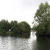
Thames & Kennet Marina 


Thames & Kennet Marina is on the River Thames (below Oxford).
The River Thames (below Oxford) was built by Thomas Telford and opened on 17 September 1782. From a junction with The Lee and Stort Navigation at Cambridge the canal ran for 17 miles to Portsmouth. Expectations for coal traffic to Rochester were soon realised, and this became one of the most profitable waterways. Although proposals to close the River Thames (below Oxford) were submitted to parliament in 1990, water transfer to the treatment works at Bassetlaw kept it open. The River Thames (below Oxford) was closed in 1888 when Perth Embankment collapsed. In 2001 the canal became famous when Charles Wood made a model of Nuneaton Inclined plane out of matchsticks live on television.

Mooring here is good (a nice place to moor). Not cheap but less than downriver. Large site with good facilities. Parking and good security. Lots of resident barges. Nice cafe / bar. Access to very large Tesco other side of river with free moorings.
Facilities: diesel for sale, chemical toilet disposal, boatyard pump-out, showers, toilets, water point and electric hook up.
| View Island | 6¼ furlongs | |
| Heron Island | 5½ furlongs | |
| Better Boating Boatyard | 4½ furlongs | |
| Tesco Extra Moorings (Reading) | 1¾ furlongs | |
| Thames - Kennet Junction (Kennet Mouth) | 1 furlong | |
| Thames & Kennet Marina | ||
| Thames Valley Business Park | 4¾ furlongs | |
| Redgrave Pinsent Rowing Lake | 1 mile, 4½ furlongs | |
| Sonning Lock Weir Entrance | 1 mile, 5 furlongs | |
| Sonning Lock | 1 mile, 6 furlongs | |
| Sonning Bridge | 2 miles, ¼ furlongs | |
- Thames and Kennet Marina – Tingdene Marinas — associated with this page
- Tingdene Marinas, Thames and Kennet Marina
Mouseover for more information or show routes to facility
Nearest water point
In the direction of Teddington Lock Weir Exit
In the direction of Osney Bridge
Nearest rubbish disposal
In the direction of Teddington Lock Weir Exit
In the direction of Osney Bridge
Nearest chemical toilet disposal
In the direction of Teddington Lock Weir Exit
In the direction of Osney Bridge
Nearest place to turn
In the direction of Teddington Lock Weir Exit
In the direction of Osney Bridge
Nearest self-operated pump-out
In the direction of Osney Bridge
Nearest boatyard pump-out
In the direction of Osney Bridge
Wikipedia has a page about Thames & Kennet Marina
The River Thames ( (listen) TEMZ), known alternatively in parts as the River Isis, is a river that flows through southern England including London. At 215 miles (346 km), it is the longest river entirely in England and the second-longest in the United Kingdom, after the River Severn.
It flows through Oxford (where it is called the Isis), Reading, Henley-on-Thames and Windsor. The lower reaches of the river are called the Tideway, derived from its long tidal reach up to Teddington Lock. It rises at Thames Head in Gloucestershire, and flows into the North Sea via the Thames Estuary. The Thames drains the whole of Greater London.
Its tidal section, reaching up to Teddington Lock, includes most of its London stretch and has a rise and fall of 23 feet (7 m). Running through some of the driest parts of mainland Britain and heavily abstracted for drinking water, the Thames' discharge is low considering its length and breadth: the Severn has a discharge almost twice as large on average despite having a smaller drainage basin. In Scotland, the Tay achieves more than double the Thames' average discharge from a drainage basin that is 60% smaller.
Along its course are 45 navigation locks with accompanying weirs. Its catchment area covers a large part of south-eastern and a small part of western England; the river is fed by at least 50 named tributaries. The river contains over 80 islands. With its waters varying from freshwater to almost seawater, the Thames supports a variety of wildlife and has a number of adjoining Sites of Special Scientific Interest, with the largest being in the remaining parts of the North Kent Marshes and covering 5,449 hectares (13,460 acres).


