Meadlands Bridge No 195
WW2 Pill Box, 196, Somerton OX25 6ND, United Kingdom
Address is taken from a point 684 yards away.

Meadlands Bridge No 195
is a minor waterways place
on the Oxford Canal (Southern Section - Main Line) between
Somerton Bridge No 196 (3¾ furlongs
to the south) and
Concorde Avenue Bridge No 165 (8 miles and 5¾ furlongs
and 5 locks
to the northwest).
The nearest place in the direction of Concorde Avenue Bridge No 165 is Somerton Deep Lock Bridge No 194;
1¼ furlongs
away.
There is no access to the towpath here.
Mooring here is unrated.
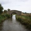
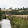
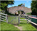
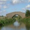
There is a bridge here which takes a track over the canal.
Somerton Mill Bridge No 199 | 1 mile, 4½ furlongs | |
Deep Cutting Bridge No 198 | 1 mile, ¼ furlongs | |
Somerton Narrows | 5 furlongs | |
Somerton Bridge Winding Hole | 4¼ furlongs | |
Somerton Bridge No 196 | 3¾ furlongs | |
Meadlands Bridge No 195 | ||
Somerton Deep Lock Bridge No 194 | 1¼ furlongs | |
Somerton Deep Lock No 34 | 1½ furlongs | |
Somerton Deep Lock Winding Hole | 2 furlongs | |
Chisnell Lift Bridge No 193 | 6 furlongs | |
Souldern Brook Culvert | 6½ furlongs |
- Oxford Canal Walk - Part One - Oxford to Thrupp - YouTube — associated with Oxford Canal
- A walk along the Oxford Canal (Southern Section) from Oxford to Thrupp Wide
Mouseover for more information or show routes to facility
Nearest water point
In the direction of Napton Junction
Aynho Wharf — 2 miles and 1 lock away
On this waterway in the direction of Napton Junction
Cherwell Street Facilities — 8 miles, 5¾ furlongs and 5 locks away
On this waterway in the direction of Napton Junction
Banbury Lock No 29 — 8 miles, 6 furlongs and 5 locks away
On this waterway in the direction of Napton Junction
Sovereign Wharf — 9 miles, ¼ furlongs and 6 locks away
On this waterway in the direction of Napton Junction
Cropredy Services — 13 miles, 1¾ furlongs and 9 locks away
On this waterway in the direction of Napton Junction
Cropredy Marina (southern basin) — 13 miles, 6¼ furlongs and 10 locks away
On this waterway in the direction of Napton Junction
Cropredy Marina (northern basins) — 13 miles, 6¾ furlongs and 10 locks away
On this waterway in the direction of Napton Junction
Fenny Compton Wharf — 19 miles, 4¼ furlongs and 18 locks away
On this waterway in the direction of Napton Junction
In the direction of End of Hythe Bridge Arm
Heyford Wharf — 4 miles, ¼ furlongs and 2 locks away
On this waterway in the direction of End of Hythe Bridge Arm
Heyford Wharf Bridge No 206 — 4 miles, ½ furlongs and 2 locks away
On this waterway in the direction of End of Hythe Bridge Arm
Thrupp Cruising Club — 11 miles, 4¾ furlongs and 7 locks away
On this waterway in the direction of End of Hythe Bridge Arm
Aubreys Lift Bridge No 221 — 11 miles, 4¾ furlongs and 7 locks away
On this waterway in the direction of End of Hythe Bridge Arm
Langford Lane Bridge No 224 — 12 miles, 2¼ furlongs and 7 locks away
On this waterway in the direction of End of Hythe Bridge Arm
Wolvercote Junction Water Point — 15 miles, 2 furlongs and 9 locks away
On this waterway in the direction of End of Hythe Bridge Arm
Wolvercote Sanitary Station — 15 miles, 6½ furlongs and 10 locks away
On this waterway in the direction of End of Hythe Bridge Arm
St Edwards Lift Bridge No 238 — 16 miles, 7¼ furlongs and 11 locks away
On this waterway in the direction of End of Hythe Bridge Arm
Oxford Visitor Moorings — 18 miles, 3½ furlongs and 11 locks away
On this waterway in the direction of End of Hythe Bridge Arm
Eynsham Lock — 18 miles, 5¾ furlongs and 11 locks away
Travel to Wolvercote Junction, then on the Oxford Canal (Duke's Cut) to Duke's Cut Junction, then on the River Thames (above Oxford) to Eynsham LockNearest rubbish disposal
In the direction of Napton Junction
Aynho Wharf — 2 miles and 1 lock away
On this waterway in the direction of Napton Junction
Cherwell Street Facilities — 8 miles, 5¾ furlongs and 5 locks away
On this waterway in the direction of Napton Junction
Sovereign Wharf — 9 miles, ¼ furlongs and 6 locks away
On this waterway in the direction of Napton Junction
Cropredy Services — 13 miles, 1¾ furlongs and 9 locks away
On this waterway in the direction of Napton Junction
Cropredy Marina (southern basin) — 13 miles, 6¼ furlongs and 10 locks away
On this waterway in the direction of Napton Junction
Cropredy Marina (northern basins) — 13 miles, 6¾ furlongs and 10 locks away
On this waterway in the direction of Napton Junction
Fenny Compton Marina — 19 miles, 1½ furlongs and 18 locks away
On this waterway in the direction of Napton Junction
In the direction of End of Hythe Bridge Arm
Heyford Wharf — 4 miles, ¼ furlongs and 2 locks away
On this waterway in the direction of End of Hythe Bridge Arm
Heyford Wharf Bridge No 206 — 4 miles, ½ furlongs and 2 locks away
On this waterway in the direction of End of Hythe Bridge Arm
Thrupp Cruising Club — 11 miles, 4¾ furlongs and 7 locks away
On this waterway in the direction of End of Hythe Bridge Arm
Aubreys Lift Bridge No 221 — 11 miles, 4¾ furlongs and 7 locks away
On this waterway in the direction of End of Hythe Bridge Arm
Wolvercote Sanitary Station — 15 miles, 6½ furlongs and 10 locks away
On this waterway in the direction of End of Hythe Bridge Arm
Eynsham Lock — 18 miles, 5¾ furlongs and 11 locks away
Travel to Wolvercote Junction, then on the Oxford Canal (Duke's Cut) to Duke's Cut Junction, then on the River Thames (above Oxford) to Eynsham LockNearest chemical toilet disposal
In the direction of Napton Junction
Cherwell Street Facilities — 8 miles, 5¾ furlongs and 5 locks away
On this waterway in the direction of Napton Junction
Sovereign Wharf — 9 miles, ¼ furlongs and 6 locks away
On this waterway in the direction of Napton Junction
Cropredy Services — 13 miles, 1¾ furlongs and 9 locks away
On this waterway in the direction of Napton Junction
Cropredy Marina (southern basin) — 13 miles, 6¼ furlongs and 10 locks away
On this waterway in the direction of Napton Junction
In the direction of End of Hythe Bridge Arm
Thrupp Cruising Club — 11 miles, 4¾ furlongs and 7 locks away
On this waterway in the direction of End of Hythe Bridge Arm
Wolvercote Sanitary Station — 15 miles, 6½ furlongs and 10 locks away
On this waterway in the direction of End of Hythe Bridge Arm
Eynsham Lock — 18 miles, 5¾ furlongs and 11 locks away
Travel to Wolvercote Junction, then on the Oxford Canal (Duke's Cut) to Duke's Cut Junction, then on the River Thames (above Oxford) to Eynsham LockNearest place to turn
In the direction of Napton Junction
Somerton Deep Lock Winding Hole — 2 furlongs and 1 lock away
On this waterway in the direction of Napton Junction
Aynho Wharf — 2 miles and 1 lock away
On this waterway in the direction of Napton Junction
Winding Hole above Nell Bridge Lock — 3 miles, 2½ furlongs and 3 locks away
On this waterway in the direction of Napton Junction
Twyford Wharf Winding Hole — 5 miles, 7¾ furlongs and 4 locks away
On this waterway in the direction of Napton Junction
Calthorpe Winding Hole — 8 miles, ¼ furlongs and 5 locks away
On this waterway in the direction of Napton Junction
Grimsbury Wharf — 9 miles, 3¼ furlongs and 6 locks away
On this waterway in the direction of Napton Junction
Southam Road Winding Hole — 9 miles, 4¾ furlongs and 6 locks away
On this waterway in the direction of Napton Junction
Southam Road Footbridge Arm — 9 miles, 7¼ furlongs and 6 locks away
On this waterway in the direction of Napton Junction
Cropredy Services — 13 miles, 1¾ furlongs and 9 locks away
On this waterway in the direction of Napton Junction
Cropredy Marina (southern basin) — 13 miles, 6¼ furlongs and 10 locks away
On this waterway in the direction of Napton Junction
Cropredy Marina (northern basins) — 13 miles, 6¾ furlongs and 10 locks away
On this waterway in the direction of Napton Junction
In the direction of End of Hythe Bridge Arm
Heyford Wharf Winding Hole — 4 miles and 2 locks away
On this waterway in the direction of End of Hythe Bridge Arm
Heyford Wharf — 4 miles, ¼ furlongs and 2 locks away
On this waterway in the direction of End of Hythe Bridge Arm
The Cleeves Winding Hole — 4 miles, 4¼ furlongs and 2 locks away
On this waterway in the direction of End of Hythe Bridge Arm
Kirtlington Winding Hole — 7 miles, 2¾ furlongs and 4 locks away
On this waterway in the direction of End of Hythe Bridge Arm
Enslow Winding Hole — 9 miles and 5 locks away
On this waterway in the direction of End of Hythe Bridge Arm
Shipton Weir Junction — 10 miles, 4¼ furlongs and 6 locks away
On this waterway in the direction of End of Hythe Bridge Arm
Thrupp Wide — 11 miles, 4¾ furlongs and 7 locks away
On this waterway in the direction of End of Hythe Bridge Arm
Wolvercote Junction — 15 miles, 2¾ furlongs and 10 locks away
On this waterway in the direction of End of Hythe Bridge Arm
Bypass Reservoir Junction — 15 miles, 4¾ furlongs and 11 locks away
Travel to Wolvercote Junction, then on the Oxford Canal (Duke's Cut) to Bypass Reservoir JunctionNearest self-operated pump-out
In the direction of Napton Junction
Cropredy Marina (southern basin) — 13 miles, 6¼ furlongs and 10 locks away
On this waterway in the direction of Napton Junction
In the direction of End of Hythe Bridge Arm
Thrupp Cruising Club — 11 miles, 4¾ furlongs and 7 locks away
On this waterway in the direction of End of Hythe Bridge Arm
Aubreys Lift Bridge No 221 — 11 miles, 4¾ furlongs and 7 locks away
On this waterway in the direction of End of Hythe Bridge Arm
Eynsham Lock — 18 miles, 5¾ furlongs and 11 locks away
Travel to Wolvercote Junction, then on the Oxford Canal (Duke's Cut) to Duke's Cut Junction, then on the River Thames (above Oxford) to Eynsham LockNearest boatyard pump-out
In the direction of Napton Junction
Aynho Wharf — 2 miles and 1 lock away
On this waterway in the direction of Napton Junction
Twyford Wharf — 5 miles, 7½ furlongs and 4 locks away
On this waterway in the direction of Napton Junction
Sovereign Wharf — 9 miles, ¼ furlongs and 6 locks away
On this waterway in the direction of Napton Junction
Cropredy Marina (southern basin) — 13 miles, 6¼ furlongs and 10 locks away
On this waterway in the direction of Napton Junction
In the direction of End of Hythe Bridge Arm
Heyford Wharf — 4 miles, ¼ furlongs and 2 locks away
On this waterway in the direction of End of Hythe Bridge Arm
Enslow Wharf — 9 miles, 1¼ furlongs and 5 locks away
On this waterway in the direction of End of Hythe Bridge Arm
Oxford Cruisers Marina — 19 miles, 5½ furlongs and 12 locks away
Travel to Wolvercote Junction, then on the Oxford Canal (Duke's Cut) to Duke's Cut Junction, then on the River Thames (above Oxford) to Oxford Cruisers MarinaDirection of TV transmitter (From Wolfbane Cybernetic)
There is no page on Wikipedia called “Meadlands Bridge”
Wikipedia pages that might relate to Meadlands Bridge
[List of schools in the London Borough of Richmond upon Thames]
Riverside Primary School Lowther Primary School Marshgate Primary School Meadlands Primary School Nelson Primary School Orleans Primary School The Queen's
[Grade II* listed buildings in Mid Suffolk]
177201°N 1.009184°E / 52.177201; 1.009184 (The Cedars Hotel) 1209561 The Meadlands Public House Needham Rd, Stowmarket House Late C20 19 April 1972 TM0571357725
[List of public art in the London Borough of Richmond upon Thames]
Barnes, London". Thanks for the Food. Retrieved 20 July 2014. "Hammersmith Bridge – Part Four". skydive.ru. Retrieved 21 July 2014. Matthews 2018, p. 229
[Wembley Greyhounds]
40.07 5-2 1977 Westpark Kale Phil Rees Sr. (Wimbledon) 40.14 6-4f 1978 Meadlands John Coleman (Wembley) 40.28 1979 Roystons Supreme Adam Jackson (Wembley)
Results of Google Search
Back of Somerton Deep Lock © Gillie Rhodes cc-by-sa/2.0 ...Mar 18, 2013 ... ... Section - Main Line)looking at Somerton Deep Lock Bridge 194 and further away in the centre of the picture is Meadlands Bridge No 195.
000, showOxford Canal - North. Hawkesbury Stop Lock No.1. 4, B4109 Tusses Bridge. M6 ... Deep Lock No 34. 194, Somerton Bridge. 195, Meadlands Bridge ...
Feb 28, 1998 ... World Wide Web: http://www.usgs.gov/. Any use of trade, product, or firm names in this publication is for descriptive purposes only and does not ...
The Oxford Canal is a 78-mile (126 km) narrow canal in central England linking Oxford with ... Hawkesbury Stop Lock No.1 ... 195, Meadlands Bridge ...
COUNTY, BRAZORIA COUNTY, 0.37?COUNTY ROAD & BRIDGE, COUNTY ROAD & BRIDGE, 0.05?EMERGENCY SERVICES DISTRICT, BRAZORIA CO ...
publication of this thesis for financial gain shall not be allowed without my written ... Meadlands Estate, Victoria proposed subdivision, model suburb,. 27.