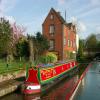
Gnosall Bridge No 35
is a village
on the Shropshire Union Canal (Birmingham and Liverpool Junction Canal - Main Line) between
Cowley Tunnel No 33 (northern entrance) (4 furlongs
to the southeast) and
Norbury Junction (Junction with former Newport Branch) (2 miles and 3¾ furlongs
to the northwest).
The nearest place in the direction of Cowley Tunnel No 33 (northern entrance) is Gnosall Visitor Moorings;
1 furlong
away.
The nearest place in the direction of Norbury Junction is The Navigation Inn (Gnosall);
a few yards
away.
There is access (via steps) to the towpath here.
Mooring here is unrated.
There is a bridge here which takes a major road over the canal.
| Cowley Tunnel No 33 (northern entrance) | 4 furlongs | |
| Gnosall Visitor Moorings (south) | 2 furlongs | |
| Boat Inn Bridge No 34 | 1½ furlongs | |
| The Boat Inn (Gnosall) | 1½ furlongs | |
| Gnosall Visitor Moorings | 1 furlong | |
| Gnosall Bridge No 35 | ||
| The Navigation Inn (Gnosall) | a few yards | |
| Gnosall Visitor Moorings (north) | ¾ furlongs | |
| Gnosall Railway Bridge No 35a | 1½ furlongs | |
| Gnosall Visitor Moorings (5 day) | 2 furlongs | |
| Plardiwick Bridge No 36 | 2¾ furlongs | |
Gnosall Fish Bar is in Newport Road, NE of the bridge.
There are no links to external websites from here.
Why not log in and add some (select "External websites" from the menu (sometimes this is under "Edit"))?
Mouseover for more information or show routes to facility
Nearest water point
In the direction of Autherley Junction
Wheaton Aston Services — 5 miles, 1½ furlongs away
On this waterway in the direction of Autherley Junction
Autherley Stop Lock Water Point — 12 miles, 7½ furlongs and 1 lock away
On this waterway in the direction of Autherley Junction
Broad Street Basin — 15 miles, 3¼ furlongs and 23 locks away
Travel to Autherley Junction, then on the Staffordshire and Worcestershire Canal (Main Line: Aldersley to Autherley) to Aldersley Junction, then on the Birmingham Canal Navigations (Main Line) to Broad Street Basin
In the direction of Nantwich Basin Entrance
The Navigation Inn (Gnosall) — a few yards away
On this waterway in the direction of Nantwich Basin Entrance
Norbury Junction Services — 2 miles, 3½ furlongs away
On this waterway in the direction of Nantwich Basin Entrance
Norbury Wharf Boatyard — 2 miles, 3¾ furlongs away
On this waterway in the direction of Nantwich Basin Entrance
Goldstone Bridge No 55 — 10 miles, ½ furlongs away
On this waterway in the direction of Nantwich Basin Entrance
Goldstone Wharf — 10 miles, 1 furlong away
On this waterway in the direction of Nantwich Basin Entrance
Tyrley Wharf Services — 12 miles, 1½ furlongs away
On this waterway in the direction of Nantwich Basin Entrance
Talbot Wharf Services — 13 miles, 5¼ furlongs and 5 locks away
On this waterway in the direction of Nantwich Basin Entrance
Audlem Wharf — 19 miles, 5 furlongs and 22 locks away
On this waterway in the direction of Nantwich Basin Entrance
Audlem Water Point (below Lock No 25) — 19 miles, 6 furlongs and 23 locks away
On this waterway in the direction of Nantwich Basin EntranceNearest rubbish disposal
In the direction of Autherley Junction
Wheaton Aston Services — 5 miles, 1½ furlongs away
On this waterway in the direction of Autherley Junction
Autherley Junction Bridge No 1 — 13 miles, ¼ furlongs and 2 locks away
On this waterway in the direction of Autherley Junction
Wolverhampton Lock No 9 — 14 miles, 5¾ furlongs and 14 locks away
Travel to Autherley Junction, then on the Staffordshire and Worcestershire Canal (Main Line: Aldersley to Autherley) to Aldersley Junction, then on the Birmingham Canal Navigations (Main Line) to Wolverhampton Lock No 9
Bratch Bottom Lock No 23 — 19 miles, 6¾ furlongs and 10 locks away
Travel to Autherley Junction, then on the Staffordshire and Worcestershire Canal (Main Line: Aldersley to Autherley) to Aldersley Junction, then on the Staffordshire and Worcestershire Canal (Main Line: Stourton to Aldersley) to Bratch Bottom Lock No 23
Broad Street Basin — 15 miles, 3¼ furlongs and 23 locks away
Travel to Autherley Junction, then on the Staffordshire and Worcestershire Canal (Main Line: Aldersley to Autherley) to Aldersley Junction, then on the Birmingham Canal Navigations (Main Line) to Broad Street Basin
In the direction of Nantwich Basin Entrance
Norbury Wharf Boatyard — 2 miles, 3¾ furlongs away
On this waterway in the direction of Nantwich Basin Entrance
Tyrley Wharf Services — 12 miles, 1½ furlongs away
On this waterway in the direction of Nantwich Basin Entrance
Audlem Wharf — 19 miles, 5 furlongs and 22 locks away
On this waterway in the direction of Nantwich Basin EntranceNearest chemical toilet disposal
In the direction of Autherley Junction
Wheaton Aston Services — 5 miles, 1½ furlongs away
On this waterway in the direction of Autherley Junction
Broad Street Basin — 15 miles, 3¼ furlongs and 23 locks away
Travel to Autherley Junction, then on the Staffordshire and Worcestershire Canal (Main Line: Aldersley to Autherley) to Aldersley Junction, then on the Birmingham Canal Navigations (Main Line) to Broad Street Basin
In the direction of Nantwich Basin Entrance
Norbury Junction Services — 2 miles, 3½ furlongs away
On this waterway in the direction of Nantwich Basin Entrance
Norbury Wharf Boatyard — 2 miles, 3¾ furlongs away
On this waterway in the direction of Nantwich Basin Entrance
Talbot Wharf Services — 13 miles, 5¼ furlongs and 5 locks away
On this waterway in the direction of Nantwich Basin Entrance
Audlem Wharf — 19 miles, 5 furlongs and 22 locks away
On this waterway in the direction of Nantwich Basin EntranceNearest place to turn
In the direction of Autherley Junction
High Onn Wharf — 2 miles, 1¾ furlongs away
On this waterway in the direction of Autherley Junction
Wheaton Aston Winding Hole — 5 miles, 1 furlong away
On this waterway in the direction of Autherley Junction
Stretton Boatyard — 6 miles, 6 furlongs and 1 lock away
On this waterway in the direction of Autherley Junction
Brewood Wharf — 7 miles, 6½ furlongs and 1 lock away
On this waterway in the direction of Autherley Junction
Park Lodge Winding Hole — 9 miles, 2½ furlongs and 1 lock away
On this waterway in the direction of Autherley Junction
Lower Hattons Winding Hole — 10 miles, 1½ furlongs and 1 lock away
On this waterway in the direction of Autherley Junction
Pendeford Hall Lane Winding hole — 11 miles and 1 lock away
On this waterway in the direction of Autherley Junction
Autherley Junction — 13 miles, ¼ furlongs and 2 locks away
On this waterway in the direction of Autherley Junction
Aldersley Junction — 13 miles, 4¼ furlongs and 2 locks away
Travel to Autherley Junction, then on the Staffordshire and Worcestershire Canal (Main Line: Aldersley to Autherley) to Aldersley Junction
Three Hammers Farm Winding Hole — 15 miles, 4½ furlongs and 2 locks away
Travel to Autherley Junction, then on the Staffordshire and Worcestershire Canal (Main Line: Autherley to Great Haywood) to Three Hammers Farm Winding Hole
Slade Heath Winding Hole — 16 miles, 2¼ furlongs and 2 locks away
Travel to Autherley Junction, then on the Staffordshire and Worcestershire Canal (Main Line: Autherley to Great Haywood) to Slade Heath Winding Hole
Latherford Winding Hole — 17 miles, 6¼ furlongs and 2 locks away
Travel to Autherley Junction, then on the Staffordshire and Worcestershire Canal (Main Line: Autherley to Great Haywood) to Latherford Winding Hole
Winding Hole above Wightwick Lock — 16 miles, 1¾ furlongs and 4 locks away
Travel to Autherley Junction, then on the Staffordshire and Worcestershire Canal (Main Line: Aldersley to Autherley) to Aldersley Junction, then on the Staffordshire and Worcestershire Canal (Main Line: Stourton to Aldersley) to Winding Hole above Wightwick Lock
In the direction of Nantwich Basin Entrance
Norbury Junction — 2 miles, 3¾ furlongs away
On this waterway in the direction of Nantwich Basin Entrance
Norbury Wharf Boatyard — 2 miles, 3¾ furlongs away
On this waterway in the direction of Nantwich Basin Entrance
Grub Street Winding Hole — 4 miles, 1 furlong away
On this waterway in the direction of Nantwich Basin Entrance
Shebdon Winding Hole — 6 miles, ¼ furlongs away
On this waterway in the direction of Nantwich Basin Entrance
Park Heath Wharf — 8 miles away
On this waterway in the direction of Nantwich Basin Entrance
Goldstone Wharf — 10 miles, 1 furlong away
On this waterway in the direction of Nantwich Basin Entrance
Talbot Wharf — 13 miles, 4¾ furlongs and 5 locks away
On this waterway in the direction of Nantwich Basin EntranceNearest self-operated pump-out
In the direction of Autherley Junction
Wheaton Aston Services — 5 miles, 1½ furlongs away
On this waterway in the direction of Autherley Junction
In the direction of Nantwich Basin Entrance
Talbot Wharf Services — 13 miles, 5¼ furlongs and 5 locks away
On this waterway in the direction of Nantwich Basin EntranceNearest boatyard pump-out
In the direction of Autherley Junction
Brewood Wharf — 7 miles, 6½ furlongs and 1 lock away
On this waterway in the direction of Autherley Junction
Autherley Wharf — 12 miles, 7¾ furlongs and 1 lock away
On this waterway in the direction of Autherley Junction
Oxley Marine — 13 miles, 1¼ furlongs and 2 locks away
Travel to Autherley Junction, then on the Staffordshire and Worcestershire Canal (Main Line: Aldersley to Autherley) to Oxley Marine
In the direction of Nantwich Basin Entrance
Norbury Wharf Boatyard — 2 miles, 3¾ furlongs away
On this waterway in the direction of Nantwich Basin EntranceDirection of TV transmitter (From Wolfbane Cybernetic)
In Brewood from Scribblings from the Mintball posted Saturday the 2nd of May, 2015
A Tale of Two Wharfs from Scribblings from the Mintball posted Saturday the 28th of September, 2013
Three Mile Post from Scribblings from the Mintball posted Saturday the 25th of August, 2007
And it shall rain for ever and ever.... from Scribblings from the Mintball posted Monday the 28th of May, 2007
There is no page on Wikipedia called “Gnosall Bridge”
Wikipedia pages that might relate to Gnosall Bridge
[Listed buildings in Gnosall]
Gnosall is a civil parish in the Borough of Stafford, Staffordshire, England. It contains 20 listed buildings that are recorded in the National Heritage
[Gnosall railway station]
Gnosall railway station was a station in Gnosall, Staffordshire, England. The station was opened in June 1849 and closed on 6 September 1964. "Gnosall
[Four Counties Ring]
Flood gates at each end protect the rest of the canal should it breach. At Gnosall the canal passes under an abandoned railway line and the A518 road before
[Birmingham and Liverpool Junction Canal]
canal was finally finished in 1835, with the section from Autherley to Gnosall opening on 12 January and the rest, including the Newport Branch, opening
[List of places in Staffordshire]
Fole, Forsbrook, Four Ashes, Fradley, Freeford, Froghall. Gentleshaw, Gnosall, Godstone, Gratwich, Great Bridgeford, Great Haywood, Great Wyrley, Grindley
[Staffordshire]
Chesterton, Staffordshire Stafford Stafford Haughton, Stone, Norton Bridge, Eccleshall, Gnosall, Baschurch Staffordshire Moorlands District Leek Alton, Hulme
[Standon Bridge railway station]
Standon Bridge railway station was a railway station in Standon, approximately 4 miles (6.4 km) west of Stone, Staffordshire. The station closed on 4 February
[Woodseaves]
B5405 road, which leads to Great Bridgeford. Nearby are the villages of Gnosall and Norbury, the hamlets of Knightley and High Offley, and the small town
[Alton Towers railway station]
Elford North Staffordshire Railway Shropshire Union Railways Haughton Gnosall South Staffordshire Railway Alrewas Hammerwich Wyrley and Cheslyn Hay Stafford
[Listed buildings in High Offley]
Historic England, "Milepost Stafford-Newport Road 9 miles from Stafford, Gnosall (1242856)", National Heritage List for England, retrieved 24 October 2019
Results of Google Search
Gnosall Bridge No 35. Shropshire Union Canal. Shropshire ...Download this stock image: Gnosall Bridge No 35. Shropshire Union Canal. Shropshire. England. UK. Europe - FD2E0E from Alamy's library of millions of high ...
Mar 4, 2020 ... No higher resolution available. ... 35 (Newport Road Bridge) over the Shropshire Union Canal, Gnosall Heath, Staffordshire, England. Date, 24 ...
The bridge has a stone band and copings, a slightly cambered plain parapet and piers. II. Bridge No 35, (Newport Road Bridge)
SHROPSHIRE UNION CANAL NEWPORT ROAD BRIDGE (NUMBER 35) AT SJ 819 203. 1 contribution ... Parish: Gnosall. National Grid Reference: SJ 81974 ...
May 12, 2018 ... taken 2 years ago, near to Gnosall Heath, Staffordshire, Great Britain. More sizes. Gnosall Bridge No 35. Carrying Newport Road across the ...
88, A530 Baddington Bridge. Moss Hall aqueduct ... 35, A518 Gnosall bridge. Wheaton Aston lock ... Trentham Lock No 35. 106, A5035 Hemheath Bridge. A50 ...
No food Monday lunchtime. Gnosall Bridge No 35 Gnosall, The Navigation Inn Newport Road Gnosall STAFFORD ST20 0BN, 01785 824562, Website · Map, x ...
This page covers the canal from Autherley Junction to Gnosall. ... (Bridge 35) Carries A518 Newport Road; Gnosall Railway Bridge (Bridge 35a) Where National ...


![Different season. A winter view of the old corn mill and Union Canal at Gnosall Heath. Compare with [[1887783]]. by Ian Paterson – 12 December 2010](https://s1.geograph.org.uk/geophotos/02/19/52/2195245_6e1c92c5_120x120.jpg)