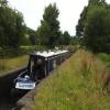
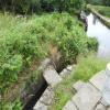
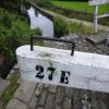
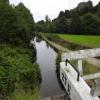
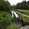
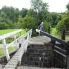
Mill Pond Lock No 27E
is a minor waterways place
on the Huddersfield Narrow Canal between
Railway Lock No 42E (Marsden. Eastern summit lock) (1 mile and 5¼ furlongs
and 14 locks
to the southwest) and
Titanic Mill (Linthwaite) (2 miles and ¼ furlongs
and 10 locks
to the east).
The nearest place in the direction of Railway Lock No 42E is Waring Bottom Lock Bridge No 50;
¾ furlongs
away.
The nearest place in the direction of Titanic Mill is Skew Bridge Lock No 26E;
1 furlong
away.
There may be access to the towpath here.
Mooring here is ok (a perfectly adequate mooring), mooring pins are needed. Shaw Carr Wood Mill Mooring.07533075284.
There is a bridge here which takes pedestrian traffic over the canal.
This is a lock, the rise of which is not known.
Bank Nook Lock No 30E | 3 furlongs | |
White Hill Lock No 29E | 1¾ furlongs | |
Booths Bank Bridge No 51 | 1¾ furlongs | |
Waring Bottom Lock No 28E | ¾ furlongs | |
Waring Bottom Lock Bridge No 50 | ¾ furlongs | |
Mill Pond Lock No 27E | ||
Skew Bridge Lock No 26E | 1 furlong | |
Shaw Carr Footbridge No 48 | 1¼ furlongs | |
Shaker Wood Lock No 25E | 3 furlongs | |
Slaithwaite Slipway | 5 furlongs | |
Shuttle Lock No 24E | 5 furlongs |
There are no links to external websites from here.
Why not log in and add some (select "External websites" from the menu (sometimes this is under "Edit"))?
Mouseover for more information or show routes to facility
Nearest water point
In the direction of Ashton-under-Lyne Junction
Standedge Tunnel (eastern entrance) — 2 miles, 2½ furlongs and 16 locks away
On this waterway in the direction of Ashton-under-Lyne Junction
Standedge Tunnel (western entrance) — 5 miles, 4¼ furlongs and 16 locks away
On this waterway in the direction of Ashton-under-Lyne Junction
Wool Road Bridge No 70 — 7 miles, 4¼ furlongs and 25 locks away
On this waterway in the direction of Ashton-under-Lyne Junction
Grove Road Bridge No 96 — 13 miles, 4¼ furlongs and 40 locks away
On this waterway in the direction of Ashton-under-Lyne Junction
In the direction of Aspley Basin (Huddersfield)
Slaithwaite Winding Hole — 1 mile, ½ furlongs and 6 locks away
On this waterway in the direction of Aspley Basin (Huddersfield)
Waterside Lock No 21E — 1 mile, 1¼ furlongs and 6 locks away
On this waterway in the direction of Aspley Basin (Huddersfield)
Aspley Basin (Huddersfield) — 5 miles, 6¾ furlongs and 27 locks away
On this waterway in the direction of Aspley Basin (Huddersfield)
Shepley Bridge Sanitary Station — 12 miles, 3¼ furlongs and 38 locks away
Travel to Aspley Basin (Huddersfield), then on the Huddersfield Broad Canal to Cooper Bridge Junction, then on the Calder and Hebble Navigation (Main Line) to Shepley Bridge Sanitary Station
Brighouse Basin — 11 miles, 5¼ furlongs and 40 locks away
Travel to Aspley Basin (Huddersfield), then on the Huddersfield Broad Canal to Cooper Bridge Junction, then on the Calder and Hebble Navigation (Main Line) to Brighouse Basin
Salterhebble Sanitary Station — 15 miles, 7¼ furlongs and 49 locks away
Travel to Aspley Basin (Huddersfield), then on the Huddersfield Broad Canal to Cooper Bridge Junction, then on the Calder and Hebble Navigation (Main Line) to Salterhebble Sanitary Station
Broad Cut Low Lock No 3 — 19 miles, ¼ furlongs and 46 locks away
Travel to Aspley Basin (Huddersfield), then on the Huddersfield Broad Canal to Cooper Bridge Junction, then on the Calder and Hebble Navigation (Main Line) to Broad Cut Low Lock No 3
Salterhebble Junction — 15 miles, 7½ furlongs and 50 locks away
Travel to Aspley Basin (Huddersfield), then on the Huddersfield Broad Canal to Cooper Bridge Junction, then on the Calder and Hebble Navigation (Main Line) to Salterhebble Junction
Sowerby Bridge Basin — 18 miles, 1½ furlongs and 50 locks away
Travel to Aspley Basin (Huddersfield), then on the Huddersfield Broad Canal to Cooper Bridge Junction, then on the Calder and Hebble Navigation (Main Line) to Salterhebble Junction, then on the Calder and Hebble Navigation (Main Line) to Sowerby Bridge BasinNearest rubbish disposal
In the direction of Ashton-under-Lyne Junction
Wool Road Visitor Mooring — 7 miles, 4½ furlongs and 25 locks away
On this waterway in the direction of Ashton-under-Lyne Junction
In the direction of Aspley Basin (Huddersfield)
Pickle Lock No 22E — 1 mile and 5 locks away
On this waterway in the direction of Aspley Basin (Huddersfield)
Aspley Basin (Huddersfield) — 5 miles, 6¾ furlongs and 27 locks away
On this waterway in the direction of Aspley Basin (Huddersfield)
Shepley Bridge Sanitary Station — 12 miles, 3¼ furlongs and 38 locks away
Travel to Aspley Basin (Huddersfield), then on the Huddersfield Broad Canal to Cooper Bridge Junction, then on the Calder and Hebble Navigation (Main Line) to Shepley Bridge Sanitary Station
Brighouse Lower Basin Visitor Moorings — 11 miles, 4¾ furlongs and 39 locks away
Travel to Aspley Basin (Huddersfield), then on the Huddersfield Broad Canal to Cooper Bridge Junction, then on the Calder and Hebble Navigation (Main Line) to Brighouse Lower Basin Visitor Moorings
Horbury Basin Residential Moorings & Sanitary Station — 16 miles, 7¾ furlongs and 45 locks away
Travel to Aspley Basin (Huddersfield), then on the Huddersfield Broad Canal to Cooper Bridge Junction, then on the Calder and Hebble Navigation (Main Line) to Horbury Basin Residential Moorings & Sanitary Station
Salterhebble Sanitary Station — 15 miles, 7¼ furlongs and 49 locks away
Travel to Aspley Basin (Huddersfield), then on the Huddersfield Broad Canal to Cooper Bridge Junction, then on the Calder and Hebble Navigation (Main Line) to Salterhebble Sanitary Station
Sowerby Bridge Basin — 18 miles, 1½ furlongs and 50 locks away
Travel to Aspley Basin (Huddersfield), then on the Huddersfield Broad Canal to Cooper Bridge Junction, then on the Calder and Hebble Navigation (Main Line) to Salterhebble Junction, then on the Calder and Hebble Navigation (Main Line) to Sowerby Bridge BasinNearest chemical toilet disposal
In the direction of Ashton-under-Lyne Junction
Wool Road Bridge No 70 — 7 miles, 4¼ furlongs and 25 locks away
On this waterway in the direction of Ashton-under-Lyne Junction
Grove Road Bridge No 96 — 13 miles, 4¼ furlongs and 40 locks away
On this waterway in the direction of Ashton-under-Lyne Junction
In the direction of Aspley Basin (Huddersfield)
Pickle Lock No 22E — 1 mile and 5 locks away
On this waterway in the direction of Aspley Basin (Huddersfield)
Waterside Lock No 21E — 1 mile, 1¼ furlongs and 6 locks away
On this waterway in the direction of Aspley Basin (Huddersfield)
Aspley Basin (Huddersfield) — 5 miles, 6¾ furlongs and 27 locks away
On this waterway in the direction of Aspley Basin (Huddersfield)
Shepley Bridge Sanitary Station — 12 miles, 3¼ furlongs and 38 locks away
Travel to Aspley Basin (Huddersfield), then on the Huddersfield Broad Canal to Cooper Bridge Junction, then on the Calder and Hebble Navigation (Main Line) to Shepley Bridge Sanitary Station
Brighouse Basin — 11 miles, 5¼ furlongs and 40 locks away
Travel to Aspley Basin (Huddersfield), then on the Huddersfield Broad Canal to Cooper Bridge Junction, then on the Calder and Hebble Navigation (Main Line) to Brighouse Basin
Savile Town Wharf and Basin (Dewsbury) — 15 miles, 6¾ furlongs and 42 locks away
Travel to Aspley Basin (Huddersfield), then on the Huddersfield Broad Canal to Cooper Bridge Junction, then on the Calder and Hebble Navigation (Main Line) to Dewsbury Arm Junction, then on the Calder and Hebble Navigation (Dewsbury Old Cut) to Savile Town Wharf and Basin (Dewsbury)
Horbury Basin Residential Moorings & Sanitary Station — 16 miles, 7¾ furlongs and 45 locks away
Travel to Aspley Basin (Huddersfield), then on the Huddersfield Broad Canal to Cooper Bridge Junction, then on the Calder and Hebble Navigation (Main Line) to Horbury Basin Residential Moorings & Sanitary Station
Salterhebble Sanitary Station — 15 miles, 7¼ furlongs and 49 locks away
Travel to Aspley Basin (Huddersfield), then on the Huddersfield Broad Canal to Cooper Bridge Junction, then on the Calder and Hebble Navigation (Main Line) to Salterhebble Sanitary Station
Sowerby Bridge Basin — 18 miles, 1½ furlongs and 50 locks away
Travel to Aspley Basin (Huddersfield), then on the Huddersfield Broad Canal to Cooper Bridge Junction, then on the Calder and Hebble Navigation (Main Line) to Salterhebble Junction, then on the Calder and Hebble Navigation (Main Line) to Sowerby Bridge BasinNearest place to turn
In the direction of Ashton-under-Lyne Junction
Booth Lock Winding Hole — 4½ furlongs and 5 locks away
On this waterway in the direction of Ashton-under-Lyne Junction
Standedge Tunnel End Winding Hole — 2 miles, 1½ furlongs and 16 locks away
On this waterway in the direction of Ashton-under-Lyne Junction
Diggle Winding Hole — 5 miles, 7 furlongs and 16 locks away
On this waterway in the direction of Ashton-under-Lyne Junction
Wool Road Winding Hole — 7 miles, 5 furlongs and 25 locks away
On this waterway in the direction of Ashton-under-Lyne Junction
Saddleworth Visitor Centre Winding Hole — 8 miles, 2¾ furlongs and 27 locks away
On this waterway in the direction of Ashton-under-Lyne Junction
Manns Wharf Bridge Winding Hole — 9 miles, 5¾ furlongs and 29 locks away
On this waterway in the direction of Ashton-under-Lyne Junction
Roughtown Court Winding Hole — 10 miles, 7 furlongs and 34 locks away
On this waterway in the direction of Ashton-under-Lyne Junction
Mossley Bottoms Winding Hole — 11 miles, 6¾ furlongs and 36 locks away
On this waterway in the direction of Ashton-under-Lyne Junction
In the direction of Aspley Basin (Huddersfield)
Slaithwaite Winding Hole — 1 mile, ½ furlongs and 6 locks away
On this waterway in the direction of Aspley Basin (Huddersfield)
Linthwaite Winding Hole — 2 miles, 1 furlong and 11 locks away
On this waterway in the direction of Aspley Basin (Huddersfield)
Isis Lock Winding Hole — 3 miles, 5½ furlongs and 19 locks away
On this waterway in the direction of Aspley Basin (Huddersfield)
University Arm — 5 miles, 6¼ furlongs and 27 locks away
On this waterway in the direction of Aspley Basin (Huddersfield)
Aspley Basin (Huddersfield) — 5 miles, 6¾ furlongs and 27 locks away
On this waterway in the direction of Aspley Basin (Huddersfield)
Anchor Street Winding Hole — 6 miles, 3¾ furlongs and 27 locks away
Travel to Aspley Basin (Huddersfield), then on the Huddersfield Broad Canal to Anchor Street Winding Hole
New Road Winding Hole — 6 miles, 7¼ furlongs and 27 locks away
Travel to Aspley Basin (Huddersfield), then on the Huddersfield Broad Canal to New Road Winding Hole
Deighton Road Bridge Winding Hole — 8 miles, ¾ furlongs and 32 locks away
Travel to Aspley Basin (Huddersfield), then on the Huddersfield Broad Canal to Deighton Road Bridge Winding Hole
Cooper Bridge Junction — 9 miles, 2¾ furlongs and 36 locks away
Travel to Aspley Basin (Huddersfield), then on the Huddersfield Broad Canal to Cooper Bridge Junction
Battye Weir Entrance — 10 miles and 37 locks away
Travel to Aspley Basin (Huddersfield), then on the Huddersfield Broad Canal to Cooper Bridge Junction, then on the Calder and Hebble Navigation (Main Line) to Battye Weir Entrance
Shepley Bridge Marina — 12 miles, 3¾ furlongs and 38 locks away
Travel to Aspley Basin (Huddersfield), then on the Huddersfield Broad Canal to Cooper Bridge Junction, then on the Calder and Hebble Navigation (Main Line) to Shepley Bridge Marina
Brighouse Basin — 11 miles, 5¼ furlongs and 40 locks away
Travel to Aspley Basin (Huddersfield), then on the Huddersfield Broad Canal to Cooper Bridge Junction, then on the Calder and Hebble Navigation (Main Line) to Brighouse BasinNearest self-operated pump-out
In the direction of Ashton-under-Lyne Junction
Wool Road Bridge No 70 — 7 miles, 4¼ furlongs and 25 locks away
On this waterway in the direction of Ashton-under-Lyne Junction
In the direction of Aspley Basin (Huddersfield)
Slaithwaite Winding Hole — 1 mile, ½ furlongs and 6 locks away
On this waterway in the direction of Aspley Basin (Huddersfield)Nearest boatyard pump-out
In the direction of Ashton-under-Lyne Junction
Portland Basin Arm — 18 miles, 4¾ furlongs and 48 locks away
Travel to Ashton-under-Lyne Junction, then on the Ashton Canal (Main Line) to Dukinfield Junction, then on the Peak Forest Canal (Lower) to Portland Basin Arm
In the direction of Aspley Basin (Huddersfield)
Aspley Basin (Huddersfield) — 5 miles, 6¾ furlongs and 27 locks away
On this waterway in the direction of Aspley Basin (Huddersfield)
Shepley Bridge Marina — 12 miles, 3¾ furlongs and 38 locks away
Travel to Aspley Basin (Huddersfield), then on the Huddersfield Broad Canal to Cooper Bridge Junction, then on the Calder and Hebble Navigation (Main Line) to Shepley Bridge Marina
Sowerby Bridge Basin — 18 miles, 1½ furlongs and 50 locks away
Travel to Aspley Basin (Huddersfield), then on the Huddersfield Broad Canal to Cooper Bridge Junction, then on the Calder and Hebble Navigation (Main Line) to Salterhebble Junction, then on the Calder and Hebble Navigation (Main Line) to Sowerby Bridge BasinDirection of TV transmitter (From Wolfbane Cybernetic)
There is no page on Wikipedia called “Mill Pond Lock No 27E”
Wikipedia pages that might relate to Mill Pond Lock No 27E
[River Cam]
river (with the section above the Mill Pond being referred to as the upper river). Between Jesus Lock and the Mill Pond,map 12 it passes through the Backsmap
[Lock (water navigation)]
stretch of river is made navigable, a lock is sometimes required to bypass an obstruction such as a rapid, dam, or mill weir – because of the change in river
[North Walsham & Dilham Canal]
reaches Briggate Lock, which can be viewed from Briggate Bridge. The mill is to the south of the bridge, while the mill pond and lock are to the north
[Erie Canal]
between locks E33 and E34 as well as a 1.5-foot (0.46 m) natural rise between Lock E35 and the Niagara River. There is no Lock E1 or Lock E31 on the Erie
[Medway watermills (middle tributaries)]
working in the period 1723–31. The mill pond was 175 yards (160.02 m) long and 75 feet (22.86 m) wide at the mill, giving an area of 4,375 square yards
[Medway watermills (lower tributaries)]
freehold of the mill until October 1838. In 1839 the area of the mill pond was given as ¾ acre. Charles Whittaker was the owner of the mill in 1842 and by
[Ohio and Erie Canal]
6 photos, 1 measured drawing, 1 photo caption page HAER No. OH-59-E, "Ohio & Erie Canal, Lock No. 28, East of Junction of Major & Riverview Roads, Peninsula
[River Ouse, Sussex]
a property called "Sharp's" in Newick, and built a paper mill close to Sharp's Bridge Lock. He was the only occupant of the building, and by the time
[Hancock Brook]
and land-locked alewife. A short, narrow thoroughfare connects the south end of Sand Pond to Hancock Pond. Hancock Pond is the largest pond of the Hancock
[Cumberland and Oxford Canal]
the Presumpscot River lock facilities were converted to dams for the S. D. Warren Paper Mill. Steamboats continued to use Songo Lock to provide transportation