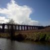
Conisbrough Viaduct
is a major waterways place
on the Sheffield and South Yorkshire Navigation (Main Line) between
Bramwith Junction (Junction of Sheffield and South Yorkshire Navigation main line with New Junction Canal) (11 miles and 5¼ furlongs
and 3 locks
to the northeast) and
Swinton Junction (Junction of Dearne and Dove Canal with S&SYN.) (4 miles and 3½ furlongs
and 3 locks
to the west).
The nearest place in the direction of Bramwith Junction is Conisbrough Railway Bridge No 60;
2¾ furlongs
away.
The nearest place in the direction of Swinton Junction is Conisbrough Wharf (Site of Conisbrough Lock);
4¼ furlongs
away.
There may not be access to the towpath here.
Mooring here is unrated.
There is a bridge here which takes a disused railway over the canal.
Sprotbrough Lock No 11 | 1 mile, 5½ furlongs | |
Sprotbrough Lock Arm | 1 mile, 5¼ furlongs | |
Sprotbrough Bridge | 1 mile, 4½ furlongs | |
Sprotbrough Lock Weir Entrance | 1 mile, 3 furlongs | |
Conisbrough Railway Bridge No 60 | 2¾ furlongs | |
Conisbrough Viaduct | ||
Conisbrough Wharf | 4¼ furlongs | |
Conisbrough Station Railway Bridge | 6½ furlongs | |
Conisbrough Road Bridge | 1 mile, ½ furlongs | |
Conisbrough Station Pipe Bridge | 1 mile, ¾ furlongs | |
Don - Dearne Junction | 1 mile, 4½ furlongs |
- S&SY navigation info — associated with Sheffield and South Yorkshire Navigation
- Sheffield & South Yorkshire navigation info from IWA
Mouseover for more information or show routes to facility
Nearest water point
In the direction of Rawmarsh Road Bridge No 39
Mexborough Low Lock No 10 — 1 mile, 6 furlongs away
On this waterway in the direction of Rawmarsh Road Bridge No 39
Swinton Lock Activity Centre and CRT Sanitary Station — 4 miles, 2¾ furlongs and 2 locks away
On this waterway in the direction of Rawmarsh Road Bridge No 39
Kilnhurst Flood Lock No 7 — 6 miles, ¼ furlongs and 3 locks away
On this waterway in the direction of Rawmarsh Road Bridge No 39
Eastwood Lock No 5 — 8 miles, 5¾ furlongs and 5 locks away
On this waterway in the direction of Rawmarsh Road Bridge No 39
Victoria Quays — 16 miles, 2¾ furlongs and 21 locks away
Travel to Rawmarsh Road Bridge No 39, then on the Sheffield and South Yorkshire Navigation (Sheffield Canal) to Victoria Quays
In the direction of Bramwith Junction
Sprotbrough Lock No 11 — 1 mile, 5½ furlongs away
On this waterway in the direction of Bramwith Junction
Doncaster Town Lock No 12 — 4 miles, 7¾ furlongs and 1 lock away
On this waterway in the direction of Bramwith Junction
Doncaster Visitor Pontoon Moorings — 5 miles, 2 furlongs and 2 locks away
On this waterway in the direction of Bramwith Junction
Long Sandall Lock No 13 — 8 miles, 3½ furlongs and 2 locks away
On this waterway in the direction of Bramwith Junction
Barnby Dun Lift Bridge — 10 miles, 4¾ furlongs and 3 locks away
On this waterway in the direction of Bramwith Junction
Bramwith Lock No 14 — 11 miles, 7½ furlongs and 3 locks away
Travel to Bramwith Junction, then on the Sheffield and South Yorkshire Navigation (Bramwith to Stainforth) to Bramwith Lock No 14
Bramwith Swing Bridge — 12 miles, 2¼ furlongs and 4 locks away
Travel to Bramwith Junction, then on the Sheffield and South Yorkshire Navigation (Bramwith to Stainforth) to Bramwith Swing Bridge
Thorne Visitor Moorings — 16 miles, 4¾ furlongs and 5 locks away
Travel to Bramwith Junction, then on the Sheffield and South Yorkshire Navigation (Bramwith to Stainforth) to Stainforth Junction, then on the Sheffield and South Yorkshire Navigation (Stainforth and Keadby Canal) to Thorne Visitor Moorings
Pollington Visitor Mooring — 19 miles, 1¾ furlongs and 4 locks away
Travel to Bramwith Junction, then on the Sheffield and South Yorkshire Navigation (New Junction Canal) to Sykehouse Junction, then on the Aire and Calder Navigation (Main Line - Goole to Castleford) to Pollington Visitor Mooring
Pollington Manor Swing Bridge — 19 miles, 2¼ furlongs and 4 locks away
Travel to Bramwith Junction, then on the Sheffield and South Yorkshire Navigation (New Junction Canal) to Sykehouse Junction, then on the Aire and Calder Navigation (Main Line - Goole to Castleford) to Pollington Manor Swing BridgeNearest rubbish disposal
In the direction of Rawmarsh Road Bridge No 39
Eastwood Lock No 5 — 8 miles, 5¾ furlongs and 5 locks away
On this waterway in the direction of Rawmarsh Road Bridge No 39
Tinsley CRT facilities — 13 miles, 5 furlongs and 20 locks away
Travel to Rawmarsh Road Bridge No 39, then on the Sheffield and South Yorkshire Navigation (Sheffield Canal) to Tinsley CRT facilities
Victoria Quays — 16 miles, 2¾ furlongs and 21 locks away
Travel to Rawmarsh Road Bridge No 39, then on the Sheffield and South Yorkshire Navigation (Sheffield Canal) to Victoria Quays
In the direction of Bramwith Junction
Doncaster Visitor Pontoon Moorings — 5 miles, 2 furlongs and 2 locks away
On this waterway in the direction of Bramwith Junction
Barnby Dun Lift Bridge — 10 miles, 4¾ furlongs and 3 locks away
On this waterway in the direction of Bramwith Junction
Bramwith Swing Bridge — 12 miles, 2¼ furlongs and 4 locks away
Travel to Bramwith Junction, then on the Sheffield and South Yorkshire Navigation (Bramwith to Stainforth) to Bramwith Swing Bridge
Thorne Visitor Moorings — 16 miles, 4¾ furlongs and 5 locks away
Travel to Bramwith Junction, then on the Sheffield and South Yorkshire Navigation (Bramwith to Stainforth) to Stainforth Junction, then on the Sheffield and South Yorkshire Navigation (Stainforth and Keadby Canal) to Thorne Visitor MooringsNearest chemical toilet disposal
In the direction of Rawmarsh Road Bridge No 39
Swinton Lock Activity Centre and CRT Sanitary Station — 4 miles, 2¾ furlongs and 2 locks away
On this waterway in the direction of Rawmarsh Road Bridge No 39
Eastwood Lock No 5 — 8 miles, 5¾ furlongs and 5 locks away
On this waterway in the direction of Rawmarsh Road Bridge No 39
Tinsley CRT facilities — 13 miles, 5 furlongs and 20 locks away
Travel to Rawmarsh Road Bridge No 39, then on the Sheffield and South Yorkshire Navigation (Sheffield Canal) to Tinsley CRT facilities
Victoria Quays — 16 miles, 2¾ furlongs and 21 locks away
Travel to Rawmarsh Road Bridge No 39, then on the Sheffield and South Yorkshire Navigation (Sheffield Canal) to Victoria Quays
In the direction of Bramwith Junction
Barnby Dun Lift Bridge — 10 miles, 4¾ furlongs and 3 locks away
On this waterway in the direction of Bramwith Junction
Bramwith Swing Bridge — 12 miles, 2¼ furlongs and 4 locks away
Travel to Bramwith Junction, then on the Sheffield and South Yorkshire Navigation (Bramwith to Stainforth) to Bramwith Swing Bridge
Thorne Visitor Moorings — 16 miles, 4¾ furlongs and 5 locks away
Travel to Bramwith Junction, then on the Sheffield and South Yorkshire Navigation (Bramwith to Stainforth) to Stainforth Junction, then on the Sheffield and South Yorkshire Navigation (Stainforth and Keadby Canal) to Thorne Visitor MooringsNearest place to turn
In the direction of Rawmarsh Road Bridge No 39
Swinton Road Corner — 3 miles, 7½ furlongs and 2 locks away
On this waterway in the direction of Rawmarsh Road Bridge No 39
Swinton Junction — 4 miles, 3½ furlongs and 3 locks away
On this waterway in the direction of Rawmarsh Road Bridge No 39
Kilnhurst Flood Lock Winding Hole — 6 miles, 2 furlongs and 4 locks away
On this waterway in the direction of Rawmarsh Road Bridge No 39
Sir Frank Price Lock Weir Exit — 8 miles, 5¼ furlongs and 5 locks away
On this waterway in the direction of Rawmarsh Road Bridge No 39
Sir Frank Price Lock Arm — 8 miles, 6½ furlongs and 6 locks away
On this waterway in the direction of Rawmarsh Road Bridge No 39
Rawmarsh Road Winding Hole — 9 miles, 3¼ furlongs and 6 locks away
Travel to Rawmarsh Road Bridge No 39, then on the Sheffield and South Yorkshire Navigation (Sheffield Canal) to Rawmarsh Road Winding Hole
Central Road Winding Hole — 10 miles, 1 furlong and 6 locks away
Travel to Rawmarsh Road Bridge No 39, then on the Sheffield and South Yorkshire Navigation (Sheffield Canal) to Central Road Winding Hole
Main Street Junction — 10 miles, 2 furlongs and 7 locks away
Travel to Rawmarsh Road Bridge No 39, then on the Sheffield and South Yorkshire Navigation (Sheffield Canal) to Main Street Junction
Rotherham Junction — 10 miles, 3¾ furlongs and 7 locks away
Travel to Rawmarsh Road Bridge No 39, then on the Sheffield and South Yorkshire Navigation (Sheffield Canal) to Rotherham Junction
Tinsley Lower Flight Weir Exit — 12 miles, 3¾ furlongs and 10 locks away
Travel to Rawmarsh Road Bridge No 39, then on the Sheffield and South Yorkshire Navigation (Sheffield Canal) to Tinsley Lower Flight Weir Exit
Don Valley Stadium Visitor Moorings — 14 miles, 4¼ furlongs and 21 locks away
Travel to Rawmarsh Road Bridge No 39, then on the Sheffield and South Yorkshire Navigation (Sheffield Canal) to Don Valley Stadium Visitor Moorings
Shirland Road Bridge Winding Hole — 14 miles, 6¾ furlongs and 21 locks away
Travel to Rawmarsh Road Bridge No 39, then on the Sheffield and South Yorkshire Navigation (Sheffield Canal) to Shirland Road Bridge Winding Hole
Victoria Quays — 16 miles, 2¾ furlongs and 21 locks away
Travel to Rawmarsh Road Bridge No 39, then on the Sheffield and South Yorkshire Navigation (Sheffield Canal) to Victoria Quays
Sheffield Terminal Warehouse — 16 miles, 3 furlongs and 21 locks away
Travel to Rawmarsh Road Bridge No 39, then on the Sheffield and South Yorkshire Navigation (Sheffield Canal) to Sheffield Terminal Warehouse
In the direction of Bramwith Junction
Sprotbrough Lock Weir Exit — 1 mile, 6 furlongs and 1 lock away
On this waterway in the direction of Bramwith Junction
Doncaster Visitor Pontoon Moorings — 5 miles, 2 furlongs and 2 locks away
On this waterway in the direction of Bramwith Junction
Gas House Bight — 5 miles, 3½ furlongs and 2 locks away
On this waterway in the direction of Bramwith Junction
Wheatley Hall Road Winding Hole — 7 miles, 2¾ furlongs and 2 locks away
On this waterway in the direction of Bramwith Junction
Huddle Grounds Winding Hole — 14 miles, 1½ furlongs and 4 locks away
Travel to Bramwith Junction, then on the Sheffield and South Yorkshire Navigation (Bramwith to Stainforth) to Stainforth Junction, then on the Sheffield and South Yorkshire Navigation (Stainforth and Keadby Canal) to Huddle Grounds Winding HoleNearest self-operated pump-out
In the direction of Bramwith Junction
Long Sandall Lock No 13 — 8 miles, 3½ furlongs and 2 locks away
On this waterway in the direction of Bramwith JunctionNearest boatyard pump-out
In the direction of Bramwith Junction
Thorne Swing Bridge — 16 miles, 5¼ furlongs and 5 locks away
Travel to Bramwith Junction, then on the Sheffield and South Yorkshire Navigation (Bramwith to Stainforth) to Stainforth Junction, then on the Sheffield and South Yorkshire Navigation (Stainforth and Keadby Canal) to Thorne Swing Bridge
Blue Water Marina — 17 miles, 2¼ furlongs and 5 locks away
Travel to Bramwith Junction, then on the Sheffield and South Yorkshire Navigation (Bramwith to Stainforth) to Stainforth Junction, then on the Sheffield and South Yorkshire Navigation (Stainforth and Keadby Canal) to Blue Water MarinaDirection of TV transmitter (From Wolfbane Cybernetic)
There is no page on Wikipedia called “Conisbrough Viaduct”
Wikipedia pages that might relate to Conisbrough Viaduct
[River Don Navigation]
the Blackburn Meadows sewage treatment plant. The former railway viaduct at Conisbrough now carries cyclists 113 feet (34 m) above the Don, as part of the
[List of railway bridges and viaducts in the United Kingdom]
This is a list of viaducts and significant bridges of the United Kingdom's railways, past and present. Contents: Top 0–9 A B C D E F G H I J K L M N O
[Sheffield and South Yorkshire Navigation]
East Viaduct Warmsworth West Viaduct A1(M) Don Viaduct Sprotbrough Lock Sprotbrough Bridge Sprotbrough Weir Rainbow Bridge Conisbrough Viaduct site
[Dearne Valley]
Dearne. It encompasses the towns of Wombwell, Wath-upon-Dearne, Swinton, Conisbrough and Mexborough, the large villages of Ardsley, Bolton on Dearne, Goldthorpe
[River Don, Yorkshire]
through the Don Valley, via Penistone, Sheffield, Rotherham, Mexborough, Conisbrough, Doncaster and Stainforth. It originally joined the Trent, but was re-engineered
[Marnham, Nottinghamshire]
ournottinghamshire.org.uk. Retrieved 2020-12-24. "Fledborough and Conisbrough viaducts". www.forgottenrelics.co.uk. Retrieved 2020-12-26. "Low Marnham -
[Great British Railway Journeys]
Portillo starts in Chapeltown, before heading to Sheffield University & Conisbrough, ending in Doncaster. 9 "Gainsborough to Ely" 12 January 2017 (2017-01-12)
[List of rivers of Yorkshire]
and the River Swale River Ure at Boroughbridge River Nidd and railway viaduct at Knaresborough The use of the term source in this list is taken to mean
[South Humberside main line]
Bridge. The line then climbs and passes over the M181 motorway and on viaduct to cross the Lincoln Edge at Scunthorpe. Through Scunthorpe, the line passes
[Meadowhall Interchange]
Speed 2 station, with a high-level viaduct station planned to be constructed parallel to the M1 motorway's Tinsley Viaduct adjacent to the mainline station
Results of Google Search
Bringing Conisbrough Viaduct back to life - YouTubeApr 22, 2015 ... A tester shot for a new series we're working on...
The magnificent Conisbrough viaduct is impossible to overlook with its 21 arches, 150 foot lattice iron girder span over the river, and 1,527 feet in length.
Sep 14, 2014 ... A short sequence of aerial shots we filmed with the new helicopter camera around the Conisbrough Viaduct - part of the new South Yorkshire ...
Mar 9, 2017 ... Conisbrough Viaduct, South Yorkshire from the Air..
Banks puts Geoff and his daughter under watch at a hotel while he widens the search for the gunman. Director: Craig Pickles | Stars: Stephen Tompkinson, ...
Starting and finishing at Conosbrough Castle Visitor's Centre. 2.5 miles, taking approximately an hour and a half.
Conisbrough Viaduct is one of England, UK's, most fascinating historical viaducts / bridges. It sits in the South of Yorkshire. It crosses the spectacular River Don.
The River Don Navigation was the result of early efforts to make the River Don in South ... The former railway viaduct at Conisbrough now carries cyclists 113 feet ( 34 m) above the Don, as part of the National Cycle Network. The final section to ...
We wanted to feature the project Re-activating Conisbrough Viaduct by Ryan Hinson where he proposes a critical approach to the reuse of an obsolete ...
Original file #x200e;(2,272 × 1,704 pixels, file size: 1.02 MB, MIME type: image/jpeg). File information. Structured data. Captions Edit. English. Add a one-line ...