CanalPlanAC

Mythe Bridge

 
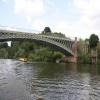
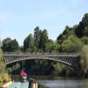
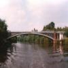
Cast iron bridge with gothic approach arches, built by Thomas Telford.
Mythe Bridge, Bushley GL20 6AA, United Kingdom (A438)
 
Information about the place
Mythe Bridge is a minor waterways place on the River Severn (main river - Worcester to Gloucester) between Kempsey (12 miles and 4 furlongs to the northwest) and Tewkesbury Junction (Junction of Rivers Severn and Avon) (3 furlongs to the south).
 
It is part of Tewkesbury.
 
The nearest place in the direction of Kempsey is Ripple Quarry Wharf (Gravel loading wharf for Ripple Quarry); 2 miles and 3 furlongs away.

There may be access to the towpath here.

Mooring here is unrated.

There is a bridge here which takes a major road over the canal.

Cable Bridge (Upton upon Severn)4 miles, ¾ furlongs
Saxon's Lode3 miles, 7¼ furlongs
Barley House3 miles, 1¼ furlongs
M50 Motorway Bridge2 miles, 3½ furlongs
Ripple Quarry Wharf2 miles, 3 furlongs
Mythe Bridge
Tewkesbury Junction3 furlongs
Upper Lode Lock Weir Entrance6½ furlongs
Upper Lode Lock No 57¼ furlongs
Cork's Hill Arm1 mile
Upper Lode Lock Weir Exit1 mile, 1¼ furlongs
 
 
Amenities

Amenities in Tewkesbury

 Costcutter
 Morison's
 Morrisons
 Gupshill Manor
 Hungry Horse
 Wheatpieces
 Gulf
 Ledbury Motors
 Morrisons Fuel

Amenities at other places in Tewkesbury

 M&S Simply Food at Back of Avon Footbridge
 Somerfield - Tewkesbury - Store# 3151 at Great Greyhounds Bridge
 Bell Hotel at Abbey Mill Tewkesbury
 Berkeley Arms at Back of Avon Footbridge
 Inferno Firepit Bar and Venue at King John's Bridge
 Nottingham Arms at Back of Avon Footbridge
 Olde Black Bear at King John's Bridge
 Royal Hop Pole at Mill Avon
 David Dudley at Back of Avon Footbridge
 W H Smith at Back of Avon Footbridge
 Fish & Chips at Great Greyhounds Bridge
 Cashpoint at Back of Avon Footbridge
 Cashpoint at Back of Avon Footbridge
 Cashpoint at Back of Avon Footbridge
 Cashpoint at Back of Avon Footbridge
 Lloyds Bank at Back of Avon Footbridge
 Mill Avon Holiday Park at Abbey Mill Tewkesbury
 Tewkesbury Marina Ltd at Tewkesbury Marina Entrance No 1
 Warners Retail Ltd T/A at Tewkesbury Marina Entrance No 1
 Travis Perkins at Tewkesbury Marina Bridge
 
Maps
If you are a user and are logged on, or if you are actively planning a route, a map will be displayed here.
Show on external mapping site: Google | OSM | Bing
 
Photos
 
External websites
 Visit the Mythe Bridge and discover its history - Industrial Tour — associated with this page
Find out the best way to visit the Mythe Bridge, how long it takes to see, how to get there, and details on its history and architecture.
 
Nearest facilities

Mouseover for more information or show routes to facility

Nearest water point

In the direction of Gloucester / Sharpness - Severn Junction

Upper Lode Lock No 57¼ furlongs away
On this waterway in the direction of Gloucester / Sharpness - Severn Junction
Tewkesbury Services5 furlongs and 1 lock away
Travel to Tewkesbury Junction, then on the River Avon - Warwickshire (Lower Avon Navigation) to Tewkesbury Services
Tewkesbury Lower Lode1 mile, 5½ furlongs and 1 lock away
On this waterway in the direction of Gloucester / Sharpness - Severn Junction
Bredon4 miles, ¾ furlongs and 1 lock away
Travel to Tewkesbury Junction, then on the River Avon - Warwickshire (Lower Avon Navigation) to Bredon
Strensham Lock6 miles, 1 furlong and 1 lock away
Travel to Tewkesbury Junction, then on the River Avon - Warwickshire (Lower Avon Navigation) to Strensham Lock
Gloucester Dock Lock13 miles, 3¼ furlongs and 1 lock away
Travel to Gloucester / Sharpness - Severn Junction, then on the Gloucester and Sharpness Canal to Gloucester Dock Lock
Gloucester Waterways Museum Arm13 miles, 4¼ furlongs and 2 locks away
Travel to Gloucester / Sharpness - Severn Junction, then on the Gloucester and Sharpness Canal to Gloucester Waterways Museum Arm
Llanthony Road Bridge13 miles, 4¾ furlongs and 2 locks away
Travel to Gloucester / Sharpness - Severn Junction, then on the Gloucester and Sharpness Canal to Llanthony Road Bridge
Llanthony Pontoons13 miles, 5½ furlongs and 2 locks away
Travel to Gloucester / Sharpness - Severn Junction, then on the Gloucester and Sharpness Canal to Llanthony Pontoons
Pershore Recreation Ground14 miles, 5 furlongs and 4 locks away
Travel to Tewkesbury Junction, then on the River Avon - Warwickshire (Lower Avon Navigation) to Pershore Recreation Ground
Sellars Bridge17 miles, 3½ furlongs and 2 locks away
Travel to Gloucester / Sharpness - Severn Junction, then on the Gloucester and Sharpness Canal to Sellars Bridge

In the direction of Diglis Junction

Diglis Locks15 miles, 2½ furlongs away
On this waterway in the direction of Diglis Junction
Worcester Trip Boat Moorings16 miles, 3 furlongs and 1 lock away
Travel to Diglis Junction, then on the River Severn (main river - Stourport to Worcester) to Worcester Trip Boat Moorings
Diglis Services15 miles, 6½ furlongs and 3 locks away
Travel to Diglis Junction, then on the Worcester and Birmingham Canal (Diglis Junction to Diglis Basin) to Diglis Basin, then on the Worcester and Birmingham Canal (Diglis Basin to King's Norton Junction) to Diglis Services
Lowesmoor Basin16 miles, 6¼ furlongs and 5 locks away
Travel to Diglis Junction, then on the Worcester and Birmingham Canal (Diglis Junction to Diglis Basin) to Diglis Basin, then on the Worcester and Birmingham Canal (Diglis Basin to King's Norton Junction) to Lowesmoor Basin

Nearest rubbish disposal

In the direction of Gloucester / Sharpness - Severn Junction

Tewkesbury Services5 furlongs and 1 lock away
Travel to Tewkesbury Junction, then on the River Avon - Warwickshire (Lower Avon Navigation) to Tewkesbury Services
Llanthony Road Bridge13 miles, 4¾ furlongs and 2 locks away
Travel to Gloucester / Sharpness - Severn Junction, then on the Gloucester and Sharpness Canal to Llanthony Road Bridge
Pershore Bridge Moorings13 miles, 7¾ furlongs and 3 locks away
Travel to Tewkesbury Junction, then on the River Avon - Warwickshire (Lower Avon Navigation) to Pershore Bridge Moorings
Pershore New Bridge14 miles and 3 locks away
Travel to Tewkesbury Junction, then on the River Avon - Warwickshire (Lower Avon Navigation) to Pershore New Bridge
Pershore Recreation Ground14 miles, 5 furlongs and 4 locks away
Travel to Tewkesbury Junction, then on the River Avon - Warwickshire (Lower Avon Navigation) to Pershore Recreation Ground
Sellars Bridge17 miles, 3½ furlongs and 2 locks away
Travel to Gloucester / Sharpness - Severn Junction, then on the Gloucester and Sharpness Canal to Sellars Bridge
Parkend Bridge19 miles, 4¾ furlongs and 2 locks away
Travel to Gloucester / Sharpness - Severn Junction, then on the Gloucester and Sharpness Canal to Parkend Bridge

In the direction of Diglis Junction

Sabrina Footbridge16 miles, 4¾ furlongs and 1 lock away
Travel to Diglis Junction, then on the River Severn (main river - Stourport to Worcester) to Sabrina Footbridge
Diglis Basin15 miles, 6 furlongs and 3 locks away
Travel to Diglis Junction, then on the Worcester and Birmingham Canal (Diglis Junction to Diglis Basin) to Diglis Basin
Lowesmoor Basin16 miles, 6¼ furlongs and 5 locks away
Travel to Diglis Junction, then on the Worcester and Birmingham Canal (Diglis Junction to Diglis Basin) to Diglis Basin, then on the Worcester and Birmingham Canal (Diglis Basin to King's Norton Junction) to Lowesmoor Basin

Nearest place to turn

In the direction of Gloucester / Sharpness - Severn Junction

Upper Lode Lock Weir Entrance6½ furlongs away
On this waterway in the direction of Gloucester / Sharpness - Severn Junction
Avon Lock Junction4¾ furlongs and 1 lock away
Travel to Tewkesbury Junction, then on the River Avon - Warwickshire (Lower Avon Navigation) to Avon Lock Junction
Abbey Mill Tewkesbury5¾ furlongs and 1 lock away
Travel to Tewkesbury Junction, then on the River Avon - Warwickshire (Lower Avon Navigation) to Avon Lock Junction, then on the River Avon - Warwickshire (Mill Avon) to Abbey Mill Tewkesbury
Tewkesbury Marina Entrance No 21 mile, ¾ furlongs and 1 lock away
Travel to Tewkesbury Junction, then on the River Avon - Warwickshire (Lower Avon Navigation) to Tewkesbury Marina Entrance No 2
Upper Lode Lock Weir Exit1 mile, 1¼ furlongs and 1 lock away
On this waterway in the direction of Gloucester / Sharpness - Severn Junction
Nafford Lock Weir Exit No 29 miles, 3½ furlongs and 2 locks away
Travel to Tewkesbury Junction, then on the River Avon - Warwickshire (Lower Avon Navigation) to Nafford Lock Weir Exit No 2
Upper Parting Junction10 miles, 6¼ furlongs and 1 lock away
On this waterway in the direction of Gloucester / Sharpness - Severn Junction
Nafford Lock Weir Entrance No 19 miles, 4½ furlongs and 3 locks away
Travel to Tewkesbury Junction, then on the River Avon - Warwickshire (Lower Avon Navigation) to Nafford Lock Weir Entrance No 1
Gloucester / Sharpness - Severn Junction13 miles, 3 furlongs and 1 lock away
On this waterway in the direction of Gloucester / Sharpness - Severn Junction Travel to Gloucester / Sharpness - Severn Junction, then on the Gloucester and Sharpness Canal to Waterways Office (South Wales and Severn Waterways) - Canal & River Trust
Over Winding Hole12 miles, 4½ furlongs and 3 locks away
Travel to Upper Parting Junction, then on the River Severn (Maisemore Channel - Northern Section) to Over Junction, then on the Hereford and Gloucester Canal to Over Winding Hole
Gloucester Docks13 miles, 4 furlongs and 2 locks away
Travel to Gloucester / Sharpness - Severn Junction, then on the Gloucester and Sharpness Canal to Gloucester Docks
Monk Meadow Dock13 miles, 7¾ furlongs and 2 locks away
Travel to Gloucester / Sharpness - Severn Junction, then on the Gloucester and Sharpness Canal to Monk Meadow Dock
Pershore Lock Weir Exit No 114 miles, 2 furlongs and 3 locks away
Travel to Tewkesbury Junction, then on the River Avon - Warwickshire (Lower Avon Navigation) to Pershore Lock Weir Exit No 1
Pershore Lock Weir Entrance No 214 miles, 3 furlongs and 4 locks away
Travel to Tewkesbury Junction, then on the River Avon - Warwickshire (Lower Avon Navigation) to Pershore Lock Weir Entrance No 2
Quedgeley Oil Depot17 miles, 2 furlongs and 2 locks away
Travel to Gloucester / Sharpness - Severn Junction, then on the Gloucester and Sharpness Canal to Quedgeley Oil Depot
Wyre Lock Weir Entrance15 miles, 3½ furlongs and 5 locks away
Travel to Tewkesbury Junction, then on the River Avon - Warwickshire (Lower Avon Navigation) to Wyre Lock Weir Entrance

In the direction of Diglis Junction

Severn - Teme Junction14 miles, 3¾ furlongs away
On this waterway in the direction of Diglis Junction
Diglis Locks Weir Exit15 miles, 1¾ furlongs away
On this waterway in the direction of Diglis Junction
Diglis Junction15 miles, 5 furlongs and 1 lock away
On this waterway in the direction of Diglis Junction

Nearest self-operated pump-out

Direction of TV transmitter (From Wolfbane Cybernetic)
 
 
Geograph
 
Wikipedia

Wikipedia has a page about Mythe Bridge

Mythe Bridge carries the A438 road across the River Severn at Tewkesbury. It is a cast-iron arch bridge spanning 170 feet (52 m) and 24 feet (7.3m) wide, designed by Thomas Telford and completed in April 1826. It is a Grade II* listed structure.

Telford was appointed to design the bridge in 1823, following a dispute between the bridge trustees and their existing architect, who had proposed a bridge with three shorter iron arches. Telford changed the scheme to a single span so as to reduce interference with navigation of the river, and also to eliminate the expense of constructing foundations in the river gravels.

Like Telford's Craigellachie Bridge, Mythe Bridge was cast by William Hazledine, and is similar in form to Telford's Galton Bridge, which spans the Birmingham Canal at Smethwick. It has six cast iron ribs, each cast in 23-foot (7m) lengths, with spandrels filled with X-shaped bracing. Telford described the iron as "best Shropshire iron, commonly called No. 2"'. The arch rises 17 feet (5.2m), one tenth of the span. The X-bracing carries the diagonal crossed bracing to the spandrels beneath the beam, as well as to the carriageway and balustrade. The abutments at either end of the bridge houses a group of six tunnel vaults with pointed arches and stone quoins. These are separated by the attached colonnettes. Hugh McIntosh was contractor for the embankment and abutments.

The total cost of the bridge including masonry approaches was £14,500, It was originally a toll bridge, but tolls were removed in 1850. An Ordnance Survey map of 1884 shows a toll booth at either end of the bridge.

Telford wrote:

I reckon this the most handsomest bridge which has been built under my direction ...

The bridge was designated a Grade II* listed building on 4 March 1952, the reason for listing it being that it is of "technological interest as a bridge of iron construction with a 52m span designed in the early 1820s, part of the first generation of this technologically significant type of bridge" and because of its "engineering interest as a significant bridge built by Thomas Telford." Historic England has placed the bridge on the Heritage at Risk register.

In 1923, the decking was strengthened by adding a reinforced concrete slab. In 1990, tests showed the bridge was too weak for many heavy goods vehicles, and traffic was limited to a 7.5 ton maximum. This was increased to 17 tons after the bridge had been strengthened in 1992. The secondary members needed strengthening and this was effected by enhancing the shear strength of the transverse cross beams by bonding steel plates to the web of the cross beams. The longitudinal cross-bracing was strengthened by using angle splints and the space between the splints and the cross-bracing was grouted. Additional transverse bracing was supplied by reinforcing the central spine of the arch, with one end bolted to steel sleeves, and the other end bolted to the cross beams at the top of the arch.

Other Wikipedia pages that might relate to Mythe Bridge
[Mythe Chapel] The Mythe Chapel is located at Tewkesbury on the Mythe (off the A38 overlooking Mythe Bridge, between Severn Trent Water and the Tewkesbury Garden Centre) [River Severn] 1940, the only bridge to cross between Worcester and Tewkesbury Queenshill Viaduct – carries the M50 between Junction 1 and 2 Mythe Bridge – designed by [Bonar Bridge] prototype for several other Telford bridges, including Craigellachie Bridge, Mythe Bridge and Holt Fleet Bridge. The bridges all employed diamond-shaped bracing [Thomas Telford] 1834) was a Scottish civil engineer, architect and stonemason, and road, bridge and canal builder. After establishing himself as an engineer of road and [Tewkesbury] impressive Mythe Bridge over the River Severn, a cast-iron structure with a 170 feet (52 m) span, opened in 1826. Tewkesbury's other notable bridge is the [List of bridges in the United Kingdom] Bridges in the United Kingdom is a link page for any road bridges or footbridges in the United Kingdom. Railway bridges are listed under: List of railway [William Hazledine] Craigellachie Bridge, Scotland (1812–1814) Menai Suspension Bridge (1819–1826) Mythe Bridge, Tewkesbury (1823–1826) Aldford Iron Bridge, Eaton Hall, Cheshire [Llandinam Bridge] cruciform and circular cross-members and is similar in design to the Mythe Bridge in Tewkesbury, Gloucestershire. Its surface is flat and falls towards [St George's Bridge] 2°45′24″W / 52.71028°N 2.75667°W / 52.71028; -2.75667 St George's Bridge was a bridge over the River Severn in Shrewsbury, England; so named as it was
 
Google

Results of Google Search

Mythe Bridge - Wikipedia
Mythe Bridge carries the A438 road across the River Severn at Tewkesbury. It is a cast-iron arch bridge spanning 170 feet (52 m) and 24 feet (7.3m) wide, ...
River level information for River Severn at Mythe Bridge - GOV.UK
River level River Severn at Mythe Bridge. Latest recorded level 0.93m at 11: 30pm Friday 8 January 2021. Levels: last 5 days and next 36 hours. Now ▽. Mon  ...
River Severn at Mythe Bridge :: the UK River Levels Website
Current River Level: 0.903m, falling · Monitoring Station: Mythe Bridge · Watercourse: River Severn · Nearest Town/Village: Tewkesbury · Local Authority:  ...
Mythe Bridge Tewkesbury Old Stone Arches R ... - Amazon.com
Buy Mythe Bridge Tewkesbury Old Stone Arches R. Severn 1830 old aquatint U.K. print: Historical & Political - Amazon.com ✓ FREE DELIVERY possible on ...
Design and performance of Thomas Telford's Bonar Bridge and ...
This paper assesses two cast-iron arch bridges of Thomas Telford (1757-1834) - Bonar Bridge (1810-12) and Mythe Bridge (1824-26) - to draw a broader ...
Mythe Bridge - HistoricBridges.org
HISTORY: The Mythe Bridge was built in 1823-6 by Thomas Telford with the main iron casting by William Hazeldine, the celebrated Shrewsbury ironmaster.
This former toll house is located next to Thomas Telford's Mythe Bridge
Aug 1, 2017 ... The Toll House - lodge - Mythe Bridge - Savills. Savills. The Toll House is a Grade II listed property that has had a number of uses throughout ...
Hi-def webcam at Mythe Bridge LVL - Farson Digital Watercams
Hi-def webcam at Mythe Bridge LVL. With regular river reports from the area, and an extensive archive of images from the past days, months and even years, this ...
Category:Mythe Bridge - Wikimedia Commons
Feb 17, 2020 ... Media in category "Mythe Bridge". The following 11 files are in this category, out of 11 total. Arch in Mythe Bridge - geograph.org.uk ...
Mythe Bridge (Tewkesbury, 1826) | Structurae
Mythe Bridge is a road bridge, deck arch bridge and iron bridge that was completed in 1826. The project is located in Tewkesbury, Gloucestershire, South West ...