CanalPlanAC

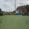
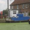
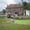
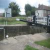
Selby Basin

 
The Waterfront, Selby YO8 8FE, United Kingdom
 
Information about the place
Selby Basin is a place on the waterways on the Aire and Calder Navigation (Selby Section) between Paper House Bridge (4 miles to the southwest) and Selby Junction (River Ouse) (Junction of Selby Canal and River Ouse (Yorkshire)) (4 furlongs and 1 lock to the northeast).
 
 
The nearest place in the direction of Paper House Bridge is Selby Swing Bridge; ¾ furlongs away.
 
The nearest place in the direction of Selby Junction (River Ouse) is Selby Junction Lock; 2 furlongs away.

Mooring here is good (a nice place to moor). Moor on the left, the right is permanent only. Some other good moorings before the bridge, but beware traffic noise.

Facilities: chemical toilet disposal, rubbish disposal, showers, toilets and water point.

You can wind here.

Brayton Bridge1 mile, 1¾ furlongs
Brayton Railway Bridge7¼ furlongs
Bawtry Road Bridge3 furlongs
Selby Narrows1 furlong
Selby Swing Bridge¾ furlongs
Selby Basin
Selby Junction Lock2 furlongs
Selby Junction (River Ouse)4 furlongs
 
 
Amenities

Amenities here

 Nelson Inn
 
Maps
If you are a user and are logged on, or if you are actively planning a route, a map will be displayed here.
Show on external mapping site: Google | OSM | Bing
 
Additional information

Nice safe place to stay with the main Town of Selby 10 minutes walk. Lovely Abbey to visit, with market day on Mondays, so quite a busy town. Train and Bus station in Selby with buses / trains to York etc.
You need to book in to go through the lock with the lock keeper as the river up to York is tidal. It is different times each day so phone first to find out times.
Quite a lot of weed in the Canal from Tankards Bridge up to Selby so slows you down.
A local shop and Chinese take a way just over swing bridge.

 
Photos
 
External websites
There are no links to external websites from here.
Why not log in and add some (select "External websites" from the menu (sometimes this is under "Edit"))?
 
Nearest facilities

Mouseover for more information or show routes to facility

Nearest water point

The nearest water point is here. Others are at:

In the direction of Selby Junction (River Ouse)

Naburn Lock14 miles and 1 lock away
Travel to Selby Junction (River Ouse), then on the River Ouse : Yorkshire (tidal section - Naburn to Goole) to Naburn Lock
Goole Marina17 miles, 1 furlong and 2 locks away
Travel to Selby Junction (River Ouse), then on the River Ouse : Yorkshire (tidal section - Naburn to Goole) to Ouse - Aire and Calder Junction, then on the Aire and Calder Navigation (Main Line - Goole to Castleford) to Goole Marina
Dutch Riverside17 miles, 2½ furlongs and 2 locks away
Travel to Selby Junction (River Ouse), then on the River Ouse : Yorkshire (tidal section - Naburn to Goole) to Ouse - Aire and Calder Junction, then on the Aire and Calder Navigation (Main Line - Goole to Castleford) to Dutch Riverside
Skeldergate Bridge19 miles, 4¼ furlongs and 2 locks away
Travel to Selby Junction (River Ouse), then on the River Ouse : Yorkshire (tidal section - Naburn to Goole) to Naburn Lock, then on the River Ouse : Yorkshire (non-tidal section) to Skeldergate Bridge

In the direction of Bank Dole Junction

Beal Lock No 28 miles, 4¾ furlongs and 1 lock away
On this waterway in the direction of Bank Dole Junction
Beal Bridge8 miles, 6 furlongs and 2 locks away
On this waterway in the direction of Bank Dole Junction
Bank Dole Lock No 111 miles, ½ furlongs and 2 locks away
On this waterway in the direction of Bank Dole Junction
Ferrybridge Flood Lock No 1112 miles, 6¾ furlongs and 3 locks away
Travel to Bank Dole Junction, then on the Aire and Calder Navigation (Main Line - Goole to Castleford) to Ferrybridge Flood Lock No 11
Ferrybridge Flood Lock Footbridge12 miles, 7¼ furlongs and 4 locks away
Travel to Bank Dole Junction, then on the Aire and Calder Navigation (Main Line - Goole to Castleford) to Ferrybridge Flood Lock Footbridge
Whitley Lock No 1215 miles, 1¾ furlongs and 3 locks away
Travel to Bank Dole Junction, then on the Aire and Calder Navigation (Main Line - Goole to Castleford) to Whitley Lock No 12
Bulholme Lock No 1017 miles, 4¾ furlongs and 4 locks away
Travel to Bank Dole Junction, then on the Aire and Calder Navigation (Main Line - Goole to Castleford) to Bulholme Lock No 10
Castleford Sanitary Station18 miles, 1½ furlongs and 5 locks away
Travel to Bank Dole Junction, then on the Aire and Calder Navigation (Main Line - Goole to Castleford) to Castleford Sanitary Station
Pollington Manor Swing Bridge19 miles and 5 locks away
Travel to Bank Dole Junction, then on the Aire and Calder Navigation (Main Line - Goole to Castleford) to Pollington Manor Swing Bridge
Pollington Visitor Mooring19 miles, ¼ furlongs and 5 locks away
Travel to Bank Dole Junction, then on the Aire and Calder Navigation (Main Line - Goole to Castleford) to Pollington Visitor Mooring

Nearest place to turn

In the direction of Selby Junction (River Ouse)

Naburn Lock Winding Hole14 miles, ¾ furlongs and 2 locks away
Travel to Selby Junction (River Ouse), then on the River Ouse : Yorkshire (tidal section - Naburn to Goole) to Naburn Lock, then on the River Ouse : Yorkshire (non-tidal section) to Naburn Lock Winding Hole
Naburn Lock Weir Entrance14 miles, 2¼ furlongs and 2 locks away
Travel to Selby Junction (River Ouse), then on the River Ouse : Yorkshire (tidal section - Naburn to Goole) to Naburn Lock, then on the River Ouse : Yorkshire (non-tidal section) to Naburn Lock Weir Entrance
Viking Marina17 miles, 1¾ furlongs and 2 locks away
Travel to Selby Junction (River Ouse), then on the River Ouse : Yorkshire (tidal section - Naburn to Goole) to Ouse - Aire and Calder Junction, then on the Aire and Calder Navigation (Main Line - Goole to Castleford) to Viking Marina
Cottingwith Junction18 miles, 4 furlongs and 2 locks away
Travel to Selby Junction (River Ouse), then on the River Ouse : Yorkshire (tidal section - Naburn to Goole) to Ouse - Derwent Junction, then on the River Derwent to Cottingwith Junction
Rowntree Wharf Arm19 miles, 7 furlongs and 3 locks away
Travel to Selby Junction (River Ouse), then on the River Ouse : Yorkshire (tidal section - Naburn to Goole) to Naburn Lock, then on the River Ouse : Yorkshire (non-tidal section) to Ouse - Foss Junction, then on the River Foss to Rowntree Wharf Arm

In the direction of Bank Dole Junction

Haddlesey Junction4 miles, 6½ furlongs and 1 lock away
On this waterway in the direction of Bank Dole Junction
Beal Lock No 2 Weir Entrance8 miles, 5¾ furlongs and 2 locks away
On this waterway in the direction of Bank Dole Junction
Bank Dole Lock Junction11 miles, ¼ furlongs and 2 locks away
On this waterway in the direction of Bank Dole Junction
Bulholme Lock Weir Exit17 miles, 4¼ furlongs and 4 locks away
Travel to Bank Dole Junction, then on the Aire and Calder Navigation (Main Line - Goole to Castleford) to Bulholme Lock Weir Exit

Nearest self-operated pump-out

Direction of TV transmitter (From Wolfbane Cybernetic)
 
 
Geograph
 
Wikipedia

There is no page on Wikipedia called “Selby Basin”

Wikipedia pages that might relate to Selby Basin
[Powder River Basin] Power Station, Selby, United Kingdom. Trials are ongoing with a UK sourced Bituminous Coal, blended to increase CV. The Powder River Basin also contains [Water politics in the Nile Basin] Ethiopia, South Sudan, Sudan and Egypt with varying climates. Considering the basin area of the Nile, Sudan has the largest size (1.9 million km²) whereas, [Selby Lake] catchment basins by the city of Dunham in collaboration with the Association pour la protection de l’environnement du lac Selby (APELS). In 2007, Selby Lake [River Ouse, Yorkshire] rainfall higher in the river's drainage basin can bring severe flooding to settlements. In recent years York, Selby, and villages in between have been flooded [Selby Canal] The Selby Canal is a 6-mile (9.7 km) canal with 2 locks which bypasses the lower reaches of the River Aire in Yorkshire, England, from the village of [United States] Lexington Books. p. 125. ISBN 978-0-7391-6247-7. James E. Seelye Jr.; Shawn Selby (2018). Shaping North America: From Exploration to the American Revolution [Red Hook, Brooklyn] Hook was the setting for the 1964 novel Last Exit to Brooklyn by Hubert Selby Jr. and the 1989 film of the same name. Red Hook appears in Bill Murray's [List of district attorneys by county] Genevieve Wayne Williams (D) Stoddard Russell D. Oliver (R) Stone Matt Selby (R) Sullivan Brian Keedy (R) Taney William Duston (R) Texas Parke Stevens [Melodisc Records] [Mel151/Mel152] 1178 Eddie Calvert, His Trumpet and His Orchestra (from Selby's Restaurant) "With a Song in My Heart " / "Kiss Me Again" (Mel164/Mel165) [List of Latin phrases (full)] many, they condemn what they do not understand. (translated by Rev. John Selby Watson) damnatio ad bestias condemnation to [the] beasts Colloquially, "thrown
 
Google

Results of Google Search

Selby Bay Yacht Club: Home
Selby Bay Yacht Club Basin at Sunset. Selby Bay Yacht Club is an active, yet relaxed boating club, with a 72-slip marina in a gorgeous setting 10 miles south of ...
Selby Bay Marina: Home
What we offer. Having experience with clients from around the globe, at Selby Bay Marina we will work with you make sure your everyday on the bay, is a breeze ...
No CapX 2020 » Selby NextGen – why we need CapX!
Feb 15, 2008 ... Basin Electric hopes to have its so-called NextGen plant operational by ... Phylliss Pudwill of Selby is a Campbell County commissioner and a ...
Selby Bay Yacht Basin, Maryland Latitude/Longitude
Latitude longitude of Selby Bay Yacht Basin in Anne Arundel County, Maryland along with maps, comments, photos and links.
Selby Canal (3) - Selby Basin
The fires station and various industrial and commercial units line Canal Road as it runs alongside the canal on the approach to Selby Basin. Selby Swing Bridge ...
Selby Bay Marina - Home | Facebook
Founded in 2008, Selby Bay Marina's team is made up of both talent and expertise. ... You were redirected here from the unofficial Page: Selby Bay Yacht Basin.
Selby Bay Yacht Basin Topo Map, Anne Arundel County MD (South ...
See the FREE topo map of Selby Bay Yacht Basin a Harbor in Anne Arundel County Maryland on the South River USGS quad map.
1 1. Species: Great Basin Silverspot Butterfly (Speyeria nokomis ...
Colorado, New Mexico, and Utah (Selby 2007). The Great Basin silverspot is known to occur on or near the Grand Mesa/Uncompahgre/. Gunnison, San Juan  ...
930 Selby Blvd., Edgewater, MD | Selby Yacht Basin | Capital Gazette
Find bars, restaurants and things to do near 930 Selby Blvd., the Edgewater location of Selby Yacht Basin on Capital Gazette Capital Gazette.
Prof. D Selby - Durham University
Feb 18, 2020 ... ... C.A., Selby, D. & Korn, D. (2013). Minor and Trace Element and Re-Os Chemistry of the Upper Devonian Woodford Shale, Permian Basin, ...