CanalPlanAC

Bottoms Bridge No 91

 
Waggon Road, Tameside OL5 9NS, United Kingdom
 
Information about the place
Bottoms Bridge No 91 is a minor waterways place on the Huddersfield Narrow Canal between Ashton-under-Lyne Junction (Junction of Ashton and Huddersfield Narrow Canals) (6 miles and 1¾ furlongs and 12 locks to the southwest) and Royal George Aqueduct (1 mile and 4½ furlongs and 5 locks to the northeast).
 
 
The nearest place in the direction of Ashton-under-Lyne Junction is Mossley Bottoms Winding Hole; ¼ furlongs away.
 
The nearest place in the direction of Royal George Aqueduct is Micklehurst Aqueduct; a few yards away.

There may be access to the towpath here.

Mooring here is unrated.

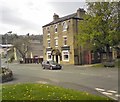
There is a bridge here which takes a minor road over the canal.


Amenities

Amenities nearby at Mossley Bottoms Winding Hole

 Britannia Inn
 Commercial
 Fish & Chips
 Fish & Chips
 Mr & Mrs Jackson T/A
 Mossley Station
 
Maps
If you are a user and are logged on, or if you are actively planning a route, a map will be displayed here.
Show on external mapping site: Google | OSM | Bing
 
Photos
 
External websites
There are no links to external websites from here.
Why not log in and add some (select "External websites" from the menu (sometimes this is under "Edit"))?
 
Nearest facilities

Mouseover for more information or show routes to facility

Nearest water point

In the direction of Ashton-under-Lyne Junction

Grove Road Bridge No 961 mile, 5¾ furlongs and 4 locks away
On this waterway in the direction of Ashton-under-Lyne Junction
Fairfield Junction9 miles, 1¾ furlongs and 12 locks away
Travel to Ashton-under-Lyne Junction, then on the Ashton Canal (Main Line) to Fairfield Junction
Marple Services14 miles, 7¼ furlongs and 28 locks away
Travel to Ashton-under-Lyne Junction, then on the Ashton Canal (Main Line) to Dukinfield Junction, then on the Peak Forest Canal (Lower) to Marple Junction, then on the Macclesfield Canal to Marple Services
New Islington Marina13 miles, 4¼ furlongs and 32 locks away
Travel to Ashton-under-Lyne Junction, then on the Ashton Canal (Main Line) to Ducie Street Junction, then on the Rochdale Canal to New Islington Marina Entrance, then on the Rochdale Canal (Main Line) to Cotton Field Wharf Marina, then on the Rochdale Canal (New Islington Marina Arm) to New Islington Marina
Braidbar Boats18 miles, 4¾ furlongs and 28 locks away
Travel to Ashton-under-Lyne Junction, then on the Ashton Canal (Main Line) to Dukinfield Junction, then on the Peak Forest Canal (Lower) to Marple Junction, then on the Macclesfield Canal to Braidbar Boats
Furness Vale Marina19 miles, 6 furlongs and 28 locks away
Travel to Ashton-under-Lyne Junction, then on the Ashton Canal (Main Line) to Dukinfield Junction, then on the Peak Forest Canal (Lower) to Marple Junction, then on the Peak Forest Canal (Upper) to Furness Vale Marina
Staffordshire, Kenworthy and other Arms14 miles, 2¼ furlongs and 39 locks away
Travel to Ashton-under-Lyne Junction, then on the Ashton Canal (Main Line) to Ducie Street Junction, then on the Rochdale Canal to Castlefield Junction, then on the Bridgewater Canal (Main Line) to Staffordshire, Kenworthy and other Arms
Potato Wharf Arm & The New Basin14 miles, 2¾ furlongs and 39 locks away
Travel to Ashton-under-Lyne Junction, then on the Ashton Canal (Main Line) to Ducie Street Junction, then on the Rochdale Canal to Castlefield Junction, then on the Bridgewater Canal (Main Line) to Potato Wharf Arm & The New Basin
Stretford Marina17 miles, 2¼ furlongs and 39 locks away
Travel to Ashton-under-Lyne Junction, then on the Ashton Canal (Main Line) to Ducie Street Junction, then on the Rochdale Canal to Castlefield Junction, then on the Bridgewater Canal (Main Line) to Stretford Marina
Watch House Cruising Club18 miles, 2½ furlongs and 39 locks away
Travel to Ashton-under-Lyne Junction, then on the Ashton Canal (Main Line) to Ducie Street Junction, then on the Rochdale Canal to Castlefield Junction, then on the Bridgewater Canal (Main Line) to Watch House Cruising Club

In the direction of Aspley Basin (Huddersfield)

Wool Road Bridge No 704 miles, 2½ furlongs and 11 locks away
On this waterway in the direction of Aspley Basin (Huddersfield)
Standedge Tunnel (western entrance)6 miles, 2¼ furlongs and 20 locks away
On this waterway in the direction of Aspley Basin (Huddersfield)
Standedge Tunnel (eastern entrance)9 miles, 4¼ furlongs and 20 locks away
On this waterway in the direction of Aspley Basin (Huddersfield)
Slaithwaite Winding Hole12 miles, 7 furlongs and 41 locks away
On this waterway in the direction of Aspley Basin (Huddersfield)
Waterside Lock No 21E12 miles, 7¾ furlongs and 41 locks away
On this waterway in the direction of Aspley Basin (Huddersfield)
Aspley Basin (Huddersfield)17 miles, 5¼ furlongs and 62 locks away
On this waterway in the direction of Aspley Basin (Huddersfield)

Nearest rubbish disposal

In the direction of Ashton-under-Lyne Junction

Marple Bottom Lock Bridge Winding Hole13 miles, 6 furlongs and 12 locks away
Travel to Ashton-under-Lyne Junction, then on the Ashton Canal (Main Line) to Dukinfield Junction, then on the Peak Forest Canal (Lower) to Marple Bottom Lock Bridge Winding Hole
Marple Services14 miles, 7¼ furlongs and 28 locks away
Travel to Ashton-under-Lyne Junction, then on the Ashton Canal (Main Line) to Dukinfield Junction, then on the Peak Forest Canal (Lower) to Marple Junction, then on the Macclesfield Canal to Marple Services
Braidbar Boats18 miles, 4¾ furlongs and 28 locks away
Travel to Ashton-under-Lyne Junction, then on the Ashton Canal (Main Line) to Dukinfield Junction, then on the Peak Forest Canal (Lower) to Marple Junction, then on the Macclesfield Canal to Braidbar Boats

In the direction of Aspley Basin (Huddersfield)

Wool Road Visitor Mooring4 miles, 2 furlongs and 11 locks away
On this waterway in the direction of Aspley Basin (Huddersfield)
Pickle Lock No 22E12 miles, 6½ furlongs and 40 locks away
On this waterway in the direction of Aspley Basin (Huddersfield)
Aspley Basin (Huddersfield)17 miles, 5¼ furlongs and 62 locks away
On this waterway in the direction of Aspley Basin (Huddersfield)

Nearest chemical toilet disposal

In the direction of Ashton-under-Lyne Junction

Grove Road Bridge No 961 mile, 5¾ furlongs and 4 locks away
On this waterway in the direction of Ashton-under-Lyne Junction
Fairfield Junction9 miles, 1¾ furlongs and 12 locks away
Travel to Ashton-under-Lyne Junction, then on the Ashton Canal (Main Line) to Fairfield Junction
Marple Services14 miles, 7¼ furlongs and 28 locks away
Travel to Ashton-under-Lyne Junction, then on the Ashton Canal (Main Line) to Dukinfield Junction, then on the Peak Forest Canal (Lower) to Marple Junction, then on the Macclesfield Canal to Marple Services
Furness Vale Marina19 miles, 6 furlongs and 28 locks away
Travel to Ashton-under-Lyne Junction, then on the Ashton Canal (Main Line) to Dukinfield Junction, then on the Peak Forest Canal (Lower) to Marple Junction, then on the Peak Forest Canal (Upper) to Furness Vale Marina
Watch House Cruising Club18 miles, 2½ furlongs and 39 locks away
Travel to Ashton-under-Lyne Junction, then on the Ashton Canal (Main Line) to Ducie Street Junction, then on the Rochdale Canal to Castlefield Junction, then on the Bridgewater Canal (Main Line) to Watch House Cruising Club

In the direction of Aspley Basin (Huddersfield)

Wool Road Bridge No 704 miles, 2½ furlongs and 11 locks away
On this waterway in the direction of Aspley Basin (Huddersfield)
Pickle Lock No 22E12 miles, 6½ furlongs and 40 locks away
On this waterway in the direction of Aspley Basin (Huddersfield)
Waterside Lock No 21E12 miles, 7¾ furlongs and 41 locks away
On this waterway in the direction of Aspley Basin (Huddersfield)
Aspley Basin (Huddersfield)17 miles, 5¼ furlongs and 62 locks away
On this waterway in the direction of Aspley Basin (Huddersfield)

Nearest place to turn

In the direction of Ashton-under-Lyne Junction

Mossley Bottoms Winding Hole¼ furlongs away
On this waterway in the direction of Ashton-under-Lyne Junction
Knowle Street Winding Hole4 miles, ¼ furlongs and 5 locks away
On this waterway in the direction of Ashton-under-Lyne Junction
Staley Wharf Winding Hole5 miles, 2¼ furlongs and 9 locks away
On this waterway in the direction of Ashton-under-Lyne Junction
Ashton-under-Lyne Junction6 miles, 1¾ furlongs and 12 locks away
On this waterway in the direction of Ashton-under-Lyne Junction
Dukinfield Junction6 miles, 5¾ furlongs and 12 locks away
Travel to Ashton-under-Lyne Junction, then on the Ashton Canal (Main Line) to Dukinfield Junction
Portland Basin Arm6 miles, 6¼ furlongs and 12 locks away
Travel to Ashton-under-Lyne Junction, then on the Ashton Canal (Main Line) to Dukinfield Junction, then on the Peak Forest Canal (Lower) to Portland Basin Arm
Dunkirk Farm Bridge Winding Hole8 miles, 3¼ furlongs and 12 locks away
Travel to Ashton-under-Lyne Junction, then on the Ashton Canal (Main Line) to Dukinfield Junction, then on the Peak Forest Canal (Lower) to Dunkirk Farm Bridge Winding Hole
Lumb Lane Bridge Winding Hole8 miles, 3¼ furlongs and 12 locks away
Travel to Ashton-under-Lyne Junction, then on the Ashton Canal (Main Line) to Lumb Lane Bridge Winding Hole
Canal Street Winding Hole9 miles, ¼ furlongs and 12 locks away
Travel to Ashton-under-Lyne Junction, then on the Ashton Canal (Main Line) to Dukinfield Junction, then on the Peak Forest Canal (Lower) to Canal Street Winding Hole
Fairfield Junction9 miles, 1¾ furlongs and 12 locks away
Travel to Ashton-under-Lyne Junction, then on the Ashton Canal (Main Line) to Fairfield Junction
Unity Mills Winding Hole10 miles, 4½ furlongs and 12 locks away
Travel to Ashton-under-Lyne Junction, then on the Ashton Canal (Main Line) to Dukinfield Junction, then on the Peak Forest Canal (Lower) to Unity Mills Winding Hole
Urwick Road Winding Hole12 miles, 3¾ furlongs and 12 locks away
Travel to Ashton-under-Lyne Junction, then on the Ashton Canal (Main Line) to Dukinfield Junction, then on the Peak Forest Canal (Lower) to Urwick Road Winding Hole
Marple Bottom Lock Bridge Winding Hole13 miles, 6 furlongs and 12 locks away
Travel to Ashton-under-Lyne Junction, then on the Ashton Canal (Main Line) to Dukinfield Junction, then on the Peak Forest Canal (Lower) to Marple Bottom Lock Bridge Winding Hole
Clayton Junction10 miles, 4 furlongs and 20 locks away
Travel to Ashton-under-Lyne Junction, then on the Ashton Canal (Main Line) to Clayton Junction

In the direction of Aspley Basin (Huddersfield)

Roughtown Court Winding Hole7½ furlongs and 2 locks away
On this waterway in the direction of Aspley Basin (Huddersfield)
Manns Wharf Bridge Winding Hole2 miles, 1 furlong and 7 locks away
On this waterway in the direction of Aspley Basin (Huddersfield)
Saddleworth Visitor Centre Winding Hole3 miles, 3¾ furlongs and 9 locks away
On this waterway in the direction of Aspley Basin (Huddersfield)
Wool Road Winding Hole4 miles, 1½ furlongs and 11 locks away
On this waterway in the direction of Aspley Basin (Huddersfield)
Diggle Winding Hole5 miles, 7½ furlongs and 20 locks away
On this waterway in the direction of Aspley Basin (Huddersfield)
Standedge Tunnel End Winding Hole9 miles, 5 furlongs and 20 locks away
On this waterway in the direction of Aspley Basin (Huddersfield)

Nearest self-operated pump-out

In the direction of Ashton-under-Lyne Junction

New Islington Marina13 miles, 4¼ furlongs and 32 locks away
Travel to Ashton-under-Lyne Junction, then on the Ashton Canal (Main Line) to Ducie Street Junction, then on the Rochdale Canal to New Islington Marina Entrance, then on the Rochdale Canal (Main Line) to Cotton Field Wharf Marina, then on the Rochdale Canal (New Islington Marina Arm) to New Islington Marina

In the direction of Aspley Basin (Huddersfield)

Wool Road Bridge No 704 miles, 2½ furlongs and 11 locks away
On this waterway in the direction of Aspley Basin (Huddersfield)
Slaithwaite Winding Hole12 miles, 7 furlongs and 41 locks away
On this waterway in the direction of Aspley Basin (Huddersfield)

Nearest boatyard pump-out

In the direction of Ashton-under-Lyne Junction

Portland Basin Arm6 miles, 6¼ furlongs and 12 locks away
Travel to Ashton-under-Lyne Junction, then on the Ashton Canal (Main Line) to Dukinfield Junction, then on the Peak Forest Canal (Lower) to Portland Basin Arm
Braidbar Boats18 miles, 4¾ furlongs and 28 locks away
Travel to Ashton-under-Lyne Junction, then on the Ashton Canal (Main Line) to Dukinfield Junction, then on the Peak Forest Canal (Lower) to Marple Junction, then on the Macclesfield Canal to Braidbar Boats
New Mills Marina18 miles, 7 furlongs and 28 locks away
Travel to Ashton-under-Lyne Junction, then on the Ashton Canal (Main Line) to Dukinfield Junction, then on the Peak Forest Canal (Lower) to Marple Junction, then on the Peak Forest Canal (Upper) to New Mills Marina
Stretford Marina17 miles, 2¼ furlongs and 39 locks away
Travel to Ashton-under-Lyne Junction, then on the Ashton Canal (Main Line) to Ducie Street Junction, then on the Rochdale Canal to Castlefield Junction, then on the Bridgewater Canal (Main Line) to Stretford Marina

In the direction of Aspley Basin (Huddersfield)

Aspley Basin (Huddersfield)17 miles, 5¼ furlongs and 62 locks away
On this waterway in the direction of Aspley Basin (Huddersfield)
Direction of TV transmitter (From Wolfbane Cybernetic)
 
 
Geograph
 
Wikipedia

Wikipedia has a page about Bottoms Bridge

Bottoms Bridge is a small unincorporated community in New Kent County, Virginia, United States. Located on U.S. Route 60 and State Route 33 in modern times, it was named for a crossing of the Chickahominy River between New Kent and Henrico County.


Other Wikipedia pages that might relate to Bottoms Bridge
[Bottoms Bridge, Virginia] 37°30′39″N 77°11′34″W / 37.51083°N 77.19278°W / 37.51083; -77.19278 Bottoms Bridge is a small unincorporated community in New Kent County, Virginia, United [Timothy Bottoms] Time of Crisis. Bottoms was born in Santa Barbara, California, the eldest of four sons of Betty (née Chapman) and James "Bud" Bottoms, who is a sculptor [Zhangjiajie Glass Bridge] is a skywalk bridge in Zhangjiajie, Hunan, above the Wulingyuan area. The bridge, built as an attraction for tourists, is glass-bottomed and is transparent [Meems Bottom Covered Bridge] Meems Bottom Covered Bridge (also Meem's Bottom Covered Bridge) is a covered bridge in Shenandoah County, Virginia, United States. The bridge, at 204 [Adam's Bridge] 79°31′18″E / 9.1210°N 79.5217°E / 9.1210; 79.5217 Adam's Bridge, also known as Rama's Bridge or Rama Setu, is a chain of limestone shoals, between Pamban [Grand Canyon Skywalk] The Grand Canyon Skywalk is a horseshoe-shaped cantilever bridge with a glass walkway at Eagle Point in Arizona near the Colorado River on the edge of [Big Bottom Slough Bridge] The Big Bottom Slough Bridge is a historic bridge in rural eastern Independence County, Arkansas. Now closed to traffic, it formerly carried Padgett Island [Bikini bridge] A bikini bridge is defined as "when bikini bottoms are suspended between the two hip bones, causing a space between the bikini and the lower abdomen" [East Taihang Glasswalk] the mountain cliff, at 1180 metres (3871 ft) high above sea level. The bridge gained notoriety after videos of it cracking under people's feet surfaced [Bridge] A bridge is a structure built to span a physical obstacle, such as a body of water, valley, or road, without closing the way underneath. It is constructed
 
Google

Results of Google Search

A huge relief: Virgin River Gorge bridge work complete, officials say ...
Jul 8, 2016 ... 6 project finished yesterday,” said Sgt John Bottoms, of the Arizona Department of Public Safety. ... ADOT personnel working the underside of I-15 Bridge No. ... People can still take Highway 91 between Littlefield, Arizona, and ...
Burlington Bottoms Wildlife Mitigation Site
Bielke, Susan, ''Burlington Bottoms Wildlife Mitigation Site'', Project No. 1991-078 -00, 24 electronic pages, (BPA Report DOE/BP-00004888-1). Field37:.
Traffic backed up in Virgin River Gorge, alternate route advised – St ...
Mar 20, 2016 ... Editor's Note: As of 6:34 p.m., northbound traffic is no longer backed up through the ... on Interstate 15, Arizona Department of Public Safety Sgt. John Bottoms said. ... in the Virgin River Gorge may take Highway 91 as an alternate route, ... has been completed, specifically surfaces for Virgin River Bridge No.
UPDATED: Northbound I-15 reopens in Virgin River gorge after ...
Aug 8, 2020 ... Traffic is being diverted onto Old Highway 91. Sorry, the video player failed to load.(Error Code: 100013). Sgt. John Bottoms with Arizona Department of Public Safety told St. George News ... The crash took place on Bridge no.
Interstate 15 reopens after trailer crash forces closure
Nov 6, 2019 ... Bottoms said the closure is expected for the next hour or so and is encouraging drivers to take ... Crews will resurface the decks of Bridge No.
Synthesis of Falsework, Formwork and Scaffolding for Highway ...
has not had a significant falsework-related failure or loss on any State bridge ... The AASHTO 1991 1nterim Specifications and some State specifications ... of forms, proper form surface treatment, a provision for clean-out ports at form bottoms, ...
Virginia Interstate Exits - Travel | Virginia Department of Transportation
Nov 1, 2019 ... Exit No. Intersects, Location, City/County. 1, Jerry's Run Trail, West Virginia line, Alleghany County. 7, Route 661 ... 91, Route 608, Stuarts Draft / Augusta Hospital , Augusta County ... 220, Route 33, Eltham, New Kent County.
Traffic Advisory: Traffic backing up on northbound I-15 through ...
Apr 10, 2015 ... ... on northbound I-15 for about two miles, Sgt. John Bottoms of the Arizona Department of ... ADOT is currently working on Virgin River Bridge No. ... work in the Virgin River Gorge may take Highway 91 as an alternative route.
EM 1110-2-1601
Jul 1, 1991 ... No. 1110-2-1601. 1 July 1991. Engineering and Design. HYDRAULIC DESIGN OF ... design, such as flow in curved channels, flow at bridge piers, flow at ... AND CHANNEL BOTTOMS OR SIDE SLOPES. FLATTER THAN DR ...