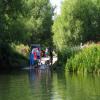
Ferry Lane Slipway (Cholsey)
is a minor waterways place
on the River Thames (below Oxford) between
Wallingford Bridge (Wallingford town centre) (2 miles and 4¾ furlongs
to the north) and
Goring Lock (Goring and Streatley villages and bridge) (3 miles and 1½ furlongs
and 1 lock
to the south).
The nearest place in the direction of Wallingford Bridge is Winterbrook Bridge;
1 mile and 6 furlongs
away.
The nearest place in the direction of Goring Lock is Moulsford Railway Bridge (Paddington to Bristol and South Wales line);
5 furlongs
away.
Mooring here is unrated.
| Benson Lock Weir Exit | 3 miles, 5½ furlongs | |
| Wallingford Moorings | 2 miles, 5 furlongs | |
| The Boat House PH (Wallingford) | 2 miles, 5 furlongs | |
| Wallingford Bridge | 2 miles, 4¾ furlongs | |
| Winterbrook Bridge | 1 mile, 6 furlongs | |
| Ferry Lane Slipway (Cholsey) | ||
| Moulsford Railway Bridge | 5 furlongs | |
| Sheridan Marine | 1 mile | |
| The Beetle and Wedge Hotel | 1 mile, 2½ furlongs | |
| South Stoke | 1 mile, 3¼ furlongs | |
| The Leatherne Bottel Restaurant | 2 miles, 2 furlongs | |
There are no links to external websites from here.
Why not log in and add some (select "External websites" from the menu (sometimes this is under "Edit"))?
Mouseover for more information or show routes to facility
Nearest water point
In the direction of Teddington Lock Weir Exit
Cleeve Lock — 2 miles, 4¾ furlongs away
On this waterway in the direction of Teddington Lock Weir Exit
Thames & Kennet Marina — 14 miles, 6¾ furlongs and 5 locks away
On this waterway in the direction of Teddington Lock Weir Exit
Shiplake Lock — 19 miles, 3¾ furlongs and 6 locks away
On this waterway in the direction of Teddington Lock Weir Exit
In the direction of Osney Bridge
Abingdon Bridge Marine — 15 miles, 4¾ furlongs and 4 locks away
On this waterway in the direction of Osney Bridge
Abingdon Lock — 16 miles, ½ furlongs and 4 locks away
On this waterway in the direction of Osney BridgeNearest rubbish disposal
In the direction of Teddington Lock Weir Exit
Goring Lock — 3 miles, 1½ furlongs and 1 lock away
On this waterway in the direction of Teddington Lock Weir Exit
Mapledurham Lock — 9 miles, 4½ furlongs and 3 locks away
On this waterway in the direction of Teddington Lock Weir Exit
Shiplake Lock — 19 miles, 3¾ furlongs and 6 locks away
On this waterway in the direction of Teddington Lock Weir Exit
In the direction of Osney Bridge
Day's Lock — 7 miles, 6½ furlongs and 1 lock away
On this waterway in the direction of Osney Bridge
Abingdon Lock — 16 miles, ½ furlongs and 4 locks away
On this waterway in the direction of Osney BridgeNearest chemical toilet disposal
In the direction of Teddington Lock Weir Exit
Mapledurham Lock — 9 miles, 4½ furlongs and 3 locks away
On this waterway in the direction of Teddington Lock Weir Exit
Thames & Kennet Marina — 14 miles, 6¾ furlongs and 5 locks away
On this waterway in the direction of Teddington Lock Weir Exit
Shiplake Lock — 19 miles, 3¾ furlongs and 6 locks away
On this waterway in the direction of Teddington Lock Weir Exit
In the direction of Osney Bridge
Day's Lock — 7 miles, 6½ furlongs and 1 lock away
On this waterway in the direction of Osney Bridge
Abingdon Lock — 16 miles, ½ furlongs and 4 locks away
On this waterway in the direction of Osney BridgeNearest place to turn
In the direction of Teddington Lock Weir Exit
Cleeve Lock Weir Entrance — 2 miles, 4 furlongs away
On this waterway in the direction of Teddington Lock Weir Exit
Cleeve Lock Weir Exit No 1 — 2 miles, 5¼ furlongs and 1 lock away
On this waterway in the direction of Teddington Lock Weir Exit
Goring Lock Weir Entrance — 3 miles, 1 furlong and 1 lock away
On this waterway in the direction of Teddington Lock Weir Exit
Goring Lock Weir Exit No 1 — 3 miles, 2¼ furlongs and 2 locks away
On this waterway in the direction of Teddington Lock Weir Exit
Whitchurch Lock Weir Exit — 7 miles, 3¼ furlongs and 3 locks away
On this waterway in the direction of Teddington Lock Weir Exit
Mapledurham Lock Weir Exit — 9 miles, 5 furlongs and 4 locks away
On this waterway in the direction of Teddington Lock Weir Exit
Fry's Island Entrance — 13 miles, 3 furlongs and 4 locks away
On this waterway in the direction of Teddington Lock Weir Exit
Caversham Lock Weir Exit — 14 miles and 5 locks away
On this waterway in the direction of Teddington Lock Weir Exit
Thames - Kennet Junction (Kennet Mouth) — 14 miles, 5¾ furlongs and 5 locks away
On this waterway in the direction of Teddington Lock Weir Exit
Blakes Lock Weir Exit — 14 miles, 7 furlongs and 5 locks away
Travel to Thames - Kennet Junction (Kennet Mouth), then on the River Thames (River Kennet) to Blakes Lock Weir Exit
Reading Jail Loop (eastern entrance) — 15 miles, ½ furlongs and 6 locks away
Travel to Thames - Kennet Junction (Kennet Mouth), then on the River Thames (River Kennet) to Reading Jail Loop (eastern entrance)
Reading Jail Loop (western entrance) — 15 miles, 2¼ furlongs and 6 locks away
Travel to Thames - Kennet Junction (Kennet Mouth), then on the River Thames (River Kennet) to Reading Jail Loop (western entrance)
Sonning Lock Weir Entrance — 16 miles, 3¾ furlongs and 5 locks away
On this waterway in the direction of Teddington Lock Weir Exit
In the direction of Osney Bridge
Benson Lock Weir Exit — 3 miles, 5½ furlongs away
On this waterway in the direction of Osney Bridge
Benson Lock Weir Entrance — 3 miles, 7¼ furlongs and 1 lock away
On this waterway in the direction of Osney Bridge
Thames - Thame Junction — 6 miles, 7¾ furlongs and 1 lock away
On this waterway in the direction of Osney Bridge
Little Wittenham Cut — 7 miles, 4¾ furlongs and 1 lock away
On this waterway in the direction of Osney Bridge
Culham Lock Weir Entrance — 15 miles, 2¾ furlongs and 4 locks away
On this waterway in the direction of Osney Bridge
Abingdon Bridge Winding Hole — 15 miles, 4¾ furlongs and 4 locks away
On this waterway in the direction of Osney Bridge
Abingdon Lock Weir Exit No 1 — 16 miles and 4 locks away
On this waterway in the direction of Osney BridgeNearest self-operated pump-out
In the direction of Teddington Lock Weir Exit
Mapledurham Lock — 9 miles, 4½ furlongs and 3 locks away
On this waterway in the direction of Teddington Lock Weir Exit
In the direction of Osney Bridge
Abingdon Lock — 16 miles, ½ furlongs and 4 locks away
On this waterway in the direction of Osney BridgeNearest boatyard pump-out
In the direction of Teddington Lock Weir Exit
Thames & Kennet Marina — 14 miles, 6¾ furlongs and 5 locks away
On this waterway in the direction of Teddington Lock Weir Exit
In the direction of Osney Bridge
Abingdon Bridge Marine — 15 miles, 4¾ furlongs and 4 locks away
On this waterway in the direction of Osney BridgeDirection of TV transmitter (From Wolfbane Cybernetic)
There is no page on Wikipedia called “Ferry Lane Slipway”
Wikipedia pages that might relate to Ferry Lane Slipway
[Roll-on/roll-off]
approximately 4m of lane space required to store a 1.5m wide Toyota Corona) or in car-equivalent units (CEU). The largest RORO passenger ferry is MS Color Magic
[Listed buildings in Rock Ferry]
"Rock Ferry Slipway (1391991)", National Heritage List for England, retrieved 14 November 2014 Historic England, "Sea Wall to Esplanade, Rock Ferry (1282542)"
[Rock Ferry]
fallen into disuse and become very dilapidated. A stone slipway originally used by the ferry service also remains. The Royal Mersey Yacht Club was founded
[Mersey Ferry]
1835, and the slipway at Woodside was widened and constructed as a stone pier. In 1838, the Monks Ferry Company began operating rival ferries from a new
[Sinah, Hayling Island]
to a slipway directly into the water. A fork to the left leads past the base of the Langstone Harbour Master to the jetty for the passenger ferry to Eastney
[Beetle and Wedge]
a restaurant set on the site of the Moulsford ferry service, on a bank of the River Thames on Ferry Lane in Moulsford, Oxfordshire, England. The restaurant
[Captain Cook Cruises, Australia]
the Lane Cove and Parramatta Rivers as far as the Gladesville Bridge. In August 1975, the custom-built Captain Cook II built by Carrington Slipways, Tomago
[Holyhead Lifeboat Station]
twenty-one years later a new boathouse and slipway were constructed on Salt Island. The boathouse and slipway were used until 1980, when a new Arun-class
[Barrow Haven]
eighteenth-century coaching inn, Haven Inn is situated on Ferry Road near the intersection with Marsh Lane. Haven Inn was run by landlady Mrs. Naomi Mason from
[MV Loch Alainn]
intended route. In January 1999, she lost steering power approaching Largs slipway and was blown into the pier. Superficial damage required further time off
Results of Google Search
Papist Way Slipway - WHERE THAMES SMOOTH WATERS GLIDE[3], 2.60m, 4.18km, Wallingford Bridge, 73.82. [4], 1.75m, 2.81km, Winterbrook Bridge, 72.96. [5], 0.00m, 0.00km, Papist Way Slip, Ferry Lane Slipway, 71.16.
Feb 17, 2008 ... ... side Opposite side of Ferry Road, Cholsey - Littlestoke slipway. ... The topic category from Geograph was Slipway (find similar images at ...
Public Slipways: Nearest upstream - Papist Way, Cholsey. Also, Ferry Lane, South Stoke (small boats only). Nearest downstream - Ferry Lane, Pangbourne.
The average house price in Ferry Lane, Cholsey, Wallingford OX10 is £413938. Find average house prices, current average values, other historic property data ...
We provide canoe hire from Cholsey to Pangbourne (9 miles, a full day in a ... at the end of Ferry Lane in Cholsey (Cholsey Marsh, Papist Way, South Oxfordshire ... because the train station at Cholsey is within walking distance of the slipway.
Jan 16, 2013 ... Wider view of what is Ferry Lane in Cholsey and Cholsey Marsh over on the right where I note they have now fenced it off; begs the question ...
... Toilet Disposal. Pump-out. Fuel. Electric Launch Charging Points. Chandlers. Slipways ... Wallingford. Maidline Cruisers ... Ferry Lane. Public. Wargrave.
Moulsford Railway Bridge, known locally as "Four Arches" bridge is a pair of parallel bridges ... It lies between the stations at Goring & Streatley and Cholsey, and crosses the Thames at ... Winterbrook Bridge (road), Moulsford Railway Bridge
Road. Reading RG1 8DQ. ENVIRONMENT AGENCY. Environment Agency. KINGS MEADOW HOUSE, KINGS ... WALLINGFORD. //. HENLEY ... Public Slipways and Launching Sites. 24. Sewage ... Caversham Bridge. Wargrave, Ferry Lane.


![Across the flood. View across the across the floods to the River Thames at Cholsey [[6402511]] by Bill Nicholls – 23 February 2020](https://s1.geograph.org.uk/geophotos/06/40/25/6402517_e03b92a9_120x120.jpg)


![Ferry lane over the river. Ferry Lane Cholsey from the Littlestoke side least it can be seen this time as opposed to the last time I was here a week ago. [[1167350]] by Bill Nicholls – 22 February 2009](https://s2.geograph.org.uk/geophotos/01/18/26/1182682_75fca303_120x120.jpg)