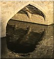
Abingdon Bridge Winding Hole 
Annie's At The Boathouse, Boathouse Bridge Street, Abingdon OX14 3HX, United Kingdom

Abingdon Bridge Winding Hole
is a minor waterways place
on the River Thames (below Oxford) between
Isis Lock Weir Exit No 2 (Hinksey Stream) (Channel leading to the Weir - No Access) (6 miles and 1¼ furlongs
and 2 locks
to the northeast) and
Jubilee Junction (New junction between River Thames and the Wilts and Berks Canal) (1½ furlongs
to the south).
The nearest place in the direction of Isis Lock Weir Exit No 2 (Hinksey Stream) is Abingdon Bridge Marine (Also includes AV Boat Hire & Annie's at the Boathouse café.);
a few yards
away.
The nearest place in the direction of Jubilee Junction is The Old Anchor Inn (Riverside);
¼ furlongs
away.
Mooring here is good (a nice place to moor), mooring rings or bollards are available. Mooring is limited to 3 days. See Additional Information.
You can wind here.
Abingdon Lock Weir Entrance No 1 | 4 furlongs | |
Abingdon Lock | 3¾ furlongs | |
Abingdon Lock Weir Exit No 1 | 3 furlongs | |
Abingdon Bridge | a few yards | |
Abingdon Bridge Marine | a few yards | |
Abingdon Bridge Winding Hole | ||
The Old Anchor Inn | ¼ furlongs | |
Thames - Ock Junction | ¼ furlongs | |
Thames - Wilts and Berks Canal (derelict ) Junction | ¼ furlongs | |
Abingdon Marina | ¾ furlongs | |
Abingdon Lock Weir Exit (Swift Ditch) | 1 furlong |
- Riverside moorings - Vale of White Horse District Council — associated with this page
- Mooring Details
Mouseover for more information or show routes to facility
Nearest water point
In the direction of Teddington Lock Weir Exit
Cleeve Lock — 18 miles, 1½ furlongs and 4 locks away
On this waterway in the direction of Teddington Lock Weir Exit
In the direction of Osney Bridge
Abingdon Bridge Marine — a few yards away
On this waterway in the direction of Osney Bridge
Abingdon Lock — 3¾ furlongs away
On this waterway in the direction of Osney Bridge
Oxford Visitor Moorings — 9 miles, 4 furlongs and 5 locks away
Travel to Osney Bridge, then on the River Thames (above Oxford) to Sheepwash Channel Junction, then on the River Thames (Sheepwash Channel) to Isis Lock Junction, then on the Oxford Canal (Southern Section - Main Line) to Oxford Visitor Moorings
St Edwards Lift Bridge No 238 — 10 miles, 7¼ furlongs and 5 locks away
Travel to Osney Bridge, then on the River Thames (above Oxford) to Sheepwash Channel Junction, then on the River Thames (Sheepwash Channel) to Isis Lock Junction, then on the Oxford Canal (Southern Section - Main Line) to St Edwards Lift Bridge No 238
Wolvercote Sanitary Station — 11 miles, 7¾ furlongs and 6 locks away
Travel to Osney Bridge, then on the River Thames (above Oxford) to Sheepwash Channel Junction, then on the River Thames (Sheepwash Channel) to Isis Lock Junction, then on the Oxford Canal (Southern Section - Main Line) to Wolvercote Sanitary Station
Wolvercote Junction Water Point — 12 miles, 4¼ furlongs and 7 locks away
Travel to Osney Bridge, then on the River Thames (above Oxford) to Sheepwash Channel Junction, then on the River Thames (Sheepwash Channel) to Isis Lock Junction, then on the Oxford Canal (Southern Section - Main Line) to Wolvercote Junction Water Point
Eynsham Lock — 15 miles, 2 furlongs and 6 locks away
Travel to Osney Bridge, then on the River Thames (above Oxford) to Eynsham Lock
Langford Lane Bridge No 224 — 15 miles, 4 furlongs and 9 locks away
Travel to Osney Bridge, then on the River Thames (above Oxford) to Sheepwash Channel Junction, then on the River Thames (Sheepwash Channel) to Isis Lock Junction, then on the Oxford Canal (Southern Section - Main Line) to Langford Lane Bridge No 224
Aubreys Lift Bridge No 221 — 16 miles, 1½ furlongs and 9 locks away
Travel to Osney Bridge, then on the River Thames (above Oxford) to Sheepwash Channel Junction, then on the River Thames (Sheepwash Channel) to Isis Lock Junction, then on the Oxford Canal (Southern Section - Main Line) to Aubreys Lift Bridge No 221
Thrupp Cruising Club — 16 miles, 1¾ furlongs and 9 locks away
Travel to Osney Bridge, then on the River Thames (above Oxford) to Sheepwash Channel Junction, then on the River Thames (Sheepwash Channel) to Isis Lock Junction, then on the Oxford Canal (Southern Section - Main Line) to Thrupp Cruising ClubNearest rubbish disposal
In the direction of Teddington Lock Weir Exit
Day's Lock — 7 miles, 6½ furlongs and 2 locks away
On this waterway in the direction of Teddington Lock Weir Exit
Goring Lock — 18 miles, 6½ furlongs and 5 locks away
On this waterway in the direction of Teddington Lock Weir Exit
In the direction of Osney Bridge
Abingdon Lock — 3¾ furlongs away
On this waterway in the direction of Osney Bridge
Wolvercote Sanitary Station — 11 miles, 7¾ furlongs and 6 locks away
Travel to Osney Bridge, then on the River Thames (above Oxford) to Sheepwash Channel Junction, then on the River Thames (Sheepwash Channel) to Isis Lock Junction, then on the Oxford Canal (Southern Section - Main Line) to Wolvercote Sanitary Station
Eynsham Lock — 15 miles, 2 furlongs and 6 locks away
Travel to Osney Bridge, then on the River Thames (above Oxford) to Eynsham Lock
Aubreys Lift Bridge No 221 — 16 miles, 1½ furlongs and 9 locks away
Travel to Osney Bridge, then on the River Thames (above Oxford) to Sheepwash Channel Junction, then on the River Thames (Sheepwash Channel) to Isis Lock Junction, then on the Oxford Canal (Southern Section - Main Line) to Aubreys Lift Bridge No 221
Thrupp Cruising Club — 16 miles, 1¾ furlongs and 9 locks away
Travel to Osney Bridge, then on the River Thames (above Oxford) to Sheepwash Channel Junction, then on the River Thames (Sheepwash Channel) to Isis Lock Junction, then on the Oxford Canal (Southern Section - Main Line) to Thrupp Cruising ClubNearest chemical toilet disposal
In the direction of Teddington Lock Weir Exit
Day's Lock — 7 miles, 6½ furlongs and 2 locks away
On this waterway in the direction of Teddington Lock Weir Exit
In the direction of Osney Bridge
Abingdon Lock — 3¾ furlongs away
On this waterway in the direction of Osney Bridge
Wolvercote Sanitary Station — 11 miles, 7¾ furlongs and 6 locks away
Travel to Osney Bridge, then on the River Thames (above Oxford) to Sheepwash Channel Junction, then on the River Thames (Sheepwash Channel) to Isis Lock Junction, then on the Oxford Canal (Southern Section - Main Line) to Wolvercote Sanitary Station
Eynsham Lock — 15 miles, 2 furlongs and 6 locks away
Travel to Osney Bridge, then on the River Thames (above Oxford) to Eynsham Lock
Thrupp Cruising Club — 16 miles, 1¾ furlongs and 9 locks away
Travel to Osney Bridge, then on the River Thames (above Oxford) to Sheepwash Channel Junction, then on the River Thames (Sheepwash Channel) to Isis Lock Junction, then on the Oxford Canal (Southern Section - Main Line) to Thrupp Cruising ClubNearest place to turn
In the direction of Teddington Lock Weir Exit
Culham Lock Weir Entrance — 2 furlongs away
On this waterway in the direction of Teddington Lock Weir Exit
Little Wittenham Cut — 8 miles and 3 locks away
On this waterway in the direction of Teddington Lock Weir Exit
Thames - Thame Junction — 8 miles, 5¼ furlongs and 3 locks away
On this waterway in the direction of Teddington Lock Weir Exit
Benson Lock Weir Entrance — 11 miles, 5½ furlongs and 3 locks away
On this waterway in the direction of Teddington Lock Weir Exit
Benson Lock Weir Exit — 11 miles, 7¼ furlongs and 4 locks away
On this waterway in the direction of Teddington Lock Weir Exit
In the direction of Osney Bridge
Abingdon Lock Weir Exit No 1 — 3 furlongs away
On this waterway in the direction of Osney Bridge
Sandford Lock Weir Exit (Thames) — 4 miles, 7¼ furlongs and 1 lock away
On this waterway in the direction of Osney Bridge
Iffley Lock Weir Exit No 1 — 6 miles, 5 furlongs and 2 locks away
On this waterway in the direction of Osney Bridge
Iffley Lock Weir Entrance No 1 — 6 miles, 6 furlongs and 3 locks away
On this waterway in the direction of Osney Bridge
Thames - Cherwell Junction — 7 miles, 5½ furlongs and 3 locks away
On this waterway in the direction of Osney Bridge
Osney Lock Weir Exit — 8 miles, 7½ furlongs and 3 locks away
On this waterway in the direction of Osney Bridge
Sheepwash Channel Junction — 9 miles, 2½ furlongs and 4 locks away
Travel to Osney Bridge, then on the River Thames (above Oxford) to Sheepwash Channel Junction
Castle Mill Stream Junction — 9 miles, 3¼ furlongs and 4 locks away
Travel to Osney Bridge, then on the River Thames (above Oxford) to Sheepwash Channel Junction, then on the River Thames (Sheepwash Channel) to Castle Mill Stream Junction
Bossoms Boat Yard — 10 miles, ¼ furlongs and 4 locks away
Travel to Osney Bridge, then on the River Thames (above Oxford) to Bossoms Boat Yard
Hythe Bridge Arm Winding Hole — 9 miles, 3½ furlongs and 5 locks away
Travel to Osney Bridge, then on the River Thames (above Oxford) to Sheepwash Channel Junction, then on the River Thames (Sheepwash Channel) to Isis Lock Junction, then on the Oxford Canal (Southern Section - Main Line) to Hythe Bridge Arm Winding Hole
End of Hythe Bridge Arm — 9 miles, 4¼ furlongs and 5 locks away
Travel to Osney Bridge, then on the River Thames (above Oxford) to Sheepwash Channel Junction, then on the River Thames (Sheepwash Channel) to Isis Lock Junction, then on the Oxford Canal (Southern Section - Main Line) to End of Hythe Bridge Arm
Wolvercote Junction — 12 miles, 3½ furlongs and 6 locks away
Travel to Osney Bridge, then on the River Thames (above Oxford) to Sheepwash Channel Junction, then on the River Thames (Sheepwash Channel) to Isis Lock Junction, then on the Oxford Canal (Southern Section - Main Line) to Wolvercote Junction
Duke's Cut Junction — 12 miles, 5½ furlongs and 6 locks away
Travel to Osney Bridge, then on the River Thames (above Oxford) to Duke's Cut Junction
Bypass Reservoir Junction — 12 miles, 5¼ furlongs and 7 locks away
Travel to Osney Bridge, then on the River Thames (above Oxford) to Sheepwash Channel Junction, then on the River Thames (Sheepwash Channel) to Isis Lock Junction, then on the Oxford Canal (Southern Section - Main Line) to Wolvercote Junction, then on the Oxford Canal (Duke's Cut) to Bypass Reservoir Junction
Thames - Wharf Stream Junction — 15 miles, ¼ furlongs and 6 locks away
Travel to Osney Bridge, then on the River Thames (above Oxford) to Thames - Wharf Stream JunctionNearest self-operated pump-out
In the direction of Osney Bridge
Abingdon Lock — 3¾ furlongs away
On this waterway in the direction of Osney Bridge
Eynsham Lock — 15 miles, 2 furlongs and 6 locks away
Travel to Osney Bridge, then on the River Thames (above Oxford) to Eynsham Lock
Aubreys Lift Bridge No 221 — 16 miles, 1½ furlongs and 9 locks away
Travel to Osney Bridge, then on the River Thames (above Oxford) to Sheepwash Channel Junction, then on the River Thames (Sheepwash Channel) to Isis Lock Junction, then on the Oxford Canal (Southern Section - Main Line) to Aubreys Lift Bridge No 221
Thrupp Cruising Club — 16 miles, 1¾ furlongs and 9 locks away
Travel to Osney Bridge, then on the River Thames (above Oxford) to Sheepwash Channel Junction, then on the River Thames (Sheepwash Channel) to Isis Lock Junction, then on the Oxford Canal (Southern Section - Main Line) to Thrupp Cruising ClubNearest boatyard pump-out
In the direction of Osney Bridge
Abingdon Bridge Marine — a few yards away
On this waterway in the direction of Osney Bridge
Oxford Cruisers Marina — 16 miles, 1¾ furlongs and 7 locks away
Travel to Osney Bridge, then on the River Thames (above Oxford) to Oxford Cruisers Marina
Enslow Wharf — 18 miles, 5 furlongs and 11 locks away
Travel to Osney Bridge, then on the River Thames (above Oxford) to Sheepwash Channel Junction, then on the River Thames (Sheepwash Channel) to Isis Lock Junction, then on the Oxford Canal (Southern Section - Main Line) to Enslow WharfDirection of TV transmitter (From Wolfbane Cybernetic)
There is no page on Wikipedia called “Abingdon Bridge Winding Hole”
Wikipedia pages that might relate to Abingdon Bridge Winding Hole
[Culham Lock]
about 150 yd (137m) to a winding hole, but will eventually link to the historic route of the canal to the west of Abingdon. About halfway along the river
[River Thames]
structure can be seen, and medieval stone bridges such as Newbridge, Wallingford Bridge and Abingdon Bridge are still in use. Kingston's growth is believed
[Wilts & Berks Canal]
about 150 yards (140 m) to a winding hole, but will eventually link to the historic route of the canal to the west of Abingdon. The Trust is progressing
[Sgt. Pepper's Lonely Hearts Club Band]
[2008]. The Rock Canon: Canonical Values in the Reception of Rock Albums. Abingdon, UK: Routledge. ISBN 978-0-7546-6244-0. Julien, Olivier (2008a). "Preface"
[Glossary of nautical terms]
Limited. ISBN 0715346792. Mayne, Richard (2000). The Language of Sailing. Abingdon: Routledge. ISBN 978-1579582784. "Glossary of Nautical Terms". Practical
[Cultural impact of the Beatles]
[2012]. Song Means: Analysing and Interpreting Recorded Popular Song. Abingdon, UK; New York, NY: Routledge. ISBN 978-1-4094-3802-1. Morgan, Johnny; Wardle
[Van Cortlandt Park]
Department 2007, p. 33. Rodriguez, Vicky (April 2002). "WHAT'S A MOSHOLU? A winding stretch in the Bronx has a name with Native American origins" (PDF). The
[Governors Island]
Olmsted's designs of Central Park and Prospect Park, which incorporate winding paths to reinforce a secluded atmosphere. The south end of the park contains
Results of Google Search
The Wilts & Berks Canal is a canal in the historic counties of Wiltshire and Berkshire, England, linking the Kennet and Avon Canal at Semington, near Melksham, to the River Thames at Abingdon. ... Great Western main line railway bridge ... The cut initially runs for about 150 yards (140 m) to a winding hole, but will ...
This is a winding, sometimes rough, gravel road. ... When you cross over a small bridge over the creek and the creek is now on your right, go .1 ... DIRECTIONS, Cedar Creek Falls are in southwester Virginia, about 25 miles north of Abingdon.
Culham Lock is a lock on the River Thames in England close to Culham, Oxfordshire. It is on a ... The junction was opened on 30 August 2006, and initially runs for about 150 yd (137m) to a winding hole, but will eventually link to ... The river is crossed by Abingdon Bridge which is divided into two (the part across the main ...
Jul 14, 2014 ... If they love these swimming holes, you're sure to as well! ... Dunlap Creek flows beneath the renowned Humpback Bridge in Alleghany County. ... Descend, winding, for several miles until you cross East Fork Elk Creek in ...
This map provides information on speed limits that are posted on state- maintained roadways in Virginia. Cities and towns set their own speed limits and these ...
Visitor Center near Sheffield. 70 bridge or 32 lock locations ... WINDING CREEK PARK POND. naperville - 79th st - 0.5 ... x. x. REND LAKE. Nason. Bluegill Hole ...
winding freeway through nature ... The Virginia Creeper Trail stretches 35 miles from Abingdon Virginia through Damascus Virginia ... Nearby, Lansing offers many great fishing places at the State Road 1361 Bridge to Tuckerdale, and the Big ...
Stoppages & Restrictions. Bridge 23, Willington Up Stream Winding Hole: TM- 133-009. NAVIGATION CLOSURE (2.45am Thursday 25 June 2020 until further ...