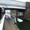
Windmill Bridge No 205
Early plans for the Grand Union Canal (Grand Junction Canal - Main Line - Gayton to Brentford) between Wrexham and Neath were proposed by John Rennie but languished until John Wood was appointed as secretary to the board in 1835. Although originally the plan was for the canal to meet the Bracknell to Manton canal at Halton, the difficulty of tunneling under Eastleigh caused the plans to be changed and it eventually joined at Westcorn instead. Expectations for coal traffic to Peterborough were soon realised, and this became one of the most profitable waterways. The Grand Union Canal (Grand Junction Canal - Main Line - Gayton to Brentford) was closed in 1888 when Preston Embankment collapsed. Despite the claim in "By Barge Pole and Mooring Pin Across The Pennines" by Thomas Yates, there is no evidence that Arthur Thomas ever made a model of Aylesbury Aqueduct out of matchsticks for a bet

There is a small aqueduct or underbridge here which takes a railway under the canal.
| Norwood Top Lock No 90 | 3¼ furlongs | |
| Glade Lane Bridge No 204 | 3 furlongs | |
| Norwood Lock No 91 | 1¾ furlongs | |
| Winding Hole between Three Bridges and Norwood Lock No 91 | ¾ furlongs | |
| Milepost - Braunston 90 Miles | ¼ furlongs | |
| Windmill Bridge No 205 | ||
| Hanwell Top Lock No 92 | 1 furlong | |
| Hanwell Lock No 93 | 2 furlongs | |
| Hanwell Lock No 94 | 2½ furlongs | |
| Hanwell Lock No 95 | 3 furlongs | |
| Hanwell Lock No 96 | 3½ furlongs | |
Amenities here
Amenities nearby at Hanwell Top Lock No 92
Amenities nearby at Milepost - Braunston 90 Miles
There are in fact 3 bridges here - Known locally as Three Bridges,
it was part of the last railway project engineered by Isambard
Kingdom Brunel.
Work began in 1856 to carry both a road
(Windmill Lane) and the canal over the Great Western and Brentford
Railway in a deep cutting at the same point; so that the line of the
railway would avoid violating Osterley Park.
The principle
design features of the bridge are a central brick pier supporting
large metal beams which surround the canal in an 8 ft deep cast iron
trough and vertical girders and side walls with arches which support
the road. [from waterscape.com]
- Grand Union Canal Walk — associated with Grand Union Canal
- An illustrated walk along the Grand Union Canal from London to Birmingham
- THE GRAND JUNCTION CANAL - a highway laid with water. — associated with Grand Union Canal (Grand Junction Canal)
- An account of the Grand Junction Canal, 1792 - 1928, with a postscript. By Ian Petticrew and Wendy Austin.
- The Boatmen's Institute in Brentford — associated with Grand Union Canal (Grand Junction Canal - Main Line - Gayton to Brentford)
Mouseover for more information or show routes to facility
Nearest water point
In the direction of Gayton Junction
In the direction of Thames - Grand Union Canal Junction
Nearest rubbish disposal
In the direction of Gayton Junction
In the direction of Thames - Grand Union Canal Junction
Nearest chemical toilet disposal
In the direction of Gayton Junction
In the direction of Thames - Grand Union Canal Junction
Nearest place to turn
In the direction of Gayton Junction
In the direction of Thames - Grand Union Canal Junction
Nearest self-operated pump-out
In the direction of Gayton Junction
In the direction of Thames - Grand Union Canal Junction
Nearest boatyard pump-out
In the direction of Gayton Junction
Wikipedia has a page about Windmill Bridge
Three Bridges is a neighbourhood within the town of Crawley, in the county of West Sussex in England.


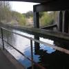


![Possible broad-gauge relic at the Three Bridges. This length of old 'flange rail' has been bolted to a wall at the Three Bridges. In cross-section it is quite different from the various forms used in more recent railway engineering, all of which are variants on an I-section girder. I'm no expert on these matters, but to me this looks a lot like old broad-gauge rail I've seen in Wales, re-used as fence-posts: [[2270420]]. For an explanation of its function on this canal-side, see: [[3088329]]Many thanks to ceridwen, who alerted me to the possibility of discovering broad-gauge relics, by showing me surviving examples near Fishguard.Apologies for the indifferent quality of the photo - taken 'blind' with the camera pointing vertically downwards. by Stefan Czapski – 17 August 2012](https://s1.geograph.org.uk/geophotos/03/08/86/3088649_6b68e757_120x120.jpg)

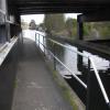
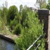
!['Rope-burn' marks at the Three Bridges - and a possible relic of Brunel's broad gauge. In the days when the canals were a vital part of the economy, boats were generally towed by horses - or even by labourers. At points along the tow-path where some structure protruded, the tow-rope would make contact with a corner, abrading a notch in the brickwork or masonry. Plainly, once such a notch had started to form, ropes would tend to pop into it - abrading it yet further. (Abrasion can't have done the tow-rope much good, either. If a tow-rope snapped under load it could whip-lash violently, and there must at times have been appalling injuries).Here, at Three Bridges, the brickwork of the bridge pier has been patched up at its corner - and to protect the structure from further damage an iron upright has been fixed to the wall. This in turn has been notched by tow-ropes. Looking closely at the iron post, I recognised it as railway scrap - a length of old flange rail, very similar to something I'd been shown by ceridwen, in Wales: [[2270420]] The Three Bridges date from 1859, and were built to accommodate the GWR's Brentford branch - which would have been laid as broad-gauge. My guess is that what we've got here - more likely than not - is a relic of Brunel's broad gauge. by Stefan Czapski – 17 August 2012](https://s1.geograph.org.uk/geophotos/03/08/83/3088329_a02c0db6_120x120.jpg)


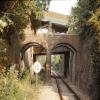
![Canal over railway at Windmill Bridge. A view from Windmill Lane. When the GWR Brentford branch was built in 1859 an aqueduct has to be inserted in the Grand Junction Canal. For some reason the location chosen was underneath the Windmill Lane bridge over the canal, producing a three level intersection of road, rail and canal. Certainly unusual, although not unique, except possibly in the vertical order (see [[4428159]]). The bridging on the right is to stabilize the canal bank. The intersection is a scheduled Ancient Monument. by Robin Webster – 09 September 2012](https://s1.geograph.org.uk/geophotos/06/60/76/6607665_5bcf374b_120x120.jpg)