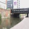
London Road Bridge
is a minor waterways place
on the River Trent (Nottingham Canal) between
Meadow Lane Junction (Junction of Nottingham Canal with River Trent) (3¼ furlongs
and 1 lock
to the southeast) and
Carrington Street Bridge (Nottingham) (1¼ furlongs
to the west).
The nearest place in the direction of Meadow Lane Junction is Poplar Arms Corner (Very sharp bend. A short arm used to head east from here.);
a few yards
away.
The nearest place in the direction of Carrington Street Bridge is Boots Pipe Bridge;
½ furlongs
away.
There may be access to the towpath here.
Mooring here is unrated.
There is a bridge here which takes a major road over the canal.
Queen's Road Bridge | ¾ furlongs | |
LMS Railway Bridge | ½ furlongs | |
Station Street Bridge | ¼ furlongs | |
London Road Railway Bridge (dismantled) | ¼ furlongs | |
Poplar Arms Corner | a few yards | |
London Road Bridge | ||
Boots Pipe Bridge | ½ furlongs | |
Trent Street Bridge | 1 furlong | |
Nottingham Tram Railway Bridge | 1 furlong | |
Carrington Street Bridge | 1¼ furlongs | |
Canal Museum Arm | 1½ furlongs |
Amenities here
Amenities nearby at Poplar Arms Corner
Amenities nearby at Boots Pipe Bridge
Amenities in Nottingham
Amenities at other places in Nottingham
at
at
at
at
at
at
at
at
at
at
at
at
at
at
at
at
at
at
at
at
at
at
at
at
at
at
at
at
at
at
at
at
at
at
at
at
at
at
at
at
at
at
at
at
at
at
at
at
at
at
at
at
at
at
at
at
at
at
at
at
There are no links to external websites from here.
Why not log in and add some (select "External websites" from the menu (sometimes this is under "Edit"))?
Mouseover for more information or show routes to facility
Nearest water point
In the direction of Lenton Chain
Beeston Lock No 5 — 5 miles, 4 furlongs and 1 lock away
Travel to Lenton Chain, then on the River Trent (Beeston Canal) to Beeston Lock No 5
Cranfleet Lock No 3 — 9 miles, 6½ furlongs and 2 locks away
Travel to Lenton Chain, then on the River Trent (Beeston Canal) to Beeston Lock No 5, then on the River Trent (Western End) to Cranfleet Lock No 3
Former BW Trent Lock Waterway Office — 10 miles, 5 furlongs and 5 locks away
Travel to Lenton Chain, then on the River Trent (Beeston Canal) to Beeston Lock No 5, then on the River Trent (Western End) to Trent Junction, then on the Grand Union Canal (Erewash Canal) to Former BW Trent Lock Waterway Office
Sawley Locks No 2 — 11 miles, 3 furlongs and 4 locks away
Travel to Lenton Chain, then on the River Trent (Beeston Canal) to Beeston Lock No 5, then on the River Trent (Western End) to Sawley Locks No 2
Shardlow — 13 miles, 4¾ furlongs and 7 locks away
Travel to Lenton Chain, then on the River Trent (Beeston Canal) to Beeston Lock No 5, then on the River Trent (Western End) to Derwent Mouth, then on the Trent and Mersey Canal (Main Line - Derwent Mouth to Burton) to Shardlow
Weston Lock No 4 — 16 miles, 4¼ furlongs and 9 locks away
Travel to Lenton Chain, then on the River Trent (Beeston Canal) to Beeston Lock No 5, then on the River Trent (Western End) to Derwent Mouth, then on the Trent and Mersey Canal (Main Line - Derwent Mouth to Burton) to Weston Lock No 4
Bishop Meadow Lock No 54 — 18 miles, 5 furlongs and 9 locks away
Travel to Lenton Chain, then on the River Trent (Beeston Canal) to Beeston Lock No 5, then on the River Trent (Western End) to Trent Junction, then on the Grand Union Canal (Leicester Section - River Soar Navigation) to Bishop Meadow Lock No 54
Swarkestone Lock No 5 — 19 miles, 3¾ furlongs and 10 locks away
Travel to Lenton Chain, then on the River Trent (Beeston Canal) to Beeston Lock No 5, then on the River Trent (Western End) to Derwent Mouth, then on the Trent and Mersey Canal (Main Line - Derwent Mouth to Burton) to Swarkestone Lock No 5
Loughborough Basin — 19 miles, 5¾ furlongs and 11 locks away
Travel to Lenton Chain, then on the River Trent (Beeston Canal) to Beeston Lock No 5, then on the River Trent (Western End) to Trent Junction, then on the Grand Union Canal (Leicester Section - River Soar Navigation) to Loughborough Branch Junction, then on the Grand Union Canal (Leicester Section - Loughborough Branch) to Loughborough Basin
In the direction of Meadow Lane Junction
Holme Lock No 5 — 2 miles, 6½ furlongs and 1 lock away
Travel to Meadow Lane Junction, then on the River Trent (non-tidal section) to Holme Lock No 5
Stoke Lock No 6 — 5 miles, 6¾ furlongs and 2 locks away
Travel to Meadow Lane Junction, then on the River Trent (non-tidal section) to Stoke Lock No 6
Gunthorpe Lock No 7 — 10 miles, 4½ furlongs and 3 locks away
Travel to Meadow Lane Junction, then on the River Trent (non-tidal section) to Gunthorpe Lock No 7
Hazelford Lock No 8 — 15 miles, 2¾ furlongs and 4 locks away
Travel to Meadow Lane Junction, then on the River Trent (non-tidal section) to Hazelford Lock No 8Nearest rubbish disposal
In the direction of Lenton Chain
Beeston Lock No 5 — 5 miles, 4 furlongs and 1 lock away
Travel to Lenton Chain, then on the River Trent (Beeston Canal) to Beeston Lock No 5
Cranfleet Lock No 3 — 9 miles, 6½ furlongs and 2 locks away
Travel to Lenton Chain, then on the River Trent (Beeston Canal) to Beeston Lock No 5, then on the River Trent (Western End) to Cranfleet Lock No 3
Former BW Trent Lock Waterway Office — 10 miles, 5 furlongs and 5 locks away
Travel to Lenton Chain, then on the River Trent (Beeston Canal) to Beeston Lock No 5, then on the River Trent (Western End) to Trent Junction, then on the Grand Union Canal (Erewash Canal) to Former BW Trent Lock Waterway Office
Sawley Locks No 2 — 11 miles, 3 furlongs and 4 locks away
Travel to Lenton Chain, then on the River Trent (Beeston Canal) to Beeston Lock No 5, then on the River Trent (Western End) to Sawley Locks No 2
Swarkestone Lock No 5 — 19 miles, 3¾ furlongs and 10 locks away
Travel to Lenton Chain, then on the River Trent (Beeston Canal) to Beeston Lock No 5, then on the River Trent (Western End) to Derwent Mouth, then on the Trent and Mersey Canal (Main Line - Derwent Mouth to Burton) to Swarkestone Lock No 5
Loughborough Basin — 19 miles, 5¾ furlongs and 11 locks away
Travel to Lenton Chain, then on the River Trent (Beeston Canal) to Beeston Lock No 5, then on the River Trent (Western End) to Trent Junction, then on the Grand Union Canal (Leicester Section - River Soar Navigation) to Loughborough Branch Junction, then on the Grand Union Canal (Leicester Section - Loughborough Branch) to Loughborough Basin
In the direction of Meadow Lane Junction
Holme Lock No 5 — 2 miles, 6½ furlongs and 1 lock away
Travel to Meadow Lane Junction, then on the River Trent (non-tidal section) to Holme Lock No 5
Stoke Lock No 6 — 5 miles, 6¾ furlongs and 2 locks away
Travel to Meadow Lane Junction, then on the River Trent (non-tidal section) to Stoke Lock No 6
Gunthorpe Lock No 7 — 10 miles, 4½ furlongs and 3 locks away
Travel to Meadow Lane Junction, then on the River Trent (non-tidal section) to Gunthorpe Lock No 7
Hazelford Lock No 8 — 15 miles, 2¾ furlongs and 4 locks away
Travel to Meadow Lane Junction, then on the River Trent (non-tidal section) to Hazelford Lock No 8Nearest chemical toilet disposal
In the direction of Lenton Chain
Beeston Lock No 5 — 5 miles, 4 furlongs and 1 lock away
Travel to Lenton Chain, then on the River Trent (Beeston Canal) to Beeston Lock No 5
Former BW Trent Lock Waterway Office — 10 miles, 5 furlongs and 5 locks away
Travel to Lenton Chain, then on the River Trent (Beeston Canal) to Beeston Lock No 5, then on the River Trent (Western End) to Trent Junction, then on the Grand Union Canal (Erewash Canal) to Former BW Trent Lock Waterway Office
Sawley Locks No 2 — 11 miles, 3 furlongs and 4 locks away
Travel to Lenton Chain, then on the River Trent (Beeston Canal) to Beeston Lock No 5, then on the River Trent (Western End) to Sawley Locks No 2
Sawley Cut Wharf — 11 miles, 4½ furlongs and 5 locks away
Travel to Lenton Chain, then on the River Trent (Beeston Canal) to Beeston Lock No 5, then on the River Trent (Western End) to Sawley Cut Wharf
In the direction of Meadow Lane Junction
Meadow Lane Lock No 7 — 3 furlongs away
On this waterway in the direction of Meadow Lane Junction
Holme Lock No 5 — 2 miles, 6½ furlongs and 1 lock away
Travel to Meadow Lane Junction, then on the River Trent (non-tidal section) to Holme Lock No 5
Stoke Lock No 6 — 5 miles, 6¾ furlongs and 2 locks away
Travel to Meadow Lane Junction, then on the River Trent (non-tidal section) to Stoke Lock No 6
Gunthorpe Lock No 7 — 10 miles, 4½ furlongs and 3 locks away
Travel to Meadow Lane Junction, then on the River Trent (non-tidal section) to Gunthorpe Lock No 7Nearest place to turn
In the direction of Lenton Chain
Canal Museum Wharf — 1½ furlongs away
On this waterway in the direction of Lenton Chain
Redfield Road Bridge Winding Hole — 2 miles, 1½ furlongs and 1 lock away
Travel to Lenton Chain, then on the River Trent (Beeston Canal) to Redfield Road Bridge Winding Hole
Rylands Bridge Winding Hole — 4 miles, 1¾ furlongs and 1 lock away
Travel to Lenton Chain, then on the River Trent (Beeston Canal) to Rylands Bridge Winding Hole
Cranfleet Lock Weir Exit — 9 miles, 5¾ furlongs and 2 locks away
Travel to Lenton Chain, then on the River Trent (Beeston Canal) to Beeston Lock No 5, then on the River Trent (Western End) to Cranfleet Lock Weir Exit
Soar Mouth — 10 miles, 5½ furlongs and 4 locks away
Travel to Lenton Chain, then on the River Trent (Beeston Canal) to Beeston Lock No 5, then on the River Trent (Western End) to Trent Junction, then on the Grand Union Canal (Leicester Section - River Soar Navigation) to Soar Mouth
Redhill Lock Junction — 11 miles and 4 locks away
Travel to Lenton Chain, then on the River Trent (Beeston Canal) to Beeston Lock No 5, then on the River Trent (Western End) to Trent Junction, then on the Grand Union Canal (Leicester Section - River Soar Navigation) to Redhill Lock Junction
Sawley Lock No 2 Weir Exit — 11 miles, 2¼ furlongs and 4 locks away
Travel to Lenton Chain, then on the River Trent (Beeston Canal) to Beeston Lock No 5, then on the River Trent (Western End) to Sawley Lock No 2 Weir Exit
Former BW Trent Lock Waterway Office — 10 miles, 5 furlongs and 5 locks away
Travel to Lenton Chain, then on the River Trent (Beeston Canal) to Beeston Lock No 5, then on the River Trent (Western End) to Trent Junction, then on the Grand Union Canal (Erewash Canal) to Former BW Trent Lock Waterway Office
Sheet Stores Basin — 11 miles, 2 furlongs and 5 locks away
Travel to Lenton Chain, then on the River Trent (Beeston Canal) to Beeston Lock No 5, then on the River Trent (Western End) to Trent Junction, then on the Grand Union Canal (Erewash Canal) to Sheet Stores Basin
Redhill Marine Ltd — 11 miles, 4½ furlongs and 5 locks away
Travel to Lenton Chain, then on the River Trent (Beeston Canal) to Beeston Lock No 5, then on the River Trent (Western End) to Trent Junction, then on the Grand Union Canal (Leicester Section - River Soar Navigation) to Redhill Marine Ltd
Ratcliffe Lock Junction — 11 miles, 7 furlongs and 5 locks away
Travel to Lenton Chain, then on the River Trent (Beeston Canal) to Beeston Lock No 5, then on the River Trent (Western End) to Trent Junction, then on the Grand Union Canal (Leicester Section - River Soar Navigation) to Ratcliffe Lock Junction
Sawley Flood Lock Weir Entrance — 12 miles and 6 locks away
Travel to Lenton Chain, then on the River Trent (Beeston Canal) to Beeston Lock No 5, then on the River Trent (Western End) to Sawley Flood Lock Weir Entrance
Ratcliffe Weir — 12 miles, 1¾ furlongs and 6 locks away
Travel to Lenton Chain, then on the River Trent (Beeston Canal) to Beeston Lock No 5, then on the River Trent (Western End) to Trent Junction, then on the Grand Union Canal (Leicester Section - River Soar Navigation) to Ratcliffe Weir
Long Eaton Winding Hole — 12 miles, 3¾ furlongs and 6 locks away
Travel to Lenton Chain, then on the River Trent (Beeston Canal) to Beeston Lock No 5, then on the River Trent (Western End) to Trent Junction, then on the Grand Union Canal (Erewash Canal) to Long Eaton Winding Hole
Derwent Mouth — 12 miles, 4 furlongs and 6 locks away
Travel to Lenton Chain, then on the River Trent (Beeston Canal) to Beeston Lock No 5, then on the River Trent (Western End) to Derwent Mouth
In the direction of Meadow Lane Junction
Poplar Arms Corner — a few yards away
On this waterway in the direction of Meadow Lane Junction
Holme Lock Weir Entrance — 2 miles, 5 furlongs and 1 lock away
Travel to Meadow Lane Junction, then on the River Trent (non-tidal section) to Holme Lock Weir Entrance
Holme Lock Weir Exit — 2 miles, 7¾ furlongs and 2 locks away
Travel to Meadow Lane Junction, then on the River Trent (non-tidal section) to Holme Lock Weir Exit
Hazelford Lock East Weir Entrance — 14 miles, 5½ furlongs and 4 locks away
Travel to Meadow Lane Junction, then on the River Trent (non-tidal section) to Hazelford Lock East Weir Entrance
Hazelford Ferry — 14 miles, 6 furlongs and 4 locks away
Travel to Meadow Lane Junction, then on the River Trent (non-tidal section) to Hazelford FerryNo information
CanalPlan has no information on any of the following facilities within range:self-operated pump-out
boatyard pump-out
Direction of TV transmitter (From Wolfbane Cybernetic)
There is no page on Wikipedia called “London Road Bridge”
Wikipedia pages that might relate to London Road Bridge
[London Bridge]
Bridge opened in 1729, London Bridge was the only road-crossing of the Thames downstream of Kingston upon Thames. London Bridge has been depicted in its
[List of bridges in London]
List of bridges in London lists the major bridges within Greater London or within the influence of London. Most of these are river crossings, and the
[Albert Bridge, London]
Albert Bridge is a road bridge over the Tideway of the River Thames connecting Chelsea in Central London on the north, left bank to Battersea on the south
[Tower Bridge]
Tower Bridge is a combined bascule and suspension bridge in London, built between 1886 and 1894. The bridge crosses the River Thames close to the Tower
[London Inner Ring Road]
Vauxhall Bridge Road, the roads that constitute the Victoria one-way system, Grosvenor Place, Park Lane, Edgware Road, Old Marylebone Road, Marylebone Road and
[London Bridge Is Falling Down]
"London Bridge Is Falling Down" (also known as "My Fair Lady" or "London Bridge") is a traditional English nursery rhyme and singing game, which is found
[Millennium Bridge, London]
Millennium Bridge, officially known as the London Millennium Footbridge, is a steel suspension bridge for pedestrians crossing the River Thames in London, linking
[Lea Bridge Road]
Lea Bridge Road is a major through route in east London, across the Lea Valley from Clapton to Whipps Cross in Leyton. It forms part of the A104 road. Places
[South Circular Road, London]
Wandsworth and Kew Bridge. Together with the North Circular Road and Woolwich Ferry, it makes a complete ring-road around Central London. The South Circular
[London Bridge (Lake Havasu City)]
London Bridge is a bridge in Lake Havasu City, Arizona. It was originally built in the 1830s and formerly spanned the River Thames in London, England.
Results of Google Search
Eddy County analyzes London Road bridgeDec 9, 2017 ... About $6000 was spent major repairs to a guardrail on the London Road bridge.
London Road Surgery. London Road Surgery is situated to the north of Canterbury City Centre and provides services to patients ... Patrixbourne Road, Bridge
Best pub in Stockton Heath, overlooking the bank of Bridge water canal. Enjoy warm British pub classics, Sunday roast and award winning real cask ale.
Archway, London · Bishop's Bridge · Croydon Flyover · Hammersmith Flyover · Holborn Viaduct · Three Bridges ...
Ballysimon Road, Limerick, V94 X2E1 ... Fax: +353 (0)61 414 767. Email: headoffice@roadbridge.ie ... +44 (0)1707 371836. Email: london@roadbridge.co .uk ...
This is a list of crossings of the River Thames comprising over 200 bridges, 27 tunnels, ... Several central London road bridges were built in the 19th century, most conspicuously Tower Bridge, the only bascule bridge on the river, designed to ...
03/08/2018. Essential safety work will start on 6 August which will result in the London Road railway bridge in Alderley Edge being closed to traffic for a fortnight .
Toll roads in the UK - find out how much it costs to use them and where they are. ... Find out how much you'll have to pay to use toll roads, bridges and tunnels within the UK ... London Congestion Charge · Durham Road User Charge Zone ...
This is due to heavy truck traffic at the bridge on London Rd and the amount of repairs that have already been done to that area. The traffic from Porter Rd ...
Join us for breakfast, lunch or dinner at The Bridge in Oxford. View our menus ... The Bridge, London Road, Oxford, Oxfordshire, UK, OX33 1JH Tel: 01865Â ...