Step Bridge Path Footbridge
is a minor waterways place
on the Basingstoke Canal between
Woodham Junction (Junction of Basingstoke Canal with River Wey) (4 miles and 3½ furlongs
and 6 locks
to the east) and
Odiham Castle Stop (End of Navigation) (26 miles and 1¼ furlongs
and 23 locks
to the west).
The nearest place in the direction of Woodham Junction is Lockfield Drive Bridge;
2 furlongs
away.
The nearest place in the direction of Odiham Castle Stop is Arthurs Bridge Winding Hole;
1¾ furlongs
away.
There may be access to the towpath here.
Mooring here is unrated.
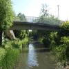
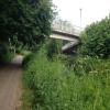
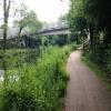
There is a bridge here which takes a footpath over the canal.
| Maybury Hill Bridge | 1 mile, 2¾ furlongs | |
| Chertsey Road Bridge | 7½ furlongs | |
| Wheatsheaf Bridge (Woking) | 4½ furlongs | |
| Brewery Bridge | 3¾ furlongs | |
| Lockfield Drive Bridge | 2 furlongs | |
| Step Bridge Path Footbridge | ||
| Arthurs Bridge Winding Hole | 1¾ furlongs | |
| Arthur's Bridge | 2 furlongs | |
| Bridge Barn PH | 2¼ furlongs | |
| Parley Drive Bridge | 3½ furlongs | |
| Langmans's Bridge | 6½ furlongs | |
Amenities here
Amenities nearby at Lockfield Drive Bridge
Amenities nearby at Arthurs Bridge Winding Hole
There are no links to external websites from here.
Why not log in and add some (select "External websites" from the menu (sometimes this is under "Edit"))?
Mouseover for more information or show routes to facility
Nearest water point
In the direction of Odiham Castle Stop
Arthur's Bridge — 2 furlongs away
On this waterway in the direction of Odiham Castle Stop
Canal Centre Swing Bridge — 8 miles, 4¼ furlongs and 22 locks away
On this waterway in the direction of Odiham Castle Stop
Mytchett Bridge — 8 miles, 5 furlongs and 22 locks away
On this waterway in the direction of Odiham Castle Stop
Ash Lock Canal Depot — 11 miles, 7½ furlongs and 23 locks away
On this waterway in the direction of Odiham Castle Stop
The Fox and Hounds (Crookham) — 17 miles, 5¾ furlongs and 23 locks away
On this waterway in the direction of Odiham Castle Stop
In the direction of Woodham Junction
Pyrford Lock No 12 — 6 miles, 3 furlongs and 6 locks away
Travel to Woodham Junction, then on the River Wey Wey Navigation to Pyrford Lock No 12
Thames Lock No 16 — 7 miles, 1¼ furlongs and 9 locks away
Travel to Woodham Junction, then on the River Wey Wey Navigation to Thames Lock No 16
Cartbridge Wharf — 10 miles, 1 furlong and 10 locks away
Travel to Woodham Junction, then on the River Wey Wey Navigation to Cartbridge Wharf
Chertsey Lock — 9 miles, 4¼ furlongs and 11 locks away
Travel to Woodham Junction, then on the River Wey Wey Navigation to Thames - Wey Junction, then on the River Thames (below Oxford) to Chertsey Lock
Molesey Lock — 12 miles, 7¼ furlongs and 11 locks away
Travel to Woodham Junction, then on the River Wey Wey Navigation to Thames - Wey Junction, then on the River Thames (below Oxford) to West End of Desborough Cut, then on the River Thames (Desborough Cut) to Thames Meadow, then on the River Thames (below Oxford) to Molesey Lock
Stoke Lock No 5 — 14 miles, 3¼ furlongs and 13 locks away
Travel to Woodham Junction, then on the River Wey Wey Navigation to Stoke Lock No 5
Guildford Waterside Centre — 14 miles, 7¾ furlongs and 14 locks away
Travel to Woodham Junction, then on the River Wey Wey Navigation to Guildford Waterside Centre
Dapdune Wharf — 15 miles, 7½ furlongs and 14 locks away
Travel to Woodham Junction, then on the River Wey Wey Navigation to Dapdune Wharf
Teddington Lock Weir Exit — 17 miles, 4¼ furlongs and 13 locks away
Travel to Woodham Junction, then on the River Wey Wey Navigation to Thames - Wey Junction, then on the River Thames (below Oxford) to West End of Desborough Cut, then on the River Thames (Desborough Cut) to Thames Meadow, then on the River Thames (below Oxford) to Teddington Lock Weir ExitNearest rubbish disposal
In the direction of Odiham Castle Stop
Arthur's Bridge — 2 furlongs away
On this waterway in the direction of Odiham Castle Stop
Canal Centre Swing Bridge — 8 miles, 4¼ furlongs and 22 locks away
On this waterway in the direction of Odiham Castle Stop
Mytchett Bridge — 8 miles, 5 furlongs and 22 locks away
On this waterway in the direction of Odiham Castle Stop
Ash Lock Canal Depot — 11 miles, 7½ furlongs and 23 locks away
On this waterway in the direction of Odiham Castle Stop
In the direction of Woodham Junction
Pyrford Lock No 12 — 6 miles, 3 furlongs and 6 locks away
Travel to Woodham Junction, then on the River Wey Wey Navigation to Pyrford Lock No 12
Shepperton Lock — 7 miles, 4½ furlongs and 10 locks away
Travel to Woodham Junction, then on the River Wey Wey Navigation to Thames - Wey Junction, then on the River Thames (below Oxford) to Shepperton Lock
Penton Hook Lock — 11 miles, 3¼ furlongs and 12 locks away
Travel to Woodham Junction, then on the River Wey Wey Navigation to Thames - Wey Junction, then on the River Thames (below Oxford) to Penton Hook Lock
Molesey Lock — 12 miles, 7¼ furlongs and 11 locks away
Travel to Woodham Junction, then on the River Wey Wey Navigation to Thames - Wey Junction, then on the River Thames (below Oxford) to West End of Desborough Cut, then on the River Thames (Desborough Cut) to Thames Meadow, then on the River Thames (below Oxford) to Molesey Lock
Bell Weir Lock — 14 miles, 1¾ furlongs and 13 locks away
Travel to Woodham Junction, then on the River Wey Wey Navigation to Thames - Wey Junction, then on the River Thames (below Oxford) to Bell Weir Lock
Guildford Waterside Centre — 14 miles, 7¾ furlongs and 14 locks away
Travel to Woodham Junction, then on the River Wey Wey Navigation to Guildford Waterside Centre
Dapdune Wharf — 15 miles, 7½ furlongs and 14 locks away
Travel to Woodham Junction, then on the River Wey Wey Navigation to Dapdune Wharf
Teddington Lock Weir Exit — 17 miles, 4¼ furlongs and 13 locks away
Travel to Woodham Junction, then on the River Wey Wey Navigation to Thames - Wey Junction, then on the River Thames (below Oxford) to West End of Desborough Cut, then on the River Thames (Desborough Cut) to Thames Meadow, then on the River Thames (below Oxford) to Teddington Lock Weir ExitNearest chemical toilet disposal
In the direction of Odiham Castle Stop
Arthur's Bridge — 2 furlongs away
On this waterway in the direction of Odiham Castle Stop
Canal Centre Swing Bridge — 8 miles, 4¼ furlongs and 22 locks away
On this waterway in the direction of Odiham Castle Stop
In the direction of Woodham Junction
Pyrford Lock No 12 — 6 miles, 3 furlongs and 6 locks away
Travel to Woodham Junction, then on the River Wey Wey Navigation to Pyrford Lock No 12
Shepperton Lock — 7 miles, 4½ furlongs and 10 locks away
Travel to Woodham Junction, then on the River Wey Wey Navigation to Thames - Wey Junction, then on the River Thames (below Oxford) to Shepperton Lock
Molesey Lock — 12 miles, 7¼ furlongs and 11 locks away
Travel to Woodham Junction, then on the River Wey Wey Navigation to Thames - Wey Junction, then on the River Thames (below Oxford) to West End of Desborough Cut, then on the River Thames (Desborough Cut) to Thames Meadow, then on the River Thames (below Oxford) to Molesey Lock
Guildford Waterside Centre — 14 miles, 7¾ furlongs and 14 locks away
Travel to Woodham Junction, then on the River Wey Wey Navigation to Guildford Waterside CentreNearest place to turn
In the direction of Odiham Castle Stop
Arthurs Bridge Winding Hole — 1¾ furlongs away
On this waterway in the direction of Odiham Castle Stop
Blackhorse Road Winding Hole — 2 miles, 2¼ furlongs and 5 locks away
On this waterway in the direction of Odiham Castle Stop
Hermitage Bridge Winding Hole — 2 miles, 3½ furlongs and 5 locks away
On this waterway in the direction of Odiham Castle Stop
Connaught Crescent Winding Hole — 3 miles, 6½ furlongs and 8 locks away
On this waterway in the direction of Odiham Castle Stop
Frimley Bottom Lock Winding Hole — 4 miles, 1¼ furlongs and 9 locks away
On this waterway in the direction of Odiham Castle Stop
Frimley Lock Winding Hole — 5 miles and 13 locks away
On this waterway in the direction of Odiham Castle Stop
Lock No 26 Winding Hole — 5 miles, 7 furlongs and 19 locks away
On this waterway in the direction of Odiham Castle Stop
In the direction of Woodham Junction
Paxton Gardens Winding Hole — 2 miles, 5½ furlongs away
On this waterway in the direction of Woodham Junction
Woodham Junction — 4 miles, 3½ furlongs and 6 locks away
On this waterway in the direction of Woodham Junction
Coxes Railway Bridge Winding Hole — 5 miles, 7½ furlongs and 8 locks away
Travel to Woodham Junction, then on the River Wey Wey Navigation to Coxes Railway Bridge Winding Hole
Newark Lock Weir Exit No 2 — 7 miles, 6¾ furlongs and 8 locks away
Travel to Woodham Junction, then on the River Wey Wey Navigation to Newark Lock Weir Exit No 2
Newark Lock Weir Exit No 1 — 7 miles, 7¼ furlongs and 8 locks away
Travel to Woodham Junction, then on the River Wey Wey Navigation to Newark Lock Weir Exit No 1
Newark Lock Weir Entrance — 8 miles, 1¾ furlongs and 9 locks away
Travel to Woodham Junction, then on the River Wey Wey Navigation to Newark Lock Weir Entrance
Five Ways Junction — 7 miles, 2½ furlongs and 10 locks away
Travel to Woodham Junction, then on the River Wey Wey Navigation to Five Ways Junction
Papercourt Lock Weir Exit — 8 miles, 4¾ furlongs and 9 locks away
Travel to Woodham Junction, then on the River Wey Wey Navigation to Papercourt Lock Weir Exit
Worsfold Flood Gates Weir Entrance — 10 miles, 3¼ furlongs and 11 locks away
Travel to Woodham Junction, then on the River Wey Wey Navigation to Worsfold Flood Gates Weir Entrance
Worsfold Winding Hole — 10 miles, 4¼ furlongs and 11 locks away
Travel to Woodham Junction, then on the River Wey Wey Navigation to Worsfold Winding Hole
Triggs Lock Weir Exit — 10 miles, 7¾ furlongs and 11 locks away
Travel to Woodham Junction, then on the River Wey Wey Navigation to Triggs Lock Weir Exit
Stoke Lock Weir Entrance — 14 miles, 6¾ furlongs and 14 locks away
Travel to Woodham Junction, then on the River Wey Wey Navigation to Stoke Lock Weir Entrance
Guildford Waterside Centre — 14 miles, 7¾ furlongs and 14 locks away
Travel to Woodham Junction, then on the River Wey Wey Navigation to Guildford Waterside CentreNearest self-operated pump-out
In the direction of Odiham Castle Stop
Canal Centre Swing Bridge — 8 miles, 4¼ furlongs and 22 locks away
On this waterway in the direction of Odiham Castle Stop
Mytchett Bridge — 8 miles, 5 furlongs and 22 locks away
On this waterway in the direction of Odiham Castle Stop
In the direction of Woodham Junction
Molesey Lock — 12 miles, 7¼ furlongs and 11 locks away
Travel to Woodham Junction, then on the River Wey Wey Navigation to Thames - Wey Junction, then on the River Thames (below Oxford) to West End of Desborough Cut, then on the River Thames (Desborough Cut) to Thames Meadow, then on the River Thames (below Oxford) to Molesey LockNo information
CanalPlan has no information on any of the following facilities within range:boatyard pump-out
Direction of TV transmitter (From Wolfbane Cybernetic)
There is no page on Wikipedia called “Step Bridge Path Footbridge”
Wikipedia pages that might relate to Step Bridge Path Footbridge
[Footbridge]
A footbridge (also a pedestrian bridge, pedestrian overpass, or pedestrian overcrossing) is a bridge designed solely for pedestrians. While the primary
[River Don, Yorkshire]
some nearby stepping stones over the river. This footbridge connects Parkside Road with the main entrance to the football stadium. The bridge was built
[Brooklyn Bridge]
two that were used to create a temporary footbridge for workers while cable spinning was ongoing. The next step was to send an engineer across the completed
[Zig-zag bridge]
possessed by a zig-zag split rail fence. Footbridge Moon bridge S bridge Step-stone bridge "The Zigzag Bridge". cultural-china.com. Archived from the original
[Teddington Lock]
Footbridge. The Navigation Act obtained in April 1771 by the Thames Navigation Commission did not allow them to build locks below Maidenhead Bridge,
[Footpath]
when crossing fences or other boundaries, or plank footbridges to cross ditches. Some mass paths are still used today in the Republic of Ireland, but
[South West Coast Path]
ferries to Crantock and a footbridge which is passable at low tide, otherwise there is a detour inland to use the road bridge. The path now skirts Pentire Point
[Linton, North Yorkshire]
walkers on a path up the Wharfe's north bank to Grassington. Amidst the group of cottages close by the Falls is a 14th-century, packhorse bridge, 'Little
[Nottingham station]
from the demolished footbridge 21 to the present footbridge 20B during the 1990s. The original route formed part of the Trent Bridge Footway, between the
[Ford (crossing)]
ford, with pedestrian footbridge, on a minor road near Weimar bei Kassel in Germany Fording an Indian River, c. 1905 Causeway Stepping stones Thompson, Della
Results of Google Search
How to Build Paths, Steps & Footbridges: Peter Jeswald ...How to Build Paths, Steps & Footbridges [Peter Jeswald] on Amazon.com. ... I have a forest property with a creek and plan to build a bridge to make it more ...
Jun 18, 2019 ... ... usually found in Alps, footbridge will follow path of old land bridge. ... of steps and across a modest wooden bridge to visit the attraction.
A footbridge is a bridge designed solely for pedestrians. While the primary meaning for a bridge ... Bridges range from stepping stones–possibly the earliest man-made structure to "bridge" ... Footbridge, part of the Appalachian Trail, USA.
Jan 27, 2020 ... PORTLAND, OR (KPTV) - A new footbridge under construction in southeast ... Koerner, who owns Koerner Camera Systems, says the new bridge ... Both Clinton Street and Gideon are bike paths, they do run parallel to each ...
How to Build a Low Arched Footbridge and Garden Bridge - Part 1. ... of the curve . See more. How to Build a Wooden Boardwalk – Al - Garten Dekoration Wood Pathway, Wooden Path ... Diy step by step article about garden bridge plans free.
Feb 25, 2016 ... Burbank City Council OKs early step in bicycle path across L.A. River ... for a new bike-and-pedestrian bridge nearby at Bob Hope Drive.
Aug 12, 2019 - Explore sanders1023's board "diy footbridge" on Pinterest. ... 110 Beautiful And Delightful Garden Bridge Ideas Garden Garden Paths, Garden Bridge, Garden Stairs ... Step 4 : How to build a strong frame for a pond bridge deck.
Nov 6, 2019 ... Grant for a bike and pedestrian bridge over Ashley River is shot down again. ... Early plans to cantelever a new path off the existing T. Allen Legare Bridge ... The bridge is but a first step in the area's larger goal of establishing ...
Apr 26, 2016 ... Help make NYC's first floating pedestrian bridge a reality ... Nancy Nowacek, Citizen Bridge, Governors Island, pedestrian overpass, foot path, ...
Apr 17, 2017 ... After years of delay, the bouncy Squibb Bridge, a pedestrian path that connects Brooklyn Heights to Brooklyn Bridge Park, is set to reopen on ...


![The Goldsworthy Arms. Been in this state for more than two and a half years [[3051584]]. I was going to say that the site would most likely soon look like [[4311973]], but maybe not, development here is perhaps at a slower pace than I assumed. by David Lally – 14 January 2015](https://s2.geograph.org.uk/geophotos/04/31/19/4311994_787b1aba_120x120.jpg)