Tunnel Bridge No 137
is a minor waterways place
on the Oxford Canal (Southern Section - Main Line) between
Cropredy Wharf Bridge No 153 (Cropredy) (5 miles and 4½ furlongs
and 9 locks
to the southeast) and
Fenny Compton Wharf (6 furlongs
to the north).
The nearest place in the direction of Cropredy Wharf Bridge No 153 is Fenny Compton Turnover Bridge No 137A;
1¼ furlongs
away.
The nearest place in the direction of Fenny Compton Wharf is Fenny Compton 'Tunnel' (western entrance);
a few yards
away.
There is access (unofficial access) to the towpath here.
Mooring here is unrated.
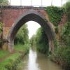
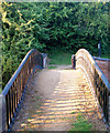
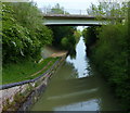
There is a bridge here which takes a track over the canal.
Site of Wormleighton Railway Bridge (narrows) | 1 mile, 2¼ furlongs | |
Wormleighton Reservoir Bridge No 139 | 1 mile, ¼ furlongs | |
Fenny Compton 'Tunnel' (eastern entrance) | 5¼ furlongs | |
Fenny Compton Bridge No 138 | 1½ furlongs | |
Fenny Compton Turnover Bridge No 137A | 1¼ furlongs | |
Tunnel Bridge No 137 | ||
Fenny Compton 'Tunnel' (western entrance) | a few yards | |
Fenny Compton Marina | 3 furlongs | |
Fenny Compton Wharf | 6 furlongs | |
The Wharf Inn (Fenny Compton) | 6 furlongs | |
Fenny Compton Bridge No 136 | 6 furlongs |
- Oxford Canal Walk - Part One - Oxford to Thrupp - YouTube — associated with Oxford Canal
- A walk along the Oxford Canal (Southern Section) from Oxford to Thrupp Wide
Mouseover for more information or show routes to facility
Nearest water point
In the direction of Napton Junction
Fenny Compton Wharf — 6 furlongs away
On this waterway in the direction of Napton Junction
Marston Doles Water Point — 8 miles, 1½ furlongs away
On this waterway in the direction of Napton Junction
Water Point at Bottom of Napton Locks — 10 miles, 1¾ furlongs and 9 locks away
On this waterway in the direction of Napton Junction
Wigrams Turn Marina — 12 miles, 2 furlongs and 9 locks away
Travel to Napton Junction, then on the Grand Union Canal (Oxford Canal Section) to Wigrams Turn Marina
Calcutt Top Lock Winding Hole — 12 miles, 6 furlongs and 9 locks away
Travel to Napton Junction, then on the Grand Union Canal (Warwick and Napton Canal) to Calcutt Top Lock Winding Hole
Calcutt Marina — 12 miles, 7¾ furlongs and 12 locks away
Travel to Napton Junction, then on the Grand Union Canal (Warwick and Napton Canal) to Calcutt Marina
Braunston Services — 17 miles, 2¼ furlongs and 9 locks away
Travel to Napton Junction, then on the Grand Union Canal (Oxford Canal Section) to Braunston Turn, then on the Oxford Canal (Northern Section - Main Line) to Braunston Services
Braunston Road Bridge No 91 — 17 miles, 3½ furlongs and 9 locks away
Travel to Napton Junction, then on the Grand Union Canal (Oxford Canal Section) to Braunston Turn, then on the Grand Union Canal (Grand Junction Canal - Main Line - Braunston to Norton) to Braunston Road Bridge No 91
Braunston Stop — 17 miles, 4¾ furlongs and 9 locks away
Travel to Napton Junction, then on the Grand Union Canal (Oxford Canal Section) to Braunston Turn, then on the Grand Union Canal (Grand Junction Canal - Main Line - Braunston to Norton) to Braunston Stop
Stockton Top Marina — 15 miles, 1 furlong and 12 locks away
Travel to Napton Junction, then on the Grand Union Canal (Warwick and Napton Canal) to Stockton Top Marina
The Blue Lias Inn — 15 miles, 6¾ furlongs and 20 locks away
Travel to Napton Junction, then on the Grand Union Canal (Warwick and Napton Canal) to The Blue Lias Inn
Kayes Arm Junction — 15 miles, 7¾ furlongs and 20 locks away
Travel to Napton Junction, then on the Grand Union Canal (Warwick and Napton Canal) to Kayes Arm Junction
Bascote Bridge No 27 — 17 miles, 1½ furlongs and 22 locks away
Travel to Napton Junction, then on the Grand Union Canal (Warwick and Napton Canal) to Bascote Bridge No 27
In the direction of End of Hythe Bridge Arm
Cropredy Marina (northern basins) — 4 miles, 7¾ furlongs and 8 locks away
On this waterway in the direction of End of Hythe Bridge Arm
Cropredy Marina (southern basin) — 5 miles and 8 locks away
On this waterway in the direction of End of Hythe Bridge Arm
Cropredy Services — 5 miles, 4¾ furlongs and 9 locks away
On this waterway in the direction of End of Hythe Bridge Arm
Sovereign Wharf — 9 miles, 6¼ furlongs and 12 locks away
On this waterway in the direction of End of Hythe Bridge Arm
Banbury Lock No 29 — 10 miles, ½ furlongs and 12 locks away
On this waterway in the direction of End of Hythe Bridge Arm
Cherwell Street Facilities — 10 miles, ¾ furlongs and 13 locks away
On this waterway in the direction of End of Hythe Bridge Arm
Aynho Wharf — 16 miles, 6¼ furlongs and 17 locks away
On this waterway in the direction of End of Hythe Bridge ArmNearest rubbish disposal
In the direction of Napton Junction
Fenny Compton Marina — 3 furlongs away
On this waterway in the direction of Napton Junction
Napton Sanitary Station — 10 miles, 1½ furlongs and 9 locks away
On this waterway in the direction of Napton Junction
Wigrams Turn Marina — 12 miles, 2 furlongs and 9 locks away
Travel to Napton Junction, then on the Grand Union Canal (Oxford Canal Section) to Wigrams Turn Marina
Calcutt Marina — 12 miles, 7¾ furlongs and 12 locks away
Travel to Napton Junction, then on the Grand Union Canal (Warwick and Napton Canal) to Calcutt Marina
Braunston Services — 17 miles, 2¼ furlongs and 9 locks away
Travel to Napton Junction, then on the Grand Union Canal (Oxford Canal Section) to Braunston Turn, then on the Oxford Canal (Northern Section - Main Line) to Braunston Services
Braunston Stop — 17 miles, 4¾ furlongs and 9 locks away
Travel to Napton Junction, then on the Grand Union Canal (Oxford Canal Section) to Braunston Turn, then on the Grand Union Canal (Grand Junction Canal - Main Line - Braunston to Norton) to Braunston Stop
Bascote Bridge No 27 — 17 miles, 1½ furlongs and 22 locks away
Travel to Napton Junction, then on the Grand Union Canal (Warwick and Napton Canal) to Bascote Bridge No 27
In the direction of End of Hythe Bridge Arm
Cropredy Marina (northern basins) — 4 miles, 7¾ furlongs and 8 locks away
On this waterway in the direction of End of Hythe Bridge Arm
Cropredy Marina (southern basin) — 5 miles and 8 locks away
On this waterway in the direction of End of Hythe Bridge Arm
Cropredy Services — 5 miles, 4¾ furlongs and 9 locks away
On this waterway in the direction of End of Hythe Bridge Arm
Sovereign Wharf — 9 miles, 6¼ furlongs and 12 locks away
On this waterway in the direction of End of Hythe Bridge Arm
Cherwell Street Facilities — 10 miles, ¾ furlongs and 13 locks away
On this waterway in the direction of End of Hythe Bridge Arm
Aynho Wharf — 16 miles, 6¼ furlongs and 17 locks away
On this waterway in the direction of End of Hythe Bridge ArmNearest chemical toilet disposal
In the direction of Napton Junction
Napton Sanitary Station — 10 miles, 1½ furlongs and 9 locks away
On this waterway in the direction of Napton Junction
Wigrams Turn Marina — 12 miles, 2 furlongs and 9 locks away
Travel to Napton Junction, then on the Grand Union Canal (Oxford Canal Section) to Wigrams Turn Marina
Calcutt Marina — 12 miles, 7¾ furlongs and 12 locks away
Travel to Napton Junction, then on the Grand Union Canal (Warwick and Napton Canal) to Calcutt Marina
Braunston Services — 17 miles, 2¼ furlongs and 9 locks away
Travel to Napton Junction, then on the Grand Union Canal (Oxford Canal Section) to Braunston Turn, then on the Oxford Canal (Northern Section - Main Line) to Braunston Services
Braunston Road Bridge No 91 — 17 miles, 3½ furlongs and 9 locks away
Travel to Napton Junction, then on the Grand Union Canal (Oxford Canal Section) to Braunston Turn, then on the Grand Union Canal (Grand Junction Canal - Main Line - Braunston to Norton) to Braunston Road Bridge No 91
Fosse Wharf — 19 miles, 7 furlongs and 29 locks away
Travel to Napton Junction, then on the Grand Union Canal (Warwick and Napton Canal) to Fosse Wharf
In the direction of End of Hythe Bridge Arm
Cropredy Marina (southern basin) — 5 miles and 8 locks away
On this waterway in the direction of End of Hythe Bridge Arm
Cropredy Services — 5 miles, 4¾ furlongs and 9 locks away
On this waterway in the direction of End of Hythe Bridge Arm
Sovereign Wharf — 9 miles, 6¼ furlongs and 12 locks away
On this waterway in the direction of End of Hythe Bridge Arm
Cherwell Street Facilities — 10 miles, ¾ furlongs and 13 locks away
On this waterway in the direction of End of Hythe Bridge ArmNearest place to turn
In the direction of Napton Junction
Fenny Compton Marina — 3 furlongs away
On this waterway in the direction of Napton Junction
Fenny Compton Wharf — 6 furlongs away
On this waterway in the direction of Napton Junction
Marston Doles Top Lock Winding Hole — 8 miles, 1¾ furlongs away
On this waterway in the direction of Napton Junction
Old Engine House Arm Junction — 9 miles, ½ furlongs and 2 locks away
On this waterway in the direction of Napton Junction
Old Engine House Winding Hole — 9 miles, 1½ furlongs and 2 locks away
Travel to Old Engine House Arm Junction, then on the Oxford Canal (Old Engine House Arm) to Old Engine House Winding Hole
Napton Winding Hole — 10 miles, 3½ furlongs and 9 locks away
On this waterway in the direction of Napton Junction
Bridge Inn Winding Hole — 11 miles, 3¼ furlongs and 9 locks away
On this waterway in the direction of Napton Junction
Napton Marina — 12 miles, ½ furlongs and 9 locks away
On this waterway in the direction of Napton Junction
Napton Junction — 12 miles, 2 furlongs and 9 locks away
On this waterway in the direction of Napton Junction
Calcutt Top Lock Winding Hole — 12 miles, 6 furlongs and 9 locks away
Travel to Napton Junction, then on the Grand Union Canal (Warwick and Napton Canal) to Calcutt Top Lock Winding Hole
Thick Thorne House Winding Hole — 13 miles, 3 furlongs and 9 locks away
Travel to Napton Junction, then on the Grand Union Canal (Oxford Canal Section) to Thick Thorne House Winding Hole
Calcutt Marina — 12 miles, 7¾ furlongs and 12 locks away
Travel to Napton Junction, then on the Grand Union Canal (Warwick and Napton Canal) to Calcutt Marina
In the direction of End of Hythe Bridge Arm
Clattercote Bridge Winding Hole — 3 miles, 4¾ furlongs and 5 locks away
On this waterway in the direction of End of Hythe Bridge Arm
Cropredy Marina (northern basins) — 4 miles, 7¾ furlongs and 8 locks away
On this waterway in the direction of End of Hythe Bridge Arm
Cropredy Marina (southern basin) — 5 miles and 8 locks away
On this waterway in the direction of End of Hythe Bridge Arm
Cropredy Services — 5 miles, 4¾ furlongs and 9 locks away
On this waterway in the direction of End of Hythe Bridge Arm
Southam Road Footbridge Arm — 8 miles, 7¼ furlongs and 12 locks away
On this waterway in the direction of End of Hythe Bridge Arm
Southam Road Winding Hole — 9 miles, 1¾ furlongs and 12 locks away
On this waterway in the direction of End of Hythe Bridge Arm
Grimsbury Wharf — 9 miles, 3 furlongs and 12 locks away
On this waterway in the direction of End of Hythe Bridge Arm
Calthorpe Winding Hole — 10 miles, 6 furlongs and 13 locks away
On this waterway in the direction of End of Hythe Bridge ArmNearest self-operated pump-out
In the direction of Napton Junction
Braunston Marina (western entrance) — 17 miles, 5 furlongs and 9 locks away
Travel to Napton Junction, then on the Grand Union Canal (Oxford Canal Section) to Braunston Turn, then on the Grand Union Canal (Grand Junction Canal - Main Line - Braunston to Norton) to Braunston Marina (western entrance)
In the direction of End of Hythe Bridge Arm
Cropredy Marina (southern basin) — 5 miles and 8 locks away
On this waterway in the direction of End of Hythe Bridge ArmNearest boatyard pump-out
In the direction of Napton Junction
Wigrams Turn Marina — 12 miles, 2 furlongs and 9 locks away
Travel to Napton Junction, then on the Grand Union Canal (Oxford Canal Section) to Wigrams Turn Marina
Calcutt Marina — 12 miles, 7¾ furlongs and 12 locks away
Travel to Napton Junction, then on the Grand Union Canal (Warwick and Napton Canal) to Calcutt Marina
Ventnor Marina (Sunrise Basin) — 13 miles, ¾ furlongs and 12 locks away
Travel to Napton Junction, then on the Grand Union Canal (Warwick and Napton Canal) to Ventnor Marina (Sunrise Basin)
Stockton Top Marina — 15 miles, 1 furlong and 12 locks away
Travel to Napton Junction, then on the Grand Union Canal (Warwick and Napton Canal) to Stockton Top Marina
In the direction of End of Hythe Bridge Arm
Cropredy Marina (southern basin) — 5 miles and 8 locks away
On this waterway in the direction of End of Hythe Bridge Arm
Sovereign Wharf — 9 miles, 6¼ furlongs and 12 locks away
On this waterway in the direction of End of Hythe Bridge Arm
Twyford Wharf — 12 miles, 7 furlongs and 14 locks away
On this waterway in the direction of End of Hythe Bridge Arm
Aynho Wharf — 16 miles, 6¼ furlongs and 17 locks away
On this waterway in the direction of End of Hythe Bridge ArmDirection of TV transmitter (From Wolfbane Cybernetic)
There is no page on Wikipedia called “Tunnel Bridge”
Wikipedia pages that might relate to Tunnel Bridge
[List of bridge–tunnels]
List of bridge–tunnels: Transcontinental railroads have many bridge–tunnels. Intercontinental and transoceanic fixed links
[Chesapeake Bay Bridge–Tunnel]
The Chesapeake Bay Bridge–Tunnel (CBBT) is a 17.6-mile (28.3 km) bridge–tunnel crossing at the mouth of the Chesapeake Bay, the Hampton Roads harbor,
[Bridge–tunnel]
A bridge–tunnel is a persistent, unbroken road or rail connection across water that uses a combination of bridges and tunnels, and sometimes causeways
[Bering Strait crossing]
A Bering Strait crossing is a hypothetical bridge or tunnel spanning the relatively narrow and shallow Bering Strait between the Chukotka Peninsula in
[Bridge and tunnel]
Bridge and Tunnel (often abbreviated B&T or BNT) is a term – often used pejoratively – to describe people who live in communities surrounding the island
[List of bridges and tunnels in New York City]
New York City is home to over 2,000 bridges and tunnels. Several agencies manage this network of crossings, including the New York City Department of
[Øresund Bridge]
completed by the 4-kilometre (2.5 mi) Drogden Tunnel from Peberholm to the Danish island of Amager. The bridge connects the road and rail networks of the
[Hampton Roads Bridge–Tunnel]
The Hampton Roads Bridge–Tunnel (HRBT) is a 3.5-mile (5.6 km)-long Hampton Roads crossing for Interstate 64 and U.S. Route 60. It is a four-lane facility
[MTA Bridges and Tunnels]
The Triborough Bridge and Tunnel Authority (TBTA), doing business as MTA Bridges and Tunnels, is an affiliate agency of the Metropolitan Transportation
[Strait of Gibraltar crossing]
The Strait of Gibraltar crossing is a hypothetical bridge or tunnel spanning the Strait of Gibraltar (about 14 km or 9 miles at its narrowest point) that
Results of Google Search
Aug 9, 2015 ... Crossing the Oxford Canal in a deep cutting near Fenny Compton called The Tunnel.
The Bethlehem Grange No. 137 is a historic Grange hall located in Selkirk, Albany County, ... Location, 24 Bridge St., Selkirk, New York. Coordinates ... Grange No. 137 website ... Other lists. Bridges and tunnels · National Historic Landmarks.
Photographers number: 268. Title: Boundary Peak and Tunnel No. 15. 137 miles from Sacramento. Notes: Watkins mount. Photographer: Alfred A Hart (Mar 28, ...
International Union of Operating Engineers Local 137. ... forklifts and bulldozers which helped build the roads, bridges, tunnels, buildings and infrastructure that ...
The Bridge-Tunnel project is a four-lane 20-mile-long vehicular toll crossing of the lower Chesapeake Bay. ... There are also high level bridges over two other navigation channels: North Channel Bridge and ... No tax dollars were used.
The town of Tunnel Hill was an important railroad town on the Western and Atlantic ... HM, BF, F, AC, CK, CT, GI, GLC US military railroad engine no. 137,, built in 1864 in the yards of ... House across from Covered Bridge on Clisby Austin Rd.
Aug 7, 2020 ... Bent under temporary bridge of Delaware, Lackawanna and Western Railroad over Erie at ... NJ-137-7, South Bergen Tunnel, for Open Cut No.
Mar 27, 2019 ... The XC Indy 137, while not our first choice for deep snow forays is as ... For sure, the Indy XC, with its conventional closed tunnel, can haul ...
Upon any bridge or other elevated structure, upon a highway, or within a highway tunnel;. h. On any railroad tracks;. i. At any place where official signs prohibit ...