CanalPlanAC

Footbridge (Sandiacre)

 
Erewash Valley Trail - Sandiacre Bridge No. 12, Ilkeston Road, Sandiacre NG10 5EA, United Kingdom
 
Information about the place
Footbridge (Sandiacre) is a minor waterways place on the Grand Union Canal (Erewash Canal) between Potter's Lock Bridge (2 miles and 7½ furlongs and 5 locks to the north) and Sandiacre (5¾ furlongs to the southwest).
 
 
The nearest place in the direction of Potter's Lock Bridge is Pasture Lock No 64; 1¾ furlongs away.
 
The nearest place in the direction of Sandiacre is Mill Lane Footbridge; 4½ furlongs away.

There may be access to the towpath here.

Mooring here is unrated.

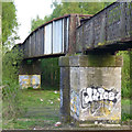
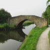
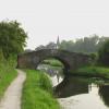
There is a bridge here which takes pedestrian traffic over the canal.

Stanton Lock Footbridge6¾ furlongs
Railway Bridge near Stapleford (disused)5 furlongs
M1 Motorway Bridge4¼ furlongs
Stanton Gate Bridge3½ furlongs
Pasture Lock No 641¾ furlongs
Footbridge (Sandiacre)
Mill Lane Footbridge4½ furlongs
Sandiacre5¾ furlongs
Sandiacre Bridge6¼ furlongs
A52 Road Bridge1 mile, ¾ furlongs
Sandiacre Junction1 mile, 2 furlongs
 
 
Amenities

Amenities here

 Farmfoods
 Kwik Save
 Hyper Discount Stores
 Cashpoint
 Cashpoint
 Cashpoint
 Cashpoint
 HSBC
 Lloyds Bank
 NatWest

Amenities nearby at Mill Lane Footbridge

 Pizza Hut
 Admiral Sir John Borlase Warren
 Blue Bell
 Ferry Inn
 SEE ADDRESS

Amenities nearby at Pasture Lock No 64

 Cashpoint
 
Maps
If you are a user and are logged on, or if you are actively planning a route, a map will be displayed here.
Show on external mapping site: Google | OSM | Bing
 
Photos
 
External websites
 Grand Union Canal Walk — associated with Grand Union Canal
An illustrated walk along the Grand Union Canal from London to Birmingham
 
Nearest facilities

Mouseover for more information or show routes to facility

Nearest water point

In the direction of Trent Junction

Former BW Trent Lock Waterway Office4 miles, 3¼ furlongs and 3 locks away
On this waterway in the direction of Trent Junction
Sawley Locks No 25 miles, 3½ furlongs and 4 locks away
Travel to Trent Junction, then on the River Trent (Western End) to Sawley Locks No 2
Cranfleet Lock No 35 miles, 1¾ furlongs and 5 locks away
Travel to Trent Junction, then on the River Trent (Western End) to Cranfleet Lock No 3
Shardlow7 miles, 5¼ furlongs and 7 locks away
Travel to Trent Junction, then on the River Trent (Western End) to Derwent Mouth, then on the Trent and Mersey Canal (Main Line - Derwent Mouth to Burton) to Shardlow
Beeston Lock No 59 miles, 4½ furlongs and 6 locks away
Travel to Trent Junction, then on the River Trent (Western End) to Beeston Lock No 5
Weston Lock No 410 miles, 4¾ furlongs and 9 locks away
Travel to Trent Junction, then on the River Trent (Western End) to Derwent Mouth, then on the Trent and Mersey Canal (Main Line - Derwent Mouth to Burton) to Weston Lock No 4
Bishop Meadow Lock No 5412 miles, 5½ furlongs and 9 locks away
Travel to Trent Junction, then on the Grand Union Canal (Leicester Section - River Soar Navigation) to Bishop Meadow Lock No 54
Swarkestone Lock No 513 miles, 6¼ furlongs and 8 locks away
Travel to Sandiacre Junction, then on the Derby and Sandiacre Canal to Swarkestone Junction, then on the Trent and Mersey Canal (Main Line - Derwent Mouth to Burton) to Swarkestone Lock No 5
Loughborough Basin13 miles, 6¼ furlongs and 11 locks away
Travel to Trent Junction, then on the Grand Union Canal (Leicester Section - River Soar Navigation) to Loughborough Branch Junction, then on the Grand Union Canal (Leicester Section - Loughborough Branch) to Loughborough Basin
Holme Lock No 517 miles, 6¾ furlongs and 9 locks away
Travel to Trent Junction, then on the River Trent (Western End) to Beeston Lock No 5, then on the River Trent (Beeston Canal) to Lenton Chain, then on the River Trent (Nottingham Canal) to Meadow Lane Junction, then on the River Trent (non-tidal section) to Holme Lock No 5
Willington Services19 miles and 9 locks away
Travel to Sandiacre Junction, then on the Derby and Sandiacre Canal to Swarkestone Junction, then on the Trent and Mersey Canal (Main Line - Derwent Mouth to Burton) to Willington Services
Barrow Boating17 miles, 5½ furlongs and 13 locks away
Travel to Trent Junction, then on the Grand Union Canal (Leicester Section - River Soar Navigation) to Barrow Boating

In the direction of Derby Road Bridge

Langley Junction7 miles, ¾ furlongs and 11 locks away
Travel to Derby Road Bridge, then on the Cromford Canal (broad gauge, navigable) to Langley Junction

Nearest rubbish disposal

In the direction of Trent Junction

Former BW Trent Lock Waterway Office4 miles, 3¼ furlongs and 3 locks away
On this waterway in the direction of Trent Junction
Sawley Locks No 25 miles, 3½ furlongs and 4 locks away
Travel to Trent Junction, then on the River Trent (Western End) to Sawley Locks No 2
Cranfleet Lock No 35 miles, 1¾ furlongs and 5 locks away
Travel to Trent Junction, then on the River Trent (Western End) to Cranfleet Lock No 3
Beeston Lock No 59 miles, 4½ furlongs and 6 locks away
Travel to Trent Junction, then on the River Trent (Western End) to Beeston Lock No 5
Swarkestone Lock No 513 miles, 6¼ furlongs and 8 locks away
Travel to Sandiacre Junction, then on the Derby and Sandiacre Canal to Swarkestone Junction, then on the Trent and Mersey Canal (Main Line - Derwent Mouth to Burton) to Swarkestone Lock No 5
Loughborough Basin13 miles, 6¼ furlongs and 11 locks away
Travel to Trent Junction, then on the Grand Union Canal (Leicester Section - River Soar Navigation) to Loughborough Branch Junction, then on the Grand Union Canal (Leicester Section - Loughborough Branch) to Loughborough Basin
Holme Lock No 517 miles, 6¾ furlongs and 9 locks away
Travel to Trent Junction, then on the River Trent (Western End) to Beeston Lock No 5, then on the River Trent (Beeston Canal) to Lenton Chain, then on the River Trent (Nottingham Canal) to Meadow Lane Junction, then on the River Trent (non-tidal section) to Holme Lock No 5
Willington Services19 miles and 9 locks away
Travel to Sandiacre Junction, then on the Derby and Sandiacre Canal to Swarkestone Junction, then on the Trent and Mersey Canal (Main Line - Derwent Mouth to Burton) to Willington Services
Barrow Boating17 miles, 5½ furlongs and 13 locks away
Travel to Trent Junction, then on the Grand Union Canal (Leicester Section - River Soar Navigation) to Barrow Boating
Broome Island18 miles, 3¾ furlongs and 13 locks away
Travel to Trent Junction, then on the Grand Union Canal (Leicester Section - River Soar Navigation) to Broome Island

Nearest chemical toilet disposal

In the direction of Trent Junction

Former BW Trent Lock Waterway Office4 miles, 3¼ furlongs and 3 locks away
On this waterway in the direction of Trent Junction
Sawley Locks No 25 miles, 3½ furlongs and 4 locks away
Travel to Trent Junction, then on the River Trent (Western End) to Sawley Locks No 2
Sawley Cut Wharf5 miles, 5 furlongs and 5 locks away
Travel to Trent Junction, then on the River Trent (Western End) to Sawley Cut Wharf
Beeston Lock No 59 miles, 4½ furlongs and 6 locks away
Travel to Trent Junction, then on the River Trent (Western End) to Beeston Lock No 5
Meadow Lane Lock No 715 miles, 3¼ furlongs and 8 locks away
Travel to Trent Junction, then on the River Trent (Western End) to Beeston Lock No 5, then on the River Trent (Beeston Canal) to Lenton Chain, then on the River Trent (Nottingham Canal) to Meadow Lane Lock No 7
Holme Lock No 517 miles, 6¾ furlongs and 9 locks away
Travel to Trent Junction, then on the River Trent (Western End) to Beeston Lock No 5, then on the River Trent (Beeston Canal) to Lenton Chain, then on the River Trent (Nottingham Canal) to Meadow Lane Junction, then on the River Trent (non-tidal section) to Holme Lock No 5
Willington Services19 miles and 9 locks away
Travel to Sandiacre Junction, then on the Derby and Sandiacre Canal to Swarkestone Junction, then on the Trent and Mersey Canal (Main Line - Derwent Mouth to Burton) to Willington Services
Barrow Boating17 miles, 5½ furlongs and 13 locks away
Travel to Trent Junction, then on the Grand Union Canal (Leicester Section - River Soar Navigation) to Barrow Boating

In the direction of Derby Road Bridge

Langley Junction7 miles, ¾ furlongs and 11 locks away
Travel to Derby Road Bridge, then on the Cromford Canal (broad gauge, navigable) to Langley Junction

Nearest place to turn

In the direction of Trent Junction

Sandiacre Junction1 mile, 2 furlongs away
On this waterway in the direction of Trent Junction
Long Eaton Winding Hole2 miles, 4½ furlongs and 2 locks away
On this waterway in the direction of Trent Junction
Sheet Stores Basin3 miles, 6¼ furlongs and 3 locks away
On this waterway in the direction of Trent Junction
Former BW Trent Lock Waterway Office4 miles, 3¼ furlongs and 3 locks away
On this waterway in the direction of Trent Junction
Soar Mouth4 miles, 5¾ furlongs and 4 locks away
Travel to Trent Junction, then on the Grand Union Canal (Leicester Section - River Soar Navigation) to Soar Mouth
Redhill Lock Junction5 miles, ½ furlongs and 4 locks away
Travel to Trent Junction, then on the Grand Union Canal (Leicester Section - River Soar Navigation) to Redhill Lock Junction
Sawley Lock No 2 Weir Exit5 miles, 2¾ furlongs and 4 locks away
Travel to Trent Junction, then on the River Trent (Western End) to Sawley Lock No 2 Weir Exit
Redhill Marine Ltd5 miles, 4¾ furlongs and 5 locks away
Travel to Trent Junction, then on the Grand Union Canal (Leicester Section - River Soar Navigation) to Redhill Marine Ltd
Ratcliffe Lock Junction5 miles, 7¼ furlongs and 5 locks away
Travel to Trent Junction, then on the Grand Union Canal (Leicester Section - River Soar Navigation) to Ratcliffe Lock Junction
Cranfleet Lock Weir Exit5 miles, 2½ furlongs and 6 locks away
Travel to Trent Junction, then on the River Trent (Western End) to Cranfleet Lock Weir Exit
Sawley Flood Lock Weir Entrance6 miles, ½ furlongs and 6 locks away
Travel to Trent Junction, then on the River Trent (Western End) to Sawley Flood Lock Weir Entrance
Ratcliffe Weir6 miles, 2¼ furlongs and 6 locks away
Travel to Trent Junction, then on the Grand Union Canal (Leicester Section - River Soar Navigation) to Ratcliffe Weir
Derwent Mouth6 miles, 4½ furlongs and 6 locks away
Travel to Trent Junction, then on the River Trent (Western End) to Derwent Mouth
Station Road Arm7 miles, 3½ furlongs and 7 locks away
Travel to Trent Junction, then on the Grand Union Canal (Leicester Section - River Soar Navigation) to Station Road Arm
Shardlow7 miles, 5¼ furlongs and 7 locks away
Travel to Trent Junction, then on the River Trent (Western End) to Derwent Mouth, then on the Trent and Mersey Canal (Main Line - Derwent Mouth to Burton) to Shardlow

In the direction of Derby Road Bridge

Winding Hole above Stanton Lock7¾ furlongs and 2 locks away
On this waterway in the direction of Derby Road Bridge
Hallam Fields Lock Winding Hole1 mile, 3¼ furlongs and 3 locks away
On this waterway in the direction of Derby Road Bridge
Winding Hole below Stenson's Lock4 miles, 2¼ furlongs and 7 locks away
On this waterway in the direction of Derby Road Bridge
Bridge Street Winding Hole4 miles, 5¾ furlongs and 8 locks away
On this waterway in the direction of Derby Road Bridge
Shipley Mill Winding Hole5 miles, 3¾ furlongs and 8 locks away
On this waterway in the direction of Derby Road Bridge

Nearest self-operated pump-out

In the direction of Trent Junction

Mercia Marina18 miles, 3 furlongs and 9 locks away
Travel to Sandiacre Junction, then on the Derby and Sandiacre Canal to Swarkestone Junction, then on the Trent and Mersey Canal (Main Line - Derwent Mouth to Burton) to Mercia Marina

Nearest boatyard pump-out

In the direction of Derby Road Bridge

Langley Junction7 miles, ¾ furlongs and 11 locks away
Travel to Derby Road Bridge, then on the Cromford Canal (broad gauge, navigable) to Langley Junction

In the direction of Trent Junction

Mercia Marina18 miles, 3 furlongs and 9 locks away
Travel to Sandiacre Junction, then on the Derby and Sandiacre Canal to Swarkestone Junction, then on the Trent and Mersey Canal (Main Line - Derwent Mouth to Burton) to Mercia Marina
Direction of TV transmitter (From Wolfbane Cybernetic)
 
 
Geograph
 
Wikipedia

Wikipedia has a page about Footbridge

A footbridge (also a pedestrian bridge, pedestrian overpass, or pedestrian overcrossing) is a bridge designed solely for pedestrians. While the primary meaning for a bridge is a structure which links "two points at a height above the ground", a footbridge can also be a lower structure, such as a boardwalk, that enables pedestrians to cross wet, fragile, or marshy land. Bridges range from stepping stones–possibly the earliest man-made structure to "bridge" water–to elaborate steel structures. Another early bridge would have been simply a fallen tree. In some cases a footbridge can be both functional and artistic.

For rural communities in the developing world, a footbridge may be a community's only access to medical clinics, schools, businesses and markets. Simple suspension bridge designs have been developed to be sustainable and easily constructed in such areas using only local materials and labor.

An enclosed footbridge between two buildings is sometimes known as a skyway. Bridges providing for both pedestrians and cyclists are often referred to as greenbridges and form an important part of a sustainable transport system.

Footbridges are often situated to allow pedestrians to cross water or railways in areas where there are no nearby roads. They are also located across roads to let pedestrians cross safely without slowing traffic. The latter is a type of pedestrian separation structure, examples of which are particularly found near schools.

Other Wikipedia pages that might relate to Footbridge
[Multnomah Falls] bridge at the falls to allow visitor access. This bridge, named the Benson Footbridge, spans the lower falls at a height of 105 feet (32 m), and provides an [Cox Green Footbridge] Cox Green Footbridge is a footbridge spanning the River Wear in North East England, linking Cox Green and Washington Staithes. The bridge opened in 1958 [Hungerford Bridge and Golden Jubilee Bridges] designed by Isambard Kingdom Brunel, opened in 1845 as a suspension footbridge. It was named after the then Hungerford Market, because it went from the [Baglung Parbat Footbridge] Baglung Parbat Footbridge is claimed to be the longest suspended footbridge in the world with a span of 576m. It connects the Kusma Meteropoliton city [Footbridge across a Ditch] Footbridge across a Ditch is an oil painting created in 1883 by Vincent van Gogh. [Flora Footbridge] The Flora Footbridge, named after Flora MacDonald, is a pedestrian/cycling bridge in Ottawa, Ontario, Canada, that spans the Rideau Canal, connecting Clegg [John W. Weeks Bridge] The John W. Weeks Memorial Bridge, usually called the Weeks Footbridge (or simply Weeks Bridge), is a pedestrian bridge over the Charles River, located [Millennium Bridge, London] The Millennium Bridge, officially known as the London Millennium Footbridge, is a steel suspension bridge for pedestrians crossing the River Thames in [Teddington Lock Footbridges] The Teddington Lock Footbridges are two footbridges over the River Thames in England, situated just upstream of Teddington Lock at Teddington. There is
 
Google