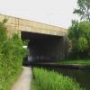
M1 Motorway Bridge
is a minor waterways place
on the Grand Union Canal (Erewash Canal) between
Potter's Lock Bridge (2 miles and 3¼ furlongs
and 4 locks
to the north) and
Sandiacre (1 mile and 2 furlongs
and 1 lock
to the south).
The nearest place in the direction of Potter's Lock Bridge is Railway Bridge near Stapleford (disused);
¾ furlongs
away.
The nearest place in the direction of Sandiacre is Stanton Gate Bridge;
¾ furlongs
away.
Mooring here is unrated.
There is a bridge here which takes a motorway over the canal.
Stanton Lock Aqueduct | 4 furlongs | |
Winding Hole above Stanton Lock | 3½ furlongs | |
Stanton Lock No 65 | 2½ furlongs | |
Stanton Lock Footbridge | 2¼ furlongs | |
Railway Bridge near Stapleford (disused) | ¾ furlongs | |
M1 Motorway Bridge | ||
Stanton Gate Bridge | ¾ furlongs | |
Pasture Lock No 64 | 2½ furlongs | |
Footbridge (Sandiacre) | 4¼ furlongs | |
Mill Lane Footbridge | 1 mile, ¾ furlongs | |
Sandiacre | 1 mile, 2 furlongs |
- Grand Union Canal Walk — associated with Grand Union Canal
- An illustrated walk along the Grand Union Canal from London to Birmingham
Mouseover for more information or show routes to facility
Nearest water point
In the direction of Trent Junction
Former BW Trent Lock Waterway Office — 4 miles, 7¾ furlongs and 4 locks away
On this waterway in the direction of Trent Junction
Sawley Locks No 2 — 5 miles, 7¾ furlongs and 5 locks away
Travel to Trent Junction, then on the River Trent (Western End) to Sawley Locks No 2
Cranfleet Lock No 3 — 5 miles, 6 furlongs and 6 locks away
Travel to Trent Junction, then on the River Trent (Western End) to Cranfleet Lock No 3
Shardlow — 8 miles, 1½ furlongs and 8 locks away
Travel to Trent Junction, then on the River Trent (Western End) to Derwent Mouth, then on the Trent and Mersey Canal (Main Line - Derwent Mouth to Burton) to Shardlow
Beeston Lock No 5 — 10 miles, ¾ furlongs and 7 locks away
Travel to Trent Junction, then on the River Trent (Western End) to Beeston Lock No 5
Weston Lock No 4 — 11 miles, 1 furlong and 10 locks away
Travel to Trent Junction, then on the River Trent (Western End) to Derwent Mouth, then on the Trent and Mersey Canal (Main Line - Derwent Mouth to Burton) to Weston Lock No 4
Bishop Meadow Lock No 54 — 13 miles, 1¾ furlongs and 10 locks away
Travel to Trent Junction, then on the Grand Union Canal (Leicester Section - River Soar Navigation) to Bishop Meadow Lock No 54
Swarkestone Lock No 5 — 14 miles, 2½ furlongs and 9 locks away
Travel to Sandiacre Junction, then on the Derby and Sandiacre Canal to Swarkestone Junction, then on the Trent and Mersey Canal (Main Line - Derwent Mouth to Burton) to Swarkestone Lock No 5
Loughborough Basin — 14 miles, 2½ furlongs and 12 locks away
Travel to Trent Junction, then on the Grand Union Canal (Leicester Section - River Soar Navigation) to Loughborough Branch Junction, then on the Grand Union Canal (Leicester Section - Loughborough Branch) to Loughborough Basin
Holme Lock No 5 — 18 miles, 3 furlongs and 10 locks away
Travel to Trent Junction, then on the River Trent (Western End) to Beeston Lock No 5, then on the River Trent (Beeston Canal) to Lenton Chain, then on the River Trent (Nottingham Canal) to Meadow Lane Junction, then on the River Trent (non-tidal section) to Holme Lock No 5
Willington Services — 19 miles, 4½ furlongs and 10 locks away
Travel to Sandiacre Junction, then on the Derby and Sandiacre Canal to Swarkestone Junction, then on the Trent and Mersey Canal (Main Line - Derwent Mouth to Burton) to Willington Services
Barrow Boating — 18 miles, 1¾ furlongs and 14 locks away
Travel to Trent Junction, then on the Grand Union Canal (Leicester Section - River Soar Navigation) to Barrow Boating
In the direction of Derby Road Bridge
Langley Junction — 6 miles, 4½ furlongs and 10 locks away
Travel to Derby Road Bridge, then on the Cromford Canal (broad gauge, navigable) to Langley JunctionNearest rubbish disposal
In the direction of Trent Junction
Former BW Trent Lock Waterway Office — 4 miles, 7¾ furlongs and 4 locks away
On this waterway in the direction of Trent Junction
Sawley Locks No 2 — 5 miles, 7¾ furlongs and 5 locks away
Travel to Trent Junction, then on the River Trent (Western End) to Sawley Locks No 2
Cranfleet Lock No 3 — 5 miles, 6 furlongs and 6 locks away
Travel to Trent Junction, then on the River Trent (Western End) to Cranfleet Lock No 3
Beeston Lock No 5 — 10 miles, ¾ furlongs and 7 locks away
Travel to Trent Junction, then on the River Trent (Western End) to Beeston Lock No 5
Swarkestone Lock No 5 — 14 miles, 2½ furlongs and 9 locks away
Travel to Sandiacre Junction, then on the Derby and Sandiacre Canal to Swarkestone Junction, then on the Trent and Mersey Canal (Main Line - Derwent Mouth to Burton) to Swarkestone Lock No 5
Loughborough Basin — 14 miles, 2½ furlongs and 12 locks away
Travel to Trent Junction, then on the Grand Union Canal (Leicester Section - River Soar Navigation) to Loughborough Branch Junction, then on the Grand Union Canal (Leicester Section - Loughborough Branch) to Loughborough Basin
Holme Lock No 5 — 18 miles, 3 furlongs and 10 locks away
Travel to Trent Junction, then on the River Trent (Western End) to Beeston Lock No 5, then on the River Trent (Beeston Canal) to Lenton Chain, then on the River Trent (Nottingham Canal) to Meadow Lane Junction, then on the River Trent (non-tidal section) to Holme Lock No 5
Willington Services — 19 miles, 4½ furlongs and 10 locks away
Travel to Sandiacre Junction, then on the Derby and Sandiacre Canal to Swarkestone Junction, then on the Trent and Mersey Canal (Main Line - Derwent Mouth to Burton) to Willington Services
Barrow Boating — 18 miles, 1¾ furlongs and 14 locks away
Travel to Trent Junction, then on the Grand Union Canal (Leicester Section - River Soar Navigation) to Barrow Boating
Broome Island — 19 miles, ¼ furlongs and 14 locks away
Travel to Trent Junction, then on the Grand Union Canal (Leicester Section - River Soar Navigation) to Broome IslandNearest chemical toilet disposal
In the direction of Trent Junction
Former BW Trent Lock Waterway Office — 4 miles, 7¾ furlongs and 4 locks away
On this waterway in the direction of Trent Junction
Sawley Locks No 2 — 5 miles, 7¾ furlongs and 5 locks away
Travel to Trent Junction, then on the River Trent (Western End) to Sawley Locks No 2
Sawley Cut Wharf — 6 miles, 1¼ furlongs and 6 locks away
Travel to Trent Junction, then on the River Trent (Western End) to Sawley Cut Wharf
Beeston Lock No 5 — 10 miles, ¾ furlongs and 7 locks away
Travel to Trent Junction, then on the River Trent (Western End) to Beeston Lock No 5
Meadow Lane Lock No 7 — 15 miles, 7¾ furlongs and 9 locks away
Travel to Trent Junction, then on the River Trent (Western End) to Beeston Lock No 5, then on the River Trent (Beeston Canal) to Lenton Chain, then on the River Trent (Nottingham Canal) to Meadow Lane Lock No 7
Holme Lock No 5 — 18 miles, 3 furlongs and 10 locks away
Travel to Trent Junction, then on the River Trent (Western End) to Beeston Lock No 5, then on the River Trent (Beeston Canal) to Lenton Chain, then on the River Trent (Nottingham Canal) to Meadow Lane Junction, then on the River Trent (non-tidal section) to Holme Lock No 5
Willington Services — 19 miles, 4½ furlongs and 10 locks away
Travel to Sandiacre Junction, then on the Derby and Sandiacre Canal to Swarkestone Junction, then on the Trent and Mersey Canal (Main Line - Derwent Mouth to Burton) to Willington Services
Barrow Boating — 18 miles, 1¾ furlongs and 14 locks away
Travel to Trent Junction, then on the Grand Union Canal (Leicester Section - River Soar Navigation) to Barrow Boating
In the direction of Derby Road Bridge
Langley Junction — 6 miles, 4½ furlongs and 10 locks away
Travel to Derby Road Bridge, then on the Cromford Canal (broad gauge, navigable) to Langley JunctionNearest place to turn
In the direction of Derby Road Bridge
Winding Hole above Stanton Lock — 3½ furlongs and 1 lock away
On this waterway in the direction of Derby Road Bridge
Hallam Fields Lock Winding Hole — 7 furlongs and 2 locks away
On this waterway in the direction of Derby Road Bridge
Winding Hole below Stenson's Lock — 3 miles, 6 furlongs and 6 locks away
On this waterway in the direction of Derby Road Bridge
Bridge Street Winding Hole — 4 miles, 1½ furlongs and 7 locks away
On this waterway in the direction of Derby Road Bridge
Shipley Mill Winding Hole — 4 miles, 7½ furlongs and 7 locks away
On this waterway in the direction of Derby Road Bridge
Anchor Road Winding Hole — 6 miles, 1¾ furlongs and 9 locks away
On this waterway in the direction of Derby Road Bridge
In the direction of Trent Junction
Sandiacre Junction — 1 mile, 6¼ furlongs and 1 lock away
On this waterway in the direction of Trent Junction
Long Eaton Winding Hole — 3 miles, ¾ furlongs and 3 locks away
On this waterway in the direction of Trent Junction
Sheet Stores Basin — 4 miles, 2¾ furlongs and 4 locks away
On this waterway in the direction of Trent Junction
Former BW Trent Lock Waterway Office — 4 miles, 7¾ furlongs and 4 locks away
On this waterway in the direction of Trent Junction
Soar Mouth — 5 miles, 2¼ furlongs and 5 locks away
Travel to Trent Junction, then on the Grand Union Canal (Leicester Section - River Soar Navigation) to Soar Mouth
Redhill Lock Junction — 5 miles, 4¾ furlongs and 5 locks away
Travel to Trent Junction, then on the Grand Union Canal (Leicester Section - River Soar Navigation) to Redhill Lock Junction
Sawley Lock No 2 Weir Exit — 5 miles, 7 furlongs and 5 locks away
Travel to Trent Junction, then on the River Trent (Western End) to Sawley Lock No 2 Weir Exit
Redhill Marine Ltd — 6 miles, 1 furlong and 6 locks away
Travel to Trent Junction, then on the Grand Union Canal (Leicester Section - River Soar Navigation) to Redhill Marine Ltd
Ratcliffe Lock Junction — 6 miles, 3½ furlongs and 6 locks away
Travel to Trent Junction, then on the Grand Union Canal (Leicester Section - River Soar Navigation) to Ratcliffe Lock Junction
Cranfleet Lock Weir Exit — 5 miles, 6¾ furlongs and 7 locks away
Travel to Trent Junction, then on the River Trent (Western End) to Cranfleet Lock Weir Exit
Sawley Flood Lock Weir Entrance — 6 miles, 4¾ furlongs and 7 locks away
Travel to Trent Junction, then on the River Trent (Western End) to Sawley Flood Lock Weir Entrance
Ratcliffe Weir — 6 miles, 6½ furlongs and 7 locks away
Travel to Trent Junction, then on the Grand Union Canal (Leicester Section - River Soar Navigation) to Ratcliffe Weir
Derwent Mouth — 7 miles, ¾ furlongs and 7 locks away
Travel to Trent Junction, then on the River Trent (Western End) to Derwent Mouth
Station Road Arm — 7 miles, 7¾ furlongs and 8 locks away
Travel to Trent Junction, then on the Grand Union Canal (Leicester Section - River Soar Navigation) to Station Road ArmNearest self-operated pump-out
In the direction of Trent Junction
Mercia Marina — 18 miles, 7¼ furlongs and 10 locks away
Travel to Sandiacre Junction, then on the Derby and Sandiacre Canal to Swarkestone Junction, then on the Trent and Mersey Canal (Main Line - Derwent Mouth to Burton) to Mercia MarinaNearest boatyard pump-out
In the direction of Derby Road Bridge
Langley Junction — 6 miles, 4½ furlongs and 10 locks away
Travel to Derby Road Bridge, then on the Cromford Canal (broad gauge, navigable) to Langley Junction
In the direction of Trent Junction
Mercia Marina — 18 miles, 7¼ furlongs and 10 locks away
Travel to Sandiacre Junction, then on the Derby and Sandiacre Canal to Swarkestone Junction, then on the Trent and Mersey Canal (Main Line - Derwent Mouth to Burton) to Mercia MarinaDirection of TV transmitter (From Wolfbane Cybernetic)
There is no page on Wikipedia called “M1 Motorway Bridge”
Wikipedia pages that might relate to M1 Motorway Bridge
[M1 motorway]
The M1 motorway connects London to Leeds, where it joins the A1(M) near Aberford, to connect to Newcastle. It was the first inter-urban motorway to be
[A1(M) motorway]
extension of the M1. Most of the English section of the A1 is a series of alternating sections of primary route, dual carriageway and motorway. From Newcastle
[M-1 motorway (Pakistan)]
The M1 motorway (Urdu: موٹروے 1) or M1, is an east-west motorway in Pakistan, connecting Peshawar to Islamabad–Rawalpindi. The motorway was constructed
[M1 motorway (Northern Ireland)]
The M1 is a motorway in Northern Ireland. It is the longest motorway in Northern Ireland and runs for 38 miles (61 km) from Belfast to Dungannon through
[M62 motorway]
engineers. Located where the M62 crosses above the M1 motorway, it is a complex three-level junction with eight bridges including a roundabout supported
[M-2 motorway (Pakistan)]
continues on to eventually become the M1 motorway linking the twin cities with Peshawar. The M-2 crosses the junction of the M4 (to Faisalabad) at Pindi Bhattian
[List of motorways in the United Kingdom]
following motorways were planned, but never built. M11, from the M1 going through Lisburn and then crossing the M1 again and ending at Newry M23, from the M2 to
[M25 motorway]
The M25 or London Orbital Motorway is a major road encircling almost all of Greater London, England. The Dartford Crossing (A282) is part of the orbital
[M1 motorway (Republic of Ireland)]
The M1 motorway (Irish: Mótarbhealach M1) is a motorway in Ireland. It forms the large majority of the N1 national primary road connecting Dublin towards
[M4 motorway]
The M4, originally the London-South Wales Motorway, is a motorway in the United Kingdom running from west London to southwest Wales. The English section
Results of Google Search
BridgesIntroduction. A total of 120 bridges and subways were constructed on this length of the M1 Motorway. This represents approximately one quarter of the ...
Dec 29, 2018 ... A teenager died after falling from a bridge into oncoming traffic on a motorway, police said. The woman, believed to be 18 and from Wakefield, ...
Dec 30, 2018 ... HEARTBROKEN pals have paid tribute to a teenage X Factor hopeful who died after falling off a bridge spanning the M1 motorway.
Mar 22, 2019 ... Man in his sixties taken to hospital after fall from bridge over M1.
The Mary McAleese Boyne Valley Bridge is a cable-stayed bridge in County Meath, and County Louth, Ireland. It spans the Boyne River 3 kilometres (1.9 mi) west of Drogheda on the county boundary between County Meath and County Louth and is part of the M1 Northern Motorway.
This project is part of the Pacific Motorway M1 North upgrade program being .... to remove the existing Underwood Road bridge over the Pacific Motorway at ...
Tinsley Viaduct is a two-tier road bridge in Sheffield, England; the first of its kind in the United Kingdom. It carries the M1 and the A631 3,389 feet (1,033 m) over the Don Valley, from ... Since the opening of the M1 junction 32 to 35a smart motorway scheme in January 2017, the viaduct once again carries 3 lanes of traffic plus ...
Dec 29, 2018 ... A young woman has died after falling from a bridge over the M1 at Ossett last night.
M1 Pacific Motorway bridge opens. A new bridge to carry southbound motorists on the M1 above the future NorthConnex tunnel portals has opened to traffic.
Jul 12, 2019 ... M1 Pacific Motorway's Underwood Road Bridge Opens. Today's opening of the new Underwood Road Bridge has brought Queensland's ...