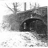
Oil Mills Bridge carries a farm track over the Cotswold Canals (Stroudwater Navigation - Un-navigable Section) just past the junction with The Chester and Kings Lynn Canal.
Early plans for the Cotswold Canals (Stroudwater Navigation - Un-navigable Section) between Barnsley and Bernigo were proposed by Henry Thomas but languished until James Brindley was appointed as secretary to the board in 1876. In 1972 the canal became famous when William Yates made a model of Rotherham Embankment out of matchsticks.

Oil Mills Bridge
is a minor waterways place
on the Cotswold Canals (Stroudwater Navigation - Un-navigable Section) between
Saul Junction Marina (5 miles and 3¾ furlongs
and 10 locks
to the west) and
Site of Entrance to Wallbridge Basin (The junction between the Stroudwater Navigation and the Thames & Severn Canal.) (1 mile and 2 furlongs
and 2 locks
to the east).
The nearest place in the direction of Saul Junction Marina is Ryeford Double Locks Nos 3 and 4 (Navigable 2012);
3¼ furlongs
away.
The nearest place in the direction of Site of Entrance to Wallbridge Basin is Ebley Wharf;
1¼ furlongs
away.
There may be access to the towpath here.
Mooring here is unrated.
There is a bridge here which takes a minor road over the canal.
| Ryeford Bridge | 6 furlongs | |
| Ryeford Wharf | 6 furlongs | |
| Ryeford Swing Bridge | 5½ furlongs | |
| Ryeford Pipe Bridge | 4½ furlongs | |
| Ryeford Double Locks Nos 3 and 4 | 3¼ furlongs | |
| Oil Mills Bridge | ||
| Ebley Wharf | 1¼ furlongs | |
| Cloth Mills Bridge | 1½ furlongs | |
| Ebley Mill Floodgate | 1¾ furlongs | |
| Ebley Mill Swing Bridge | 1¾ furlongs | |
| Ebley Overflow Weir | 2½ furlongs | |
Amenities nearby at Ebley Wharf
There are no links to external websites from here.
Why not log in and add some (select "External websites" from the menu (sometimes this is under "Edit"))?
Why not log in and add some (select "External websites" from the menu (sometimes this is under "Edit"))?
Mouseover for more information or show routes to facility
Nearest water point
In the direction of Walk Bridge
Saul Junction Marina — 5 miles, 3¾ furlongs and 10 locks away
Travel to Walk Bridge, then on the Cotswold Canals (Stroudwater Navigation - Navigable Section) to Saul Junction Marina
Saul Junction Winding Hole — 5 miles, 5¼ furlongs and 10 locks away
Travel to Walk Bridge, then on the Cotswold Canals (Stroudwater Navigation - Navigable Section) to Saul Junction, then on the Gloucester and Sharpness Canal to Saul Junction Winding Hole
Cotswold Canals Trust Visitor Centre - Saul Junction — 5 miles, 6 furlongs and 10 locks away
Travel to Walk Bridge, then on the Cotswold Canals (Stroudwater Navigation - Navigable Section) to Saul Junction, then on the Gloucester and Sharpness Canal to Cotswold Canals Trust Visitor Centre - Saul Junction
Fretherne Bridge — 6 miles, 3¼ furlongs and 10 locks away
Travel to Walk Bridge, then on the Cotswold Canals (Stroudwater Navigation - Navigable Section) to Saul Junction, then on the Gloucester and Sharpness Canal to Fretherne Bridge
Splatt Bridge — 7 miles, 4 furlongs and 10 locks away
Travel to Walk Bridge, then on the Cotswold Canals (Stroudwater Navigation - Navigable Section) to Saul Junction, then on the Gloucester and Sharpness Canal to Splatt Bridge
Patch Bridge — 9 miles, 2¾ furlongs and 10 locks away
Travel to Walk Bridge, then on the Cotswold Canals (Stroudwater Navigation - Navigable Section) to Saul Junction, then on the Gloucester and Sharpness Canal to Patch Bridge
Sellars Bridge — 9 miles, 2¾ furlongs and 10 locks away
Travel to Walk Bridge, then on the Cotswold Canals (Stroudwater Navigation - Navigable Section) to Saul Junction, then on the Gloucester and Sharpness Canal to Sellars Bridge
Purton Lower Bridge — 11 miles, 6¼ furlongs and 10 locks away
Travel to Walk Bridge, then on the Cotswold Canals (Stroudwater Navigation - Navigable Section) to Saul Junction, then on the Gloucester and Sharpness Canal to Purton Lower Bridge
Llanthony Pontoons — 13 miles, ¾ furlongs and 10 locks away
Travel to Walk Bridge, then on the Cotswold Canals (Stroudwater Navigation - Navigable Section) to Saul Junction, then on the Gloucester and Sharpness Canal to Llanthony Pontoons
Llanthony Road Bridge — 13 miles, 1¾ furlongs and 10 locks away
Travel to Walk Bridge, then on the Cotswold Canals (Stroudwater Navigation - Navigable Section) to Saul Junction, then on the Gloucester and Sharpness Canal to Llanthony Road Bridge
Gloucester Waterways Museum Arm — 13 miles, 2 furlongs and 10 locks away
Travel to Walk Bridge, then on the Cotswold Canals (Stroudwater Navigation - Navigable Section) to Saul Junction, then on the Gloucester and Sharpness Canal to Gloucester Waterways Museum Arm
Gloucester Dock Lock — 13 miles, 3 furlongs and 10 locks away
Travel to Walk Bridge, then on the Cotswold Canals (Stroudwater Navigation - Navigable Section) to Saul Junction, then on the Gloucester and Sharpness Canal to Gloucester Dock LockNearest rubbish disposal
In the direction of Walk Bridge
Saul Junction Marina — 5 miles, 3¾ furlongs and 10 locks away
Travel to Walk Bridge, then on the Cotswold Canals (Stroudwater Navigation - Navigable Section) to Saul Junction Marina
Saul Junction Winding Hole — 5 miles, 5¼ furlongs and 10 locks away
Travel to Walk Bridge, then on the Cotswold Canals (Stroudwater Navigation - Navigable Section) to Saul Junction, then on the Gloucester and Sharpness Canal to Saul Junction Winding Hole
Fretherne Bridge — 6 miles, 3¼ furlongs and 10 locks away
Travel to Walk Bridge, then on the Cotswold Canals (Stroudwater Navigation - Navigable Section) to Saul Junction, then on the Gloucester and Sharpness Canal to Fretherne Bridge
Parkend Bridge — 7 miles, 1½ furlongs and 10 locks away
Travel to Walk Bridge, then on the Cotswold Canals (Stroudwater Navigation - Navigable Section) to Saul Junction, then on the Gloucester and Sharpness Canal to Parkend Bridge
Splatt Bridge — 7 miles, 4 furlongs and 10 locks away
Travel to Walk Bridge, then on the Cotswold Canals (Stroudwater Navigation - Navigable Section) to Saul Junction, then on the Gloucester and Sharpness Canal to Splatt Bridge
Patch Bridge — 9 miles, 2¾ furlongs and 10 locks away
Travel to Walk Bridge, then on the Cotswold Canals (Stroudwater Navigation - Navigable Section) to Saul Junction, then on the Gloucester and Sharpness Canal to Patch Bridge
Sellars Bridge — 9 miles, 2¾ furlongs and 10 locks away
Travel to Walk Bridge, then on the Cotswold Canals (Stroudwater Navigation - Navigable Section) to Saul Junction, then on the Gloucester and Sharpness Canal to Sellars Bridge
Purton Lower Bridge — 11 miles, 6¼ furlongs and 10 locks away
Travel to Walk Bridge, then on the Cotswold Canals (Stroudwater Navigation - Navigable Section) to Saul Junction, then on the Gloucester and Sharpness Canal to Purton Lower Bridge
Sharpness Barge Arm — 13 miles, 1½ furlongs and 10 locks away
Travel to Walk Bridge, then on the Cotswold Canals (Stroudwater Navigation - Navigable Section) to Saul Junction, then on the Gloucester and Sharpness Canal to Sharpness Barge Arm
Llanthony Road Bridge — 13 miles, 1¾ furlongs and 10 locks away
Travel to Walk Bridge, then on the Cotswold Canals (Stroudwater Navigation - Navigable Section) to Saul Junction, then on the Gloucester and Sharpness Canal to Llanthony Road BridgeNearest chemical toilet disposal
In the direction of Walk Bridge
Saul Junction Marina — 5 miles, 3¾ furlongs and 10 locks away
Travel to Walk Bridge, then on the Cotswold Canals (Stroudwater Navigation - Navigable Section) to Saul Junction Marina
Cotswold Canals Trust Visitor Centre - Saul Junction — 5 miles, 6 furlongs and 10 locks away
Travel to Walk Bridge, then on the Cotswold Canals (Stroudwater Navigation - Navigable Section) to Saul Junction, then on the Gloucester and Sharpness Canal to Cotswold Canals Trust Visitor Centre - Saul Junction
Sharpness Barge Arm — 13 miles, 1½ furlongs and 10 locks away
Travel to Walk Bridge, then on the Cotswold Canals (Stroudwater Navigation - Navigable Section) to Saul Junction, then on the Gloucester and Sharpness Canal to Sharpness Barge Arm
Llanthony Road Bridge — 13 miles, 1¾ furlongs and 10 locks away
Travel to Walk Bridge, then on the Cotswold Canals (Stroudwater Navigation - Navigable Section) to Saul Junction, then on the Gloucester and Sharpness Canal to Llanthony Road BridgeNearest place to turn
In the direction of Walk Bridge
Ryeford Winding Hole — 6½ furlongs and 2 locks away
On this waterway in the direction of Walk Bridge
The Ocean — 1 mile, 6¼ furlongs and 2 locks away
On this waterway in the direction of Walk Bridge
Saul Junction Winding Hole — 5 miles, 5¼ furlongs and 10 locks away
Travel to Walk Bridge, then on the Cotswold Canals (Stroudwater Navigation - Navigable Section) to Saul Junction, then on the Gloucester and Sharpness Canal to Saul Junction Winding Hole
Pegthorne Bridge Winding Hole — 6 miles, 1¾ furlongs and 10 locks away
Travel to Walk Bridge, then on the Cotswold Canals (Stroudwater Navigation - Navigable Section) to Saul Junction, then on the Gloucester and Sharpness Canal to Pegthorne Bridge Winding Hole
Quedgeley Oil Depot — 9 miles, 4¼ furlongs and 10 locks away
Travel to Walk Bridge, then on the Cotswold Canals (Stroudwater Navigation - Navigable Section) to Saul Junction, then on the Gloucester and Sharpness Canal to Quedgeley Oil Depot
Monk Meadow Dock — 12 miles, 6½ furlongs and 10 locks away
Travel to Walk Bridge, then on the Cotswold Canals (Stroudwater Navigation - Navigable Section) to Saul Junction, then on the Gloucester and Sharpness Canal to Monk Meadow Dock
Sharpness Barge Arm — 13 miles, 1½ furlongs and 10 locks away
Travel to Walk Bridge, then on the Cotswold Canals (Stroudwater Navigation - Navigable Section) to Saul Junction, then on the Gloucester and Sharpness Canal to Sharpness Barge Arm
Gloucester Docks — 13 miles, 2½ furlongs and 10 locks away
Travel to Walk Bridge, then on the Cotswold Canals (Stroudwater Navigation - Navigable Section) to Saul Junction, then on the Gloucester and Sharpness Canal to Gloucester Docks
Waterways Office (South Wales and Severn Waterways) - Canal & River Trust — 13 miles, 2¾ furlongs and 10 locks away
Travel to Walk Bridge, then on the Cotswold Canals (Stroudwater Navigation - Navigable Section) to Saul Junction, then on the Gloucester and Sharpness Canal to Waterways Office (South Wales and Severn Waterways) - Canal & River Trust
Gloucester / Sharpness - Severn Junction — 13 miles, 3¼ furlongs and 11 locks away
Travel to Walk Bridge, then on the Cotswold Canals (Stroudwater Navigation - Navigable Section) to Saul Junction, then on the Gloucester and Sharpness Canal to Gloucester / Sharpness - Severn Junction
Upper Parting Junction — 16 miles and 11 locks away
Travel to Walk Bridge, then on the Cotswold Canals (Stroudwater Navigation - Navigable Section) to Saul Junction, then on the Gloucester and Sharpness Canal to Gloucester / Sharpness - Severn Junction, then on the River Severn (main river - Worcester to Gloucester) to Upper Parting Junction
Over Winding Hole — 15 miles, 3 furlongs and 12 locks away
Travel to Walk Bridge, then on the Cotswold Canals (Stroudwater Navigation - Navigable Section) to Saul Junction, then on the Gloucester and Sharpness Canal to Gloucester / Sharpness - Severn Junction, then on the River Severn (old river navigation) to Lower Parting, then on the River Severn (Maisemore Channel - Southern Section) to Over Junction, then on the Hereford and Gloucester Canal to Over Winding Hole
In the direction of Site of Entrance to Wallbridge Basin
Brimscombe Port — 4 miles and 9 locks away
Travel to Site of Entrance to Wallbridge Basin, then on the Cotswold Canals (Thames and Severn Canal - Wide section) to Brimscombe PortNearest self-operated pump-out
In the direction of Walk Bridge
Cotswold Canals Trust Visitor Centre - Saul Junction — 5 miles, 6 furlongs and 10 locks away
Travel to Walk Bridge, then on the Cotswold Canals (Stroudwater Navigation - Navigable Section) to Saul Junction, then on the Gloucester and Sharpness Canal to Cotswold Canals Trust Visitor Centre - Saul Junction
Purton Lower Bridge — 11 miles, 6¼ furlongs and 10 locks away
Travel to Walk Bridge, then on the Cotswold Canals (Stroudwater Navigation - Navigable Section) to Saul Junction, then on the Gloucester and Sharpness Canal to Purton Lower Bridge
Llanthony Pontoons — 13 miles, ¾ furlongs and 10 locks away
Travel to Walk Bridge, then on the Cotswold Canals (Stroudwater Navigation - Navigable Section) to Saul Junction, then on the Gloucester and Sharpness Canal to Llanthony PontoonsNearest boatyard pump-out
In the direction of Walk Bridge
Saul Junction Marina — 5 miles, 3¾ furlongs and 10 locks away
Travel to Walk Bridge, then on the Cotswold Canals (Stroudwater Navigation - Navigable Section) to Saul Junction Marina
Patch Bridge — 9 miles, 2¾ furlongs and 10 locks away
Travel to Walk Bridge, then on the Cotswold Canals (Stroudwater Navigation - Navigable Section) to Saul Junction, then on the Gloucester and Sharpness Canal to Patch BridgeDirection of TV transmitter (From Wolfbane Cybernetic)
There is no page on Wikipedia called “Oil Mills Bridge”
Wikipedia pages that might relate to Oil Mills Bridge
[Stroudwater Navigation]
Lock and Oil Mills Bridge. Oil Mills Bridge itself was rebuilt, with the brickwork left after its demolition being incorporated into the new bridge. By mid-2012
[Loose Stream]
(Bridge Mill) Originally a fulling mill, then a corn mill. A powder mill was established here in the eighteenth century and later an oil mill. Bridge mill
[Chicago Bridge & Iron Company]
in the Caplinger Mills Historic District, junction of Washington Ave. and the Sac River, Caplinger Mills, Missouri (Chicago Bridge Co.), NRHP-listed
[London Bridge]
under the two south arches to power grain mills; the difference in water levels on the two sides of the bridge could be as much as 6 feet (1.8 m), producing
[Mill (grinding)]
processes. There are many different types of mills and many types of materials processed in them. Historically mills were powered by hand or by animals (e.g
[River Ouse, Sussex]
also owned Barcombe Oil Mill. A siding from the mill to Barcombe Mills railway station revolutionised transport, and a new, larger mill was built in 1870
[Medway watermills (lower tributaries)]
NGA Mills Archive[permanent dead link] Mills Archive[permanent dead link] Mills Archive[permanent dead link] Mills Archive[permanent dead link] Mill Archive[permanent
[Colonial Industrial Quarter (Bethlehem, Pennsylvania)]
fine sett of Mills. The best Grist Mills and bolting Mills, that are anywhere to be found. The best fulling Mills, an oil Mill, a Mill to grind Bark
[Stoneferry]
there was a whiting and oil mill in Stoneferry, by 1910 development was continuous along the River Hull banks, consisting of mills for seed oils, whiting
[Moi's Bridge]
Moi's Bridge is a small town that has its roots both in Uasin Gishu County, Trans Nzoia County and Kakamega County, Kenya. It is a town that has since
Results of Google Search
Oil Mills Bridge - Stroudwater NavigationMar 1, 2018 ... The re-building of this bridge was completed in May 2008. The bridge was built on the demolished remains of the original brick arch bridge.
The Stroudwater Navigation is a canal which linked Stroud to the Severn Estuary in England and Wales. It was authorised in 1776, although part had already been built, as the proprietors believed that an Act of Parliament obtained in 1730 gave them the necessary powers. Opened in 1779, it was a commercial success, ...
THE PLACE. Find the interpretation post next to the bridge and you'll find out more about what the local mill has been used for, but the oil in its name refers to oil seed rape, which was one of the many different products processed at this mill .
Stoneferry is a suburb of Kingston upon Hull, East Riding of Yorkshire, England. It was formerly a small hamlet on the east bank of the River Hull, the site of a ferry, and, after 1905, a bridge. The area is primarily industrial, and is situated on the east bank of the river, as well as close by areas on the west bank. Stoneferry ...
These mills were known as the Roswell Manufacturing Company. The waterfall created when the creek was dammed to provide waterpower as well as the original machine shop can be viewed from the interpreted trail. A covered pedestrian bridge over the creek connects the walking trail that begins in Old Mill Park to the ...
Architectural Style: Reinforced Concrete Arched Bridge THEME / CONTEXT The Tempe (Old Mill Avenue) Bridge is associated with the context of Community Planning and Development. It falls under the theme of transportation - bridge. HISTORIC ASSOCIATION The Tempe (Old Mill Avenue) Bridge is among the oldest ...
Services Available at AutoZone E Mills Ave. Check Engine - Fix Finder (in store only) · Battery Charging (in store only) · Loan-A-Tool® Program · Oil Recycling · Battery Testing (in store only) · Rewards ...
West Street Railroad Bridge. 49. Point Street Bridge. 50. Mount Hope Bridge. 54. Roosevelt Avenue Bridge. 55. Brownings Mill Bridge. 56. 1-larrison Avenue Railroad Bridge. 57. Barrington and Warren L3ridges. 58. Broad Street Bridge. 59 . Oakland Bridge. 60. Elrnwood Avenue Bridge. 61. Standard Oil Company Bridge.
Queen Creek Olive Mill WELCOME TO QUEEN CREEK OLIVE MILL. What would you like to do? Visit Shop. Queen Creek Olive Mill. Arizona's only producer of 100 ?xtra virgin olive oil ...
Oregon Olive Mill is a premier purveyor of estate-milled Extra Virgin Olive Oil and home to the only Olioteca in the Pacific Northwest. Founded in 2008, Oregon Olive Mill is home to 17 acres of olive trees and a state-of-the-art Italian mill. Our oils are a premium blend of carefully sourced olives from our own grove and ...


