Birkwood Lock No 2 
William Lamb, Bottomboat Road, Wakefield WF3 4AY, United Kingdom
Address is taken from a point 644 yards away.
Address is taken from a point 644 yards away.

Birkwood Lock No 2
is a minor waterways place
on the Aire and Calder Navigation (Wakefield Section) between
Stanley Ferry Aqueduct (This is a pair of Aqueducts over the River Calder) (5¼ furlongs
to the southwest) and
Fairies Hill Lock Junction (Access to private moorings through Fairies Hill Lock) (2 miles and 2¾ furlongs
and 2 locks
to the east).
The nearest place in the direction of Stanley Ferry Aqueduct is Birkwood Lock Field Bridge;
½ furlongs
away.
The nearest place in the direction of Fairies Hill Lock Junction is King's Road Lock No 3 (Altofts village half a mile south. C&RT key needed to operate this lock.);
6¾ furlongs
away.
Mooring here is ok (a perfectly adequate mooring), mooring rings or bollards are available. Visitor moorings at side of towpath for approx 3 boats.
This is a lock with a rise of 7f0.
| Stanley Ferry Marina | 5¾ furlongs | |
| Stanley Ferry Aqueduct | 5¼ furlongs | |
| Stanley Ferry Workshops (C&R Trust) | 5 furlongs | |
| Altofts Bridge | 4½ furlongs | |
| Birkwood Lock Field Bridge | ½ furlongs | |
| Birkwood Lock No 2 | ||
| King's Road Lock No 3 | 6¾ furlongs | |
| Foxholes Lane Bridge | 7¾ furlongs | |
| Site of Foxholes Lock No 4 (leading to River Calder) | 1 mile | |
| Site of Nordons Swing Bridge | 1 mile, 2¼ furlongs | |
| Lock Lane Motorway Bridge | 1 mile, 2½ furlongs | |
Amenities nearby at Birkwood Lock Field Bridge
Nothing here but the Stanley ferry, only 10 mins walk away.
There are no links to external websites from here.
Why not log in and add some (select "External websites" from the menu (sometimes this is under "Edit"))?
Why not log in and add some (select "External websites" from the menu (sometimes this is under "Edit"))?
Mouseover for more information or show routes to facility
Nearest water point
In the direction of Castleford Junction
King's Road Lock No 3 — 6¾ furlongs and 1 lock away
On this waterway in the direction of Castleford Junction
Woodnook Lock No 6 — 2 miles, ¼ furlongs and 2 locks away
On this waterway in the direction of Castleford Junction
Fairies Hill Moorings — 2 miles, 3¾ furlongs and 4 locks away
Travel to Fairies Hill Lock Junction, then on the Aire and Calder Navigation (Wakefield Section - Fairies Hill Mooring Arm) to Fairies Hill Moorings
Castleford Sanitary Station — 4 miles, 2¾ furlongs and 4 locks away
Travel to Castleford Junction, then on the Aire and Calder Navigation (Main Line - Goole to Castleford) to Castleford Sanitary Station
Bulholme Lock No 10 — 4 miles, 7¾ furlongs and 4 locks away
Travel to Castleford Junction, then on the Aire and Calder Navigation (Main Line - Goole to Castleford) to Bulholme Lock No 10
Lemonroyd Lock No 7 — 7 miles, 5½ furlongs and 3 locks away
Travel to Castleford Junction, then on the Aire and Calder Navigation (Main Line - Castleford to Leeds) to Lemonroyd Lock No 7
Lemonroyd Marina — 7 miles, 6½ furlongs and 4 locks away
Travel to Castleford Junction, then on the Aire and Calder Navigation (Main Line - Castleford to Leeds) to Lemonroyd Marina
Woodlesford Lock No 5 — 9 miles, ¼ furlongs and 4 locks away
Travel to Castleford Junction, then on the Aire and Calder Navigation (Main Line - Castleford to Leeds) to Woodlesford Lock No 5
Ferrybridge Flood Lock Footbridge — 9 miles, 5¼ furlongs and 5 locks away
Travel to Castleford Junction, then on the Aire and Calder Navigation (Main Line - Goole to Castleford) to Ferrybridge Flood Lock Footbridge
Ferrybridge Flood Lock No 11 — 9 miles, 5½ furlongs and 5 locks away
Travel to Castleford Junction, then on the Aire and Calder Navigation (Main Line - Goole to Castleford) to Ferrybridge Flood Lock No 11
Fishpond Lock No 4 — 9 miles, 7¼ furlongs and 5 locks away
Travel to Castleford Junction, then on the Aire and Calder Navigation (Main Line - Castleford to Leeds) to Fishpond Lock No 4
Bank Dole Lock No 1 — 11 miles, 3¾ furlongs and 6 locks away
Travel to Castleford Junction, then on the Aire and Calder Navigation (Main Line - Goole to Castleford) to Bank Dole Junction, then on the Aire and Calder Navigation (Selby Section) to Bank Dole Lock No 1
Leeds Sanitary Station — 13 miles, 5 furlongs and 7 locks away
Travel to Castleford Junction, then on the Aire and Calder Navigation (Main Line - Castleford to Leeds) to Leeds Sanitary Station
Beal Bridge — 13 miles, 6¼ furlongs and 7 locks away
Travel to Castleford Junction, then on the Aire and Calder Navigation (Main Line - Goole to Castleford) to Bank Dole Junction, then on the Aire and Calder Navigation (Selby Section) to Beal Bridge
Beal Lock No 2 — 13 miles, 7½ furlongs and 7 locks away
Travel to Castleford Junction, then on the Aire and Calder Navigation (Main Line - Goole to Castleford) to Bank Dole Junction, then on the Aire and Calder Navigation (Selby Section) to Beal Lock No 2
Whitley Lock No 12 — 15 miles, 1½ furlongs and 6 locks away
Travel to Castleford Junction, then on the Aire and Calder Navigation (Main Line - Goole to Castleford) to Whitley Lock No 12
Leeds Dock Visitor Moorings — 13 miles, 7¼ furlongs and 8 locks away
Travel to Castleford Junction, then on the Aire and Calder Navigation (Main Line - Castleford to Leeds) to Leeds Dock Entrance, then on the Aire and Calder Navigation (Leeds Dock) to Leeds Dock Visitor Moorings
In the direction of Fall Ing Junction
Stanley Ferry Water Point — 6½ furlongs and 1 lock away
On this waterway in the direction of Fall Ing Junction
Ramsdens Bridge Sanitary Station — 7 furlongs and 1 lock away
On this waterway in the direction of Fall Ing Junction
Broad Cut Low Lock No 3 — 6 miles, 3 furlongs and 4 locks away
Travel to Fall Ing Junction, then on the Calder and Hebble Navigation (Main Line) to Broad Cut Low Lock No 3Nearest rubbish disposal
In the direction of Castleford Junction
Castleford Sanitary Station — 4 miles, 2¾ furlongs and 4 locks away
Travel to Castleford Junction, then on the Aire and Calder Navigation (Main Line - Goole to Castleford) to Castleford Sanitary Station
Lemonroyd Marina — 7 miles, 6½ furlongs and 4 locks away
Travel to Castleford Junction, then on the Aire and Calder Navigation (Main Line - Castleford to Leeds) to Lemonroyd Marina
Woodlesford Lock No 5 — 9 miles, ¼ furlongs and 4 locks away
Travel to Castleford Junction, then on the Aire and Calder Navigation (Main Line - Castleford to Leeds) to Woodlesford Lock No 5
Leeds Sanitary Station — 13 miles, 5 furlongs and 7 locks away
Travel to Castleford Junction, then on the Aire and Calder Navigation (Main Line - Castleford to Leeds) to Leeds Sanitary Station
Whitley Lock No 12 — 15 miles, 1½ furlongs and 6 locks away
Travel to Castleford Junction, then on the Aire and Calder Navigation (Main Line - Goole to Castleford) to Whitley Lock No 12
Leeds Basin — 14 miles, 4¼ furlongs and 9 locks away
Travel to Castleford Junction, then on the Aire and Calder Navigation (Main Line - Castleford to Leeds) to Leeds Bridge, then on the Leeds and Liverpool Canal (Main Line - Wigan to Leeds) to Leeds Basin
In the direction of Fall Ing Junction
Ramsdens Bridge Visitor Moorings — 6¾ furlongs and 1 lock away
On this waterway in the direction of Fall Ing Junction
Horbury Basin Residential Moorings & Sanitary Station — 8 miles, 3½ furlongs and 6 locks away
Travel to Fall Ing Junction, then on the Calder and Hebble Navigation (Main Line) to Horbury Basin Residential Moorings & Sanitary Station
Shepley Bridge Sanitary Station — 13 miles and 13 locks away
Travel to Fall Ing Junction, then on the Calder and Hebble Navigation (Main Line) to Shepley Bridge Sanitary Station
Brighouse Lower Basin Visitor Moorings — 18 miles, 2½ furlongs and 18 locks away
Travel to Fall Ing Junction, then on the Calder and Hebble Navigation (Main Line) to Brighouse Lower Basin Visitor Moorings
Aspley Basin (Huddersfield) — 19 miles, 4½ furlongs and 24 locks away
Travel to Fall Ing Junction, then on the Calder and Hebble Navigation (Main Line) to Cooper Bridge Junction, then on the Huddersfield Broad Canal to Aspley Basin (Huddersfield)Nearest chemical toilet disposal
In the direction of Castleford Junction
Fairies Hill Moorings — 2 miles, 3¾ furlongs and 4 locks away
Travel to Fairies Hill Lock Junction, then on the Aire and Calder Navigation (Wakefield Section - Fairies Hill Mooring Arm) to Fairies Hill Moorings
Castleford Sanitary Station — 4 miles, 2¾ furlongs and 4 locks away
Travel to Castleford Junction, then on the Aire and Calder Navigation (Main Line - Goole to Castleford) to Castleford Sanitary Station
Lemonroyd Marina — 7 miles, 6½ furlongs and 4 locks away
Travel to Castleford Junction, then on the Aire and Calder Navigation (Main Line - Castleford to Leeds) to Lemonroyd Marina
Leeds Sanitary Station — 13 miles, 5 furlongs and 7 locks away
Travel to Castleford Junction, then on the Aire and Calder Navigation (Main Line - Castleford to Leeds) to Leeds Sanitary Station
Whitley Lock No 12 — 15 miles, 1½ furlongs and 6 locks away
Travel to Castleford Junction, then on the Aire and Calder Navigation (Main Line - Goole to Castleford) to Whitley Lock No 12
In the direction of Fall Ing Junction
Ramsdens Bridge Sanitary Station — 7 furlongs and 1 lock away
On this waterway in the direction of Fall Ing Junction
Horbury Basin Residential Moorings & Sanitary Station — 8 miles, 3½ furlongs and 6 locks away
Travel to Fall Ing Junction, then on the Calder and Hebble Navigation (Main Line) to Horbury Basin Residential Moorings & Sanitary Station
Savile Town Wharf and Basin (Dewsbury) — 11 miles, 4½ furlongs and 9 locks away
Travel to Fall Ing Junction, then on the Calder and Hebble Navigation (Main Line) to Dewsbury Arm Junction, then on the Calder and Hebble Navigation (Dewsbury Old Cut) to Savile Town Wharf and Basin (Dewsbury)
Shepley Bridge Sanitary Station — 13 miles and 13 locks away
Travel to Fall Ing Junction, then on the Calder and Hebble Navigation (Main Line) to Shepley Bridge Sanitary Station
Brighouse Basin — 18 miles, 2¾ furlongs and 19 locks away
Travel to Fall Ing Junction, then on the Calder and Hebble Navigation (Main Line) to Brighouse Basin
Aspley Basin (Huddersfield) — 19 miles, 4½ furlongs and 24 locks away
Travel to Fall Ing Junction, then on the Calder and Hebble Navigation (Main Line) to Cooper Bridge Junction, then on the Huddersfield Broad Canal to Aspley Basin (Huddersfield)Nearest place to turn
In the direction of Castleford Junction
Fairies Hill Lock Arm — 1 mile, 6¾ furlongs and 2 locks away
On this waterway in the direction of Castleford Junction
Bulholme Lock Weir Exit — 5 miles and 5 locks away
Travel to Castleford Junction, then on the Aire and Calder Navigation (Main Line - Goole to Castleford) to Bulholme Lock Weir Exit
Lemonroyd Lock Weir Exit — 7 miles, 4½ furlongs and 3 locks away
Travel to Castleford Junction, then on the Aire and Calder Navigation (Main Line - Castleford to Leeds) to Lemonroyd Lock Weir Exit
Fleet Lane Arm — 8 miles, ½ furlongs and 4 locks away
Travel to Castleford Junction, then on the Aire and Calder Navigation (Main Line - Castleford to Leeds) to Fleet Lane Arm
Junction with River Aire (Old Channel) South — 12 miles, 2¾ furlongs and 6 locks away
Travel to Castleford Junction, then on the Aire and Calder Navigation (Main Line - Castleford to Leeds) to Junction with River Aire (Old Channel) South
Bank Dole Lock Junction — 11 miles, 4 furlongs and 7 locks away
Travel to Castleford Junction, then on the Aire and Calder Navigation (Main Line - Goole to Castleford) to Bank Dole Junction, then on the Aire and Calder Navigation (Selby Section) to Bank Dole Lock Junction
Junction with River Aire (Old Channel) North — 13 miles and 7 locks away
Travel to Castleford Junction, then on the Aire and Calder Navigation (Main Line - Castleford to Leeds) to Junction with River Aire (Old Channel) North
Knostrop Flood Lock Weir Entrance — 13 miles, ¼ furlongs and 7 locks away
Travel to Castleford Junction, then on the Aire and Calder Navigation (Main Line - Castleford to Leeds) to Knostrop Flood Lock Weir Entrance
Beal Lock No 2 Weir Entrance — 13 miles, 6½ furlongs and 7 locks away
Travel to Castleford Junction, then on the Aire and Calder Navigation (Main Line - Goole to Castleford) to Bank Dole Junction, then on the Aire and Calder Navigation (Selby Section) to Beal Lock No 2 Weir Entrance
Leeds Dock Side Arm — 13 miles, 7¼ furlongs and 8 locks away
Travel to Castleford Junction, then on the Aire and Calder Navigation (Main Line - Castleford to Leeds) to Leeds Dock Entrance, then on the Aire and Calder Navigation (Leeds Dock) to Leeds Dock Side Arm
River Aire Junction — 14 miles, 3½ furlongs and 8 locks away
Travel to Castleford Junction, then on the Aire and Calder Navigation (Main Line - Castleford to Leeds) to Leeds Bridge, then on the Leeds and Liverpool Canal (Main Line - Wigan to Leeds) to River Aire Junction
Leeds Basin — 14 miles, 4¼ furlongs and 9 locks away
Travel to Castleford Junction, then on the Aire and Calder Navigation (Main Line - Castleford to Leeds) to Leeds Bridge, then on the Leeds and Liverpool Canal (Main Line - Wigan to Leeds) to Leeds Basin
In the direction of Fall Ing Junction
Stanley Ferry Marina — 5¾ furlongs and 1 lock away
On this waterway in the direction of Fall Ing Junction
Wakefield Weir Entrance — 3 miles, 6 furlongs and 3 locks away
Travel to Fall Ing Junction, then on the Calder and Hebble Navigation (Main Line) to Wakefield Weir Entrance
Broad Cut Weir Entrance — 6 miles, 2½ furlongs and 4 locks away
Travel to Fall Ing Junction, then on the Calder and Hebble Navigation (Main Line) to Broad Cut Weir Entrance
Waller Bridge Winding Hole — 6 miles, 4¾ furlongs and 5 locks away
Travel to Fall Ing Junction, then on the Calder and Hebble Navigation (Main Line) to Waller Bridge Winding Hole
Horbury Basin Residential Moorings & Sanitary Station — 8 miles, 3½ furlongs and 6 locks away
Travel to Fall Ing Junction, then on the Calder and Hebble Navigation (Main Line) to Horbury Basin Residential Moorings & Sanitary Station
Dewsbury Arm Junction — 10 miles, 4½ furlongs and 9 locks away
Travel to Fall Ing Junction, then on the Calder and Hebble Navigation (Main Line) to Dewsbury Arm Junction
Savile Town Wharf and Basin (Dewsbury) — 11 miles, 4½ furlongs and 9 locks away
Travel to Fall Ing Junction, then on the Calder and Hebble Navigation (Main Line) to Dewsbury Arm Junction, then on the Calder and Hebble Navigation (Dewsbury Old Cut) to Savile Town Wharf and Basin (Dewsbury)
Shepley Bridge Marina — 12 miles, 7½ furlongs and 13 locks away
Travel to Fall Ing Junction, then on the Calder and Hebble Navigation (Main Line) to Shepley Bridge MarinaNearest self-operated pump-out
In the direction of Castleford Junction
Castleford Sanitary Station — 4 miles, 2¾ furlongs and 4 locks away
Travel to Castleford Junction, then on the Aire and Calder Navigation (Main Line - Goole to Castleford) to Castleford Sanitary Station
Leeds Sanitary Station — 13 miles, 5 furlongs and 7 locks away
Travel to Castleford Junction, then on the Aire and Calder Navigation (Main Line - Castleford to Leeds) to Leeds Sanitary Station
In the direction of Fall Ing Junction
Ramsdens Bridge Sanitary Station — 7 furlongs and 1 lock away
On this waterway in the direction of Fall Ing JunctionNearest boatyard pump-out
In the direction of Castleford Junction
Lemonroyd Marina — 7 miles, 6½ furlongs and 4 locks away
Travel to Castleford Junction, then on the Aire and Calder Navigation (Main Line - Castleford to Leeds) to Lemonroyd Marina
In the direction of Fall Ing Junction
Shepley Bridge Marina — 12 miles, 7½ furlongs and 13 locks away
Travel to Fall Ing Junction, then on the Calder and Hebble Navigation (Main Line) to Shepley Bridge Marina
Aspley Basin (Huddersfield) — 19 miles, 4½ furlongs and 24 locks away
Travel to Fall Ing Junction, then on the Calder and Hebble Navigation (Main Line) to Cooper Bridge Junction, then on the Huddersfield Broad Canal to Aspley Basin (Huddersfield)Direction of TV transmitter (From Wolfbane Cybernetic)
Searching Wikipedia page for “Birkwood Lock” failed. Refresh the page to try again
Results of Google Search
Birkwood Lock No 2Birkwood Lock No 2 The Aire and Calder Navigation is a river and canal system of the River Aire and the River Calder in the metropolitan county of West ...
Lock 2, Birkwood Lock. Detail. From Date: 07/11/2016 08:00. To Date: 11/11/ 2016 17:00 inclusive. Type: Navigation Restriction. Reason: Repair. Is the towpath ...
Birkwood Lock is situated on the Aire & Calder Navigation close to Wakefield in West ... There are no dedicated car parking spaces for mooring customers.
Oct 4, 2016 ... Works are being carried out to upgrade the PLC at Lock 2, Birkwood Lock. The lock will not be available for user operation during these works.
A reminder to observe the rules on social distancing, NO GROUPS OF PEOPLE please keep your distance! ... £8 full day (2 rods) and £7 concession ... THE FISH, FOLLOWING A HIGH DEMAND FOR FISHING FOLLOWING THE LOCK DOWN.
Lock 2, Birkwood Lock, Altofts, Wakefield Branch (Aire & Calder) ... 16:00 inclusive. Type: Navigation Closure. Reason: Repair. Is the towpath closed? No ...
Mar 1, 2019 ... However these gates are no longer used and they have begun to decay. The lock is a Historic England Grade II Listed Building. "NORMANTON ...
Jul 8, 2014 ... ... interruption to Birkwood Lock meaning passage through the lock will not be possible during this time. . ... Starts at: Lock 2, Birkwood Lock.


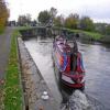



![Birkwood lock, intermediate gates. The intermediate lock gates are no longer in use. This one appears to have been rammed at some time.See [[1843708]] by Mike Kirby – 24 April 2010](https://s3.geograph.org.uk/geophotos/01/84/37/1843739_f27c864c_120x120.jpg)
![Birkwood Lock, intermediate gates. Although the intermediate lock gates are no longer in use, British Waterways have carried out repairs to the previously damaged gate. See [[1843739]] by Mike Kirby – 19 May 2012](https://s1.geograph.org.uk/geophotos/02/96/14/2961477_95cb4bb9_120x120.jpg)
![Freda Carless (3). The Freda Carless entering Birkwood lock, a tricky manoeuvre as the barge is over 33 metres long.See [[1501110]] by Mike Kirby – 03 March 2012](https://s2.geograph.org.uk/geophotos/02/85/24/2852478_a25e95af_120x120.jpg)

![Birkwood Lock. Looking down the lock towards Stanley Ferry.See [[1843708]] by Mike Kirby – 24 April 2010](https://s3.geograph.org.uk/geophotos/01/84/38/1843899_3d731046_120x120.jpg)
![Birkwood Lock's middle gates have been removed. The sawn-up remains were in a barge below the lock. The yellow fencing surrounds the lockside infrastructure for the gates. The gates [[1843739]] allowed shorter boats to use only part of the 141ft long lock, but have been disused for many years. by Christine Johnstone – 19 December 2020](https://s3.geograph.org.uk/geophotos/06/71/11/6711143_52a1c370_120x120.jpg)


![Birkwood Lock, walkway on the gates. The lock keepers means of access to and from his house. (There is a walkway on each set of gates, as one set will always be open).See [[1843708]] by Mike Kirby – 24 April 2010](https://s0.geograph.org.uk/geophotos/01/84/38/1843880_0c4f2f63_120x120.jpg)

![Birkwood lock gates. The arms of the gates appear to be badly weathered, but I’m led to believe that they cannot be replaced due to the grade II listing.See [[1843708]] by Mike Kirby – 24 April 2010](https://s3.geograph.org.uk/geophotos/01/84/38/1843867_8bc0f6e4_120x120.jpg)


![Birkwood lock, gates opening. Gates opening to allow a narrowboat through, heading to Stanley Ferry.See [[1843708]] by Mike Kirby – 24 April 2010](https://s2.geograph.org.uk/geophotos/01/84/37/1843750_577e37a7_120x120.jpg)
![Birkwood Lock, sluice gates control. The sluice gates were formerly opened by hand, but are now power operated at the push of a button. See [[1843708]] by Mike Kirby – 24 April 2010](https://s3.geograph.org.uk/geophotos/01/84/37/1843727_5e2ab815_120x120.jpg)
![Stone arched outfall. See [[1843708]] by Mike Kirby – 24 April 2010](https://s0.geograph.org.uk/geophotos/01/84/38/1843836_7aecc561_120x120.jpg)

![Birkwood Lock. Northerly entrance/exit of the lock.See [[1843708]] by Mike Kirby – 24 April 2010](https://s0.geograph.org.uk/geophotos/01/84/38/1843812_1f04b7db_120x120.jpg)

![Exiting Birkwood Lock. An unnamed narrow boat emerging from the lock, heading to Stanley Ferry.See [[1843708]] by Mike Kirby – 24 April 2010](https://s0.geograph.org.uk/geophotos/01/84/37/1843764_a4ce0e62_120x120.jpg)


