CanalPlanAC

Whitley Bridge

 
Templar Close, Eggborough DN14 0WL, United Kingdom
 
Information about the place
 
 
The nearest place in the direction of Heck Bridge is Selby Road Bridge; a few yards away.
 
The nearest place in the direction of Bank Dole Junction is Stubbs Pipe Bridge (Whitley Pipe Bridge); 1 mile away.

There may be access to the towpath here.

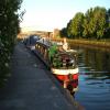
Mooring here is good (a nice place to moor), mooring rings or bollards are available. Mooring is limited to 48 hours. Close to Whitley Bridge train station.

There is a bridge here which takes a minor road over the canal.

Whitley Lock No 125¾ furlongs
Whitley M62 Bridge No 194¾ furlongs
A19 Whitley Bridge1¾ furlongs
Whitley Pipe Bridge¾ furlongs
Selby Road Bridgea few yards
Whitley Bridge
Stubbs Pipe Bridge1 mile
Stubbs Bridge1 mile, 5¾ furlongs
Kellingley Railway Bridge2 miles, ¾ furlongs
Kellingley Bridge2 miles, 3¾ furlongs
Wheeland Road Skew Bridge3 miles, ¾ furlongs
 
 
Amenities

Amenities here

 Whitley Bridge, Whitey Bridge Pallets & Truckstop
 L R Carroll & Son
 Whitley Bridge Station
 
Maps
If you are a user and are logged on, or if you are actively planning a route, a map will be displayed here.
Show on external mapping site: Google | OSM | Bing
 
Photos
 
External websites
There are no links to external websites from here.
Why not log in and add some (select "External websites" from the menu (sometimes this is under "Edit"))?
 
Nearest facilities

Mouseover for more information or show routes to facility

Nearest water point

In the direction of Castleford Junction

Bank Dole Lock No 13 miles, 3½ furlongs away
Travel to Bank Dole Junction, then on the Aire and Calder Navigation (Selby Section) to Bank Dole Lock No 1
Ferrybridge Flood Lock No 114 miles, 6 furlongs away
On this waterway in the direction of Castleford Junction
Ferrybridge Flood Lock Footbridge4 miles, 6¼ furlongs and 1 lock away
On this waterway in the direction of Castleford Junction
Beal Bridge5 miles, 6 furlongs and 1 lock away
Travel to Bank Dole Junction, then on the Aire and Calder Navigation (Selby Section) to Beal Bridge
Beal Lock No 25 miles, 7¼ furlongs and 1 lock away
Travel to Bank Dole Junction, then on the Aire and Calder Navigation (Selby Section) to Beal Lock No 2
Bulholme Lock No 109 miles, 4 furlongs and 1 lock away
On this waterway in the direction of Castleford Junction
Castleford Sanitary Station10 miles, ¾ furlongs and 2 locks away
On this waterway in the direction of Castleford Junction
Woodnook Lock No 612 miles, 3¼ furlongs and 3 locks away
Travel to Castleford Junction, then on the Aire and Calder Navigation (Wakefield Section) to Woodnook Lock No 6
Fairies Hill Moorings12 miles, 2 furlongs and 4 locks away
Travel to Castleford Junction, then on the Aire and Calder Navigation (Wakefield Section) to Fairies Hill Lock Junction, then on the Aire and Calder Navigation (Wakefield Section - Fairies Hill Mooring Arm) to Fairies Hill Moorings
Lemonroyd Lock No 713 miles, 5¼ furlongs and 3 locks away
Travel to Castleford Junction, then on the Aire and Calder Navigation (Main Line - Castleford to Leeds) to Lemonroyd Lock No 7
Selby Basin14 miles, 4 furlongs and 3 locks away
Travel to Bank Dole Junction, then on the Aire and Calder Navigation (Selby Section) to Selby Basin
Lemonroyd Marina13 miles, 6¼ furlongs and 4 locks away
Travel to Castleford Junction, then on the Aire and Calder Navigation (Main Line - Castleford to Leeds) to Lemonroyd Marina

In the direction of Ouse - Aire and Calder Junction

Whitley Lock No 125¾ furlongs away
On this waterway in the direction of Ouse - Aire and Calder Junction
Pollington Manor Swing Bridge4 miles, 4 furlongs and 2 locks away
On this waterway in the direction of Ouse - Aire and Calder Junction
Pollington Visitor Mooring4 miles, 4¼ furlongs and 2 locks away
On this waterway in the direction of Ouse - Aire and Calder Junction
Dutch Riverside12 miles, 6¼ furlongs and 2 locks away
On this waterway in the direction of Ouse - Aire and Calder Junction
Goole Marina12 miles, 7¾ furlongs and 2 locks away
On this waterway in the direction of Ouse - Aire and Calder Junction
Bramwith Lock No 1412 miles, 3 furlongs and 3 locks away
Travel to Sykehouse Junction, then on the Sheffield and South Yorkshire Navigation (New Junction Canal) to Bramwith Junction, then on the Sheffield and South Yorkshire Navigation (Bramwith to Stainforth) to Bramwith Lock No 14
Barnby Dun Lift Bridge13 miles, 1¼ furlongs and 3 locks away
Travel to Sykehouse Junction, then on the Sheffield and South Yorkshire Navigation (New Junction Canal) to Bramwith Junction, then on the Sheffield and South Yorkshire Navigation (Main Line) to Barnby Dun Lift Bridge
Bramwith Swing Bridge12 miles, 5¾ furlongs and 4 locks away
Travel to Sykehouse Junction, then on the Sheffield and South Yorkshire Navigation (New Junction Canal) to Bramwith Junction, then on the Sheffield and South Yorkshire Navigation (Bramwith to Stainforth) to Bramwith Swing Bridge

Nearest rubbish disposal

In the direction of Castleford Junction

Castleford Sanitary Station10 miles, ¾ furlongs and 2 locks away
On this waterway in the direction of Castleford Junction
Selby Basin14 miles, 4 furlongs and 3 locks away
Travel to Bank Dole Junction, then on the Aire and Calder Navigation (Selby Section) to Selby Basin
Lemonroyd Marina13 miles, 6¼ furlongs and 4 locks away
Travel to Castleford Junction, then on the Aire and Calder Navigation (Main Line - Castleford to Leeds) to Lemonroyd Marina
Woodlesford Lock No 515 miles and 4 locks away
Travel to Castleford Junction, then on the Aire and Calder Navigation (Main Line - Castleford to Leeds) to Woodlesford Lock No 5
Ramsdens Bridge Visitor Moorings15 miles, 2¼ furlongs and 6 locks away
Travel to Castleford Junction, then on the Aire and Calder Navigation (Wakefield Section) to Ramsdens Bridge Visitor Moorings
Leeds Sanitary Station19 miles, 4½ furlongs and 7 locks away
Travel to Castleford Junction, then on the Aire and Calder Navigation (Main Line - Castleford to Leeds) to Leeds Sanitary Station

In the direction of Ouse - Aire and Calder Junction

Whitley Lock No 125¾ furlongs away
On this waterway in the direction of Ouse - Aire and Calder Junction
Dutch Riverside12 miles, 6¼ furlongs and 2 locks away
On this waterway in the direction of Ouse - Aire and Calder Junction
Goole Marina12 miles, 7¾ furlongs and 2 locks away
On this waterway in the direction of Ouse - Aire and Calder Junction
Barnby Dun Lift Bridge13 miles, 1¼ furlongs and 3 locks away
Travel to Sykehouse Junction, then on the Sheffield and South Yorkshire Navigation (New Junction Canal) to Bramwith Junction, then on the Sheffield and South Yorkshire Navigation (Main Line) to Barnby Dun Lift Bridge
Bramwith Swing Bridge12 miles, 5¾ furlongs and 4 locks away
Travel to Sykehouse Junction, then on the Sheffield and South Yorkshire Navigation (New Junction Canal) to Bramwith Junction, then on the Sheffield and South Yorkshire Navigation (Bramwith to Stainforth) to Bramwith Swing Bridge
Thorne Visitor Moorings17 miles, ¼ furlongs and 5 locks away
Travel to Sykehouse Junction, then on the Sheffield and South Yorkshire Navigation (New Junction Canal) to Bramwith Junction, then on the Sheffield and South Yorkshire Navigation (Bramwith to Stainforth) to Stainforth Junction, then on the Sheffield and South Yorkshire Navigation (Stainforth and Keadby Canal) to Thorne Visitor Moorings
Doncaster Visitor Pontoon Moorings18 miles, 4 furlongs and 4 locks away
Travel to Sykehouse Junction, then on the Sheffield and South Yorkshire Navigation (New Junction Canal) to Bramwith Junction, then on the Sheffield and South Yorkshire Navigation (Main Line) to Doncaster Visitor Pontoon Moorings

Nearest chemical toilet disposal

In the direction of Castleford Junction

Castleford Sanitary Station10 miles, ¾ furlongs and 2 locks away
On this waterway in the direction of Castleford Junction
Fairies Hill Moorings12 miles, 2 furlongs and 4 locks away
Travel to Castleford Junction, then on the Aire and Calder Navigation (Wakefield Section) to Fairies Hill Lock Junction, then on the Aire and Calder Navigation (Wakefield Section - Fairies Hill Mooring Arm) to Fairies Hill Moorings
Selby Basin14 miles, 4 furlongs and 3 locks away
Travel to Bank Dole Junction, then on the Aire and Calder Navigation (Selby Section) to Selby Basin
Lemonroyd Marina13 miles, 6¼ furlongs and 4 locks away
Travel to Castleford Junction, then on the Aire and Calder Navigation (Main Line - Castleford to Leeds) to Lemonroyd Marina
Ramsdens Bridge Sanitary Station15 miles, 2¾ furlongs and 6 locks away
Travel to Castleford Junction, then on the Aire and Calder Navigation (Wakefield Section) to Ramsdens Bridge Sanitary Station
Leeds Sanitary Station19 miles, 4½ furlongs and 7 locks away
Travel to Castleford Junction, then on the Aire and Calder Navigation (Main Line - Castleford to Leeds) to Leeds Sanitary Station

In the direction of Ouse - Aire and Calder Junction

Whitley Lock No 125¾ furlongs away
On this waterway in the direction of Ouse - Aire and Calder Junction
Dutch Riverside12 miles, 6¼ furlongs and 2 locks away
On this waterway in the direction of Ouse - Aire and Calder Junction
Goole Marina12 miles, 7¾ furlongs and 2 locks away
On this waterway in the direction of Ouse - Aire and Calder Junction
Barnby Dun Lift Bridge13 miles, 1¼ furlongs and 3 locks away
Travel to Sykehouse Junction, then on the Sheffield and South Yorkshire Navigation (New Junction Canal) to Bramwith Junction, then on the Sheffield and South Yorkshire Navigation (Main Line) to Barnby Dun Lift Bridge
Bramwith Swing Bridge12 miles, 5¾ furlongs and 4 locks away
Travel to Sykehouse Junction, then on the Sheffield and South Yorkshire Navigation (New Junction Canal) to Bramwith Junction, then on the Sheffield and South Yorkshire Navigation (Bramwith to Stainforth) to Bramwith Swing Bridge
Thorne Visitor Moorings17 miles, ¼ furlongs and 5 locks away
Travel to Sykehouse Junction, then on the Sheffield and South Yorkshire Navigation (New Junction Canal) to Bramwith Junction, then on the Sheffield and South Yorkshire Navigation (Bramwith to Stainforth) to Stainforth Junction, then on the Sheffield and South Yorkshire Navigation (Stainforth and Keadby Canal) to Thorne Visitor Moorings

Nearest place to turn

In the direction of Castleford Junction

Bank Dole Lock Junction3 miles, 3¾ furlongs and 1 lock away
Travel to Bank Dole Junction, then on the Aire and Calder Navigation (Selby Section) to Bank Dole Lock Junction
Beal Lock No 2 Weir Entrance5 miles, 6¼ furlongs and 1 lock away
Travel to Bank Dole Junction, then on the Aire and Calder Navigation (Selby Section) to Beal Lock No 2 Weir Entrance
Bulholme Lock Weir Exit9 miles, 3½ furlongs and 1 lock away
On this waterway in the direction of Castleford Junction
Haddlesey Junction9 miles, 5¾ furlongs and 2 locks away
Travel to Bank Dole Junction, then on the Aire and Calder Navigation (Selby Section) to Haddlesey Junction
Lemonroyd Lock Weir Exit13 miles, 4¼ furlongs and 3 locks away
Travel to Castleford Junction, then on the Aire and Calder Navigation (Main Line - Castleford to Leeds) to Lemonroyd Lock Weir Exit
Fairies Hill Lock Arm12 miles, 5 furlongs and 4 locks away
Travel to Castleford Junction, then on the Aire and Calder Navigation (Wakefield Section) to Fairies Hill Lock Arm
Selby Basin14 miles, 4 furlongs and 3 locks away
Travel to Bank Dole Junction, then on the Aire and Calder Navigation (Selby Section) to Selby Basin
Fleet Lane Arm14 miles, ¼ furlongs and 4 locks away
Travel to Castleford Junction, then on the Aire and Calder Navigation (Main Line - Castleford to Leeds) to Fleet Lane Arm
Stanley Ferry Marina15 miles, 1¼ furlongs and 6 locks away
Travel to Castleford Junction, then on the Aire and Calder Navigation (Wakefield Section) to Stanley Ferry Marina
Junction with River Aire (Old Channel) South18 miles, 2½ furlongs and 6 locks away
Travel to Castleford Junction, then on the Aire and Calder Navigation (Main Line - Castleford to Leeds) to Junction with River Aire (Old Channel) South
Junction with River Aire (Old Channel) North18 miles, 7¾ furlongs and 7 locks away
Travel to Castleford Junction, then on the Aire and Calder Navigation (Main Line - Castleford to Leeds) to Junction with River Aire (Old Channel) North
Knostrop Flood Lock Weir Entrance18 miles, 7¾ furlongs and 7 locks away
Travel to Castleford Junction, then on the Aire and Calder Navigation (Main Line - Castleford to Leeds) to Knostrop Flood Lock Weir Entrance
Wakefield Weir Entrance18 miles, 1½ furlongs and 8 locks away
Travel to Castleford Junction, then on the Aire and Calder Navigation (Wakefield Section) to Fall Ing Junction, then on the Calder and Hebble Navigation (Main Line) to Wakefield Weir Entrance
Leeds Dock Side Arm19 miles, 7 furlongs and 8 locks away
Travel to Castleford Junction, then on the Aire and Calder Navigation (Main Line - Castleford to Leeds) to Leeds Dock Entrance, then on the Aire and Calder Navigation (Leeds Dock) to Leeds Dock Side Arm

In the direction of Ouse - Aire and Calder Junction

Viking Marina12 miles, 7 furlongs and 2 locks away
On this waterway in the direction of Ouse - Aire and Calder Junction
Huddle Grounds Winding Hole14 miles, 5 furlongs and 4 locks away
Travel to Sykehouse Junction, then on the Sheffield and South Yorkshire Navigation (New Junction Canal) to Bramwith Junction, then on the Sheffield and South Yorkshire Navigation (Bramwith to Stainforth) to Stainforth Junction, then on the Sheffield and South Yorkshire Navigation (Stainforth and Keadby Canal) to Huddle Grounds Winding Hole
Wheatley Hall Road Winding Hole16 miles, 3¼ furlongs and 4 locks away
Travel to Sykehouse Junction, then on the Sheffield and South Yorkshire Navigation (New Junction Canal) to Bramwith Junction, then on the Sheffield and South Yorkshire Navigation (Main Line) to Wheatley Hall Road Winding Hole
Gas House Bight18 miles, 2½ furlongs and 4 locks away
Travel to Sykehouse Junction, then on the Sheffield and South Yorkshire Navigation (New Junction Canal) to Bramwith Junction, then on the Sheffield and South Yorkshire Navigation (Main Line) to Gas House Bight
Doncaster Visitor Pontoon Moorings18 miles, 4 furlongs and 4 locks away
Travel to Sykehouse Junction, then on the Sheffield and South Yorkshire Navigation (New Junction Canal) to Bramwith Junction, then on the Sheffield and South Yorkshire Navigation (Main Line) to Doncaster Visitor Pontoon Moorings

Nearest self-operated pump-out

In the direction of Castleford Junction

Castleford Sanitary Station10 miles, ¾ furlongs and 2 locks away
On this waterway in the direction of Castleford Junction
Ramsdens Bridge Sanitary Station15 miles, 2¾ furlongs and 6 locks away
Travel to Castleford Junction, then on the Aire and Calder Navigation (Wakefield Section) to Ramsdens Bridge Sanitary Station
Leeds Sanitary Station19 miles, 4½ furlongs and 7 locks away
Travel to Castleford Junction, then on the Aire and Calder Navigation (Main Line - Castleford to Leeds) to Leeds Sanitary Station

In the direction of Ouse - Aire and Calder Junction

Long Sandall Lock No 1315 miles, 2¾ furlongs and 3 locks away
Travel to Sykehouse Junction, then on the Sheffield and South Yorkshire Navigation (New Junction Canal) to Bramwith Junction, then on the Sheffield and South Yorkshire Navigation (Main Line) to Long Sandall Lock No 13
Direction of TV transmitter (From Wolfbane Cybernetic)
 
 
Geograph
 
Wikipedia

Wikipedia has a page about Whitley Bridge

Whitley Bridge railway station serves the villages of Eggborough and Whitley in North Yorkshire, England. It is located on the Pontefract Line and is 20 miles (32 km) east of Leeds. It was opened by the Lancashire and Yorkshire Railway in 1848, on their line between Wakefield Kirkgate and Goole via Knottingley.

Other Wikipedia pages that might relate to Whitley Bridge
[Whitley Bridge railway station] Whitley Bridge railway station serves the villages of Eggborough and Whitley in North Yorkshire, England. It is located on the Pontefract Line and is 20 [Whitley, Coventry] Whitley is a suburb of southern Coventry in the West Midlands of England. The name Whitley is said to mean "from the white meadow". From 1938 to 1951, [Whitley Bay] Whitley Bay is a seaside town on the north east coast of England. Historically in Northumberland, it is administered as part of the borough of North Tyneside [Whitley, North Yorkshire] 7 miles (11 km) north east of Pontefract. The village is served by Whitley Bridge railway station to the north, but only has one train a day eastwards [Roundhay Garden Scene] Le Prince, his mother-in-law Sarah Whitley (née Robinson, 1816 – 24 October 1888), his father-in-law Joseph Whitley (1817 – 12 January 1891) and Annie [Jack Whitley] Following his death in 1955, Whitley was buried in an unmarked grave at Brompton Cemetery, next to Chelsea's Stamford Bridge ground, the only Chelsea player [Pontefract line] junction at this point; there is also the Askern branch line for Doncaster Whitley Bridge runs under East Coast Main Line Hensall: junction for the Hull and Barnsley [DN postcode area] Hensall, Howden, Pincheon Green, Rawcliffe, Snaith, Sykehouse, Whitley, Whitley Bridge Doncaster, East Riding of Yorkshire, Selby DN15 SCUNTHORPE Alkborough [Eggborough] used by residents and it is a shared facility with the residents of Whitley Bridge who have no village hall of their own. Other activities take place at [Northern Trains] Woodlesford, Castleford, Glasshoughton, Pontefract Monkhill, Knottingley, Whitley Bridge, Hensall, Snaith and Rawcliffe 156 Wakefield Line Route tph Calling
 
Google

Results of Google Search

260 N Whitley Bridge Rd, Delta, AL 36258 | Zillow
The property 260 N Whitley Bridge Rd, Delta, AL 36258 is currently not for sale on Zillow. View details, sales history and Zestimate data for this property on ...
Whitley Bridge railway station - Wikipedia
Whitley Bridge railway station serves the villages of Eggborough and Whitley in North Yorkshire, England. It is located on the Pontefract Line and is 20 miles (32  ...
28 S Whitley Bridge Rd, Delta, AL 36258 | Zillow
The property 28 S Whitley Bridge Rd, Delta, AL 36258 is currently not for sale on Zillow. View details, sales history and Zestimate data for this property on Zillow.
Not Cool, Marshall - Knaresborough to Whitley Bridge - YouTube
Aug 4, 2017 ... ... Four of the seven awkward stations are Rawcliffe, Snaith, Hensall and Whitley Bridge) which only gets 3 trains a day, one w/b in the morning, ...
132 S Whitley Bridge Rd, Delta, AL 36258 - realtor.com®
Apr 18, 2020 ... View 1 photos for 132 S Whitley Bridge Rd, Delta, AL 36258 a bed, bath, 4356 Sq . Ft. single family home built in that sold on 06/05/2019.
Whitley Bridge Station, Goole Vacation Rentals: condo and ...
Explore an array of Whitley Bridge Station, Goole vacation rentals, including apartment and condo rentals, houses & more bookable online. Choose from more ...
268 N Whitley Bridge Rd, Delta, AL 36258 - realtor.com®
Apr 18, 2020 ... View 1 photos for 268 N Whitley Bridge Rd, Delta, AL 36258 a bed, bath, 1736 Sq. Ft. mfd/mobile home built in 2007.
Top 10 Hotels Near Whitley Bridge Station from $62 | Expedia
Browse 22 Whitley Bridge Station hotels & save money. Read user reviews of over 1000000 hotels worldwide. No Expedia cancellation fee.
Action Center / Bridge or Small Structure Repair / Whitley County ...
Small Structures are considered as culverts or small bridges that are 36 inches in diameter, or greater, up to 20 feet. Anyone may report a problem with a bridge ...
Whitley Bridge Topo Map, Imperial County CA (Picacho Area)
See the FREE topo map of Whitley Bridge a Arch in Imperial County California on the Picacho USGS quad map.