CanalPlanAC

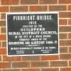
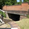
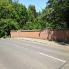
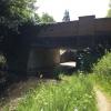
Pirbright Bridge

 
Bisley Camp Road, Pirbright GU24 0AG, United Kingdom
 
Information about the place
Pirbright Bridge is a minor waterways place on the Basingstoke Canal between Woodham Junction (Junction of Basingstoke Canal with River Wey) (8 miles and 4½ furlongs and 14 locks to the east) and Odiham Castle Stop (End of Navigation) (22 miles and ½ furlongs and 15 locks to the west).
 
 
The nearest place in the direction of Woodham Junction is Connaught Crescent Winding Hole; 2¼ furlongs away.
 
The nearest place in the direction of Odiham Castle Stop is Frimley Bottom Lock No 15; ¼ furlongs away.

There may be access to the towpath here.

Mooring here is unrated.

There is a bridge here which takes a minor road over the canal.


Amenities

Amenities here

 Forecourt M-F 5.30pm Sa 1pm
 
Maps
If you are a user and are logged on, or if you are actively planning a route, a map will be displayed here.
Show on external mapping site: Google | OSM | Bing
 
Additional information

There is no other information about Pirbright Bridge. Why not add some

 
Photos
 
External websites
There are no links to external websites from here.
Why not log in and add some (select "External websites" from the menu (sometimes this is under "Edit"))?
 
Nearest facilities

Mouseover for more information or show routes to facility

Nearest water point

In the direction of Odiham Castle Stop

Canal Centre Swing Bridge4 miles, 3¼ furlongs and 14 locks away
On this waterway in the direction of Odiham Castle Stop
Mytchett Bridge4 miles, 4¼ furlongs and 14 locks away
On this waterway in the direction of Odiham Castle Stop
Ash Lock Canal Depot7 miles, 6¾ furlongs and 15 locks away
On this waterway in the direction of Odiham Castle Stop
The Fox and Hounds (Crookham)13 miles, 5 furlongs and 15 locks away
On this waterway in the direction of Odiham Castle Stop
Barley Mow Bridge17 miles, 6 furlongs and 15 locks away
On this waterway in the direction of Odiham Castle Stop

In the direction of Woodham Junction

Arthur's Bridge3 miles, 7 furlongs and 8 locks away
On this waterway in the direction of Woodham Junction
Pyrford Lock No 1210 miles, 4 furlongs and 14 locks away
Travel to Woodham Junction, then on the River Wey Wey Navigation to Pyrford Lock No 12
Thames Lock No 1611 miles, 2 furlongs and 17 locks away
Travel to Woodham Junction, then on the River Wey Wey Navigation to Thames Lock No 16
Cartbridge Wharf14 miles, 1¾ furlongs and 18 locks away
Travel to Woodham Junction, then on the River Wey Wey Navigation to Cartbridge Wharf
Chertsey Lock13 miles, 5 furlongs and 19 locks away
Travel to Woodham Junction, then on the River Wey Wey Navigation to Thames - Wey Junction, then on the River Thames (below Oxford) to Chertsey Lock
Molesey Lock17 miles, ¼ furlongs and 19 locks away
Travel to Woodham Junction, then on the River Wey Wey Navigation to Thames - Wey Junction, then on the River Thames (below Oxford) to West End of Desborough Cut, then on the River Thames (Desborough Cut) to Thames Meadow, then on the River Thames (below Oxford) to Molesey Lock
Stoke Lock No 518 miles, 4 furlongs and 21 locks away
Travel to Woodham Junction, then on the River Wey Wey Navigation to Stoke Lock No 5
Guildford Waterside Centre19 miles, ½ furlongs and 22 locks away
Travel to Woodham Junction, then on the River Wey Wey Navigation to Guildford Waterside Centre

Nearest rubbish disposal

In the direction of Odiham Castle Stop

Canal Centre Swing Bridge4 miles, 3¼ furlongs and 14 locks away
On this waterway in the direction of Odiham Castle Stop
Mytchett Bridge4 miles, 4¼ furlongs and 14 locks away
On this waterway in the direction of Odiham Castle Stop
Ash Lock Canal Depot7 miles, 6¾ furlongs and 15 locks away
On this waterway in the direction of Odiham Castle Stop

In the direction of Woodham Junction

Arthur's Bridge3 miles, 7 furlongs and 8 locks away
On this waterway in the direction of Woodham Junction
Pyrford Lock No 1210 miles, 4 furlongs and 14 locks away
Travel to Woodham Junction, then on the River Wey Wey Navigation to Pyrford Lock No 12
Shepperton Lock11 miles, 5¼ furlongs and 18 locks away
Travel to Woodham Junction, then on the River Wey Wey Navigation to Thames - Wey Junction, then on the River Thames (below Oxford) to Shepperton Lock
Penton Hook Lock15 miles, 4¼ furlongs and 20 locks away
Travel to Woodham Junction, then on the River Wey Wey Navigation to Thames - Wey Junction, then on the River Thames (below Oxford) to Penton Hook Lock
Molesey Lock17 miles, ¼ furlongs and 19 locks away
Travel to Woodham Junction, then on the River Wey Wey Navigation to Thames - Wey Junction, then on the River Thames (below Oxford) to West End of Desborough Cut, then on the River Thames (Desborough Cut) to Thames Meadow, then on the River Thames (below Oxford) to Molesey Lock
Bell Weir Lock18 miles, 2½ furlongs and 21 locks away
Travel to Woodham Junction, then on the River Wey Wey Navigation to Thames - Wey Junction, then on the River Thames (below Oxford) to Bell Weir Lock
Guildford Waterside Centre19 miles, ½ furlongs and 22 locks away
Travel to Woodham Junction, then on the River Wey Wey Navigation to Guildford Waterside Centre

Nearest chemical toilet disposal

In the direction of Odiham Castle Stop

Canal Centre Swing Bridge4 miles, 3¼ furlongs and 14 locks away
On this waterway in the direction of Odiham Castle Stop

In the direction of Woodham Junction

Arthur's Bridge3 miles, 7 furlongs and 8 locks away
On this waterway in the direction of Woodham Junction
Pyrford Lock No 1210 miles, 4 furlongs and 14 locks away
Travel to Woodham Junction, then on the River Wey Wey Navigation to Pyrford Lock No 12
Shepperton Lock11 miles, 5¼ furlongs and 18 locks away
Travel to Woodham Junction, then on the River Wey Wey Navigation to Thames - Wey Junction, then on the River Thames (below Oxford) to Shepperton Lock
Molesey Lock17 miles, ¼ furlongs and 19 locks away
Travel to Woodham Junction, then on the River Wey Wey Navigation to Thames - Wey Junction, then on the River Thames (below Oxford) to West End of Desborough Cut, then on the River Thames (Desborough Cut) to Thames Meadow, then on the River Thames (below Oxford) to Molesey Lock
Guildford Waterside Centre19 miles, ½ furlongs and 22 locks away
Travel to Woodham Junction, then on the River Wey Wey Navigation to Guildford Waterside Centre

Nearest place to turn

In the direction of Odiham Castle Stop

Frimley Bottom Lock Winding Hole½ furlongs and 1 lock away
On this waterway in the direction of Odiham Castle Stop
Frimley Lock Winding Hole7 furlongs and 5 locks away
On this waterway in the direction of Odiham Castle Stop
Lock No 26 Winding Hole1 mile, 6¼ furlongs and 11 locks away
On this waterway in the direction of Odiham Castle Stop
Potter's Wharf4 miles, 5 furlongs and 14 locks away
On this waterway in the direction of Odiham Castle Stop
Anglers' Flash5 miles, 1½ furlongs and 14 locks away
On this waterway in the direction of Odiham Castle Stop
Winter's Close Winding Hole5 miles, 2¾ furlongs and 14 locks away
On this waterway in the direction of Odiham Castle Stop
Great Bottom Flash5 miles, 5¾ furlongs and 14 locks away
On this waterway in the direction of Odiham Castle Stop
Ash Wharf Bridge Winding Hole6 miles, 6½ furlongs and 14 locks away
On this waterway in the direction of Odiham Castle Stop
Ash Lock Canal Depot7 miles, 6¾ furlongs and 15 locks away
On this waterway in the direction of Odiham Castle Stop
Wharf Bridge (Aldershot) Winding Hole9 miles, 2¼ furlongs and 15 locks away
On this waterway in the direction of Odiham Castle Stop
Eelmoor Bridge Winding Hole10 miles, 5½ furlongs and 15 locks away
On this waterway in the direction of Odiham Castle Stop
Pondtail Bridge Winding Hole12 miles, ½ furlongs and 15 locks away
On this waterway in the direction of Odiham Castle Stop

In the direction of Woodham Junction

Connaught Crescent Winding Hole2¼ furlongs away
On this waterway in the direction of Woodham Junction
Hermitage Bridge Winding Hole1 mile, 5½ furlongs and 3 locks away
On this waterway in the direction of Woodham Junction
Blackhorse Road Winding Hole1 mile, 6¾ furlongs and 3 locks away
On this waterway in the direction of Woodham Junction
Arthurs Bridge Winding Hole3 miles, 7¼ furlongs and 8 locks away
On this waterway in the direction of Woodham Junction
Paxton Gardens Winding Hole6 miles, 6¼ furlongs and 8 locks away
On this waterway in the direction of Woodham Junction
Woodham Junction8 miles, 4½ furlongs and 14 locks away
On this waterway in the direction of Woodham Junction
Coxes Railway Bridge Winding Hole10 miles, ¼ furlongs and 16 locks away
Travel to Woodham Junction, then on the River Wey Wey Navigation to Coxes Railway Bridge Winding Hole
Newark Lock Weir Exit No 211 miles, 7½ furlongs and 16 locks away
Travel to Woodham Junction, then on the River Wey Wey Navigation to Newark Lock Weir Exit No 2

Nearest self-operated pump-out

In the direction of Odiham Castle Stop

Canal Centre Swing Bridge4 miles, 3¼ furlongs and 14 locks away
On this waterway in the direction of Odiham Castle Stop
Mytchett Bridge4 miles, 4¼ furlongs and 14 locks away
On this waterway in the direction of Odiham Castle Stop

In the direction of Woodham Junction

Molesey Lock17 miles, ¼ furlongs and 19 locks away
Travel to Woodham Junction, then on the River Wey Wey Navigation to Thames - Wey Junction, then on the River Thames (below Oxford) to West End of Desborough Cut, then on the River Thames (Desborough Cut) to Thames Meadow, then on the River Thames (below Oxford) to Molesey Lock

No information

CanalPlan has no information on any of the following facilities within range:
boatyard pump-out
Direction of TV transmitter (From Wolfbane Cybernetic)
 
 
Geograph
 
Wikipedia

There is no page on Wikipedia called “Pirbright Bridge”

Wikipedia pages that might relate to Pirbright Bridge
[Basingstoke Canal] Greywell and Brookwood Lye and a short stretch between Monument Bridge and Scotland Bridge in Woking. It is the most botanically rich aquatic area in England [Guildford pub bombings] targeted because they were popular with British Army personnel stationed at Pirbright barracks. Four soldiers and one civilian were killed. Sixty-five people [List of road junctions in the United Kingdom: P] 52°03′17″N 0°42′45″W / 52.05472°N 0.71250°W / 52.05472; -0.71250 Pirbright Bridge Junction Brookwood, Surrey A324 Connaught Road A324 Dawney Hill B3012 [Chertsey branch line] (WS&SWR) – was authorised on 25 June 1847 to build a line from Staines to Pirbright and a branch from that line to Chertsey, where it would connect with the [A roads in Zone 3 of the Great Britain numbering scheme] Frimley Green via the following renumbered roads: B3012 (to Pirbright), A324 (through Pirbright), B3012 (to Fox Corner), and A322 (to Guildford). A322 Bracknell [British Army] other Soldiers will attend Phase 1 training at the Army Training Centre Pirbright or Army Training Regiment, Winchester, and then complete Phase 2 training [Shackleford] Esher, Oxshott, Weybridge, Wisley, all around Woking, Brookwood, Deepcut, Pirbright, Frimley, Lightwater, Camberley, Chobham Common, Virginia Water and Ottershaw [List of watermills in the United Kingdom] Mill, Ockham Old Castle Mill, Pixham Paddington Mill, Abinger Pirbright Mill, Pirbright Pixham Mill, Dorking Rickford's Mill, Worplesdon Shalford Mill [Guildford] civilian. The pubs were targeted because soldiers from the barracks at Pirbright were known to frequent them. The subsequently arrested suspects, who became [List of schools in Surrey] School, Guildford Pine Ridge Infant School, Camberley Pirbright Village Primary School, Pirbright Polesden Lacey Infant School, Great Bookham Potters Gate
 
Google

Results of Google Search

Segment Details for Pirbright Bridge > Deepcut Underpass - Canal ...
Pirbright Bridge > Deepcut Underpass - Canal Route. Important note: Segment placings and history are only available to Strava Subscribers - More info.
Pirbright Bridge | Hampshire County Council
Hide this message. COVID-19 update. People visiting the canal should continue to follow the social distancing guidelines in place, to protect everyone from ...
Marvel at the Deepcut Flight, Basingstoke Canal, Pirbright – Toddle ...
The stretch of the Basingstoke Canal tow path from Pirbright Bridge to Curzon Bridge in Deepcut, is a picturesque two miles that takes you past 11 of the 14 locks ...
_GUILD_PROPLPI_74688_1 | Howfield Cottage, Pirbright Bridge ...
UPRN: 10007066174. Full Address: Howfield Cottage, Pirbright Bridge, Bisley Camp Road, Brookwood, Woking, GU24 0AG. Property Description: Pirbright ...
Basingstoke Canal - Wikipedia
The Basingstoke Canal is a British canal, completed in 1794, built to connect Basingstoke with ... Pirbright Bridge (18) ... Mytchett Lake Canal Bridge (25) ...
_GUILD_PROPLPI_6224114_1 | Lock Adjacent To, Pirbright Bridge ...
UPRN: 10007096208. Full Address: Lock Adjacent To, Pirbright Bridge, Bisley Camp Road, Brookwood. Property Description: Pirbright Bridge. Property Number ...
Pirbright Flyover (Bml1) Intersection Bridge - The ABC Railway Guide
We don't yet have any photos of Pirbright Flyover (Bml1) Intersection Bridge. Add a photo. Bridge Information. Bridge Reference: 2/93C; Area: Woking; Route: ...
File:Pirbright Bridge and Deepcut Bottom Lock No 15 - geograph.org ...
File:Pirbright Bridge and Deepcut Bottom Lock No 15 - geograph.org.uk - 582860 .jpg. Language; Watch · Edit. File; File history; File usage on Commons ...
Putney Bridge Station to Pirbright - 4 ways to travel via train, and ...
The cheapest way to get from Putney Bridge Station to Pirbright costs only £6, and the quickest way takes just 40 mins. Find the travel option that best suits you.