CanalPlanAC

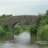
Head Nook Bridge No 43

 
Moss Lane, Myerscough PR3 0RU, United Kingdom
 
Information about the place
Head Nook Bridge No 43 is a minor waterways place on the Lancaster Canal (Main Line) between Ribble Link - Lancaster Canal Junction (9 miles and 4¼ furlongs to the south) and Lodge Hill Junction (Junction with Lancaster Canal - Glasson Dock Branch) (13 miles and ½ furlongs to the north).
 
 
The nearest place in the direction of Ribble Link - Lancaster Canal Junction is White Horse Winding Hole; 2¾ furlongs away.
 
The nearest place in the direction of Lodge Hill Junction is Roebuck Bridge No 44; 3¾ furlongs away.

There may be access to the towpath here.

Mooring here is unrated.

There is a bridge here which takes a minor road over the canal.

Hankinson Bridge No 401 mile, 5¼ furlongs
Park Head Bridge No 411 mile, 3¾ furlongs
Park Head Winding Hole1 mile, 3 furlongs
White Horse Bridge No 425 furlongs
White Horse Winding Hole2¾ furlongs
Head Nook Bridge No 43
Roebuck Bridge No 443¾ furlongs
Garstang Road Narrows4¼ furlongs
Roebuck Aqueduct4½ furlongs
Bilsborrow Winding Hole6¼ furlongs
Myerscough Hall Bridge No 456¾ furlongs
 
 
Amenities

Amenities nearby at Roebuck Bridge No 44

 Owd Nells Tavern
 
Maps
If you are a user and are logged on, or if you are actively planning a route, a map will be displayed here.
Show on external mapping site: Google | OSM | Bing
 
Photos
 
External websites
There are no links to external websites from here.
Why not log in and add some (select "External websites" from the menu (sometimes this is under "Edit"))?
 
Nearest facilities

Mouseover for more information or show routes to facility

Nearest water point

In the direction of Preston Terminus

Swill Brook Basin3 miles, 6¼ furlongs away
On this waterway in the direction of Preston Terminus
Blackleach Lane Marina4 miles, 1½ furlongs away
On this waterway in the direction of Preston Terminus
Woodplumpton Road Bridge No 1210 miles, 3½ furlongs away
On this waterway in the direction of Preston Terminus

In the direction of Tewitfield

Bilsborrow Winding Hole6¼ furlongs away
On this waterway in the direction of Tewitfield
Moss Lane Bridge No 635 miles, 7 furlongs away
On this waterway in the direction of Tewitfield
Ratcliffe Bridge No 759 miles, 7¾ furlongs away
On this waterway in the direction of Tewitfield
Lodge Hill Junction13 miles, ½ furlongs away
On this waterway in the direction of Tewitfield
Brows Bridge No 815 miles, 4½ furlongs and 6 locks away
Travel to Lodge Hill Junction, then on the Lancaster Canal (Glasson Branch) to Brows Bridge No 8
Glasson Visitor Moorings15 miles, 5 furlongs and 6 locks away
Travel to Lodge Hill Junction, then on the Lancaster Canal (Glasson Branch) to Glasson Visitor Moorings
Glasson Basin15 miles, 6½ furlongs and 6 locks away
Travel to Lodge Hill Junction, then on the Lancaster Canal (Glasson Branch) to Glasson Basin

Nearest rubbish disposal

In the direction of Preston Terminus

Woodplumpton Road Bridge No 1210 miles, 3½ furlongs away
On this waterway in the direction of Preston Terminus

In the direction of Tewitfield

Bilsborrow Winding Hole6¼ furlongs away
On this waterway in the direction of Tewitfield

Nearest chemical toilet disposal

In the direction of Preston Terminus

Woodplumpton Road Bridge No 1210 miles, 3½ furlongs away
On this waterway in the direction of Preston Terminus

In the direction of Tewitfield

Bilsborrow Winding Hole6¼ furlongs away
On this waterway in the direction of Tewitfield

Nearest place to turn

In the direction of Preston Terminus

White Horse Winding Hole2¾ furlongs away
On this waterway in the direction of Preston Terminus
Park Head Winding Hole1 mile, 3 furlongs away
On this waterway in the direction of Preston Terminus
Hollowforth Winding Hole2 miles, 1¼ furlongs away
On this waterway in the direction of Preston Terminus
Moons Bridge Marina2 miles, 2¼ furlongs away
On this waterway in the direction of Preston Terminus
Swill Brook Basin3 miles, 6¼ furlongs away
On this waterway in the direction of Preston Terminus
Salwick Hall Winding Hole6 miles, 6 furlongs away
On this waterway in the direction of Preston Terminus On this waterway in the direction of Preston Terminus
Ward's House Winding Hole No 17 miles, 2¼ furlongs away
On this waterway in the direction of Preston Terminus
Tom Benson Way Bridge Winding Hole9 miles, 2¾ furlongs away
On this waterway in the direction of Preston Terminus
Ribble Link - Lancaster Canal Junction9 miles, 4¼ furlongs away
On this waterway in the direction of Preston Terminus

In the direction of Tewitfield

Bilsborrow Winding Hole6¼ furlongs away
On this waterway in the direction of Tewitfield
Catterall Bridge Winding Hole3 miles, 4½ furlongs away
On this waterway in the direction of Tewitfield
Greenhalgh Castle Bridge Winding Hole4 miles, 5 furlongs away
On this waterway in the direction of Tewitfield
Dimples Bridge Winding Hole4 miles, 7 furlongs away
On this waterway in the direction of Tewitfield
The Moorings Basin5 miles, 5 furlongs away
On this waterway in the direction of Tewitfield
Kepple Lane Bridge Winding Hole5 miles, 5½ furlongs away
On this waterway in the direction of Tewitfield
Moss Lane Bridge Winding Hole (south)5 miles, 6¾ furlongs away
On this waterway in the direction of Tewitfield
Moss Lane Bridge Winding Hole (north)5 miles, 7 furlongs away
On this waterway in the direction of Tewitfield
Cathouse Bridge Winding Hole6 miles, ¾ furlongs away
On this waterway in the direction of Tewitfield
Bells Bridge Winding Hole7 miles, 3¼ furlongs away
On this waterway in the direction of Tewitfield

No information

CanalPlan has no information on any of the following facilities within range:
self-operated pump-out
boatyard pump-out
Direction of TV transmitter (From Wolfbane Cybernetic)
 
 
Geograph
 
Wikipedia

There is no page on Wikipedia called “Head Nook Bridge”

Wikipedia pages that might relate to Head Nook Bridge
[Heads Nook] Heads Nook is a village in the City of Carlisle District, in the English county of Cumbria. The village was served by Heads Nook railway station. Nearby [Listed buildings in Myerscough and Bilsborrow] Horse Bridge (No.42), Myerscough and Bilsborrow (1163825)", National Heritage List for England, retrieved 6 December 2015 Historic England, "Head Nook Bridge [Heads Nook railway station] Heads Nook railway station served the village of Heads Nook, south-west of Brampton, Cumbria, England. The station was on the Newcastle and Carlisle Railway [Allenwood, Cumbria] Carlisle district, in the county of Cumbria, England. Nearby settlements include the villages of Warwick Bridge and Heads Nook. A-Z Carlisle (page 20) v t e [Sydney Harbour Bridge] The Sydney Harbour Bridge is an Australian heritage-listed steel through arch bridge across Sydney Harbour that carries rail, vehicular, bicycle, and [List of collieries in Lancashire since 1854] 1970 Cross Hillock opened after 1866, closed 1887 Gin Pit Colliery Nook Colliery Nook Nos 2, 3 and 4, had four shafts. Atherton Chanters Colliery, Hindsford [Urlay Nook] Urlay Nook is a village within the borough of Stockton-on-Tees and the ceremonial county of County Durham, England. It is situated a short distance to [Tees Transporter Bridge] The Tees Transporter Bridge, often referred to as the Middlesbrough Transporter Bridge, is the furthest downstream bridge across the River Tees, England [River Dibb] south-west through Burnett Fold Nook and then south before returning south-west to pass under the B6265 at Dibble's Bridge, which has been the scene of two [Broadwath] Beck. Nearby settlements include the villages of Wetheral, Warwick Bridge and Heads Nook. Cumbria portal Listed buildings in Wetheral Broadwath website v
 
Google