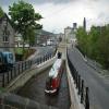
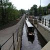
Slaithwaite Bridge No 44A
is a place on the waterways
on the Huddersfield Narrow Canal between
Railway Lock No 42E (Marsden. Eastern summit lock) (2 miles and 4 furlongs
and 19 locks
to the west) and
Titanic Mill (Linthwaite) (1 mile and 1½ furlongs
and 6 locks
to the east).
The nearest place in the direction of Railway Lock No 42E is Old Bank Bridge No 45;
¼ furlongs
away.
The nearest place in the direction of Titanic Mill is Britannia Road Bridge No 44;
¼ furlongs
away.
There is access (unofficial access) to the towpath here.
Mooring here is impossible (it may be physically impossible, forbidden, or allowed only for specific short-term purposes).
There is a bridge here which takes a minor road over the canal.
Uppermill Bridge No 47 | 1¾ furlongs | |
Canal Side Visitor Moorings | 1 furlong | |
Slaithwaite Aqueduct | ½ furlongs | |
Dartmouth Lock No 23E | ¼ furlongs | |
Old Bank Bridge No 45 | ¼ furlongs | |
Slaithwaite Bridge No 44A | ||
Britannia Road Bridge No 44 | ¼ furlongs | |
Slaithwaite Narrows | ¾ furlongs | |
Pickle Lock No 22E | 1¼ furlongs | |
Slaithwaite Winding Hole | 1¾ furlongs | |
Slaithwaite Visitor Moorings | 2 furlongs |
Amenities nearby at Britannia Road Bridge No 44
There are no links to external websites from here.
Why not log in and add some (select "External websites" from the menu (sometimes this is under "Edit"))?
Mouseover for more information or show routes to facility
Nearest water point
In the direction of Ashton-under-Lyne Junction
Standedge Tunnel (eastern entrance) — 3 miles, 1¼ furlongs and 20 locks away
On this waterway in the direction of Ashton-under-Lyne Junction
Standedge Tunnel (western entrance) — 6 miles, 3 furlongs and 20 locks away
On this waterway in the direction of Ashton-under-Lyne Junction
Wool Road Bridge No 70 — 8 miles, 3 furlongs and 29 locks away
On this waterway in the direction of Ashton-under-Lyne Junction
Grove Road Bridge No 96 — 14 miles, 3 furlongs and 44 locks away
On this waterway in the direction of Ashton-under-Lyne Junction
In the direction of Aspley Basin (Huddersfield)
Slaithwaite Winding Hole — 1¾ furlongs and 1 lock away
On this waterway in the direction of Aspley Basin (Huddersfield)
Waterside Lock No 21E — 2½ furlongs and 1 lock away
On this waterway in the direction of Aspley Basin (Huddersfield)
Aspley Basin (Huddersfield) — 5 miles and 22 locks away
On this waterway in the direction of Aspley Basin (Huddersfield)
Shepley Bridge Sanitary Station — 11 miles, 4½ furlongs and 33 locks away
Travel to Aspley Basin (Huddersfield), then on the Huddersfield Broad Canal to Cooper Bridge Junction, then on the Calder and Hebble Navigation (Main Line) to Shepley Bridge Sanitary Station
Brighouse Basin — 10 miles, 6½ furlongs and 35 locks away
Travel to Aspley Basin (Huddersfield), then on the Huddersfield Broad Canal to Cooper Bridge Junction, then on the Calder and Hebble Navigation (Main Line) to Brighouse Basin
Salterhebble Sanitary Station — 15 miles, ½ furlongs and 44 locks away
Travel to Aspley Basin (Huddersfield), then on the Huddersfield Broad Canal to Cooper Bridge Junction, then on the Calder and Hebble Navigation (Main Line) to Salterhebble Sanitary Station
Broad Cut Low Lock No 3 — 18 miles, 1½ furlongs and 41 locks away
Travel to Aspley Basin (Huddersfield), then on the Huddersfield Broad Canal to Cooper Bridge Junction, then on the Calder and Hebble Navigation (Main Line) to Broad Cut Low Lock No 3
Salterhebble Junction — 15 miles, ¾ furlongs and 45 locks away
Travel to Aspley Basin (Huddersfield), then on the Huddersfield Broad Canal to Cooper Bridge Junction, then on the Calder and Hebble Navigation (Main Line) to Salterhebble Junction
Sowerby Bridge Basin — 17 miles, 2½ furlongs and 45 locks away
Travel to Aspley Basin (Huddersfield), then on the Huddersfield Broad Canal to Cooper Bridge Junction, then on the Calder and Hebble Navigation (Main Line) to Salterhebble Junction, then on the Calder and Hebble Navigation (Main Line) to Sowerby Bridge BasinNearest rubbish disposal
In the direction of Ashton-under-Lyne Junction
Wool Road Visitor Mooring — 8 miles, 3¼ furlongs and 29 locks away
On this waterway in the direction of Ashton-under-Lyne Junction
In the direction of Aspley Basin (Huddersfield)
Pickle Lock No 22E — 1¼ furlongs away
On this waterway in the direction of Aspley Basin (Huddersfield)
Aspley Basin (Huddersfield) — 5 miles and 22 locks away
On this waterway in the direction of Aspley Basin (Huddersfield)
Shepley Bridge Sanitary Station — 11 miles, 4½ furlongs and 33 locks away
Travel to Aspley Basin (Huddersfield), then on the Huddersfield Broad Canal to Cooper Bridge Junction, then on the Calder and Hebble Navigation (Main Line) to Shepley Bridge Sanitary Station
Brighouse Lower Basin Visitor Moorings — 10 miles, 6 furlongs and 34 locks away
Travel to Aspley Basin (Huddersfield), then on the Huddersfield Broad Canal to Cooper Bridge Junction, then on the Calder and Hebble Navigation (Main Line) to Brighouse Lower Basin Visitor Moorings
Horbury Basin Residential Moorings & Sanitary Station — 16 miles, 1 furlong and 40 locks away
Travel to Aspley Basin (Huddersfield), then on the Huddersfield Broad Canal to Cooper Bridge Junction, then on the Calder and Hebble Navigation (Main Line) to Horbury Basin Residential Moorings & Sanitary Station
Salterhebble Sanitary Station — 15 miles, ½ furlongs and 44 locks away
Travel to Aspley Basin (Huddersfield), then on the Huddersfield Broad Canal to Cooper Bridge Junction, then on the Calder and Hebble Navigation (Main Line) to Salterhebble Sanitary Station
Sowerby Bridge Basin — 17 miles, 2½ furlongs and 45 locks away
Travel to Aspley Basin (Huddersfield), then on the Huddersfield Broad Canal to Cooper Bridge Junction, then on the Calder and Hebble Navigation (Main Line) to Salterhebble Junction, then on the Calder and Hebble Navigation (Main Line) to Sowerby Bridge BasinNearest chemical toilet disposal
In the direction of Ashton-under-Lyne Junction
Wool Road Bridge No 70 — 8 miles, 3 furlongs and 29 locks away
On this waterway in the direction of Ashton-under-Lyne Junction
Grove Road Bridge No 96 — 14 miles, 3 furlongs and 44 locks away
On this waterway in the direction of Ashton-under-Lyne Junction
In the direction of Aspley Basin (Huddersfield)
Pickle Lock No 22E — 1¼ furlongs away
On this waterway in the direction of Aspley Basin (Huddersfield)
Waterside Lock No 21E — 2½ furlongs and 1 lock away
On this waterway in the direction of Aspley Basin (Huddersfield)
Aspley Basin (Huddersfield) — 5 miles and 22 locks away
On this waterway in the direction of Aspley Basin (Huddersfield)
Shepley Bridge Sanitary Station — 11 miles, 4½ furlongs and 33 locks away
Travel to Aspley Basin (Huddersfield), then on the Huddersfield Broad Canal to Cooper Bridge Junction, then on the Calder and Hebble Navigation (Main Line) to Shepley Bridge Sanitary Station
Brighouse Basin — 10 miles, 6½ furlongs and 35 locks away
Travel to Aspley Basin (Huddersfield), then on the Huddersfield Broad Canal to Cooper Bridge Junction, then on the Calder and Hebble Navigation (Main Line) to Brighouse Basin
Savile Town Wharf and Basin (Dewsbury) — 15 miles and 37 locks away
Travel to Aspley Basin (Huddersfield), then on the Huddersfield Broad Canal to Cooper Bridge Junction, then on the Calder and Hebble Navigation (Main Line) to Dewsbury Arm Junction, then on the Calder and Hebble Navigation (Dewsbury Old Cut) to Savile Town Wharf and Basin (Dewsbury)
Horbury Basin Residential Moorings & Sanitary Station — 16 miles, 1 furlong and 40 locks away
Travel to Aspley Basin (Huddersfield), then on the Huddersfield Broad Canal to Cooper Bridge Junction, then on the Calder and Hebble Navigation (Main Line) to Horbury Basin Residential Moorings & Sanitary Station
Salterhebble Sanitary Station — 15 miles, ½ furlongs and 44 locks away
Travel to Aspley Basin (Huddersfield), then on the Huddersfield Broad Canal to Cooper Bridge Junction, then on the Calder and Hebble Navigation (Main Line) to Salterhebble Sanitary Station
Sowerby Bridge Basin — 17 miles, 2½ furlongs and 45 locks away
Travel to Aspley Basin (Huddersfield), then on the Huddersfield Broad Canal to Cooper Bridge Junction, then on the Calder and Hebble Navigation (Main Line) to Salterhebble Junction, then on the Calder and Hebble Navigation (Main Line) to Sowerby Bridge BasinNearest place to turn
In the direction of Ashton-under-Lyne Junction
Booth Lock Winding Hole — 1 mile, 3¼ furlongs and 9 locks away
On this waterway in the direction of Ashton-under-Lyne Junction
Standedge Tunnel End Winding Hole — 3 miles, ½ furlongs and 20 locks away
On this waterway in the direction of Ashton-under-Lyne Junction
Diggle Winding Hole — 6 miles, 5¾ furlongs and 20 locks away
On this waterway in the direction of Ashton-under-Lyne Junction
Wool Road Winding Hole — 8 miles, 3¾ furlongs and 29 locks away
On this waterway in the direction of Ashton-under-Lyne Junction
Saddleworth Visitor Centre Winding Hole — 9 miles, 1¾ furlongs and 31 locks away
On this waterway in the direction of Ashton-under-Lyne Junction
Manns Wharf Bridge Winding Hole — 10 miles, 4½ furlongs and 33 locks away
On this waterway in the direction of Ashton-under-Lyne Junction
Roughtown Court Winding Hole — 11 miles, 5¾ furlongs and 38 locks away
On this waterway in the direction of Ashton-under-Lyne Junction
In the direction of Aspley Basin (Huddersfield)
Slaithwaite Winding Hole — 1¾ furlongs and 1 lock away
On this waterway in the direction of Aspley Basin (Huddersfield)
Linthwaite Winding Hole — 1 mile, 2¼ furlongs and 6 locks away
On this waterway in the direction of Aspley Basin (Huddersfield)
Isis Lock Winding Hole — 2 miles, 6¾ furlongs and 14 locks away
On this waterway in the direction of Aspley Basin (Huddersfield)
University Arm — 4 miles, 7¼ furlongs and 22 locks away
On this waterway in the direction of Aspley Basin (Huddersfield)
Aspley Basin (Huddersfield) — 5 miles and 22 locks away
On this waterway in the direction of Aspley Basin (Huddersfield)
Anchor Street Winding Hole — 5 miles, 5 furlongs and 22 locks away
Travel to Aspley Basin (Huddersfield), then on the Huddersfield Broad Canal to Anchor Street Winding Hole
New Road Winding Hole — 6 miles, ½ furlongs and 22 locks away
Travel to Aspley Basin (Huddersfield), then on the Huddersfield Broad Canal to New Road Winding Hole
Deighton Road Bridge Winding Hole — 7 miles, 2 furlongs and 27 locks away
Travel to Aspley Basin (Huddersfield), then on the Huddersfield Broad Canal to Deighton Road Bridge Winding Hole
Cooper Bridge Junction — 8 miles, 4 furlongs and 31 locks away
Travel to Aspley Basin (Huddersfield), then on the Huddersfield Broad Canal to Cooper Bridge Junction
Battye Weir Entrance — 9 miles, 1 furlong and 32 locks away
Travel to Aspley Basin (Huddersfield), then on the Huddersfield Broad Canal to Cooper Bridge Junction, then on the Calder and Hebble Navigation (Main Line) to Battye Weir Entrance
Shepley Bridge Marina — 11 miles, 5 furlongs and 33 locks away
Travel to Aspley Basin (Huddersfield), then on the Huddersfield Broad Canal to Cooper Bridge Junction, then on the Calder and Hebble Navigation (Main Line) to Shepley Bridge Marina
Brighouse Basin — 10 miles, 6½ furlongs and 35 locks away
Travel to Aspley Basin (Huddersfield), then on the Huddersfield Broad Canal to Cooper Bridge Junction, then on the Calder and Hebble Navigation (Main Line) to Brighouse Basin
Ganny Winding Hole — 11 miles, 3¾ furlongs and 36 locks away
Travel to Aspley Basin (Huddersfield), then on the Huddersfield Broad Canal to Cooper Bridge Junction, then on the Calder and Hebble Navigation (Main Line) to Ganny Winding HoleNearest self-operated pump-out
In the direction of Ashton-under-Lyne Junction
Wool Road Bridge No 70 — 8 miles, 3 furlongs and 29 locks away
On this waterway in the direction of Ashton-under-Lyne Junction
In the direction of Aspley Basin (Huddersfield)
Slaithwaite Winding Hole — 1¾ furlongs and 1 lock away
On this waterway in the direction of Aspley Basin (Huddersfield)Nearest boatyard pump-out
In the direction of Ashton-under-Lyne Junction
Portland Basin Arm — 19 miles, 3¾ furlongs and 52 locks away
Travel to Ashton-under-Lyne Junction, then on the Ashton Canal (Main Line) to Dukinfield Junction, then on the Peak Forest Canal (Lower) to Portland Basin Arm
In the direction of Aspley Basin (Huddersfield)
Aspley Basin (Huddersfield) — 5 miles and 22 locks away
On this waterway in the direction of Aspley Basin (Huddersfield)
Shepley Bridge Marina — 11 miles, 5 furlongs and 33 locks away
Travel to Aspley Basin (Huddersfield), then on the Huddersfield Broad Canal to Cooper Bridge Junction, then on the Calder and Hebble Navigation (Main Line) to Shepley Bridge Marina
Sowerby Bridge Basin — 17 miles, 2½ furlongs and 45 locks away
Travel to Aspley Basin (Huddersfield), then on the Huddersfield Broad Canal to Cooper Bridge Junction, then on the Calder and Hebble Navigation (Main Line) to Salterhebble Junction, then on the Calder and Hebble Navigation (Main Line) to Sowerby Bridge BasinDirection of TV transmitter (From Wolfbane Cybernetic)
There is no page on Wikipedia called “Slaithwaite Bridge No 44A”
Wikipedia pages that might relate to Slaithwaite Bridge No 44A
[Slaithwaite]
Slaithwaite /ˈslæθ.weɪt/, locally slaithwaite /ˈslaʊ.ɪt/ (Old Norse: Timber-fell clearing), is a village within the Metropolitan Borough of Kirklees,
[Slaithwaite railway station]
Slaithwaite railway station serves the village of Slaithwaite near Huddersfield, West Yorkshire, England. The station is 4 miles (6 km) west of Huddersfield
[Huddersfield railway station]
station Manchester Victoria TransPennine Express North TransPennine Leeds Slaithwaite Dewsbury Stalybridge Deighton Terminus Northern Trains Calder Valley
[Colne Valley]
Calder at Cooper Bridge. Using the more common definition, the Colne Valley includes the towns and villages of Marsden, Slaithwaite, Linthwaite, Milnsbridge
[Huddersfield Cricket League]
Kirkburton | Marsden | Scholes | Shelley | Shepley | Skelmanthorpe | Slaithwaite Cedar Court Conference Almondbury | Cawthorne | Cumberwoth United | Kirkheaton
[Huddersfield Narrow Canal]
canal between Saddleworth and Dobcross The section of canal through Slaithwaite town centre, between locks 21E and 23E, had been culverted and a car
[Huddersfield line]
for the trains on the Penistone line Longwood and Milnsbridge Golcar Slaithwaite Marsden Standedge Tunnel: three parallel tunnels, two single-line, one
[Longroyd Bridge]
travels down through the Colne Valley passing Milnsbridge, Linthwaite, and Slaithwaite to Marsden before crossing the Pennine hills to Oldham and Manchester
[Hebden Bridge railway station]
Hebden Bridge railway station serves the town of Hebden Bridge in West Yorkshire, England. The station is on the Calder Valley Line, operated by Northern
[List of places in Yorkshire]
Skipsea Brough, Skipton, Skipwith, Skirlaugh, Skirlington, Skirpenbeck, Slaithwaite, Sledmere, Sleights, Smithies, Snainton, Snaith, Sneaton, South Bank