CanalPlanAC

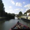
Newport Pagnell Road Bridge No 76

 
Black Horse, Great Linford
Wolverton Road, Milton Keynes MK14 5AJ, United Kingdom
 
Information about the place
Newport Pagnell Road Bridge No 76 is a minor waterways place on the Grand Union Canal (Grand Junction Canal - Main Line - Gayton to Brentford) between New Bradwell Footbridge No 71B (1 mile and 6¼ furlongs to the southwest) and Great Linford Railway Bridge No 76A (disused) (1 furlong to the east).
 
 
The nearest place in the direction of New Bradwell Footbridge No 71B is Stantonbury Wharf; ¼ furlongs away.
 
The nearest place in the direction of Great Linford Railway Bridge No 76A (disused) is The Black Horse PH (Great Linford); ¼ furlongs away.

There may be access to the towpath here.

Mooring here is unrated.

Facilities: rubbish disposal.

There is a bridge here which takes a minor road over the canal.


Amenities
 
Maps
If you are a user and are logged on, or if you are actively planning a route, a map will be displayed here.
Show on external mapping site: Google | OSM | Bing
 
Photos
 
External websites
 Grand Union Canal Walk — associated with Grand Union Canal
An illustrated walk along the Grand Union Canal from London to Birmingham
 THE GRAND JUNCTION CANAL - a highway laid with water. — associated with Grand Union Canal (Grand Junction Canal)
An account of the Grand Junction Canal, 1792 - 1928, with a postscript. By Ian Petticrew and Wendy Austin.
 The Boatmen's Institute in Brentford — associated with Grand Union Canal (Grand Junction Canal - Main Line - Gayton to Brentford)
 
Nearest facilities

Mouseover for more information or show routes to facility

Nearest water point

In the direction of Thames - Grand Union Canal Junction

Giffard Park Sanitary Station7¾ furlongs away
On this waterway in the direction of Thames - Grand Union Canal Junction
Peartree Bridge No 884 miles, 4 furlongs away
On this waterway in the direction of Thames - Grand Union Canal Junction
Fenny Stratford Services6 miles, 5½ furlongs and 1 lock away
On this waterway in the direction of Thames - Grand Union Canal Junction
Willowbridge Marina8 miles, 4 furlongs and 1 lock away
On this waterway in the direction of Thames - Grand Union Canal Junction
Soulbury Bottom Lock No 2410 miles, 6¼ furlongs and 2 locks away
On this waterway in the direction of Thames - Grand Union Canal Junction
Rothschild Road Wharf14 miles, 2 furlongs and 6 locks away
On this waterway in the direction of Thames - Grand Union Canal Junction
Leighton Linslade Services14 miles, 6½ furlongs and 6 locks away
On this waterway in the direction of Thames - Grand Union Canal Junction
Slapton Wharf18 miles, 4¼ furlongs and 9 locks away
On this waterway in the direction of Thames - Grand Union Canal Junction

In the direction of Gayton Junction

Winding Hole below Cosgrove Lock4 miles, 2 furlongs away
On this waterway in the direction of Gayton Junction
Cosgrove Sanitary Station4 miles, 3¼ furlongs and 1 lock away
On this waterway in the direction of Gayton Junction
Stoke Bruerne Services10 miles, ¾ furlongs and 1 lock away
On this waterway in the direction of Gayton Junction
Stoke Bruerne Bottom Lock No 2010 miles, 1 furlong and 1 lock away
On this waterway in the direction of Gayton Junction
The Boat Inn (Stoke Bruerne)10 miles, 7¼ furlongs and 8 locks away
On this waterway in the direction of Gayton Junction
Gayton Services14 miles, 6½ furlongs and 8 locks away
Travel to Gayton Junction, then on the Grand Union Canal (Northampton Branch) to Gayton Services
Northampton Marina19 miles, 7¼ furlongs and 25 locks away
Travel to Gayton Junction, then on the Grand Union Canal (Northampton Branch) to Northampton Junction, then on the River Nene (main river) to Northampton Marina

Nearest rubbish disposal

The nearest rubbish disposal is here. Others are at:

In the direction of Gayton Junction

Cosgrove Sanitary Station4 miles, 3¼ furlongs and 1 lock away
On this waterway in the direction of Gayton Junction
Stoke Bruerne Services10 miles, ¾ furlongs and 1 lock away
On this waterway in the direction of Gayton Junction
Waterside Café10 miles, 7¼ furlongs and 8 locks away
On this waterway in the direction of Gayton Junction
Gayton Services14 miles, 6½ furlongs and 8 locks away
Travel to Gayton Junction, then on the Grand Union Canal (Northampton Branch) to Gayton Services
Northampton Marina19 miles, 7¼ furlongs and 25 locks away
Travel to Gayton Junction, then on the Grand Union Canal (Northampton Branch) to Northampton Junction, then on the River Nene (main river) to Northampton Marina

In the direction of Thames - Grand Union Canal Junction

Fenny Stratford Services6 miles, 5½ furlongs and 1 lock away
On this waterway in the direction of Thames - Grand Union Canal Junction
Soulbury Middle Lock No 2510 miles, 6¾ furlongs and 3 locks away
On this waterway in the direction of Thames - Grand Union Canal Junction
Leighton Rubbish Disposal14 miles, 7 furlongs and 6 locks away
On this waterway in the direction of Thames - Grand Union Canal Junction

Nearest chemical toilet disposal

In the direction of Thames - Grand Union Canal Junction

Giffard Park Sanitary Station7¾ furlongs away
On this waterway in the direction of Thames - Grand Union Canal Junction
Fenny Stratford Services6 miles, 5½ furlongs and 1 lock away
On this waterway in the direction of Thames - Grand Union Canal Junction
Leighton Linslade Services14 miles, 6½ furlongs and 6 locks away
On this waterway in the direction of Thames - Grand Union Canal Junction

In the direction of Gayton Junction

Cosgrove Sanitary Station4 miles, 3¼ furlongs and 1 lock away
On this waterway in the direction of Gayton Junction
Stoke Bruerne Services10 miles, ¾ furlongs and 1 lock away
On this waterway in the direction of Gayton Junction
Gayton Services14 miles, 6½ furlongs and 8 locks away
Travel to Gayton Junction, then on the Grand Union Canal (Northampton Branch) to Gayton Services
Northampton Marina19 miles, 7¼ furlongs and 25 locks away
Travel to Gayton Junction, then on the Grand Union Canal (Northampton Branch) to Northampton Junction, then on the River Nene (main river) to Northampton Marina

Nearest place to turn

In the direction of Thames - Grand Union Canal Junction

Linford Winding Hole4½ furlongs away
On this waterway in the direction of Thames - Grand Union Canal Junction
Linford Wharf Winding Hole5 furlongs away
On this waterway in the direction of Thames - Grand Union Canal Junction
Blue Bridge Winding Hole3 miles, 2 furlongs away
On this waterway in the direction of Thames - Grand Union Canal Junction
Little Woolstone Winding Hole3 miles, 4¾ furlongs away
On this waterway in the direction of Thames - Grand Union Canal Junction
Milton Keynes Marina4 miles, 4¾ furlongs away
On this waterway in the direction of Thames - Grand Union Canal Junction
Fenny Stratford Basin6 miles, 7¼ furlongs and 1 lock away
On this waterway in the direction of Thames - Grand Union Canal Junction
Water Eaton Winding Hole7 miles, 5½ furlongs and 1 lock away
On this waterway in the direction of Thames - Grand Union Canal Junction
Winding Hole below Stoke Hammond Lock9 miles, 3½ furlongs and 1 lock away
On this waterway in the direction of Thames - Grand Union Canal Junction
Old Linslade Winding Hole12 miles, 3¾ furlongs and 5 locks away
On this waterway in the direction of Thames - Grand Union Canal Junction
Rothschild Road Wharf14 miles, 2 furlongs and 6 locks away
On this waterway in the direction of Thames - Grand Union Canal Junction
Bossington Lane Winding Hole14 miles, 2¾ furlongs and 6 locks away
On this waterway in the direction of Thames - Grand Union Canal Junction

In the direction of Gayton Junction

New Bradwell Winding Hole1 mile, 6 furlongs away
On this waterway in the direction of Gayton Junction
Galleon Wharf3 miles, 4½ furlongs away
On this waterway in the direction of Gayton Junction
Winding Hole below Cosgrove Lock4 miles, 2 furlongs away
On this waterway in the direction of Gayton Junction
Junction with Old Stratford Arm4 miles, 2½ furlongs and 1 lock away
On this waterway in the direction of Gayton Junction
Site of Bridge 1 and End of Navigation4 miles, 3½ furlongs and 1 lock away
Travel to Junction with Old Stratford Arm, then on the Grand Union Canal (Grand Junction Canal - Old Stratford Arm) to Site of Bridge 1 and End of Navigation
Thrupp Wharf Marina5 miles, 3½ furlongs and 1 lock away
On this waterway in the direction of Gayton Junction
Kingfisher Marina7 miles, 2¾ furlongs and 1 lock away
On this waterway in the direction of Gayton Junction
River Tove Junction10 miles, ¼ furlongs and 1 lock away
On this waterway in the direction of Gayton Junction
Blisworth Tunnel Winding Hole11 miles, 1¾ furlongs and 8 locks away
On this waterway in the direction of Gayton Junction

Nearest self-operated pump-out

In the direction of Thames - Grand Union Canal Junction

Willowbridge Marina8 miles, 4 furlongs and 1 lock away
On this waterway in the direction of Thames - Grand Union Canal Junction

In the direction of Gayton Junction

Blisworth Marina14 miles, 5¾ furlongs and 8 locks away
On this waterway in the direction of Gayton Junction
Northampton Marina19 miles, 7¼ furlongs and 25 locks away
Travel to Gayton Junction, then on the Grand Union Canal (Northampton Branch) to Northampton Junction, then on the River Nene (main river) to Northampton Marina

Nearest boatyard pump-out

In the direction of Thames - Grand Union Canal Junction

Campbell Wharf Marina3 miles, 2¼ furlongs away
On this waterway in the direction of Thames - Grand Union Canal Junction
Milton Keynes Marina4 miles, 4¾ furlongs away
On this waterway in the direction of Thames - Grand Union Canal Junction
Rothschild Road Wharf14 miles, 2 furlongs and 6 locks away
On this waterway in the direction of Thames - Grand Union Canal Junction
Grove Lock Marina16 miles, 2 furlongs and 7 locks away
On this waterway in the direction of Thames - Grand Union Canal Junction

In the direction of Gayton Junction

Yardley Wharf7 miles, 2½ furlongs and 1 lock away
On this waterway in the direction of Gayton Junction
Blisworth Marina14 miles, 5¾ furlongs and 8 locks away
On this waterway in the direction of Gayton Junction
Gayton Marina15 miles, ¼ furlongs and 8 locks away
Travel to Gayton Junction, then on the Grand Union Canal (Northampton Branch) to Gayton Marina
Direction of TV transmitter (From Wolfbane Cybernetic)
 
 
Geograph
 
Wikipedia

There is no page on Wikipedia called “Newport Pagnell Road Bridge”

Wikipedia pages that might relate to Newport Pagnell Road Bridge
[Newport Pagnell] Newport Pagnell is a town and civil parish in the Borough of Milton Keynes, Buckinghamshire, England. The Office for National Statistics records Newport [Newport Pagnell Canal] The Newport Pagnell Canal was a 1.25 mile canal in Buckinghamshire that ran from the Grand Junction Canal at Great Linford to Newport Pagnell through [Wolverton–Newport Pagnell line] The Wolverton–Newport Pagnell line was a railway branch line in Buckinghamshire, United Kingdom running from Wolverton on the London and North Western [Newport Pagnell railway station] Newport Pagnell railway station was a railway station that served Newport Pagnell, Buckinghamshire, on the Wolverton–Newport Pagnell line. Opened in 1867 [Tickford Bridge] Tickford Bridge, over the River Ouzel (or Lovat) in Newport Pagnell, Buckinghamshire, England, was built in 1810. It is one of the last (21 still remaining) [Milton Keynes grid road system] motorway bridge (near Newport Pagnell services) would be part of the H2.[citation needed] Newport Road and Fen Street (both part of the former A5130 road) skirt [Battle of Olney Bridge] 0°42′11″W / 52.14938°N 0.70314°W / 52.14938; -0.70314 Olney Newport Pagnell The Battle of Olney Bridge was a skirmish that occurred on 4 November 1643 during [List of post towns in the United Kingdom] confused with Newport Pagnell, Buckinghamshire (MK); Newport, Monmouthshire (NP); Newport, Isle of Wight (PO); Newport, Pembrokeshire (SA); or Newport, Shropshire [Broughton, Milton Keynes] the old turnpike, once the A50, became part of the A5130 (comprising Newport Road and Fen Street), which was later declassified, though the initial route [A50 road] down-classified as: B526 between Northampton and the Newport Pagnell bypass. A509 between the Newport Pagnell bypass and Junction 14 of the M1. A5130 between
 
Google

Results of Google Search

Bridges and other structures - Milton Keynes Council
Grand Union Main Line
Nicholson/Ordnance Survey Guide to the waterways - 1 by Not known, ISBN: 978 -0-00-728160-2, 170 pages, Published ... Newport Pagnell Road Bridge No 76.
M1 motorway - Wikipedia
The M1 motorway connects London to Leeds, where it joins the A1(M) near Aberford, ... The early M1 had no speed limits, no central reservation or crash barriers, and ... The new road involved the construction of a series of new junctions, bridges ... and a minibus crashed between junctions 14 and 15, near Newport Pagnell, ...