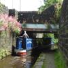
Goods Yard Bridge No 58
is a minor waterways place
on the Huddersfield Narrow Canal between
Railway Lock No 42E (Marsden. Eastern summit lock) (¼ furlongs
to the west) and
Titanic Mill (Linthwaite) (3 miles and 5¼ furlongs
and 25 locks
to the east).
The nearest place in the direction of Railway Lock No 42E is Station Approach Bridge No 59;
¼ furlongs
away.
The nearest place in the direction of Titanic Mill is Dirker Lock No 41E;
½ furlongs
away.
There may be access to the towpath here.
Mooring here is good (a nice place to moor), mooring pins are needed.
There is a bridge here which takes a track over the canal.
High Lea Narrows | 1¼ furlongs | |
Marsden Pipe Bridge | ¾ furlongs | |
Station Road Bridge No 60 | ½ furlongs | |
Railway Lock No 42E | ¼ furlongs | |
Station Approach Bridge No 59 | ¼ furlongs | |
Goods Yard Bridge No 58 | ||
Dirker Lock No 41E | ½ furlongs | |
Hopper Lock No 40E | 1¼ furlongs | |
Warehouse Hill Lock No 39E | 2 furlongs | |
Smithy Holme Bridge No 56 | 2 furlongs | |
Colne Lock No 38E | 2½ furlongs |
Amenities here
There are no links to external websites from here.
Why not log in and add some (select "External websites" from the menu (sometimes this is under "Edit"))?
Mouseover for more information or show routes to facility
Nearest water point
In the direction of Ashton-under-Lyne Junction
Standedge Tunnel (eastern entrance) — 5½ furlongs and 1 lock away
On this waterway in the direction of Ashton-under-Lyne Junction
Standedge Tunnel (western entrance) — 3 miles, 7¼ furlongs and 1 lock away
On this waterway in the direction of Ashton-under-Lyne Junction
Wool Road Bridge No 70 — 5 miles, 7¼ furlongs and 10 locks away
On this waterway in the direction of Ashton-under-Lyne Junction
Grove Road Bridge No 96 — 11 miles, 7¼ furlongs and 25 locks away
On this waterway in the direction of Ashton-under-Lyne Junction
Fairfield Junction — 19 miles, 3½ furlongs and 33 locks away
Travel to Ashton-under-Lyne Junction, then on the Ashton Canal (Main Line) to Fairfield Junction
In the direction of Aspley Basin (Huddersfield)
Slaithwaite Winding Hole — 2 miles, 5½ furlongs and 20 locks away
On this waterway in the direction of Aspley Basin (Huddersfield)
Waterside Lock No 21E — 2 miles, 6¼ furlongs and 20 locks away
On this waterway in the direction of Aspley Basin (Huddersfield)
Aspley Basin (Huddersfield) — 7 miles, 3¾ furlongs and 41 locks away
On this waterway in the direction of Aspley Basin (Huddersfield)
Shepley Bridge Sanitary Station — 14 miles, ¼ furlongs and 52 locks away
Travel to Aspley Basin (Huddersfield), then on the Huddersfield Broad Canal to Cooper Bridge Junction, then on the Calder and Hebble Navigation (Main Line) to Shepley Bridge Sanitary Station
Brighouse Basin — 13 miles, 2 furlongs and 54 locks away
Travel to Aspley Basin (Huddersfield), then on the Huddersfield Broad Canal to Cooper Bridge Junction, then on the Calder and Hebble Navigation (Main Line) to Brighouse Basin
Salterhebble Sanitary Station — 17 miles, 4 furlongs and 63 locks away
Travel to Aspley Basin (Huddersfield), then on the Huddersfield Broad Canal to Cooper Bridge Junction, then on the Calder and Hebble Navigation (Main Line) to Salterhebble Sanitary Station
Salterhebble Junction — 17 miles, 4½ furlongs and 64 locks away
Travel to Aspley Basin (Huddersfield), then on the Huddersfield Broad Canal to Cooper Bridge Junction, then on the Calder and Hebble Navigation (Main Line) to Salterhebble Junction
Sowerby Bridge Basin — 19 miles, 6¼ furlongs and 64 locks away
Travel to Aspley Basin (Huddersfield), then on the Huddersfield Broad Canal to Cooper Bridge Junction, then on the Calder and Hebble Navigation (Main Line) to Salterhebble Junction, then on the Calder and Hebble Navigation (Main Line) to Sowerby Bridge BasinNearest rubbish disposal
In the direction of Ashton-under-Lyne Junction
Wool Road Visitor Mooring — 5 miles, 7½ furlongs and 10 locks away
On this waterway in the direction of Ashton-under-Lyne Junction
In the direction of Aspley Basin (Huddersfield)
Pickle Lock No 22E — 2 miles, 5 furlongs and 19 locks away
On this waterway in the direction of Aspley Basin (Huddersfield)
Aspley Basin (Huddersfield) — 7 miles, 3¾ furlongs and 41 locks away
On this waterway in the direction of Aspley Basin (Huddersfield)
Shepley Bridge Sanitary Station — 14 miles, ¼ furlongs and 52 locks away
Travel to Aspley Basin (Huddersfield), then on the Huddersfield Broad Canal to Cooper Bridge Junction, then on the Calder and Hebble Navigation (Main Line) to Shepley Bridge Sanitary Station
Brighouse Lower Basin Visitor Moorings — 13 miles, 1¾ furlongs and 53 locks away
Travel to Aspley Basin (Huddersfield), then on the Huddersfield Broad Canal to Cooper Bridge Junction, then on the Calder and Hebble Navigation (Main Line) to Brighouse Lower Basin Visitor Moorings
Horbury Basin Residential Moorings & Sanitary Station — 18 miles, 4¾ furlongs and 59 locks away
Travel to Aspley Basin (Huddersfield), then on the Huddersfield Broad Canal to Cooper Bridge Junction, then on the Calder and Hebble Navigation (Main Line) to Horbury Basin Residential Moorings & Sanitary Station
Salterhebble Sanitary Station — 17 miles, 4 furlongs and 63 locks away
Travel to Aspley Basin (Huddersfield), then on the Huddersfield Broad Canal to Cooper Bridge Junction, then on the Calder and Hebble Navigation (Main Line) to Salterhebble Sanitary Station
Sowerby Bridge Basin — 19 miles, 6¼ furlongs and 64 locks away
Travel to Aspley Basin (Huddersfield), then on the Huddersfield Broad Canal to Cooper Bridge Junction, then on the Calder and Hebble Navigation (Main Line) to Salterhebble Junction, then on the Calder and Hebble Navigation (Main Line) to Sowerby Bridge BasinNearest chemical toilet disposal
In the direction of Ashton-under-Lyne Junction
Wool Road Bridge No 70 — 5 miles, 7¼ furlongs and 10 locks away
On this waterway in the direction of Ashton-under-Lyne Junction
Grove Road Bridge No 96 — 11 miles, 7¼ furlongs and 25 locks away
On this waterway in the direction of Ashton-under-Lyne Junction
Fairfield Junction — 19 miles, 3½ furlongs and 33 locks away
Travel to Ashton-under-Lyne Junction, then on the Ashton Canal (Main Line) to Fairfield Junction
In the direction of Aspley Basin (Huddersfield)
Pickle Lock No 22E — 2 miles, 5 furlongs and 19 locks away
On this waterway in the direction of Aspley Basin (Huddersfield)
Waterside Lock No 21E — 2 miles, 6¼ furlongs and 20 locks away
On this waterway in the direction of Aspley Basin (Huddersfield)
Aspley Basin (Huddersfield) — 7 miles, 3¾ furlongs and 41 locks away
On this waterway in the direction of Aspley Basin (Huddersfield)
Shepley Bridge Sanitary Station — 14 miles, ¼ furlongs and 52 locks away
Travel to Aspley Basin (Huddersfield), then on the Huddersfield Broad Canal to Cooper Bridge Junction, then on the Calder and Hebble Navigation (Main Line) to Shepley Bridge Sanitary Station
Brighouse Basin — 13 miles, 2 furlongs and 54 locks away
Travel to Aspley Basin (Huddersfield), then on the Huddersfield Broad Canal to Cooper Bridge Junction, then on the Calder and Hebble Navigation (Main Line) to Brighouse Basin
Savile Town Wharf and Basin (Dewsbury) — 17 miles, 3¾ furlongs and 56 locks away
Travel to Aspley Basin (Huddersfield), then on the Huddersfield Broad Canal to Cooper Bridge Junction, then on the Calder and Hebble Navigation (Main Line) to Dewsbury Arm Junction, then on the Calder and Hebble Navigation (Dewsbury Old Cut) to Savile Town Wharf and Basin (Dewsbury)
Horbury Basin Residential Moorings & Sanitary Station — 18 miles, 4¾ furlongs and 59 locks away
Travel to Aspley Basin (Huddersfield), then on the Huddersfield Broad Canal to Cooper Bridge Junction, then on the Calder and Hebble Navigation (Main Line) to Horbury Basin Residential Moorings & Sanitary Station
Salterhebble Sanitary Station — 17 miles, 4 furlongs and 63 locks away
Travel to Aspley Basin (Huddersfield), then on the Huddersfield Broad Canal to Cooper Bridge Junction, then on the Calder and Hebble Navigation (Main Line) to Salterhebble Sanitary Station
Sowerby Bridge Basin — 19 miles, 6¼ furlongs and 64 locks away
Travel to Aspley Basin (Huddersfield), then on the Huddersfield Broad Canal to Cooper Bridge Junction, then on the Calder and Hebble Navigation (Main Line) to Salterhebble Junction, then on the Calder and Hebble Navigation (Main Line) to Sowerby Bridge BasinNearest place to turn
In the direction of Ashton-under-Lyne Junction
Standedge Tunnel End Winding Hole — 4¾ furlongs and 1 lock away
On this waterway in the direction of Ashton-under-Lyne Junction
Diggle Winding Hole — 4 miles, 2 furlongs and 1 lock away
On this waterway in the direction of Ashton-under-Lyne Junction
Wool Road Winding Hole — 6 miles and 10 locks away
On this waterway in the direction of Ashton-under-Lyne Junction
Saddleworth Visitor Centre Winding Hole — 6 miles, 6 furlongs and 12 locks away
On this waterway in the direction of Ashton-under-Lyne Junction
Manns Wharf Bridge Winding Hole — 8 miles, ¾ furlongs and 14 locks away
On this waterway in the direction of Ashton-under-Lyne Junction
Roughtown Court Winding Hole — 9 miles, 2 furlongs and 19 locks away
On this waterway in the direction of Ashton-under-Lyne Junction
Mossley Bottoms Winding Hole — 10 miles, 1¾ furlongs and 21 locks away
On this waterway in the direction of Ashton-under-Lyne Junction
Knowle Street Winding Hole — 14 miles, 1¾ furlongs and 26 locks away
On this waterway in the direction of Ashton-under-Lyne Junction
Staley Wharf Winding Hole — 15 miles, 3¾ furlongs and 30 locks away
On this waterway in the direction of Ashton-under-Lyne Junction
Ashton-under-Lyne Junction — 16 miles, 3½ furlongs and 33 locks away
On this waterway in the direction of Ashton-under-Lyne Junction
Dukinfield Junction — 16 miles, 7½ furlongs and 33 locks away
Travel to Ashton-under-Lyne Junction, then on the Ashton Canal (Main Line) to Dukinfield Junction
Portland Basin Arm — 17 miles and 33 locks away
Travel to Ashton-under-Lyne Junction, then on the Ashton Canal (Main Line) to Dukinfield Junction, then on the Peak Forest Canal (Lower) to Portland Basin Arm
In the direction of Aspley Basin (Huddersfield)
Booth Lock Winding Hole — 1 mile, ½ furlongs and 10 locks away
On this waterway in the direction of Aspley Basin (Huddersfield)
Slaithwaite Winding Hole — 2 miles, 5½ furlongs and 20 locks away
On this waterway in the direction of Aspley Basin (Huddersfield)
Linthwaite Winding Hole — 3 miles, 6 furlongs and 25 locks away
On this waterway in the direction of Aspley Basin (Huddersfield)
Isis Lock Winding Hole — 5 miles, 2½ furlongs and 33 locks away
On this waterway in the direction of Aspley Basin (Huddersfield)
University Arm — 7 miles, 3 furlongs and 41 locks away
On this waterway in the direction of Aspley Basin (Huddersfield)
Aspley Basin (Huddersfield) — 7 miles, 3¾ furlongs and 41 locks away
On this waterway in the direction of Aspley Basin (Huddersfield)
Anchor Street Winding Hole — 8 miles, ¾ furlongs and 41 locks away
Travel to Aspley Basin (Huddersfield), then on the Huddersfield Broad Canal to Anchor Street Winding Hole
New Road Winding Hole — 8 miles, 4 furlongs and 41 locks away
Travel to Aspley Basin (Huddersfield), then on the Huddersfield Broad Canal to New Road Winding HoleNearest self-operated pump-out
In the direction of Ashton-under-Lyne Junction
Wool Road Bridge No 70 — 5 miles, 7¼ furlongs and 10 locks away
On this waterway in the direction of Ashton-under-Lyne Junction
In the direction of Aspley Basin (Huddersfield)
Slaithwaite Winding Hole — 2 miles, 5½ furlongs and 20 locks away
On this waterway in the direction of Aspley Basin (Huddersfield)Nearest boatyard pump-out
In the direction of Ashton-under-Lyne Junction
Portland Basin Arm — 17 miles and 33 locks away
Travel to Ashton-under-Lyne Junction, then on the Ashton Canal (Main Line) to Dukinfield Junction, then on the Peak Forest Canal (Lower) to Portland Basin Arm
In the direction of Aspley Basin (Huddersfield)
Aspley Basin (Huddersfield) — 7 miles, 3¾ furlongs and 41 locks away
On this waterway in the direction of Aspley Basin (Huddersfield)
Shepley Bridge Marina — 14 miles, ½ furlongs and 52 locks away
Travel to Aspley Basin (Huddersfield), then on the Huddersfield Broad Canal to Cooper Bridge Junction, then on the Calder and Hebble Navigation (Main Line) to Shepley Bridge Marina
Sowerby Bridge Basin — 19 miles, 6¼ furlongs and 64 locks away
Travel to Aspley Basin (Huddersfield), then on the Huddersfield Broad Canal to Cooper Bridge Junction, then on the Calder and Hebble Navigation (Main Line) to Salterhebble Junction, then on the Calder and Hebble Navigation (Main Line) to Sowerby Bridge BasinDirection of TV transmitter (From Wolfbane Cybernetic)
There is no page on Wikipedia called “Goods Yard Bridge”
Wikipedia pages that might relate to Goods Yard Bridge
[Withymoor Goods Yard]
Withymoor Goods Yard was a railway goods yard situated in Netherton, West Midlands, England. It opened in 1879 at the termination of a branch line which
[Rozelle Yard]
Rozelle Yard was a goods railway yard in Rozelle, New South Wales, Australia. Since heavy rail traffic ceased, part of the site has been redeveloped into
[Westmoreland Road goods yard]
Westmoreland Road goods yard was the main Great Western Railway goods station for the city of Bath in England, situated on the main line between the passenger
[Stainland branch]
Vale Station and goods yard. After West vale station, the line continued onwards, still climbing at 1 in 50, passing under a small bridge carrying Long Heys
[Sydney Freight Network]
from Marrickville to Port Botany. An additional Goods Yard was established at Cooks River in 1947. This yard connects with the Port Botany line to the east
[Monmouth Troy Goods Yard]
Monmouth Troy Goods Yard was a large goods yard near Monmouth Troy railway station in Monmouth, Wales. It was opened in 1857 by the Coleford, Monmouth
[Westminster Bridge]
nearest Thames bridge to London Bridge was at Kingston. From late Tudor times congestion in trading hours at London Bridge (for road goods and carriages
[Stamford Bridge railway station]
two-road goods shed, which backed onto the down platform. The large yard between the goods shed and the station building served as a holding area for goods received
[Kimberley Park railway station]
down platform, with a smaller waiting room being provided on the up. The goods yard was situated on the down side of the line, comprising a single siding
[Severn Tunnel Junction railway station]
reverse, it sorted goods from the rest of the UK to South Wales. The goods yard was bombed during World War II, due to the large goods yard facility. From
Results of Google Search
MBTA bus route 57 stops and schedules, including maps, real-time updates, parking and accessibility ... 57A. Watertown Yard. 3 min. Watertown Yard. 8 min. View schedule ... MBTA and MassDOT Announce Tobin Bridge Bus Lane Pilot ...
Title 57 - Highways, Bridges and Ferries ... The prohibition of Section 57-25-10 does not extend to a welcome sign or other sign providing ... (9) signs of thirty-two square feet or less advertising agricultural products of a seasonal nature, ... All dimensions include border and trim but exclude decorative bases and supports.
Where can I find employment information about working at a weigh station? ... I am a common carrier of household goods and other items. ... A. Florida State Statute 316.515 (3) covers the number of trailers and length of trailers allowed in Florida. ... A. No, like a truck tractor semi-trailer combinations the trailer may be 57 feet ...
May 24, 2018 ... ... time on his leased property just north of Red Creek and within yards of the Highway 57 bridge construction area. For him, there's no problem, ...
After crossing the bridge at Cairo, Illinois, I-57 is the longest interstate in Illinois. ... and all of I-57 in Illinois is listed on the IDOT Designated Truck Route list I-57 is not tolled ... The southernmost Amtrak station in the I-57 corridor is Effingham, IL.
Donate Clothing and Goods ... More videos. Your browser does not currently recognize any of the video formats available. ... 57 E Bridge St, Oswego, NY 13126 ...
VIA 57 WEST is a residential building in Midtown West, Manhattan, NYC, a fresh new design by architect Bjarke Ingles.
If no drawspan openings are listed immediately below, no non-military drawspan openings are scheduled. Listed openings are for maintenance and commercial ...
Nov 15, 2015 ... The neck sounds very good- I have it adjusted as... ... the pole pieces (the bridge pickup matches my yard - both have huge mushrooms sprouting from them). ... Op I re read the part about 57+ not being a safe bet, and I frankly ...