CanalPlanAC

Station Approach Bridge No 59

 
The Railway, Station Road, Marsden HD7 6DH, United Kingdom
 
Information about the place
Station Approach Bridge No 59 is a minor waterways place on the Huddersfield Narrow Canal between Railway Lock No 42E (Marsden. Eastern summit lock) (a few yards to the west) and Titanic Mill (Linthwaite) (3 miles and 5¼ furlongs and 25 locks to the east).
 
 
The nearest place in the direction of Titanic Mill is Goods Yard Bridge No 58; ¼ furlongs away.

There may be access to the towpath here.

Mooring here is unrated.

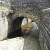
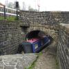
There is a bridge here which takes a track over the canal.


Amenities

Amenities nearby at Goods Yard Bridge No 58

 Railway
 
Maps
If you are a user and are logged on, or if you are actively planning a route, a map will be displayed here.
Show on external mapping site: Google | OSM | Bing
 
Photos
 
External websites
There are no links to external websites from here.
Why not log in and add some (select "External websites" from the menu (sometimes this is under "Edit"))?
 
Nearest facilities

Mouseover for more information or show routes to facility

Nearest water point

In the direction of Ashton-under-Lyne Junction

Standedge Tunnel (eastern entrance)5¼ furlongs and 1 lock away
On this waterway in the direction of Ashton-under-Lyne Junction
Standedge Tunnel (western entrance)3 miles, 7¼ furlongs and 1 lock away
On this waterway in the direction of Ashton-under-Lyne Junction
Wool Road Bridge No 705 miles, 7 furlongs and 10 locks away
On this waterway in the direction of Ashton-under-Lyne Junction
Grove Road Bridge No 9611 miles, 7¼ furlongs and 25 locks away
On this waterway in the direction of Ashton-under-Lyne Junction
Fairfield Junction19 miles, 3¼ furlongs and 33 locks away
Travel to Ashton-under-Lyne Junction, then on the Ashton Canal (Main Line) to Fairfield Junction

In the direction of Aspley Basin (Huddersfield)

Slaithwaite Winding Hole2 miles, 5½ furlongs and 20 locks away
On this waterway in the direction of Aspley Basin (Huddersfield)
Waterside Lock No 21E2 miles, 6¼ furlongs and 20 locks away
On this waterway in the direction of Aspley Basin (Huddersfield)
Aspley Basin (Huddersfield)7 miles, 3¾ furlongs and 41 locks away
On this waterway in the direction of Aspley Basin (Huddersfield)
Shepley Bridge Sanitary Station14 miles, ½ furlongs and 52 locks away
Travel to Aspley Basin (Huddersfield), then on the Huddersfield Broad Canal to Cooper Bridge Junction, then on the Calder and Hebble Navigation (Main Line) to Shepley Bridge Sanitary Station
Brighouse Basin13 miles, 2¼ furlongs and 54 locks away
Travel to Aspley Basin (Huddersfield), then on the Huddersfield Broad Canal to Cooper Bridge Junction, then on the Calder and Hebble Navigation (Main Line) to Brighouse Basin
Salterhebble Sanitary Station17 miles, 4¼ furlongs and 63 locks away
Travel to Aspley Basin (Huddersfield), then on the Huddersfield Broad Canal to Cooper Bridge Junction, then on the Calder and Hebble Navigation (Main Line) to Salterhebble Sanitary Station
Salterhebble Junction17 miles, 4¾ furlongs and 64 locks away
Travel to Aspley Basin (Huddersfield), then on the Huddersfield Broad Canal to Cooper Bridge Junction, then on the Calder and Hebble Navigation (Main Line) to Salterhebble Junction
Sowerby Bridge Basin19 miles, 6½ furlongs and 64 locks away
Travel to Aspley Basin (Huddersfield), then on the Huddersfield Broad Canal to Cooper Bridge Junction, then on the Calder and Hebble Navigation (Main Line) to Salterhebble Junction, then on the Calder and Hebble Navigation (Main Line) to Sowerby Bridge Basin

Nearest rubbish disposal

In the direction of Ashton-under-Lyne Junction

Wool Road Visitor Mooring5 miles, 7½ furlongs and 10 locks away
On this waterway in the direction of Ashton-under-Lyne Junction

In the direction of Aspley Basin (Huddersfield)

Pickle Lock No 22E2 miles, 5 furlongs and 19 locks away
On this waterway in the direction of Aspley Basin (Huddersfield)
Aspley Basin (Huddersfield)7 miles, 3¾ furlongs and 41 locks away
On this waterway in the direction of Aspley Basin (Huddersfield)
Shepley Bridge Sanitary Station14 miles, ½ furlongs and 52 locks away
Travel to Aspley Basin (Huddersfield), then on the Huddersfield Broad Canal to Cooper Bridge Junction, then on the Calder and Hebble Navigation (Main Line) to Shepley Bridge Sanitary Station
Brighouse Lower Basin Visitor Moorings13 miles, 1¾ furlongs and 53 locks away
Travel to Aspley Basin (Huddersfield), then on the Huddersfield Broad Canal to Cooper Bridge Junction, then on the Calder and Hebble Navigation (Main Line) to Brighouse Lower Basin Visitor Moorings
Horbury Basin Residential Moorings & Sanitary Station18 miles, 4¾ furlongs and 59 locks away
Travel to Aspley Basin (Huddersfield), then on the Huddersfield Broad Canal to Cooper Bridge Junction, then on the Calder and Hebble Navigation (Main Line) to Horbury Basin Residential Moorings & Sanitary Station
Salterhebble Sanitary Station17 miles, 4¼ furlongs and 63 locks away
Travel to Aspley Basin (Huddersfield), then on the Huddersfield Broad Canal to Cooper Bridge Junction, then on the Calder and Hebble Navigation (Main Line) to Salterhebble Sanitary Station
Sowerby Bridge Basin19 miles, 6½ furlongs and 64 locks away
Travel to Aspley Basin (Huddersfield), then on the Huddersfield Broad Canal to Cooper Bridge Junction, then on the Calder and Hebble Navigation (Main Line) to Salterhebble Junction, then on the Calder and Hebble Navigation (Main Line) to Sowerby Bridge Basin

Nearest chemical toilet disposal

In the direction of Ashton-under-Lyne Junction

Wool Road Bridge No 705 miles, 7 furlongs and 10 locks away
On this waterway in the direction of Ashton-under-Lyne Junction
Grove Road Bridge No 9611 miles, 7¼ furlongs and 25 locks away
On this waterway in the direction of Ashton-under-Lyne Junction
Fairfield Junction19 miles, 3¼ furlongs and 33 locks away
Travel to Ashton-under-Lyne Junction, then on the Ashton Canal (Main Line) to Fairfield Junction

In the direction of Aspley Basin (Huddersfield)

Pickle Lock No 22E2 miles, 5 furlongs and 19 locks away
On this waterway in the direction of Aspley Basin (Huddersfield)
Waterside Lock No 21E2 miles, 6¼ furlongs and 20 locks away
On this waterway in the direction of Aspley Basin (Huddersfield)
Aspley Basin (Huddersfield)7 miles, 3¾ furlongs and 41 locks away
On this waterway in the direction of Aspley Basin (Huddersfield)
Shepley Bridge Sanitary Station14 miles, ½ furlongs and 52 locks away
Travel to Aspley Basin (Huddersfield), then on the Huddersfield Broad Canal to Cooper Bridge Junction, then on the Calder and Hebble Navigation (Main Line) to Shepley Bridge Sanitary Station
Brighouse Basin13 miles, 2¼ furlongs and 54 locks away
Travel to Aspley Basin (Huddersfield), then on the Huddersfield Broad Canal to Cooper Bridge Junction, then on the Calder and Hebble Navigation (Main Line) to Brighouse Basin
Savile Town Wharf and Basin (Dewsbury)17 miles, 4 furlongs and 56 locks away
Travel to Aspley Basin (Huddersfield), then on the Huddersfield Broad Canal to Cooper Bridge Junction, then on the Calder and Hebble Navigation (Main Line) to Dewsbury Arm Junction, then on the Calder and Hebble Navigation (Dewsbury Old Cut) to Savile Town Wharf and Basin (Dewsbury)
Horbury Basin Residential Moorings & Sanitary Station18 miles, 4¾ furlongs and 59 locks away
Travel to Aspley Basin (Huddersfield), then on the Huddersfield Broad Canal to Cooper Bridge Junction, then on the Calder and Hebble Navigation (Main Line) to Horbury Basin Residential Moorings & Sanitary Station
Salterhebble Sanitary Station17 miles, 4¼ furlongs and 63 locks away
Travel to Aspley Basin (Huddersfield), then on the Huddersfield Broad Canal to Cooper Bridge Junction, then on the Calder and Hebble Navigation (Main Line) to Salterhebble Sanitary Station
Sowerby Bridge Basin19 miles, 6½ furlongs and 64 locks away
Travel to Aspley Basin (Huddersfield), then on the Huddersfield Broad Canal to Cooper Bridge Junction, then on the Calder and Hebble Navigation (Main Line) to Salterhebble Junction, then on the Calder and Hebble Navigation (Main Line) to Sowerby Bridge Basin

Nearest place to turn

In the direction of Ashton-under-Lyne Junction

Standedge Tunnel End Winding Hole4½ furlongs and 1 lock away
On this waterway in the direction of Ashton-under-Lyne Junction
Diggle Winding Hole4 miles, 2 furlongs and 1 lock away
On this waterway in the direction of Ashton-under-Lyne Junction
Wool Road Winding Hole5 miles, 7¾ furlongs and 10 locks away
On this waterway in the direction of Ashton-under-Lyne Junction
Saddleworth Visitor Centre Winding Hole6 miles, 5¾ furlongs and 12 locks away
On this waterway in the direction of Ashton-under-Lyne Junction
Manns Wharf Bridge Winding Hole8 miles, ½ furlongs and 14 locks away
On this waterway in the direction of Ashton-under-Lyne Junction
Roughtown Court Winding Hole9 miles, 2 furlongs and 19 locks away
On this waterway in the direction of Ashton-under-Lyne Junction
Mossley Bottoms Winding Hole10 miles, 1½ furlongs and 21 locks away
On this waterway in the direction of Ashton-under-Lyne Junction
Knowle Street Winding Hole14 miles, 1¾ furlongs and 26 locks away
On this waterway in the direction of Ashton-under-Lyne Junction
Staley Wharf Winding Hole15 miles, 3¾ furlongs and 30 locks away
On this waterway in the direction of Ashton-under-Lyne Junction
Ashton-under-Lyne Junction16 miles, 3¼ furlongs and 33 locks away
On this waterway in the direction of Ashton-under-Lyne Junction
Dukinfield Junction16 miles, 7¼ furlongs and 33 locks away
Travel to Ashton-under-Lyne Junction, then on the Ashton Canal (Main Line) to Dukinfield Junction
Portland Basin Arm16 miles, 7¾ furlongs and 33 locks away
Travel to Ashton-under-Lyne Junction, then on the Ashton Canal (Main Line) to Dukinfield Junction, then on the Peak Forest Canal (Lower) to Portland Basin Arm

In the direction of Aspley Basin (Huddersfield)

Booth Lock Winding Hole1 mile, ¾ furlongs and 10 locks away
On this waterway in the direction of Aspley Basin (Huddersfield)
Slaithwaite Winding Hole2 miles, 5½ furlongs and 20 locks away
On this waterway in the direction of Aspley Basin (Huddersfield)
Linthwaite Winding Hole3 miles, 6¼ furlongs and 25 locks away
On this waterway in the direction of Aspley Basin (Huddersfield)
Isis Lock Winding Hole5 miles, 2½ furlongs and 33 locks away
On this waterway in the direction of Aspley Basin (Huddersfield)
University Arm7 miles, 3¼ furlongs and 41 locks away
On this waterway in the direction of Aspley Basin (Huddersfield)
Aspley Basin (Huddersfield)7 miles, 3¾ furlongs and 41 locks away
On this waterway in the direction of Aspley Basin (Huddersfield)
Anchor Street Winding Hole8 miles, ¾ furlongs and 41 locks away
Travel to Aspley Basin (Huddersfield), then on the Huddersfield Broad Canal to Anchor Street Winding Hole
New Road Winding Hole8 miles, 4¼ furlongs and 41 locks away
Travel to Aspley Basin (Huddersfield), then on the Huddersfield Broad Canal to New Road Winding Hole

Nearest self-operated pump-out

In the direction of Ashton-under-Lyne Junction

Wool Road Bridge No 705 miles, 7 furlongs and 10 locks away
On this waterway in the direction of Ashton-under-Lyne Junction

In the direction of Aspley Basin (Huddersfield)

Slaithwaite Winding Hole2 miles, 5½ furlongs and 20 locks away
On this waterway in the direction of Aspley Basin (Huddersfield)

Nearest boatyard pump-out

In the direction of Ashton-under-Lyne Junction

Portland Basin Arm16 miles, 7¾ furlongs and 33 locks away
Travel to Ashton-under-Lyne Junction, then on the Ashton Canal (Main Line) to Dukinfield Junction, then on the Peak Forest Canal (Lower) to Portland Basin Arm

In the direction of Aspley Basin (Huddersfield)

Aspley Basin (Huddersfield)7 miles, 3¾ furlongs and 41 locks away
On this waterway in the direction of Aspley Basin (Huddersfield)
Shepley Bridge Marina14 miles, ¾ furlongs and 52 locks away
Travel to Aspley Basin (Huddersfield), then on the Huddersfield Broad Canal to Cooper Bridge Junction, then on the Calder and Hebble Navigation (Main Line) to Shepley Bridge Marina
Sowerby Bridge Basin19 miles, 6½ furlongs and 64 locks away
Travel to Aspley Basin (Huddersfield), then on the Huddersfield Broad Canal to Cooper Bridge Junction, then on the Calder and Hebble Navigation (Main Line) to Salterhebble Junction, then on the Calder and Hebble Navigation (Main Line) to Sowerby Bridge Basin
Direction of TV transmitter (From Wolfbane Cybernetic)
 
 
Geograph
 
Wikipedia

There is no page on Wikipedia called “Station Approach Bridge”

Wikipedia pages that might relate to Station Approach Bridge
[London Bridge station] London Bridge is a central London railway terminus and connected London Underground station in Southwark, south-east London. It occupies a large area on [Tower Bridge] Lane, on the south – now known as Tower Bridge Approach and Tower Bridge Road, respectively. Until the bridge was opened, the Tower Subway – 400 m to [Forth Bridge approach railways] Forth Bridge approach railways were railway lines constructed in the period 1887 to 1890 to form new main lines on the opening of the Forth Bridge at the [Spiral bridge] steep terrain, or where the approach road to a bridge would terminate too far from the bridge's end. The shape of the bridge forms a helix, not a spiral [Sydney Harbour Bridge] 18 cm (7.1 in). The total weight of the steelwork of the bridge, including the arch and approach spans, is 52,800 tonnes (52,000 long tons; 58,200 short [London Bridge] 30 metres (98 ft) upstream from previous alignments. The approaches to the medieval bridge were marked by the church of St Magnus-the-Martyr on the northern [Forth Bridge] railway station, the track curves very slightly to the east before coming to the southern approach viaduct. After the railway crosses the bridge, it passes [Hell Gate Bridge] 350-foot (106.7 m) fixed truss bridge crosses the Bronx Kill, a strait now narrowed by fill. Together with approaches, the bridges are more than 17,000 feet [Brooklyn Bridge] Brooklyn Bridge, the cable car line was designed as a steam/cable-hauled hybrid. They were powered from a generating station under the Brooklyn approach. The [Bridge to nowhere] 075610) A second bridge sits over a minor road on the same rail line to the southwest, and the former station is now a parking lot. Broken bridge, located in
 
Google

Results of Google Search

Lancashire & Yorkshire Railway
A collection of engineers' drawings relating to various bridges, stations, etc in Salford. The following are all headed 'Salford Widening' and date from 1892- 1894. Bridge over No 6 approach. (Ms 59). Bridge over No 6 approach, West span. (Ms 78). Bridge over No 6 approach - East span. (Ms 64). Bridge over No 6 approach ...
London Bridge station - Wikipedia
London Bridge is a central London railway terminus and connected London Underground station in Southwark, occupying a large area on three levels immediately south-east of London Bridge and 1.6 miles (2.6 km) east of Charing Cross. The main line station is the oldest railway station in London fare zone 1 and one of ...
London Bridge - Facilities, Shops, and Parking Information.
London Bridge. Transformed. London Bridge is the fourth busiest station in the country, bringing around 56 million passengers into the city each year. The station has undergone a phase of significant improvements and will continue into 2018. The changes being delivered will allow more Thameslink trains with up to 18 ...
Live departures & arrivals
Hayes (Kent) [ HYS ]. Cycle hire availability: No; Cycle parking: Yes. More information on Hayes (Kent) station. Key. Delayed: This service is delayed; No report: There is no report on the progress of this service yet; Cancelled: The service has been cancelled. On time: This service is on time; Start here: The service has not yet ...
Our Stores | The Savanna
We are based 5 minutes walk from Wimbledon train station next door to Sainsbury's car park on Worple Road. Opening Hours: ... Raynes Park - Raynes Park Station, Approach Road, SW20 0JY 020 8417 0044. We're based ... London Bridge - Unit SU58, 59 St Thomas Street, London, SE1 3QX 020 7357 9314. Our London ...
Bridge Inspection Pocket Guide
the deck drainage systems to remove water from the bridge and approach roadway. What to Look For. Normally, the approaches are drained by crowning the roadway and sloping the shoulders to side ditches, gutters, or catch basins. Check for pavements that are no longer crowned, have high shoulders, or have low spots, ...
London Waterloo Station - Car Park
Find parking charges, opening hours, postcode and a parking map of London Waterloo Station Station Approach Road as well as other car parks, street parking, pay and ... Features. Disabled Spaces. No height restrictions. Motorcycle Spaces. Overnight. Manned. CCTV. More features: Safer Parking Award, Bike Racks, Lit ...
Trains Hayes Kent to London Bridge - Train Timetables & Cheap ...
07:59 ON TIME. Hayes (Kent) Platform 2. 08:34 ON TIME. London Bridge Platform 2 estimated. 35 m. > Direct. Peak. From £6.40. Find tickets. 08:29 ON TIME. Hayes (Kent) Platform 2 estimated. 09:04 ON TIME. London Bridge Platform 2 estimated. 35 m. > Direct. Peak. From £6.40. Find tickets. 08:59 ON TIME. Hayes (Kent) ...
Abandoned Stations : Williamsburg Bridge Railway terminal
Williamsburg Bridge Railway terminal. Passenger service: October 1904 - December 1948. Existing abandoned portions: Portions of track and track-level platforms, 8 loop tracks. Touring: J M Z trains to Essex St. Look into the space south of the station when no Brooklyn-bound train is in the station.
BRIDGE HYDRAULIC REPORT
Sep 22, 2016 ... Des No. 1600384 & 1600385. Bridge No. I70-59-05180 CEBL & JCWB. Page 2 of 9. TABLE OF CONTENTS. 1. Location . ..... The cross sections at river station 5185 and 5188 are elevation adjusted copies of the ... section at River Station 6015 was used as the approach cross section for both bridges.