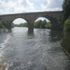
Fairburn Railway Bridge
Whedale Lane, New Fryston WF10 2PN, United Kingdom
Address is taken from a point 383 yards away.

Fairburn Railway Bridge
is a minor waterways place
on the Aire and Calder Navigation (Main Line - Goole to Castleford) between
Bank Dole Junction (Junction of the Aire and Calder Navigation (Selby Section) and the Aire and Calder Navigation (Main Line)) (3 miles and 5 furlongs
and 1 lock
to the southeast) and
Castleford Junction (Junction of the Aire and Calder Navigation (Wakefield Section) and the Aire and Calder Navigation (Main Line)) (3 miles and 3 furlongs
and 2 locks
to the west).
The nearest place in the direction of Bank Dole Junction is A1(M) Motorway Bridge;
2¾ furlongs
away.
The nearest place in the direction of Castleford Junction is Fryston Basin;
5½ furlongs
away.
Mooring here is unrated.
There is a bridge here which takes a railway over the canal.
| Old Great North Road Bridge | 1 mile, 7¼ furlongs | |
| Ferrybridge Railway Bridge | 1 mile, 2¾ furlongs | |
| Power Station Pipe Bridge | 7¾ furlongs | |
| Ferrybridge Wharf | 6¾ furlongs | |
| A1(M) Motorway Bridge | 2¾ furlongs | |
| Fairburn Railway Bridge | ||
| Fryston Basin | 5½ furlongs | |
| Fairburn Ings Basin | 2 miles, 1½ furlongs | |
| Bulholme Lock Railway Bridge | 2 miles, 4 furlongs | |
| Bulholme Lock Weir Exit | 2 miles, 5 furlongs | |
| Bulholme Lock No 10 | 2 miles, 5¼ furlongs | |
Amenities nearby at Fryston Basin
There are no links to external websites from here.
Why not log in and add some (select "External websites" from the menu (sometimes this is under "Edit"))?
Mouseover for more information or show routes to facility
Nearest water point
In the direction of Castleford Junction
Bulholme Lock No 10 — 2 miles, 5¼ furlongs away
On this waterway in the direction of Castleford Junction
Castleford Sanitary Station — 3 miles, 2 furlongs and 1 lock away
On this waterway in the direction of Castleford Junction
Woodnook Lock No 6 — 5 miles, 4¾ furlongs and 2 locks away
Travel to Castleford Junction, then on the Aire and Calder Navigation (Wakefield Section) to Woodnook Lock No 6
Fairies Hill Moorings — 5 miles, 3¼ furlongs and 3 locks away
Travel to Castleford Junction, then on the Aire and Calder Navigation (Wakefield Section) to Fairies Hill Lock Junction, then on the Aire and Calder Navigation (Wakefield Section - Fairies Hill Mooring Arm) to Fairies Hill Moorings
Lemonroyd Lock No 7 — 6 miles, 6½ furlongs and 2 locks away
Travel to Castleford Junction, then on the Aire and Calder Navigation (Main Line - Castleford to Leeds) to Lemonroyd Lock No 7
Lemonroyd Marina — 6 miles, 7½ furlongs and 3 locks away
Travel to Castleford Junction, then on the Aire and Calder Navigation (Main Line - Castleford to Leeds) to Lemonroyd Marina
King's Road Lock No 3 — 6 miles, 6¼ furlongs and 3 locks away
Travel to Castleford Junction, then on the Aire and Calder Navigation (Wakefield Section) to King's Road Lock No 3
Woodlesford Lock No 5 — 8 miles, 1¼ furlongs and 3 locks away
Travel to Castleford Junction, then on the Aire and Calder Navigation (Main Line - Castleford to Leeds) to Woodlesford Lock No 5
Fishpond Lock No 4 — 9 miles and 4 locks away
Travel to Castleford Junction, then on the Aire and Calder Navigation (Main Line - Castleford to Leeds) to Fishpond Lock No 4
Stanley Ferry Water Point — 8 miles, 3¼ furlongs and 5 locks away
Travel to Castleford Junction, then on the Aire and Calder Navigation (Wakefield Section) to Stanley Ferry Water Point
Ramsdens Bridge Sanitary Station — 8 miles, 4 furlongs and 5 locks away
Travel to Castleford Junction, then on the Aire and Calder Navigation (Wakefield Section) to Ramsdens Bridge Sanitary Station
Leeds Sanitary Station — 12 miles, 6 furlongs and 6 locks away
Travel to Castleford Junction, then on the Aire and Calder Navigation (Main Line - Castleford to Leeds) to Leeds Sanitary Station
In the direction of Ouse - Aire and Calder Junction
Ferrybridge Flood Lock Footbridge — 2 miles, ¼ furlongs away
On this waterway in the direction of Ouse - Aire and Calder Junction
Ferrybridge Flood Lock No 11 — 2 miles, ¾ furlongs away
On this waterway in the direction of Ouse - Aire and Calder Junction
Bank Dole Lock No 1 — 3 miles, 7 furlongs and 1 lock away
Travel to Bank Dole Junction, then on the Aire and Calder Navigation (Selby Section) to Bank Dole Lock No 1
Beal Bridge — 6 miles, 1½ furlongs and 2 locks away
Travel to Bank Dole Junction, then on the Aire and Calder Navigation (Selby Section) to Beal Bridge
Beal Lock No 2 — 6 miles, 2¾ furlongs and 2 locks away
Travel to Bank Dole Junction, then on the Aire and Calder Navigation (Selby Section) to Beal Lock No 2
Whitley Lock No 12 — 7 miles, 4½ furlongs and 1 lock away
On this waterway in the direction of Ouse - Aire and Calder Junction
Pollington Manor Swing Bridge — 11 miles, 2½ furlongs and 3 locks away
On this waterway in the direction of Ouse - Aire and Calder Junction
Pollington Visitor Mooring — 11 miles, 3 furlongs and 3 locks away
On this waterway in the direction of Ouse - Aire and Calder JunctionNearest rubbish disposal
In the direction of Castleford Junction
Castleford Sanitary Station — 3 miles, 2 furlongs and 1 lock away
On this waterway in the direction of Castleford Junction
Lemonroyd Marina — 6 miles, 7½ furlongs and 3 locks away
Travel to Castleford Junction, then on the Aire and Calder Navigation (Main Line - Castleford to Leeds) to Lemonroyd Marina
Woodlesford Lock No 5 — 8 miles, 1¼ furlongs and 3 locks away
Travel to Castleford Junction, then on the Aire and Calder Navigation (Main Line - Castleford to Leeds) to Woodlesford Lock No 5
Ramsdens Bridge Visitor Moorings — 8 miles, 3¾ furlongs and 5 locks away
Travel to Castleford Junction, then on the Aire and Calder Navigation (Wakefield Section) to Ramsdens Bridge Visitor Moorings
Leeds Sanitary Station — 12 miles, 6 furlongs and 6 locks away
Travel to Castleford Junction, then on the Aire and Calder Navigation (Main Line - Castleford to Leeds) to Leeds Sanitary Station
Leeds Basin — 13 miles, 5 furlongs and 8 locks away
Travel to Castleford Junction, then on the Aire and Calder Navigation (Main Line - Castleford to Leeds) to Leeds Bridge, then on the Leeds and Liverpool Canal (Main Line - Wigan to Leeds) to Leeds Basin
Horbury Basin Residential Moorings & Sanitary Station — 16 miles, ½ furlongs and 10 locks away
Travel to Castleford Junction, then on the Aire and Calder Navigation (Wakefield Section) to Fall Ing Junction, then on the Calder and Hebble Navigation (Main Line) to Horbury Basin Residential Moorings & Sanitary Station
In the direction of Ouse - Aire and Calder Junction
Whitley Lock No 12 — 7 miles, 4½ furlongs and 1 lock away
On this waterway in the direction of Ouse - Aire and Calder Junction
Selby Basin — 14 miles, 7½ furlongs and 4 locks away
Travel to Bank Dole Junction, then on the Aire and Calder Navigation (Selby Section) to Selby Basin
Dutch Riverside — 19 miles, 5 furlongs and 3 locks away
On this waterway in the direction of Ouse - Aire and Calder Junction
Goole Marina — 19 miles, 6½ furlongs and 3 locks away
On this waterway in the direction of Ouse - Aire and Calder Junction
Barnby Dun Lift Bridge — 20 miles and 4 locks away
Travel to Sykehouse Junction, then on the Sheffield and South Yorkshire Navigation (New Junction Canal) to Bramwith Junction, then on the Sheffield and South Yorkshire Navigation (Main Line) to Barnby Dun Lift Bridge
Bramwith Swing Bridge — 19 miles, 4½ furlongs and 5 locks away
Travel to Sykehouse Junction, then on the Sheffield and South Yorkshire Navigation (New Junction Canal) to Bramwith Junction, then on the Sheffield and South Yorkshire Navigation (Bramwith to Stainforth) to Bramwith Swing BridgeNearest chemical toilet disposal
In the direction of Castleford Junction
Castleford Sanitary Station — 3 miles, 2 furlongs and 1 lock away
On this waterway in the direction of Castleford Junction
Fairies Hill Moorings — 5 miles, 3¼ furlongs and 3 locks away
Travel to Castleford Junction, then on the Aire and Calder Navigation (Wakefield Section) to Fairies Hill Lock Junction, then on the Aire and Calder Navigation (Wakefield Section - Fairies Hill Mooring Arm) to Fairies Hill Moorings
Lemonroyd Marina — 6 miles, 7½ furlongs and 3 locks away
Travel to Castleford Junction, then on the Aire and Calder Navigation (Main Line - Castleford to Leeds) to Lemonroyd Marina
Ramsdens Bridge Sanitary Station — 8 miles, 4 furlongs and 5 locks away
Travel to Castleford Junction, then on the Aire and Calder Navigation (Wakefield Section) to Ramsdens Bridge Sanitary Station
Leeds Sanitary Station — 12 miles, 6 furlongs and 6 locks away
Travel to Castleford Junction, then on the Aire and Calder Navigation (Main Line - Castleford to Leeds) to Leeds Sanitary Station
Horbury Basin Residential Moorings & Sanitary Station — 16 miles, ½ furlongs and 10 locks away
Travel to Castleford Junction, then on the Aire and Calder Navigation (Wakefield Section) to Fall Ing Junction, then on the Calder and Hebble Navigation (Main Line) to Horbury Basin Residential Moorings & Sanitary Station
Savile Town Wharf and Basin (Dewsbury) — 19 miles, 1¼ furlongs and 13 locks away
Travel to Castleford Junction, then on the Aire and Calder Navigation (Wakefield Section) to Fall Ing Junction, then on the Calder and Hebble Navigation (Main Line) to Dewsbury Arm Junction, then on the Calder and Hebble Navigation (Dewsbury Old Cut) to Savile Town Wharf and Basin (Dewsbury)
In the direction of Ouse - Aire and Calder Junction
Whitley Lock No 12 — 7 miles, 4½ furlongs and 1 lock away
On this waterway in the direction of Ouse - Aire and Calder Junction
Selby Basin — 14 miles, 7½ furlongs and 4 locks away
Travel to Bank Dole Junction, then on the Aire and Calder Navigation (Selby Section) to Selby Basin
Dutch Riverside — 19 miles, 5 furlongs and 3 locks away
On this waterway in the direction of Ouse - Aire and Calder Junction
Goole Marina — 19 miles, 6½ furlongs and 3 locks away
On this waterway in the direction of Ouse - Aire and Calder Junction
Barnby Dun Lift Bridge — 20 miles and 4 locks away
Travel to Sykehouse Junction, then on the Sheffield and South Yorkshire Navigation (New Junction Canal) to Bramwith Junction, then on the Sheffield and South Yorkshire Navigation (Main Line) to Barnby Dun Lift Bridge
Bramwith Swing Bridge — 19 miles, 4½ furlongs and 5 locks away
Travel to Sykehouse Junction, then on the Sheffield and South Yorkshire Navigation (New Junction Canal) to Bramwith Junction, then on the Sheffield and South Yorkshire Navigation (Bramwith to Stainforth) to Bramwith Swing BridgeNearest place to turn
In the direction of Castleford Junction
Bulholme Lock Weir Exit — 2 miles, 5 furlongs away
On this waterway in the direction of Castleford Junction
Lemonroyd Lock Weir Exit — 6 miles, 5½ furlongs and 2 locks away
Travel to Castleford Junction, then on the Aire and Calder Navigation (Main Line - Castleford to Leeds) to Lemonroyd Lock Weir Exit
Fairies Hill Lock Arm — 5 miles, 6¼ furlongs and 3 locks away
Travel to Castleford Junction, then on the Aire and Calder Navigation (Wakefield Section) to Fairies Hill Lock Arm
Fleet Lane Arm — 7 miles, 1½ furlongs and 3 locks away
Travel to Castleford Junction, then on the Aire and Calder Navigation (Main Line - Castleford to Leeds) to Fleet Lane Arm
Stanley Ferry Marina — 8 miles, 2½ furlongs and 5 locks away
Travel to Castleford Junction, then on the Aire and Calder Navigation (Wakefield Section) to Stanley Ferry Marina
Junction with River Aire (Old Channel) South — 11 miles, 3¾ furlongs and 5 locks away
Travel to Castleford Junction, then on the Aire and Calder Navigation (Main Line - Castleford to Leeds) to Junction with River Aire (Old Channel) South
Junction with River Aire (Old Channel) North — 12 miles, 1 furlong and 6 locks away
Travel to Castleford Junction, then on the Aire and Calder Navigation (Main Line - Castleford to Leeds) to Junction with River Aire (Old Channel) North
Knostrop Flood Lock Weir Entrance — 12 miles, 1¼ furlongs and 6 locks away
Travel to Castleford Junction, then on the Aire and Calder Navigation (Main Line - Castleford to Leeds) to Knostrop Flood Lock Weir Entrance
Wakefield Weir Entrance — 11 miles, 3 furlongs and 7 locks away
Travel to Castleford Junction, then on the Aire and Calder Navigation (Wakefield Section) to Fall Ing Junction, then on the Calder and Hebble Navigation (Main Line) to Wakefield Weir Entrance
Leeds Dock Side Arm — 13 miles, ¼ furlongs and 7 locks away
Travel to Castleford Junction, then on the Aire and Calder Navigation (Main Line - Castleford to Leeds) to Leeds Dock Entrance, then on the Aire and Calder Navigation (Leeds Dock) to Leeds Dock Side Arm
River Aire Junction — 13 miles, 4½ furlongs and 7 locks away
Travel to Castleford Junction, then on the Aire and Calder Navigation (Main Line - Castleford to Leeds) to Leeds Bridge, then on the Leeds and Liverpool Canal (Main Line - Wigan to Leeds) to River Aire Junction
Leeds Basin — 13 miles, 5 furlongs and 8 locks away
Travel to Castleford Junction, then on the Aire and Calder Navigation (Main Line - Castleford to Leeds) to Leeds Bridge, then on the Leeds and Liverpool Canal (Main Line - Wigan to Leeds) to Leeds Basin
Broad Cut Weir Entrance — 13 miles, 7½ furlongs and 8 locks away
Travel to Castleford Junction, then on the Aire and Calder Navigation (Wakefield Section) to Fall Ing Junction, then on the Calder and Hebble Navigation (Main Line) to Broad Cut Weir Entrance
Waller Bridge Winding Hole — 14 miles, 1½ furlongs and 9 locks away
Travel to Castleford Junction, then on the Aire and Calder Navigation (Wakefield Section) to Fall Ing Junction, then on the Calder and Hebble Navigation (Main Line) to Waller Bridge Winding Hole
Horbury Basin Residential Moorings & Sanitary Station — 16 miles, ½ furlongs and 10 locks away
Travel to Castleford Junction, then on the Aire and Calder Navigation (Wakefield Section) to Fall Ing Junction, then on the Calder and Hebble Navigation (Main Line) to Horbury Basin Residential Moorings & Sanitary Station
In the direction of Ouse - Aire and Calder Junction
Bank Dole Lock Junction — 3 miles, 7¼ furlongs and 2 locks away
Travel to Bank Dole Junction, then on the Aire and Calder Navigation (Selby Section) to Bank Dole Lock Junction
Beal Lock No 2 Weir Entrance — 6 miles, 1¾ furlongs and 2 locks away
Travel to Bank Dole Junction, then on the Aire and Calder Navigation (Selby Section) to Beal Lock No 2 Weir Entrance
Haddlesey Junction — 10 miles, 1 furlong and 3 locks away
Travel to Bank Dole Junction, then on the Aire and Calder Navigation (Selby Section) to Haddlesey Junction
Selby Basin — 14 miles, 7½ furlongs and 4 locks away
Travel to Bank Dole Junction, then on the Aire and Calder Navigation (Selby Section) to Selby Basin
Viking Marina — 19 miles, 5¾ furlongs and 3 locks away
On this waterway in the direction of Ouse - Aire and Calder JunctionNearest self-operated pump-out
In the direction of Castleford Junction
Castleford Sanitary Station — 3 miles, 2 furlongs and 1 lock away
On this waterway in the direction of Castleford Junction
Ramsdens Bridge Sanitary Station — 8 miles, 4 furlongs and 5 locks away
Travel to Castleford Junction, then on the Aire and Calder Navigation (Wakefield Section) to Ramsdens Bridge Sanitary Station
Leeds Sanitary Station — 12 miles, 6 furlongs and 6 locks away
Travel to Castleford Junction, then on the Aire and Calder Navigation (Main Line - Castleford to Leeds) to Leeds Sanitary StationNearest boatyard pump-out
In the direction of Castleford Junction
Lemonroyd Marina — 6 miles, 7½ furlongs and 3 locks away
Travel to Castleford Junction, then on the Aire and Calder Navigation (Main Line - Castleford to Leeds) to Lemonroyd Marina
In the direction of Ouse - Aire and Calder Junction
Goole Marina — 19 miles, 6½ furlongs and 3 locks away
On this waterway in the direction of Ouse - Aire and Calder JunctionDirection of TV transmitter (From Wolfbane Cybernetic)
There is no page on Wikipedia called “Fairburn Railway Bridge”
Wikipedia pages that might relate to Fairburn Railway Bridge
[BR Standard Class 4 2-6-4T]
a series of class four tank engines was ordered, based on the ex-LMS Fairburn 2-6-4T with some modifications. The lineage of the class could therefore
[Newcastle railway station]
crossing became the High Level Bridge.[page needed][page needed] In February 1846 the Newcastle and Carlisle Railway exerted pressure for the general
[Strathspey Railway (preserved)]
Pickersgill Bogies (Caledonian Railway), Caley 439 tanks, Caley 812 classes, and Fairburn tanks. In British Railways days the shed was allocated the
[Aire and Calder Navigation]
Ltd. ISBN 0-7524-1715-0. Crabtree, Harold (1993). Clarke, Mike (ed.). Railway on the Water. The Sobriety Project. ISBN 0-9522592-0-6. Cumberlidge, Jane
[List of crossings of the River Aire]
Calder Bairstow in "Railways Through Airedale and Wharfedale" lists it as Burley Viaduct From Victoria Bridge to Richmond Bridge, the River runs in conjunction
[East Grinstead railway station]
the railway, the nearest stations were 6 miles (9.7 km) away at Godstone on the South Eastern Railway's Redhill to Tonbridge line and at Three Bridges on
[London, Midland and Scottish Railway]
London, Midland and Scottish Railway (LMS) was a British railway company. It was formed on 1 January 1923 under the Railways Act of 1921, which required
[River Aire]
Rodley Nature Reserve, Kirkstall Valley Nature Reserve, St Aidans and Fairburn Ings RSPB reserve all lie alongside the Aire. The Aire is navigable upstream
[CSX Transportation]
Cleveland, Ohio Detroit, Michigan East St. Louis – Rose Lake Yard Fairburn, Georgia – Fairburn Terminal Hilliard, Ohio – Buckeye Yard/Columbus Van Yard Indianapolis
[France]
July 2011. "French Cheese". Archived from the original on 27 August 2010. Fairburn, Carolyn (29 February 1992). "Fading stars – Michelin Red Guide". The Times
Results of Google Search
File:The Aire railway bridge near Fairburn - geograph.org.uk ...Feb 3, 2018 ... File:The Aire railway bridge near Fairburn - geograph.org.uk - 1173976. Size of this preview: 450 × 600 pixels. Other resolutions: 180 × 240 ...
Sir William Fairbairn, 1st Baronet of Ardwick (19 February 1789 – 18 August 1874 ) was a ... Fairbairn himself developed wrought iron trough bridges which used some of the ideas ... Fairbairn drew on his experience with the construction of iron-hulled ships when designing the Britannia Bridge and Conwy Railway Bridges.
Media in category "Aire Bridge (railway), Fairburn/Castleford". The following 7 files are in this category, out of 7 total. Railway bridge over the River Aire ...
Also, in 1911, the Fairburn Railway and Electric Company began passenger service ... The construction of two railroad bridges was also carried out at this time.
Fairburn Railway Bridge Popular among teens for jumping into the river in summer.
Download this stock image: A wildlife hide and an old railway bridge at Fairburn Ings Nature Reserve in Yorkshire - R7MXEC from Alamy's library of millions of ...
Nov 17, 2018 ... As an added bonus near to the end of the Saturday charter we got some nice glints approaching Newby Bridge station. Big thanks to Peter that ...
Jul 22, 2015 ... Fairburn Railway Bridge, over the River Aire. taken 5 years ago, near to Fairburn, North Yorkshire, Great Britain. More sizes. Fairburn Railway ...
Nov 13, 2019 ... Fairburn Councilwoman Hattie Portis-Jones has withdrawn an ethics ... of a proposed pedestrian bridge over U.S. 29 and the CSX railway that ...
Download this stock image: Looking SE at the Britannia Bridge, a railway bridge designed by Robert Stephenson with Sir William Fairburn, built 1846-50 acro ...


![Aire Bridge. A view of [[[3807653]]] from the other bank, with the riverside path in the foreground. by Derek Harper – 05 January 2014](https://s0.geograph.org.uk/geophotos/03/80/76/3807656_4f9dfeff_120x120.jpg)