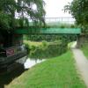
Thornhill Bridge No 214B
is a minor waterways place
on the Leeds and Liverpool Canal (Main Line - Wigan to Leeds) between
Saltaire Road Bridge No 207A (Saltaire) (5 miles and ¼ furlongs
and 5 locks
to the west) and
Armley Mills Bridge No 225 (6 miles and 7 furlongs
and 7 locks
to the east).
The nearest place in the direction of Saltaire Road Bridge No 207A is Harrogate Road Bridge No 214A;
1¼ furlongs
away.
The nearest place in the direction of Armley Mills Bridge No 225 is Swiftcraft Boats;
¼ furlongs
away.
There may be access to the towpath here.
Mooring here is unrated.
There is a bridge here which takes a minor road over the canal.
| Dobson Staircase Locks Nos 14 and 15 | 5¼ furlongs | |
| Milman Swing Bridge No 214 | 4 furlongs | |
| The Moorings Winding Hole | 3¼ furlongs | |
| Apperley Bridge Marina | 2¾ furlongs | |
| Harrogate Road Bridge No 214A | 1¼ furlongs | |
| Thornhill Bridge No 214B | ||
| Swiftcraft Boats | ¼ furlongs | |
| Woodhouse Narrows | 4½ furlongs | |
| Woodhouse Bend | 5 furlongs | |
| Calverley Lodge Swing Bridge No 215 | 1 mile, 2¾ furlongs | |
| Calverley Winding Hole | 1 mile, 5¼ furlongs | |
There are no links to external websites from here.
Why not log in and add some (select "External websites" from the menu (sometimes this is under "Edit"))?
Mouseover for more information or show routes to facility
Nearest water point
In the direction of Leeds Bridge
Oddy Staircase Locks Nos 4 and 5 — 7 miles, 3½ furlongs and 8 locks away
On this waterway in the direction of Leeds Bridge
Leeds Visitor Moorings — 7 miles, 7½ furlongs and 11 locks away
On this waterway in the direction of Leeds Bridge
Leeds Dock Visitor Moorings — 8 miles, 5¾ furlongs and 13 locks away
Travel to Leeds Bridge, then on the Aire and Calder Navigation (Main Line - Castleford to Leeds) to Leeds Dock Entrance, then on the Aire and Calder Navigation (Leeds Dock) to Leeds Dock Visitor Moorings
Leeds Sanitary Station — 8 miles, 7¼ furlongs and 14 locks away
Travel to Leeds Bridge, then on the Aire and Calder Navigation (Main Line - Castleford to Leeds) to Leeds Sanitary Station
Fishpond Lock No 4 — 12 miles, 5 furlongs and 15 locks away
Travel to Leeds Bridge, then on the Aire and Calder Navigation (Main Line - Castleford to Leeds) to Fishpond Lock No 4
Woodlesford Lock No 5 — 13 miles, 4 furlongs and 16 locks away
Travel to Leeds Bridge, then on the Aire and Calder Navigation (Main Line - Castleford to Leeds) to Woodlesford Lock No 5
Lemonroyd Marina — 14 miles, 5¾ furlongs and 17 locks away
Travel to Leeds Bridge, then on the Aire and Calder Navigation (Main Line - Castleford to Leeds) to Lemonroyd Marina
Lemonroyd Lock No 7 — 14 miles, 6¾ furlongs and 17 locks away
Travel to Leeds Bridge, then on the Aire and Calder Navigation (Main Line - Castleford to Leeds) to Lemonroyd Lock No 7
Castleford Sanitary Station — 18 miles, 3¼ furlongs and 19 locks away
Travel to Leeds Bridge, then on the Aire and Calder Navigation (Main Line - Castleford to Leeds) to Castleford Junction, then on the Aire and Calder Navigation (Main Line - Goole to Castleford) to Castleford Sanitary Station
Bulholme Lock No 10 — 19 miles and 19 locks away
Travel to Leeds Bridge, then on the Aire and Calder Navigation (Main Line - Castleford to Leeds) to Castleford Junction, then on the Aire and Calder Navigation (Main Line - Goole to Castleford) to Bulholme Lock No 10
In the direction of Wigan Junction
Apperley Bridge Marina — 2¾ furlongs away
On this waterway in the direction of Wigan Junction
Dobson Locks Services — 5¾ furlongs and 2 locks away
On this waterway in the direction of Wigan Junction
Bingley Services — 7 miles, 7¼ furlongs and 16 locks away
On this waterway in the direction of Wigan Junction
ABC Swing Footbridge — 8 miles, 1½ furlongs and 16 locks away
On this waterway in the direction of Wigan JunctionNearest rubbish disposal
In the direction of Leeds Bridge
Leeds Basin — 8 miles and 12 locks away
On this waterway in the direction of Leeds Bridge
Leeds Sanitary Station — 8 miles, 7¼ furlongs and 14 locks away
Travel to Leeds Bridge, then on the Aire and Calder Navigation (Main Line - Castleford to Leeds) to Leeds Sanitary Station
Woodlesford Lock No 5 — 13 miles, 4 furlongs and 16 locks away
Travel to Leeds Bridge, then on the Aire and Calder Navigation (Main Line - Castleford to Leeds) to Woodlesford Lock No 5
Lemonroyd Marina — 14 miles, 5¾ furlongs and 17 locks away
Travel to Leeds Bridge, then on the Aire and Calder Navigation (Main Line - Castleford to Leeds) to Lemonroyd Marina
Castleford Sanitary Station — 18 miles, 3¼ furlongs and 19 locks away
Travel to Leeds Bridge, then on the Aire and Calder Navigation (Main Line - Castleford to Leeds) to Castleford Junction, then on the Aire and Calder Navigation (Main Line - Goole to Castleford) to Castleford Sanitary Station
In the direction of Wigan Junction
Dobson Locks Services — 5¾ furlongs and 2 locks away
On this waterway in the direction of Wigan Junction
Bingley Services — 7 miles, 7¼ furlongs and 16 locks away
On this waterway in the direction of Wigan JunctionNearest chemical toilet disposal
In the direction of Leeds Bridge
Leeds Sanitary Station — 8 miles, 7¼ furlongs and 14 locks away
Travel to Leeds Bridge, then on the Aire and Calder Navigation (Main Line - Castleford to Leeds) to Leeds Sanitary Station
Lemonroyd Marina — 14 miles, 5¾ furlongs and 17 locks away
Travel to Leeds Bridge, then on the Aire and Calder Navigation (Main Line - Castleford to Leeds) to Lemonroyd Marina
Castleford Sanitary Station — 18 miles, 3¼ furlongs and 19 locks away
Travel to Leeds Bridge, then on the Aire and Calder Navigation (Main Line - Castleford to Leeds) to Castleford Junction, then on the Aire and Calder Navigation (Main Line - Goole to Castleford) to Castleford Sanitary Station
In the direction of Wigan Junction
Dobson Locks Services — 5¾ furlongs and 2 locks away
On this waterway in the direction of Wigan Junction
Bingley Services — 7 miles, 7¼ furlongs and 16 locks away
On this waterway in the direction of Wigan JunctionNearest place to turn
In the direction of Leeds Bridge
Calverley Winding Hole — 1 mile, 5¼ furlongs away
On this waterway in the direction of Leeds Bridge
Aire Valley Marina (eastern entrance) — 6 miles, 4¾ furlongs and 7 locks away
On this waterway in the direction of Leeds Bridge
Leeds Basin — 8 miles and 12 locks away
On this waterway in the direction of Leeds Bridge
River Aire Junction — 8 miles, ¾ furlongs and 13 locks away
On this waterway in the direction of Leeds Bridge
Leeds Dock Side Arm — 8 miles, 5¾ furlongs and 13 locks away
Travel to Leeds Bridge, then on the Aire and Calder Navigation (Main Line - Castleford to Leeds) to Leeds Dock Entrance, then on the Aire and Calder Navigation (Leeds Dock) to Leeds Dock Side Arm
Knostrop Flood Lock Weir Entrance — 9 miles, 4 furlongs and 14 locks away
Travel to Leeds Bridge, then on the Aire and Calder Navigation (Main Line - Castleford to Leeds) to Knostrop Flood Lock Weir Entrance
Junction with River Aire (Old Channel) North — 9 miles, 4¼ furlongs and 14 locks away
Travel to Leeds Bridge, then on the Aire and Calder Navigation (Main Line - Castleford to Leeds) to Junction with River Aire (Old Channel) North
Junction with River Aire (Old Channel) South — 10 miles, 1½ furlongs and 15 locks away
Travel to Leeds Bridge, then on the Aire and Calder Navigation (Main Line - Castleford to Leeds) to Junction with River Aire (Old Channel) South
In the direction of Wigan Junction
The Moorings Winding Hole — 3¼ furlongs away
On this waterway in the direction of Wigan Junction
Field locks Winding Hole — 1 mile, 7¾ furlongs and 5 locks away
On this waterway in the direction of Wigan Junction
Baildon Winding Hole — 3 miles, 3¾ furlongs and 5 locks away
On this waterway in the direction of Wigan Junction
Shipley Junction — 4 miles, ¾ furlongs and 5 locks away
On this waterway in the direction of Wigan Junction
Ashley Mill Basin — 4 miles, 4½ furlongs and 5 locks away
On this waterway in the direction of Wigan Junction
Hirst Mill Winding Hole — 5 miles, 4¾ furlongs and 6 locks away
On this waterway in the direction of Wigan Junction
Primrose Lane Winding Hole — 6 miles, 3½ furlongs and 8 locks away
On this waterway in the direction of Wigan Junction
Park Road Winding Hole — 7 miles, 1½ furlongs and 8 locks away
On this waterway in the direction of Wigan Junction
Bingley Winding Hole — 7 miles, 3¾ furlongs and 8 locks away
On this waterway in the direction of Wigan Junction
Crossflats Winding Hole — 8 miles, 1½ furlongs and 16 locks away
On this waterway in the direction of Wigan Junction
Stockbridge Winding Hole — 10 miles, 5 furlongs and 16 locks away
On this waterway in the direction of Wigan Junction
Booth's Swing Bridge Winding Hole — 11 miles, 7¼ furlongs and 16 locks away
On this waterway in the direction of Wigan JunctionNearest self-operated pump-out
In the direction of Leeds Bridge
Leeds Sanitary Station — 8 miles, 7¼ furlongs and 14 locks away
Travel to Leeds Bridge, then on the Aire and Calder Navigation (Main Line - Castleford to Leeds) to Leeds Sanitary Station
Castleford Sanitary Station — 18 miles, 3¼ furlongs and 19 locks away
Travel to Leeds Bridge, then on the Aire and Calder Navigation (Main Line - Castleford to Leeds) to Castleford Junction, then on the Aire and Calder Navigation (Main Line - Goole to Castleford) to Castleford Sanitary Station
In the direction of Wigan Junction
Dobson Locks Services — 5¾ furlongs and 2 locks away
On this waterway in the direction of Wigan JunctionNearest boatyard pump-out
In the direction of Leeds Bridge
Lemonroyd Marina — 14 miles, 5¾ furlongs and 17 locks away
Travel to Leeds Bridge, then on the Aire and Calder Navigation (Main Line - Castleford to Leeds) to Lemonroyd Marina
In the direction of Wigan Junction
Apperley Bridge Marina — 2¾ furlongs away
On this waterway in the direction of Wigan Junction
Shipley Wharf — 4 miles, 3½ furlongs and 5 locks away
On this waterway in the direction of Wigan Junction
Hainsworth’s Boatyard — 8 miles, 1 furlong and 16 locks away
On this waterway in the direction of Wigan Junction
Silsden Wharf — 14 miles, 1 furlong and 16 locks away
On this waterway in the direction of Wigan Junction
Snaygill Boatyard — 19 miles, 1¾ furlongs and 16 locks away
On this waterway in the direction of Wigan JunctionDirection of TV transmitter (From Wolfbane Cybernetic)
There is no page on Wikipedia called “Thornhill Bridge No 214B”
Wikipedia pages that might relate to Thornhill Bridge No 214B
[Sexual attraction]
1081–1093. doi:10.1037/0022-3514.66.6.1081. PMID 8046578. Gangestad, S. W.; Thornhill, R. (22 May 1998). "Menstrual cycle variation in women's preferences for
[Leeds and Liverpool Canal]
Granary Wharf, Leeds city centre Armley Pool Kirkstall Bramley Apperley Bridge Shipley Saltaire Bingley Keighley Silsden Skipton Gargrave Barnoldswick
[Clear and present danger]
clear and present danger test was invoked by the majority in the 1940 Thornhill v. Alabama decision in which a state antipicketing law was invalidated
[Terrace, British Columbia]
century earlier. The Old Skeena Bridge officially opened July 1925, halting the use of the Ferry Island ferry service to Thornhill Creek. In 1944, the Skeena
[Avontuur Railway]
operations in 1965 to Loerie, later to Thornhill or Van Stadens River, the highest two-foot narrow-gauge railway bridge in the world. The motive power for
[List of The Drew Carey Show episodes]
(Darcy, Celia), but for the later part of the season he is seeing Sharon Bridges (Jenica Bergere). Mimi starts dating Drew's brother Steve, much to Drew's
[COVID-19 pandemic in Canada]
Strategic Innovation Fund. The PM stated that Canadian medical supply firms Thornhill Medical, Medicom and Spartan Bioscience were looking to expand production
[CA postcode area]
BECKERMET Beckermet Copeland CA22 EGREMONT Egremont, Thornhill Copeland CA23 CLEATOR Cleator, Ennerdale Bridge Copeland CA24 MOOR ROW Moor Row Copeland CA25
[List of public housing projects in Canada]
Street Non-Profit Homes Heritage Village Trinity Square St. Luke's Lodge Thornhill Green Thomson Court Apartments Singles Kingston Rideau Heights Brantford
[West Yorkshire]
hiking in villages including Hebden Bridge, Ilkley with its scenic riversides, cherry blossoms and suspension bridge and equally in Wharfedale, Otley. West
Results of Google Search
Thornhill Bridge No 214B Leeds Liverpool Canal | The Leeds ...Thornhill Bridge No 214B Leeds Liverpool Canal. The Leeds & Liverpool Canal is 127 miles long, with 91 locks, and is the single longest canal built by one ...
The towpath is currently closed between Bridge 214B (Thornhill Bridge) and Bridge 215 ... Type: Towpath Closure. Reason: Repair. Is the towpath closed? No ...
Jan 25, 1986 ... File:View from Thornhill Bridge 214B, Leeds and Liverpool Canal - geograph.org. uk - 645466.jpg. Language ... No higher resolution available.
Starts at: Bridge 214B, Thornhill Bridge. Ends at: Bridge ... You may need to wait for contractors to move equipment out of the way but no longer than 30 minutes.

![Canal fishermen. Viewed from Parkin Lane or Thornhill Bridge, [[5050771]] and is on the route known as Calverley Cutting. The view is little changed from thirty years earlier [[645466]] except that the former warehouse to the right (now grade 2 listed, list entry 1213417) is now in domestic use. by Stephen Craven – 16 July 2016](https://s2.geograph.org.uk/geophotos/05/05/08/5050810_6d720eab_120x120.jpg)


![Parkin Lane bridge. Also known as Thornhill Bridge, the road bridge over the Leeds-Liverpool Canal has an 18 tonne limit [[5050771]] and is on the route known as Calverley Cutting. by Stephen Craven – 16 July 2016](https://s2.geograph.org.uk/geophotos/05/05/07/5050782_a35cbf5e_120x120.jpg)

![Canal looking east from Parkin Lane bridge. See [[5050810]] for a similar view taken about five years earlier. For the buildings to the right of the photo, see [[5012104]]. I wonder whether the narrowing of the canal at this point indicates the location of a crossing (maybe swing bridge) before the construction of Calverley Cutting including the bridge from which this photo was taken? by Stephen Craven – 24 March 2021](https://s2.geograph.org.uk/geophotos/06/81/09/6810998_15225710_120x120.jpg)


![Boatyard on the canal by Parkin Lane. The buildings look rather neglected, but [[5012104]] suggests they were still in use, at least five years ago. by Stephen Craven – 24 March 2021](https://s3.geograph.org.uk/geophotos/06/81/11/6811147_23df4a65_120x120.jpg)


![Access arch to Shaw House Farm. Road access to the far is via an arch through the embankment of Parkin Lane. See [[129049]] for a view from 2006, showing that the wooden gates have been introduced since then. by Stephen Craven – 24 March 2021](https://s2.geograph.org.uk/geophotos/06/81/11/6811146_c89695bc_120x120.jpg)