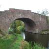
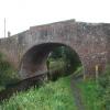
Bonemill Bridge No 61
is a minor waterways place
on the Chesterfield Canal (Retford to the Trent) between
Wiseton Top Bridge No 70 (5 miles and 4¼ furlongs
to the north) and
West Retford Lock No 58 (Wharf Bridge) (2 miles and 2¾ furlongs
and 2 locks
to the west).
The nearest place in the direction of Wiseton Top Bridge No 70 is Gate Inn Visitor Moorings (Pub Closed - 2025);
5½ furlongs
away.
The nearest place in the direction of West Retford Lock No 58 is Whitsunday Pie Bridge No 60;
3¾ furlongs
away.
There may be access to the towpath here.
Mooring here is unrated.
There is a bridge here which takes a minor road over the canal.
Scotter Lane Road Bridge No 65 | 1 mile, 3½ furlongs | |
Main Street Field Bridge No 64 | 1 mile, 2½ furlongs | |
Church Bridge No 63 | 1 mile | |
Clarborough Top Bridge No 62 | 6 furlongs | |
Gate Inn Visitor Moorings | 5½ furlongs | |
Bonemill Bridge No 61 | ||
Whitsunday Pie Bridge No 60 | 3¾ furlongs | |
Whitsunday Pie Lock No 60 | 3¾ furlongs | |
Hop Pole Bridge No 59 | 6 furlongs | |
Leverton Road Bridge No 58 | 1 mile, 1 furlong | |
Grove Mill Bridge Winding Hole | 1 mile, 4¼ furlongs |
There are no links to external websites from here.
Why not log in and add some (select "External websites" from the menu (sometimes this is under "Edit"))?
Mouseover for more information or show routes to facility
Nearest water point
In the direction of West Retford Lock No 58
Hop Pole Bridge No 59 — 6 furlongs and 1 lock away
On this waterway in the direction of West Retford Lock No 58
Forest Middle Top Lock No 55 — 4 miles, 7¾ furlongs and 5 locks away
Travel to West Retford Lock No 58, then on the Chesterfield Canal (Norwood to Retford) to Forest Middle Top Lock No 55
Forest Middle Top Water Point — 5 miles and 6 locks away
Travel to West Retford Lock No 58, then on the Chesterfield Canal (Norwood to Retford) to Forest Middle Top Water Point
Shireoaks Marina — 14 miles, 3½ furlongs and 19 locks away
Travel to West Retford Lock No 58, then on the Chesterfield Canal (Norwood to Retford) to Shireoaks Marina
In the direction of Chesterfield Canal - River Trent Junction
Clayworth CRT Boaters Facilities — 3 miles, 4¾ furlongs away
On this waterway in the direction of Chesterfield Canal - River Trent Junction
West Stockwith Basin — 13 miles, 1¾ furlongs and 4 locks away
On this waterway in the direction of Chesterfield Canal - River Trent JunctionNearest rubbish disposal
In the direction of West Retford Lock No 58
Forest Middle Top Lock No 55 — 4 miles, 7¾ furlongs and 5 locks away
Travel to West Retford Lock No 58, then on the Chesterfield Canal (Norwood to Retford) to Forest Middle Top Lock No 55
Shireoaks Marina — 14 miles, 3½ furlongs and 19 locks away
Travel to West Retford Lock No 58, then on the Chesterfield Canal (Norwood to Retford) to Shireoaks Marina
In the direction of Chesterfield Canal - River Trent Junction
Clayworth CRT Boaters Facilities — 3 miles, 4¾ furlongs away
On this waterway in the direction of Chesterfield Canal - River Trent Junction
West Stockwith Basin — 13 miles, 1¾ furlongs and 4 locks away
On this waterway in the direction of Chesterfield Canal - River Trent JunctionNearest chemical toilet disposal
In the direction of West Retford Lock No 58
Forest Middle Top Lock No 55 — 4 miles, 7¾ furlongs and 5 locks away
Travel to West Retford Lock No 58, then on the Chesterfield Canal (Norwood to Retford) to Forest Middle Top Lock No 55
Cuckoo Wharf Elsan — 12 miles, 1¾ furlongs and 10 locks away
Travel to West Retford Lock No 58, then on the Chesterfield Canal (Norwood to Retford) to Cuckoo Wharf Elsan
Shireoaks Marina — 14 miles, 3½ furlongs and 19 locks away
Travel to West Retford Lock No 58, then on the Chesterfield Canal (Norwood to Retford) to Shireoaks Marina
In the direction of Chesterfield Canal - River Trent Junction
Clayworth CRT Boaters Facilities — 3 miles, 4¾ furlongs away
On this waterway in the direction of Chesterfield Canal - River Trent Junction
West Stockwith Basin — 13 miles, 1¾ furlongs and 4 locks away
On this waterway in the direction of Chesterfield Canal - River Trent JunctionNearest place to turn
In the direction of West Retford Lock No 58
Grove Mill Bridge Winding Hole — 1 mile, 4¼ furlongs and 1 lock away
On this waterway in the direction of West Retford Lock No 58
Retford Winding Hole — 1 mile, 6 furlongs and 1 lock away
On this waterway in the direction of West Retford Lock No 58
Babworth Winding Hole — 3 miles, 2 furlongs and 3 locks away
Travel to West Retford Lock No 58, then on the Chesterfield Canal (Norwood to Retford) to Babworth Winding Hole
Forest Top Lock Winding Hole — 5 miles, 2½ furlongs and 6 locks away
Travel to West Retford Lock No 58, then on the Chesterfield Canal (Norwood to Retford) to Forest Top Lock Winding Hole
Ranby Bridge Winding Hole — 7 miles, 4½ furlongs and 7 locks away
Travel to West Retford Lock No 58, then on the Chesterfield Canal (Norwood to Retford) to Ranby Bridge Winding Hole
High Hoe Road Bridge Winding Hole — 11 miles, 4½ furlongs and 9 locks away
Travel to West Retford Lock No 58, then on the Chesterfield Canal (Norwood to Retford) to High Hoe Road Bridge Winding Hole
Morse Lock Winding Hole — 12 miles, 4½ furlongs and 11 locks away
Travel to West Retford Lock No 58, then on the Chesterfield Canal (Norwood to Retford) to Morse Lock Winding Hole
Junction with former Lady Lee Arm — 13 miles, ¾ furlongs and 12 locks away
Travel to West Retford Lock No 58, then on the Chesterfield Canal (Norwood to Retford) to Junction with former Lady Lee Arm
Shireoaks Marina — 14 miles, 3½ furlongs and 19 locks away
Travel to West Retford Lock No 58, then on the Chesterfield Canal (Norwood to Retford) to Shireoaks Marina
Little Lane Bridge Winding Hole — 15 miles, 3¼ furlongs and 27 locks away
Travel to West Retford Lock No 58, then on the Chesterfield Canal (Norwood to Retford) to Little Lane Bridge Winding Hole
Manor Road Winding Hole — 18 miles and 42 locks away
Travel to West Retford Lock No 58, then on the Chesterfield Canal (Norwood to Retford) to Manor Road Winding Hole
Kiveton Waters Marina — 18 miles, 6½ furlongs and 45 locks away
Travel to West Retford Lock No 58, then on the Chesterfield Canal (Norwood to Retford) to Norwood Tunnel (eastern entrance), then on the Chesterfield Canal (Unnavigable section) to Kiveton Waters Marina
In the direction of Chesterfield Canal - River Trent Junction
Main Street Winding Hole — 1 mile, 7½ furlongs away
On this waterway in the direction of Chesterfield Canal - River Trent Junction
Clayworth Top Bridge Winding Hole — 3 miles, 5½ furlongs away
On this waterway in the direction of Chesterfield Canal - River Trent Junction
Otter's Bridge Winding Hole — 4 miles, 2¼ furlongs away
On this waterway in the direction of Chesterfield Canal - River Trent Junction
Drakeholes Visitor Moorings — 6 miles, 5½ furlongs away
On this waterway in the direction of Chesterfield Canal - River Trent Junction
Drakeholes Tunnel (southern entrance) — 6 miles, 5¾ furlongs away
On this waterway in the direction of Chesterfield Canal - River Trent Junction
Manor Farm Winding Hole — 10 miles, 5½ furlongs and 2 locks away
On this waterway in the direction of Chesterfield Canal - River Trent Junction
West Stockwith Basin — 13 miles, 1¾ furlongs and 4 locks away
On this waterway in the direction of Chesterfield Canal - River Trent JunctionNo information
CanalPlan has no information on any of the following facilities within range:self-operated pump-out
boatyard pump-out
Direction of TV transmitter (From Wolfbane Cybernetic)
There is no page on Wikipedia called “Bonemill Bridge”
Wikipedia pages that might relate to Bonemill Bridge
[River Nar]
1 m). Nine consisted of a single guillotine gate, while that at Upper Bonemill was fitted with mitre gates. The sluices were a little over 11 feet (3
[List of Sites of Special Scientific Interest in Cambridgeshire]
on 4 March 2016. Retrieved 17 December 2016. "Designated Sites View: Bonemills Hollow". Sites of Special Scientific Interest. Natural England. Archived
Results of Google Search
The following information outlines the roadworks and road closures around the county for the week starting 27 July 2019.
The following information outlines the roadworks and road closures around the county for the week starting 20 July 2019.
Nov 16, 2018 ... View 33 photos for 97 Bone Mill Rd, East Haddam, CT 06423 a 2 bed, 2 bath, 1500 Sq. Ft. single family ... Estimated values are not a substitute for professional expertise. ..... 61 Hemlock Valley Rd, East Haddam, CT 06423.
The Mauthausen–Gusen concentration camp complex consisted of the Mauthausen ... Starting with the camp at Mauthausen, the number of subcamps expanded over time and by the ... RSHA) it was referred to by the nickname Knochenmühle – the bone-grinder (literally bone-mill). ...... 61. rocznica wyzwolenia Auschwitz.
Home · Services For Residents · Town Departments and Offices · Building & Housing Inspection; Off Street Parking Plans ...
Pickering Beck is a river that runs for over 18 miles (29 km) from its source in the North York .... The beck flows under Bridge Street (a Grade II listed bridge), The Ropery and ... All mills, apart from the Bone Mill, were for corn milling. ... cared for by the Pickering Fisheries Association, there is no supplementary stocking of fish.