CanalPlanAC

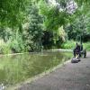
Preston Terminus

 
Southern end of canal
Also known as: Preston
SK Coachwork, Aqueduct Street, Preston PR2 2NJ, United Kingdom
 
Information about the place
Preston Terminus is a place on the waterways at the end of the Lancaster Canal (Main Line); past Ribble Link - Lancaster Canal Junction (1 mile and 4 furlongs to the west).
 
 
The nearest place in the direction of Ribble Link - Lancaster Canal Junction is Ashton Basin; ¾ furlongs away.

Mooring here is tolerable (it's just about possible if really necessary), mooring rings or bollards are available. Mooring is limited to 1.65 hours. unsafe.

Preston Terminus
Ashton Basin¾ furlongs
Roebuck Bridge No 112¾ furlongs
Blackpool Road Bridge No 11A3½ furlongs
Woodplumpton Road Bridge No 124¾ furlongs
Cadley Services5¼ furlongs
 
 
Amenities

Amenities here

 Aldi
 Farmfoods
 Lidl
 Caffe Nero
 Starbucks
 Adelphi
 Dog & Partridge
 Grey Friar
 Grey Friar
 Guild
 Hartleys Wine Bar
 Old Black Bull
 Princess Alice
 SEE ADDRESS
 Sun Hotel
 Poundland
 Primark
 Fish & Chips
 Fish & Chips
 Subway Sandwich Shop
 Barclays
 Barclays
 Cashpoint
 Cashpoint
 Cashpoint
 Cashpoint
 Cashpoint
 Cashpoint
 Cashpoint
 Cashpoint
 Cashpoint
 Cashpoint
 Cashpoint
 HSBC
 HSBC
 Lloyds Bank
 Nationwide
 TSB
 Lancashire Plant & Tool Hire Ltd
 Shell
 Texaco
 Texaco
 Trebaron Garden Centre Limited
 B&Q
 B&Q
 Jewson
 Travis Perkins
 Wickes

Amenities nearby at Ashton Basin

 Fish & Chips
 KFC
 
Maps
If you are a user and are logged on, or if you are actively planning a route, a map will be displayed here.
Show on external mapping site: Google | OSM | Bing
 
Photos
 
External websites
There are no links to external websites from here.
Why not log in and add some (select "External websites" from the menu (sometimes this is under "Edit"))?
 
Nearest facilities

Mouseover for more information or show routes to facility

Nearest water point

In the direction of Tewitfield

Woodplumpton Road Bridge No 124¾ furlongs away
On this waterway in the direction of Tewitfield
Blackleach Lane Marina6 miles, 6¾ furlongs away
On this waterway in the direction of Tewitfield
Swill Brook Basin7 miles, 2 furlongs away
On this waterway in the direction of Tewitfield
Bilsborrow Winding Hole11 miles, 6½ furlongs away
On this waterway in the direction of Tewitfield
Moss Lane Bridge No 6316 miles, 7¼ furlongs away
On this waterway in the direction of Tewitfield
Spark Bridge Sanitary Station15 miles, 1¼ furlongs and 10 locks away
Travel to Ribble Link - Lancaster Canal Junction, then on the River Ribble (Ribble Link) to Ribble - Savick Brook Junction, then on the River Ribble (Main River) to Astland Lamp, then on the River Douglas to Tarleton Junction, then on the Leeds and Liverpool Canal (Rufford Branch) to Spark Bridge Sanitary Station
St Mary's Marina16 miles, 1¼ furlongs and 10 locks away
Travel to Ribble Link - Lancaster Canal Junction, then on the River Ribble (Ribble Link) to Ribble - Savick Brook Junction, then on the River Ribble (Main River) to Astland Lamp, then on the River Douglas to Tarleton Junction, then on the Leeds and Liverpool Canal (Rufford Branch) to St Mary's Marina
Burscough Bridge Wharf19 miles, 7 furlongs and 17 locks away
Travel to Ribble Link - Lancaster Canal Junction, then on the River Ribble (Ribble Link) to Ribble - Savick Brook Junction, then on the River Ribble (Main River) to Astland Lamp, then on the River Douglas to Tarleton Junction, then on the Leeds and Liverpool Canal (Rufford Branch) to Lathom Junction, then on the Leeds and Liverpool Canal (Main Line - Liverpool to Wigan) to Burscough Bridge Wharf

Nearest rubbish disposal

In the direction of Tewitfield

Woodplumpton Road Bridge No 124¾ furlongs away
On this waterway in the direction of Tewitfield
Bilsborrow Winding Hole11 miles, 6½ furlongs away
On this waterway in the direction of Tewitfield
Spark Bridge Sanitary Station15 miles, 1¼ furlongs and 10 locks away
Travel to Ribble Link - Lancaster Canal Junction, then on the River Ribble (Ribble Link) to Ribble - Savick Brook Junction, then on the River Ribble (Main River) to Astland Lamp, then on the River Douglas to Tarleton Junction, then on the Leeds and Liverpool Canal (Rufford Branch) to Spark Bridge Sanitary Station

Nearest place to turn

In the direction of Tewitfield

Ashton Basin¾ furlongs away
On this waterway in the direction of Tewitfield
Bexhill Road Winding Hole1 mile, ¾ furlongs away
On this waterway in the direction of Tewitfield
Ribble Link - Lancaster Canal Junction1 mile, 4 furlongs away
On this waterway in the direction of Tewitfield
Tom Benson Way Bridge Winding Hole1 mile, 5½ furlongs away
On this waterway in the direction of Tewitfield
Ward's House Winding Hole No 13 miles, 6 furlongs away
On this waterway in the direction of Tewitfield
Ward's House Winding Hole No 24 miles, ¼ furlongs away
On this waterway in the direction of Tewitfield
Salwick Hall Winding Hole4 miles, 2¼ furlongs away
On this waterway in the direction of Tewitfield
Ribble Link Staircase Winding Hole1 mile, 5 furlongs and 3 locks away
Travel to Ribble Link - Lancaster Canal Junction, then on the River Ribble (Ribble Link) to Ribble Link Staircase Winding Hole
Ribble Link Lock No 5 Winding Hole2 miles, 1¼ furlongs and 4 locks away
Travel to Ribble Link - Lancaster Canal Junction, then on the River Ribble (Ribble Link) to Ribble Link Lock No 5 Winding Hole
Swill Brook Basin7 miles, 2 furlongs away
On this waterway in the direction of Tewitfield
Moons Bridge Marina8 miles, 6¼ furlongs away
On this waterway in the direction of Tewitfield
Hollowforth Winding Hole8 miles, 7 furlongs away
On this waterway in the direction of Tewitfield
Park Head Winding Hole9 miles, 5¼ furlongs away
On this waterway in the direction of Tewitfield
Winding Hole above Lock No 83 miles, 2½ furlongs and 7 locks away
Travel to Ribble Link - Lancaster Canal Junction, then on the River Ribble (Ribble Link) to Winding Hole above Lock No 8
White Horse Winding Hole10 miles, 5½ furlongs away
On this waterway in the direction of Tewitfield
Bilsborrow Winding Hole11 miles, 6½ furlongs away
On this waterway in the direction of Tewitfield
Catterall Bridge Winding Hole14 miles, 4¾ furlongs away
On this waterway in the direction of Tewitfield
Greenhalgh Castle Bridge Winding Hole15 miles, 5¼ furlongs away
On this waterway in the direction of Tewitfield
Dimples Bridge Winding Hole15 miles, 7¼ furlongs away
On this waterway in the direction of Tewitfield
The Moorings Basin16 miles, 5¼ furlongs away
On this waterway in the direction of Tewitfield
Direction of TV transmitter (From Wolfbane Cybernetic)
 
 
Geograph
 
Wikipedia

There is no page on Wikipedia called “Preston Terminus”

Wikipedia pages that might relate to Preston Terminus
[Preston, Lancashire] Preston /ˈprɛstən/ (listen) is a city on the north bank of the River Ribble. The city is the administrative centre of Lancashire, England, The City of [Melbourne tram route 11] the West Preston terminus was extended to the north side of the intersection to clear the intersection. Initially, the line to West Preston was single [Lancaster and Preston Junction Railway] completed the station comprised a handsome building. The company made its Preston terminus at Dock Street near the Lancaster Canal, but the site had no other [Bus station] who use wheelchairs. At 37 acres (150,000 m2), the Chennai Mofussil Bus Terminus in Chennai, India, is the largest bus station in Asia. The Woodlands Temporary [Root River State Trail] (0 km) - Fountain, Minnesota (western terminus of trail segment) 6.5 miles (10.5 km) - junction with Harmony-Preston Valley segment 11.2 miles (18.0 km) [Maudlands railway station] (also known as Maudland railway station, or Preston Maudland(s)) was the original Preston terminus of the Preston and Wyre Joint Railway to Fleetwood, in [Deepdale Street railway station] Deepdale Street railway station was the original Preston terminus of the Preston and Longridge Railway in Lancashire, England, when it first opened in [Clayton Brook] stretch of the Lancaster Canal. The canal summit was once linked to the Preston terminus of the said canal via the Lancaster Canal Tramroad. The demise of this [Maudland Bridge railway station] Maudland Bridge railway station was once the Preston terminus of the Longridge Branch Line, in Lancashire, England. It was located on Maudland Road, between [Preston bus station] English Heritage. Preston Borough Council (as it was then known) opposed the application. Putting forward the case for a smaller terminus, a report, commissioned
 
Google