Lansdowne Road Bridge No 11
is a minor waterways place
on the Worcester and Birmingham Canal (Diglis Basin to King's Norton Junction) between
Diglis Basin (Tow-path goes around the first basin) (1 mile and 3 furlongs
and 2 locks
to the south) and
Hanbury Junction (Junction with Droitwich Junction Canal (Restored - Opened 1/July/2011). Hanbury Wharf) (7 miles and 5½ furlongs
and 12 locks
to the northeast).
The nearest place in the direction of Diglis Basin is Lowesmoor Railway Bridge No 10;
2½ furlongs
away.
The nearest place in the direction of Hanbury Junction is Tavern Hill Bridge No 12;
2 furlongs
away.
There may be access to the towpath here.
Mooring here is unrated.
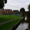
There is a bridge here which takes a minor road over the canal.
| Cromwell Street Footbridge Bridge No 6 | 4½ furlongs | |
| Lowesmoor Bridge No 8 | 3½ furlongs | |
| Rainbow Hill Bridge No 9 | 3 furlongs | |
| Lowesmoor Basin | 2¾ furlongs | |
| Lowesmoor Railway Bridge No 10 | 2½ furlongs | |
| Lansdowne Road Bridge No 11 | ||
| Tavern Hill Bridge No 12 | 2 furlongs | |
| Lowesmoor Visitor Moorings | 2½ furlongs | |
| Gregory's Mill Bridge No 13 | 3¼ furlongs | |
| Gregory's Mill Bottom Lock No 5 | 3½ furlongs | |
| Gregory's Mill Top Lock No 6 | 4¼ furlongs | |
Amenities here
Amenities nearby at Tavern Hill Bridge No 12
Amenities nearby at Lowesmoor Railway Bridge No 10
Amenities in Worcester
Amenities at other places in Worcester
There are no links to external websites from here.
Why not log in and add some (select "External websites" from the menu (sometimes this is under "Edit"))?
Mouseover for more information or show routes to facility
Nearest water point
In the direction of King's Norton Junction
Hanbury Boatyard — 7 miles, 4½ furlongs and 12 locks away
On this waterway in the direction of King's Norton Junction
Droitwich Spa Marina — 8 miles, ¾ furlongs and 15 locks away
Travel to Hanbury Junction, then on the Droitwich Canals (Droitwich Junction Canal) to Droitwich Spa Marina
Stoke Works Water Point — 10 miles, 1¾ furlongs and 18 locks away
On this waterway in the direction of King's Norton Junction
Tardebigge Wharf — 14 miles, 2 furlongs and 54 locks away
On this waterway in the direction of King's Norton Junction
Hopwood Visitor Moorings — 19 miles, 5¾ furlongs and 54 locks away
On this waterway in the direction of King's Norton Junction
In the direction of Diglis Basin
Lowesmoor Basin — 2¾ furlongs away
On this waterway in the direction of Diglis Basin
Diglis Services — 1 mile, 2½ furlongs and 2 locks away
On this waterway in the direction of Diglis Basin
Diglis Locks — 1 mile, 6¾ furlongs and 4 locks away
Travel to Diglis Basin, then on the Worcester and Birmingham Canal (Diglis Junction to Diglis Basin) to Diglis Junction, then on the River Severn (main river - Worcester to Gloucester) to Diglis Locks
Worcester Trip Boat Moorings — 2 miles, 2¼ furlongs and 4 locks away
Travel to Diglis Basin, then on the Worcester and Birmingham Canal (Diglis Junction to Diglis Basin) to Diglis Junction, then on the River Severn (main river - Stourport to Worcester) to Worcester Trip Boat Moorings
Holt Lock (Holt Fleet) — 8 miles, 7 furlongs and 5 locks away
Travel to Diglis Basin, then on the Worcester and Birmingham Canal (Diglis Junction to Diglis Basin) to Diglis Junction, then on the River Severn (main river - Stourport to Worcester) to Holt Lock (Holt Fleet)
Lincomb Lock — 13 miles, ¾ furlongs and 6 locks away
Travel to Diglis Basin, then on the Worcester and Birmingham Canal (Diglis Junction to Diglis Basin) to Diglis Junction, then on the River Severn (main river - Stourport to Worcester) to Lincomb Lock
Upper Basin Waterpoint — 14 miles, 4¼ furlongs and 9 locks away
Travel to Diglis Basin, then on the Worcester and Birmingham Canal (Diglis Junction to Diglis Basin) to Diglis Junction, then on the River Severn (main river - Stourport to Worcester) to Severn - Stourport Broad Locks Entrance, then on the Staffordshire and Worcestershire Canal (Stourport Basins: Broad Route) to Stourport Upper Basin, then on the Staffordshire and Worcestershire Canal (Stourport Basins: Narrow Route) to Upper Basin Waterpoint
Upper Lode Lock No 5 — 18 miles, ¼ furlongs and 5 locks away
Travel to Diglis Basin, then on the Worcester and Birmingham Canal (Diglis Junction to Diglis Basin) to Diglis Junction, then on the River Severn (main river - Worcester to Gloucester) to Upper Lode Lock No 5
Tewkesbury Services — 17 miles, 6 furlongs and 6 locks away
Travel to Diglis Basin, then on the Worcester and Birmingham Canal (Diglis Junction to Diglis Basin) to Diglis Junction, then on the River Severn (main river - Worcester to Gloucester) to Tewkesbury Junction, then on the River Avon - Warwickshire (Lower Avon Navigation) to Tewkesbury Services
Netherwich Basin — 11 miles, 3 furlongs and 13 locks away
Travel to Diglis Basin, then on the Worcester and Birmingham Canal (Diglis Junction to Diglis Basin) to Diglis Junction, then on the River Severn (main river - Stourport to Worcester) to Hawford Junction, then on the Droitwich Canals (Droitwich Barge Canal) to Netherwich Basin
Tewkesbury Lower Lode — 18 miles, 6½ furlongs and 6 locks away
Travel to Diglis Basin, then on the Worcester and Birmingham Canal (Diglis Junction to Diglis Basin) to Diglis Junction, then on the River Severn (main river - Worcester to Gloucester) to Tewkesbury Lower Lode
Caldwall Mill Bridge No 14 — 18 miles, 2½ furlongs and 12 locks away
Travel to Diglis Basin, then on the Worcester and Birmingham Canal (Diglis Junction to Diglis Basin) to Diglis Junction, then on the River Severn (main river - Stourport to Worcester) to Severn - Stourport Broad Locks Entrance, then on the Staffordshire and Worcestershire Canal (Stourport Basins: Broad Route) to Stourport Upper Basin, then on the Staffordshire and Worcestershire Canal (Stourport Basins: Narrow Route) to York Street Bridge, then on the Staffordshire and Worcestershire Canal (Main Line: Stourport to Stourton) to Caldwall Mill Bridge No 14Nearest rubbish disposal
In the direction of King's Norton Junction
Droitwich Spa Marina — 8 miles, ¾ furlongs and 15 locks away
Travel to Hanbury Junction, then on the Droitwich Canals (Droitwich Junction Canal) to Droitwich Spa Marina
Stoke Bottom Lock No 23 — 10 miles, 7½ furlongs and 18 locks away
On this waterway in the direction of King's Norton Junction
Tardebigge Wharf — 14 miles, 2 furlongs and 54 locks away
On this waterway in the direction of King's Norton Junction
In the direction of Diglis Basin
Lowesmoor Basin — 2¾ furlongs away
On this waterway in the direction of Diglis Basin
Diglis Basin — 1 mile, 3 furlongs and 2 locks away
On this waterway in the direction of Diglis Basin
Sabrina Footbridge — 2 miles, 4 furlongs and 4 locks away
Travel to Diglis Basin, then on the Worcester and Birmingham Canal (Diglis Junction to Diglis Basin) to Diglis Junction, then on the River Severn (main river - Stourport to Worcester) to Sabrina Footbridge
Upper Basin Waterpoint — 14 miles, 4¼ furlongs and 9 locks away
Travel to Diglis Basin, then on the Worcester and Birmingham Canal (Diglis Junction to Diglis Basin) to Diglis Junction, then on the River Severn (main river - Stourport to Worcester) to Severn - Stourport Broad Locks Entrance, then on the Staffordshire and Worcestershire Canal (Stourport Basins: Broad Route) to Stourport Upper Basin, then on the Staffordshire and Worcestershire Canal (Stourport Basins: Narrow Route) to Upper Basin Waterpoint
Tewkesbury Services — 17 miles, 6 furlongs and 6 locks away
Travel to Diglis Basin, then on the Worcester and Birmingham Canal (Diglis Junction to Diglis Basin) to Diglis Junction, then on the River Severn (main river - Worcester to Gloucester) to Tewkesbury Junction, then on the River Avon - Warwickshire (Lower Avon Navigation) to Tewkesbury Services
Netherwich Basin — 11 miles, 3 furlongs and 13 locks away
Travel to Diglis Basin, then on the Worcester and Birmingham Canal (Diglis Junction to Diglis Basin) to Diglis Junction, then on the River Severn (main river - Stourport to Worcester) to Hawford Junction, then on the Droitwich Canals (Droitwich Barge Canal) to Netherwich BasinNearest chemical toilet disposal
In the direction of King's Norton Junction
Droitwich Spa Marina — 8 miles, ¾ furlongs and 15 locks away
Travel to Hanbury Junction, then on the Droitwich Canals (Droitwich Junction Canal) to Droitwich Spa Marina
Stoke Bottom Lock No 23 — 10 miles, 7½ furlongs and 18 locks away
On this waterway in the direction of King's Norton Junction
Tardebigge Wharf — 14 miles, 2 furlongs and 54 locks away
On this waterway in the direction of King's Norton Junction
In the direction of Diglis Basin
Lowesmoor Basin — 2¾ furlongs away
On this waterway in the direction of Diglis Basin
Diglis Services — 1 mile, 2½ furlongs and 2 locks away
On this waterway in the direction of Diglis Basin
Stourport Marina — 13 miles, 4¼ furlongs and 7 locks away
Travel to Diglis Basin, then on the Worcester and Birmingham Canal (Diglis Junction to Diglis Basin) to Diglis Junction, then on the River Severn (main river - Stourport to Worcester) to Stourport Marina
Upper Basin Waterpoint — 14 miles, 4¼ furlongs and 9 locks away
Travel to Diglis Basin, then on the Worcester and Birmingham Canal (Diglis Junction to Diglis Basin) to Diglis Junction, then on the River Severn (main river - Stourport to Worcester) to Severn - Stourport Broad Locks Entrance, then on the Staffordshire and Worcestershire Canal (Stourport Basins: Broad Route) to Stourport Upper Basin, then on the Staffordshire and Worcestershire Canal (Stourport Basins: Narrow Route) to Upper Basin Waterpoint
Caldwall Mill Bridge No 14 — 18 miles, 2½ furlongs and 12 locks away
Travel to Diglis Basin, then on the Worcester and Birmingham Canal (Diglis Junction to Diglis Basin) to Diglis Junction, then on the River Severn (main river - Stourport to Worcester) to Severn - Stourport Broad Locks Entrance, then on the Staffordshire and Worcestershire Canal (Stourport Basins: Broad Route) to Stourport Upper Basin, then on the Staffordshire and Worcestershire Canal (Stourport Basins: Narrow Route) to York Street Bridge, then on the Staffordshire and Worcestershire Canal (Main Line: Stourport to Stourton) to Caldwall Mill Bridge No 14Nearest place to turn
In the direction of King's Norton Junction
Bilford Locks Winding Hole — 7 furlongs and 3 locks away
On this waterway in the direction of King's Norton Junction
Tibberton Winding Hole — 4 miles, 4½ furlongs and 12 locks away
On this waterway in the direction of King's Norton Junction
Dunhampstead Winding Hole — 5 miles, 4 furlongs and 12 locks away
On this waterway in the direction of King's Norton Junction
Dunhampstead Boatyard — 5 miles, 6¼ furlongs and 12 locks away
On this waterway in the direction of King's Norton Junction
Hanbury Boatyard — 7 miles, 4½ furlongs and 12 locks away
On this waterway in the direction of King's Norton Junction
Hanbury Junction — 7 miles, 5½ furlongs and 12 locks away
On this waterway in the direction of King's Norton Junction
Hanbury Junction Winding Hole — 7 miles, 6¾ furlongs and 12 locks away
On this waterway in the direction of King's Norton Junction
Droitwich Spa Marina — 8 miles, ¾ furlongs and 15 locks away
Travel to Hanbury Junction, then on the Droitwich Canals (Droitwich Junction Canal) to Droitwich Spa Marina
In the direction of Diglis Basin
Lowesmoor Basin — 2¾ furlongs away
On this waterway in the direction of Diglis Basin
Diglis Junction — 1 mile, 4¼ furlongs and 4 locks away
Travel to Diglis Basin, then on the Worcester and Birmingham Canal (Diglis Junction to Diglis Basin) to Diglis Junction
Diglis Locks Weir Exit — 1 mile, 7¼ furlongs and 5 locks away
Travel to Diglis Basin, then on the Worcester and Birmingham Canal (Diglis Junction to Diglis Basin) to Diglis Junction, then on the River Severn (main river - Worcester to Gloucester) to Diglis Locks Weir Exit
Severn - Teme Junction — 2 miles, 5¼ furlongs and 5 locks away
Travel to Diglis Basin, then on the Worcester and Birmingham Canal (Diglis Junction to Diglis Basin) to Diglis Junction, then on the River Severn (main river - Worcester to Gloucester) to Severn - Teme Junction
Bevere Lock Weir Exit — 5 miles, 2¾ furlongs and 4 locks away
Travel to Diglis Basin, then on the Worcester and Birmingham Canal (Diglis Junction to Diglis Basin) to Diglis Junction, then on the River Severn (main river - Stourport to Worcester) to Bevere Lock Weir Exit
Bevere Lock Weir Entrance — 5 miles, 5¼ furlongs and 5 locks away
Travel to Diglis Basin, then on the Worcester and Birmingham Canal (Diglis Junction to Diglis Basin) to Diglis Junction, then on the River Severn (main river - Stourport to Worcester) to Bevere Lock Weir Entrance
Holt Lock Weir Exit — 8 miles, 6 furlongs and 5 locks away
Travel to Diglis Basin, then on the Worcester and Birmingham Canal (Diglis Junction to Diglis Basin) to Diglis Junction, then on the River Severn (main river - Stourport to Worcester) to Holt Lock Weir Exit
Holt Lock Weir Entrance — 9 miles, 1¼ furlongs and 6 locks away
Travel to Diglis Basin, then on the Worcester and Birmingham Canal (Diglis Junction to Diglis Basin) to Diglis Junction, then on the River Severn (main river - Stourport to Worcester) to Holt Lock Weir Entrance
Ladywood Top Lock Winding Hole — 8 miles, 5 furlongs and 13 locks away
Travel to Diglis Basin, then on the Worcester and Birmingham Canal (Diglis Junction to Diglis Basin) to Diglis Junction, then on the River Severn (main river - Stourport to Worcester) to Hawford Junction, then on the Droitwich Canals (Droitwich Barge Canal) to Ladywood Top Lock Winding Hole
Severn - Stourport Narrow Locks Entrance — 14 miles, 3¼ furlongs and 7 locks away
Travel to Diglis Basin, then on the Worcester and Birmingham Canal (Diglis Junction to Diglis Basin) to Diglis Junction, then on the River Severn (main river - Stourport to Worcester) to Severn - Stourport Narrow Locks Entrance
Stourport Lower Basin - between Broad Locks — 14 miles, 3¼ furlongs and 8 locks away
Travel to Diglis Basin, then on the Worcester and Birmingham Canal (Diglis Junction to Diglis Basin) to Diglis Junction, then on the River Severn (main river - Stourport to Worcester) to Severn - Stourport Broad Locks Entrance, then on the Staffordshire and Worcestershire Canal (Stourport Basins: Broad Route) to Stourport Lower Basin - between Broad Locks
Stourport Lower Basin - between Narrow Locks — 14 miles, 3¾ furlongs and 8 locks away
Travel to Diglis Basin, then on the Worcester and Birmingham Canal (Diglis Junction to Diglis Basin) to Diglis Junction, then on the River Severn (main river - Stourport to Worcester) to Severn - Stourport Broad Locks Entrance, then on the Staffordshire and Worcestershire Canal (Stourport Basins: Broad Route) to Stourport Lower Basin - between Broad Locks, then on the Staffordshire and Worcestershire Canal (Stourport Basins: Broad Locks to Narrow Locks to Stourport Lower Basin - between Narrow LocksNearest self-operated pump-out
In the direction of King's Norton Junction
Droitwich Spa Marina — 8 miles, ¾ furlongs and 15 locks away
Travel to Hanbury Junction, then on the Droitwich Canals (Droitwich Junction Canal) to Droitwich Spa Marina
In the direction of Diglis Basin
Diglis Services — 1 mile, 2½ furlongs and 2 locks away
On this waterway in the direction of Diglis BasinNearest boatyard pump-out
In the direction of King's Norton Junction
Dunhampstead Boatyard — 5 miles, 6¼ furlongs and 12 locks away
On this waterway in the direction of King's Norton Junction
Hanbury Boatyard — 7 miles, 4½ furlongs and 12 locks away
On this waterway in the direction of King's Norton Junction
In the direction of Diglis Basin
Lowesmoor Basin — 2¾ furlongs away
On this waterway in the direction of Diglis Basin
Stourport Marina — 13 miles, 4¼ furlongs and 7 locks away
Travel to Diglis Basin, then on the Worcester and Birmingham Canal (Diglis Junction to Diglis Basin) to Diglis Junction, then on the River Severn (main river - Stourport to Worcester) to Stourport Marina
Stourport Upper Basin — 14 miles, 4 furlongs and 9 locks away
Travel to Diglis Basin, then on the Worcester and Birmingham Canal (Diglis Junction to Diglis Basin) to Diglis Junction, then on the River Severn (main river - Stourport to Worcester) to Severn - Stourport Broad Locks Entrance, then on the Staffordshire and Worcestershire Canal (Stourport Basins: Broad Route) to Stourport Upper Basin
Upper Staircase Lock Landing Pontoon — 14 miles, 4¾ furlongs and 9 locks away
Travel to Diglis Basin, then on the Worcester and Birmingham Canal (Diglis Junction to Diglis Basin) to Diglis Junction, then on the River Severn (main river - Stourport to Worcester) to Severn - Stourport Broad Locks Entrance, then on the Staffordshire and Worcestershire Canal (Stourport Basins: Broad Route) to Stourport Upper Basin, then on the Staffordshire and Worcestershire Canal (Stourport Basins: Narrow Route) to Upper Staircase Lock Landing PontoonDirection of TV transmitter (From Wolfbane Cybernetic)
There is no page on Wikipedia called “Lansdowne Road Bridge”
Wikipedia pages that might relate to Lansdowne Road Bridge
[Lansdowne Road]
Lansdowne Road Stadium (Irish: Bóthar Lansdúin, IPA: [ˈbˠoːhəɾˠ ˈl̪ˠan̪ˠsˠd̪ˠuːn̪ˠ]) was a stadium in Dublin owned by the Irish Rugby Football Union (IRFU)
[The Stone Bridge]
of the Marquess of Landsdowne in 1850, this was however impossible. List of paintings by Rembrandt Entry 207 for A High Stone Bridge in Hofstede de Groot
[List of Dublin bridges and tunnels]
the road bridge in Celbridge Rock Bridge [footbridge at Celbridge Abbey] Straffan Bridge A truss bridge just west of Straffan Bridge The Bridge at 16
[Lansdowne Road railway station]
railway stations in Ireland "Landsdowne Road station" (PDF). Railscot - Irish Railways. Retrieved 2007-09-03. Irish Rail Lansdowne Road Station Website
[2016 in aviation]
Tomahawk at Markham Airport in Markham, Ontario, Canada, and crashes it near Landsdowne Place mall in Peterborough, Ontario. The incident sparks concerns about
[Ballsbridge]
Herbert Park. Until 1965 there was a well-known botanical garden on Landsdowne Road near Ballsbridge. The garden belonged to Trinity College, which had
[Lansdowne, New South Wales]
in the past appeared on maps with a spelling of 'Landsdowne'. Lansdowne Bridge is a sandstone bridge built by David Lennox that (from 1957) carries northbound-only
[Hampden Bridge, Kangaroo Valley]
Hampden Bridge is a heritage-listed single-span suspension bridge that carries Moss Vale Road (B73) across the Kangaroo River, in Kangaroo Valley, in
[List of streets and squares in Dublin]
(1836-40) Archived 14 July 2014 at the Wayback Machine Roads Act 1993 (Classification of Regional Roads) Order 2006 Archived 27 September 2007 at the Wayback
[Leeds and the Thousand Islands]
Formerly, this township was divided into three separate townships: Leeds, Landsdowne and Escott townships; these townships amalgamated to form the current
Results of Google Search
NR: 11/16/1987 (NR Reference #: 87002012) ... Milford Road Bridge over Lehigh Valley Railroad (SI&A #1050160) ..... Lansdown (ID#1588) ..... District No.
This article lists the bridges and tunnels in Dublin and the Greater Dublin Area in Ireland. .... Sewage treatment works bridge; Leixlip Bridge [Leixlip Road]; M4 motorway .... Herbert's Bridge, Landsdowne Bridge, Herbert's Road, Landsdowne Road ... There are a number of bridges, but it is not clear which channels are the  ...
Jan 3, 2018 ... Railway bridges on the Irish Rail network and their ratings. 1. Grant. Signed ... Tolerable faults, no restriction in use necessary. 1.0 ... 61A5 5th Subway at Landsdowne Rd. IRFU. 1.0 ... UBR62. 62 Lansdowne Road Station Subway ... Lord Cloncurry's Footbridge -. Protected. 1.0. OBC11. Cloverhill Rd. 1.0.
No 11 Pimlico Road is an all day bar and restaurant within minutes walk of Sloane Square and Victoria Stations. Menus are freshly prepared in house, starting ...
... ROUTE 18. 132.14, 750 STATE ROUTE 18, 957 OLD BRIDGE TPKE ... PEARL RD. 133.06, 11 THOMAS RD, 9 THOMAS RD ... 133.18, 11 CHURCHILL RD, 9 CHURCHILL RD. 133.20, 10 ..... 745, 30 LANDSDOWNE RD, 78 CANTERBURY RD .... NJParcels.com make no guarantees on the validity of the data presented.
Apr 2, 2019 ... Highway Safety - We plan to address the "worst-of-the worst" roads in terms of ... Structurally Deficient Bridges - Approximately half of SCDOT's 750 structurally ... Interstate Widening - SCDOT plans to begin 11 or 12 interstate widening projects. ..... US 301, Clarendon, US 301 over Pudding Swamp (No.
Map of National Highway 11 showing all the important NH 11 route locations in this map, also know easy driving directions from Agra to Bikaner by road with accurate directions and route map. ... National Highway No. 11 Route: Agra to ...
Jun 10, 2019 ... Landsdowne Park June 17-August 9, 2019, 12:00-12:30 pm ... Posted on: June 11, 2019 ... New Franklin Road Bridge to Open in March.

![Lansdowne Road canal bridge, Worcester. Viewed from the towpath of the Worcester & Birmingham Canal, which the bridge crosses. Part of a mural can be seen on the left.[[2837499]]. by P L Chadwick – 20 February 2012](https://s0.geograph.org.uk/geophotos/02/83/75/2837524_9d288d8e_120x120.jpg)